
 Plan Your Trip
Makalu, Sherpani West Col Trek & Traverse – 25 Days
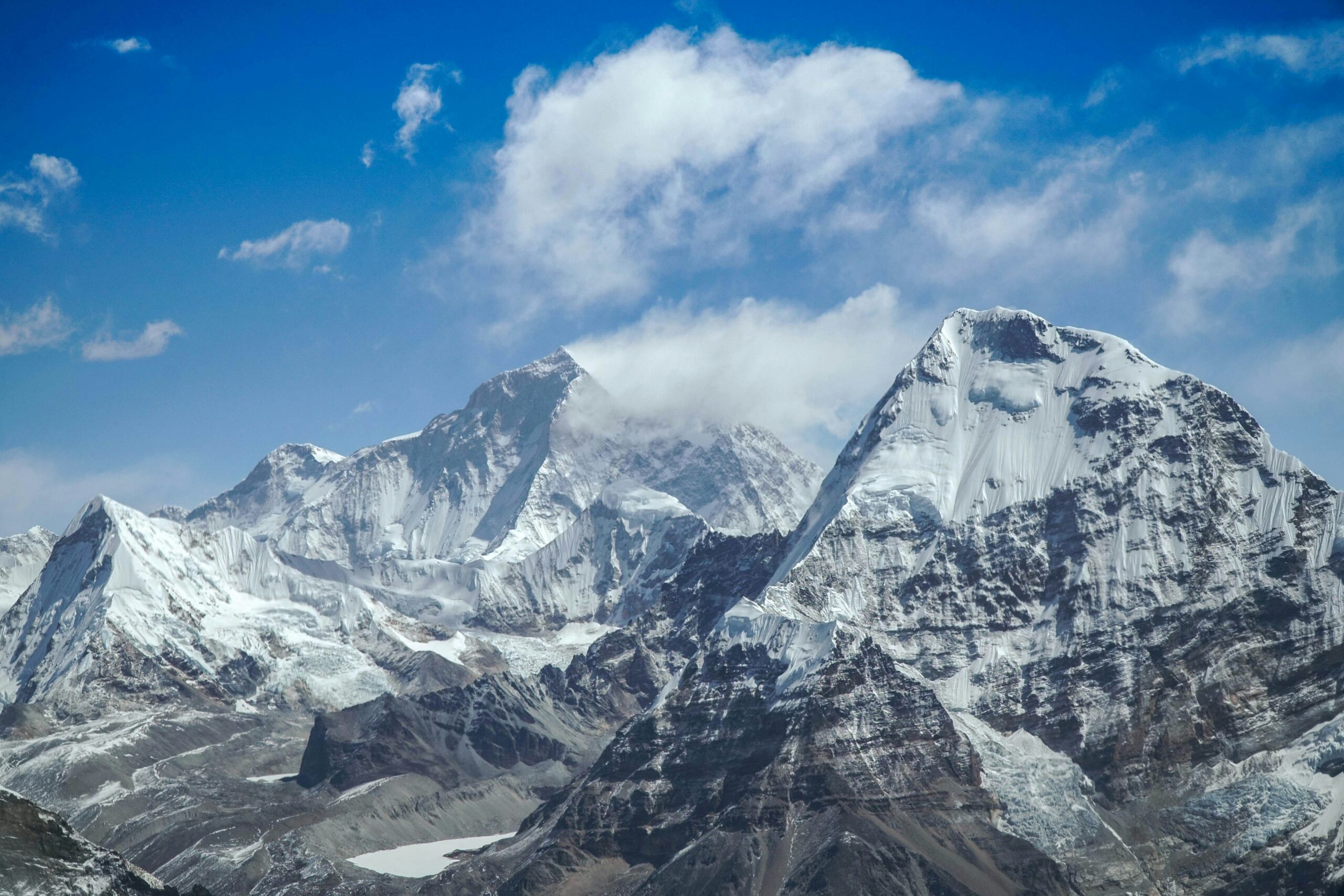
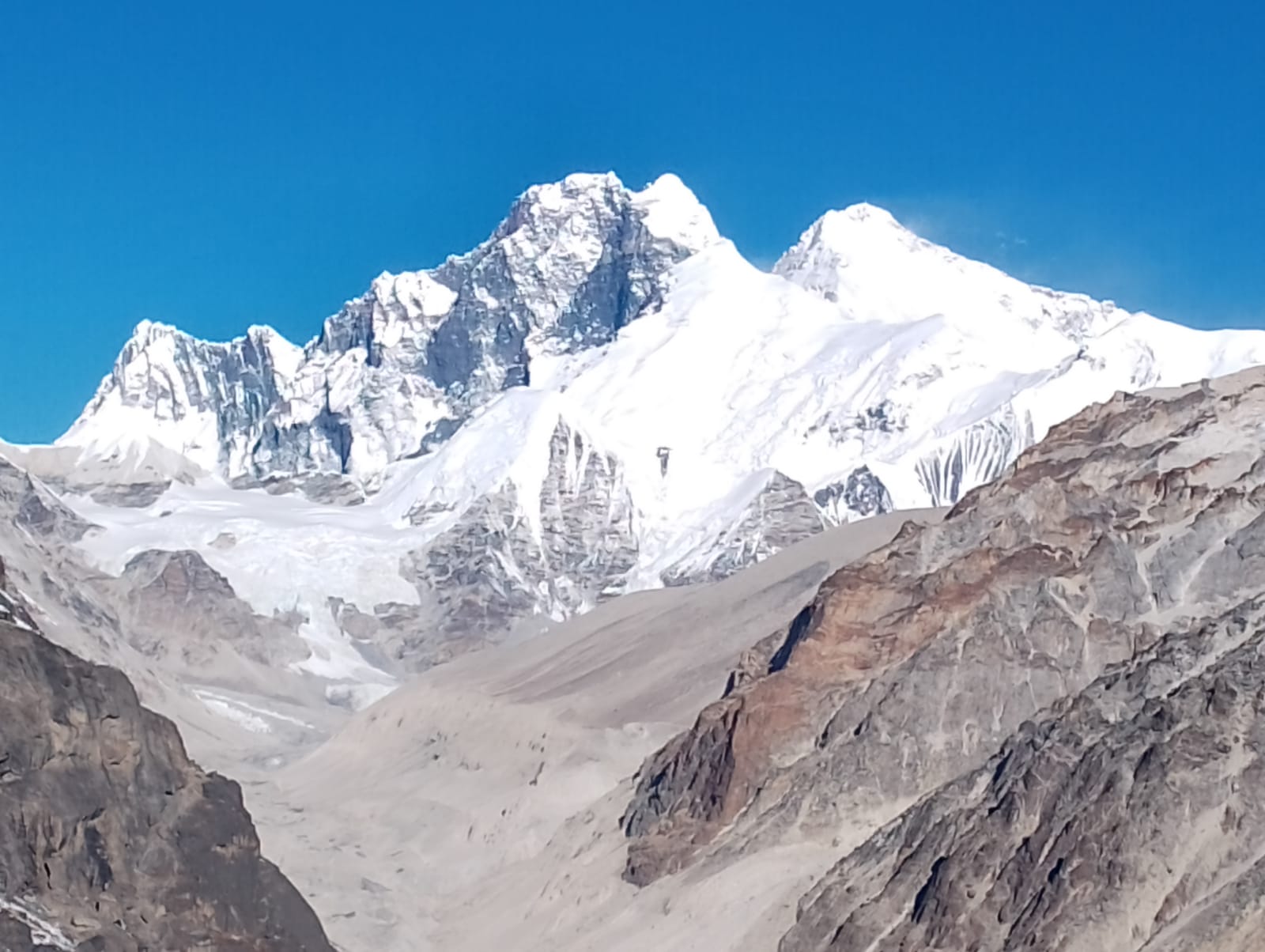
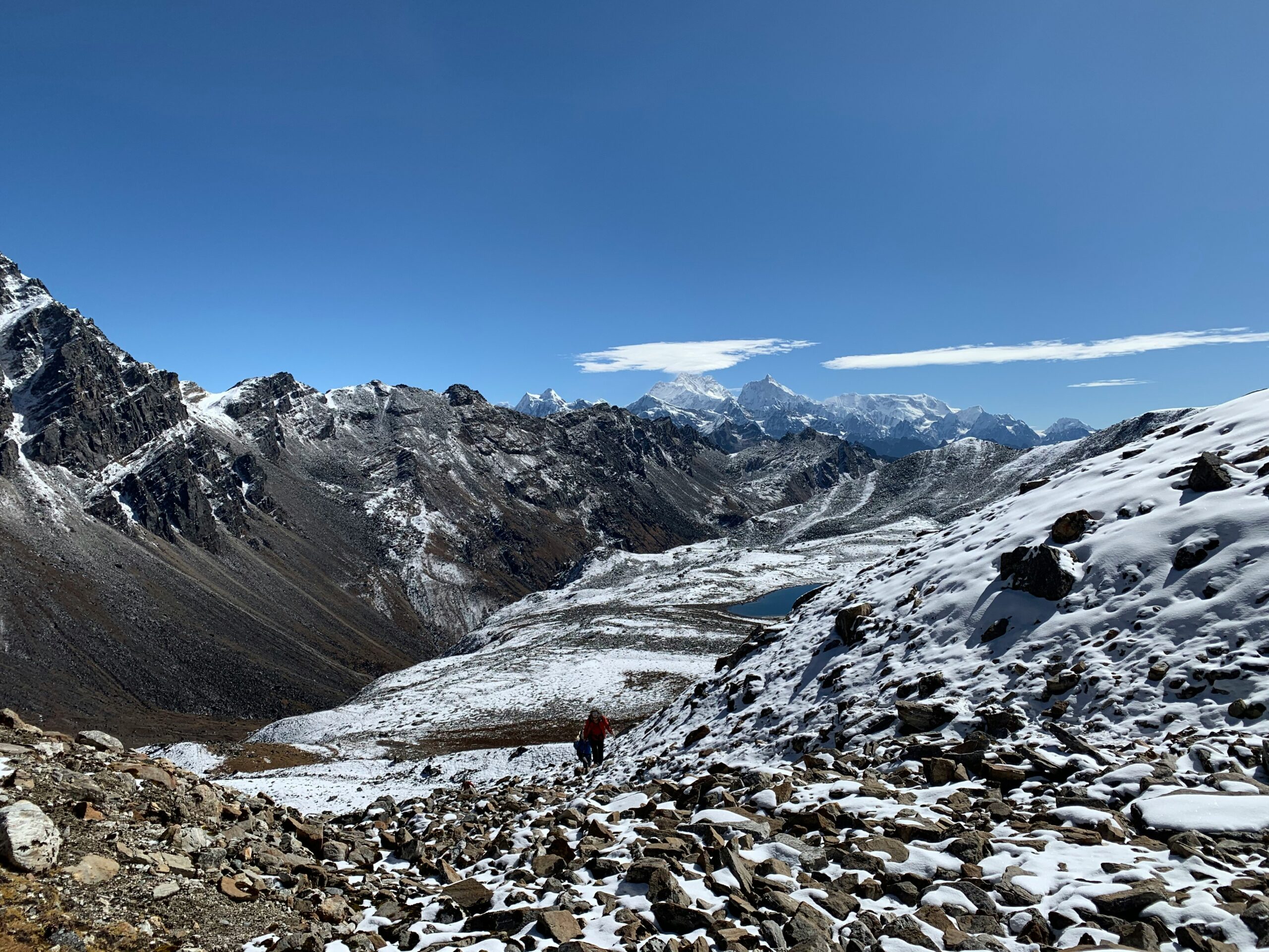

Trip Overview

Trek Region
Makalu

Difficulty Level
Hard

Transport
Kathmandu–Tumlingtar (domestic flight); Lukla–Kathmandu (domestic flight)

Total Trip Duration
25 Days

Max Elevation
6,143m

Meals
All meals included throughout
Trip Highlights
- Cross three of the highest trekking passes in the entire Himalayan range in one continuous traverse — Sherpani Col (6,135m), West Col (6,143m), and Amphu Labtsa (5,845m) — requiring crampons, ice axes, fixed ropes, and technical glacier travel
- Stand at Makalu Base Camp (4,870m) at the foot of Makalu (8,481m) — the fifth-highest mountain in the world — in one of the most remote and least-visited base camp locations in Nepal
- Trek through the pristine wilderness of Makalu-Barun National Park — one of Nepal’s most biodiverse and least-disturbed protected areas, home to snow leopard, red panda, Himalayan tahr, musk deer, and an extraordinary diversity of flora at all altitudes
- Walk the remote Barun Valley — a wild glacial corridor of moraines, alpine lakes, and towering ice walls that very few trekkers in Nepal have ever entered
- Experience complete, extended wilderness camping above 4,000m for the majority of the trek — a genuine expedition into the heart of the eastern Himalayas
- Traverse the Baruntse Glacier — a dramatically crevassed glacial ice field between Sherpani Col and West Col that involves technical rope-work and glacier navigation
- Camp at the remote glacial lakes of Panch Pokhari after crossing West Col — an extraordinarily beautiful and utterly isolated location surrounded by 6,000m and 7,000m peaks
- Cross the Amphu Labtsa Pass (5,845m) — a steep, exposed ice and rock ridge connecting the Hongu basin with the Khumbu — one of the most technically demanding non-climbing crossings available to trekkers in Nepal
- Descend into the Chhukung Valley in the heart of the Khumbu Everest region and rejoin the world of teahouses for the first time in nearly two weeks
- Look across Lhotse (8,516m), Everest (8,848m), Ama Dablam (6,812m), Makalu (8,481m), Baruntse (7,162m), Chamlang (7,319m), and dozens of lesser peaks from multiple high-altitude vantage points throughout the traverse
- Experience the dramatic landscape transition from the subtropical forests and Rai and Sherpa villages of eastern Nepal around Num and Seduwa to the pure glacial wilderness of the Barun Valley
- Visit Tashi Gaon (2,070m) — a charming Sherpa and Rai village at the last inhabited settlement before the Makalu wilderness begins — where ancient agricultural traditions persist in the shadow of 8,000m peaks
- Stand on the most technically demanding crossings available to non-climbers anywhere in the Nepal Himalayan range and look across a panorama that encompasses more 8,000m peaks than almost any other vantage point on Earth
Trip Summary
There are difficult treks in Nepal. There are challenging treks. And then there is the Makalu, Sherpani & West Col Trek & Traverse a journey in an entirely different category from everything else the country offers to non-climbing trekkers. In 25 days, this extraordinary circuit crosses three of the highest and most technically demanding passes in the entire Himalayan range Sherpani Col (6,135m), West Col (6,143m), and Amphu Labtsa Pass (5,845m) while passing through the wild, remote, and utterly spectacular wilderness of the Makalu-Barun National Park, standing at the base of Makalu (8,481m) the fifth-highest mountain on Earth and finishing through the heart of the Khumbu Everest region at Chhukung before descending to Lukla.
This is not a teahouse trek with some difficult days. This is a genuine Himalayan expedition in trekking form requiring mountaineering equipment including crampons, ice axes, fixed ropes, and harnesses; weeks of complete wilderness camping above 4,000m in terrain where no other facilities exist; an experienced high-altitude team with technical glacier and ice face experience; and the kind of physical and mental preparation that separates committed mountaineers from casual altitude trekkers.
The reward for this preparation is access to a landscape that the vast majority of Nepal’s trekking visitors will never see the wild, glaciated upper reaches of the Barun Valley, the ice-blue crevasse world of the Baruntse Glacier, the remote glacial lakes of Panch Pokhari, the knife-edge traverse of the Amphu Labtsa ice ridge, and panoramic views of Everest, Lhotse, Makalu, Baruntse, Chamlang, Kanchenjunga, and dozens of other Himalayan giants from passes that few people on Earth have ever stood on.
The circuit begins with a flight from Kathmandu to Tumlingtar and a drive to Num (1,560m) in the wild Arun Valley of eastern Nepal, traverses the full length of the Makalu-Barun wilderness, crosses the three technical passes from east to west in the most logical and safe sequence, and finishes with a descent through the Khumbu to Lukla for the flight back to Kathmandu.
When To Visit
The Makalu, Sherpani & West Col Traverse is the most weather-sensitive trekking circuit in Nepal — the three technical passes above 5,845m are affected by weather and snow conditions in ways that can make the difference between a safe, successful crossing and a dangerous, potentially life-threatening situation. Timing is not a preference on this trek — it is a fundamental safety parameter.
Autumn (September to November) is unequivocally the best season for this traverse and the most strongly recommended. After the monsoon clears in mid-September, the snow on the three passes consolidates, the weather windows are stable and predictable, visibility is at its annual peak, and the approach through the Makalu-Barun forest is in its finest condition. October is the gold standard month — the passes are in optimal condition, the views from all three cols are at their absolute clearest, the Khumbu descent section is at its most beautiful, and the weather windows for technical crossings are reliable and consistent. Early November is the second-best option with slightly cooler temperatures but continued excellent conditions.
Spring (late April to May) is the second viable season. The snow on the passes is softening from winter accumulation by late April, and the rhododendron forests of the Makalu-Barun approach are spectacularly in bloom. May is the preferred spring month — winter snow has consolidated enough for safe crampon travel but the days are long and warm enough for comfortable camping above 5,000m. Late March and early April carry higher avalanche risk on the approach glaciers due to unstable winter snowpack and are not recommended.
Pre-monsoon (early June) is not recommended — the monsoon arrives in the Makalu region earlier than in the Khumbu, and wet conditions on the high passes create serious rockfall and avalanche risk.
Monsoon (June to August) is completely unsuitable for this traverse. The technical passes become extremely dangerous in wet monsoon conditions and the lower approach through the Arun Valley forest becomes impassable in heavy rain and landslide season.
Winter (December to February) is not viable for the high pass section. The cols accumulate deep, unstable winter snowpack that makes technical crossing dangerously difficult even for experienced climbers. The approach valleys are cold and teahouse-less. This traverse should never be attempted in winter
Itinerary
Welcome to Nepal. Our team meets you at Tribhuvan International Airport and transfers you to your hotel in Kathmandu. This evening’s briefing is more detailed and more critical than on any standard trekking circuit — the Makalu Sherpani West Col Traverse is a genuine expedition and the preparation meeting reflects that.
Your senior guide and expedition leader join you for a comprehensive session covering the full 25-day traverse section by section. The technical briefing includes the nature of the three passes — what Sherpani Col’s approach glacier looks like, how West Col is accessed from the Baruntse Glacier, and what the Amphu Labtsa ice ridge crossing involves. You go through the rope systems, crampon technique review, ice axe usage, glacier travel protocols, and emergency procedures specific to each technical section. Permit requirements, camping logistics, food supply planning, weather windows, the importance of the acclimatization days at Khongma Danda, Makalu Base Camp, and Swiss Camp, and the medical protocols for altitude at 6,000m+ are all covered.
Come with questions. Come with your gear list for review. The quality of your preparation for this trek determines the quality and safety of the experience in the high section. Overnight in Kathmandu.
A full day in Kathmandu dedicated to final logistics before the traverse begins. This is not a sightseeing day it is a working day that ensures everything required for a safe and complete 25-day expedition is in place before you leave the city.
Your guide team accompanies you through Thamel for any last-minute gear acquisition crampon and ice axe rental and fitting, additional down layers if needed, high-altitude sleeping bag upgrade if required, personal medications, water purification supplies, and high-energy trail snacks for the wilderness section. The Makalu-Barun National Park permit and TIMS card are processed at the relevant offices. All camping equipment, technical rope gear, and food supplies for the wilderness section are checked and confirmed by our logistics team.
In the afternoon, a final gear spread and weight check ensures every member of the team is carrying the right equipment and that porter loads are properly balanced for the long approach through the Arun Valley. A proper dinner and early sleep. The flight to Tumlingtar departs early tomorrow. Overnight in Kathmandu.
A 45-minute domestic flight from Kathmandu to Tumlingtar Airport (518m) a short mountain airstrip in the wide Arun River valley of eastern Nepal followed by a long and dramatically scenic road drive northward up the Arun Valley to Num (1,560m), the trailhead village for the Makalu-Barun wilderness.
The drive through the Arun Valley is one of the finest road journeys in eastern Nepal. The Arun River — one of the oldest rivers in the world, pre-dating the Himalayas themselves and cutting through the range as the mountains rose around it flows through a landscape of extraordinary ecological diversity. Tropical and subtropical vegetation at the lower elevations gives way to terraced farmland and forested hillsides as the road climbs northward. Occasional glimpses of distant snow peaks appear above the valley walls.
Num (1,560m) is a small, pleasant village at the edge of the Makalu-Barun National Park administrative area. Camp is set up here for the night by your logistics team. Dinner around the camp mess tent is your first taste of the expedition-style routine that will define the next three weeks. Flight time: 45 minutes. Drive time: 5–6 hours.
The first walking day takes you across the Arun River on a suspension bridge below Num and into the lower reaches of the Makalu-Barun National Park corridor. The descent to the river is steep and then the trail climbs through Lumba (Lumband) fields and mixed subtropical forest before arriving at Seduwa (1,500m) a large village perched dramatically on a cliff face above the Arun River gorge.
The lower Arun Valley environment is strikingly different from any other Nepal trekking region warm, lush, and ecologically rich with a subtropical character that includes plantain trees, orchids, tree ferns, and a birdlife diversity that reflects the extraordinary altitudinal range of the Makalu-Barun ecosystem, which spans from 218m at the Arun confluence to over 8,481m at Makalu’s summit. The cultural character of the lower villages is a mix of Rai and Sherpa communities two of eastern Nepal’s most historically significant ethnic groups and the teahouses and homestays here carry a warmth and authenticity that mass-tourism trekking regions rarely match.
The jungle sounds at night in the lower Arun are remarkable a fitting introduction to the wild, uncompromised wilderness you have committed to entering. Walking time: 5–6 hours.
The trail climbs steadily from Seduwa through dense forest of rhododendron, oak, and bamboo gaining elevation steadily through the morning before emerging at a series of high community tea stops along the ridge. The path crosses several small streams, passes through the hamlet of Chekse Danda with its small teahouse and school, and then continues through similar gradient to reach Tashi Gaon (2,070m).
Tashi Gaon is one of the finest villages on the entire traverse the last permanently inhabited settlement before the Makalu wilderness begins and a place where the character of the community reflects centuries of life on the edge of one of Nepal’s most remote and wild protected areas. The village is primarily Sherpa a community who migrated from higher Khumbu areas generations ago to farm the richer soils of this lower elevation — and their culture, food, and hospitality carry the warmth and directness characteristic of Sherpa mountain communities everywhere.
The afternoon in Tashi Gaon is worth using well. Walk through the village lanes, observe the ancient stone water mills still operating beside the trail, visit the small community gompa, and talk to your guide about the wilderness ahead. From tomorrow, the trail enters a world that is genuinely unlike anything on Nepal’s standard trekking circuits. Walking time: 4–5 hours
The day the nature of the trek changes decisively. From Tashi Gaon, the trail enters a sustained and serious climb through dense rhododendron and oak forest that gains nearly 1,500m of altitude over the course of the day. The gradient is steep, consistent, and demanding one of the most physically challenging pure ascent days of the entire traverse.
The forest is extraordinary a UNESCO-recognized biodiversity hotspot where rhododendron species occur in a vertical sequence that ranges from large-leafed tropical varieties at the base to compact alpine species near the tree line. In bloom season (March–May) the ascent through this rhododendron corridor is spectacular beyond description. The forest thins progressively as altitude is gained and eventually gives way to open ridge at the Khongma Danda camp (3,560m) a broad grassy ridge with the first proper panoramic mountain views of the traverse.
Kanchenjunga (8,586m) the world’s third-highest mountain, appears on the eastern horizon for the first time. Makalu (8,481m) rises to the north-northwest. The scale of the peaks visible from the Khongma Danda ridge on a clear afternoon is a powerful reminder of where you are and what you are heading toward. Walking time: 6–7 hours.
From Khongma Danda, the trail follows the high ridge northward a spectacular ridgeline walk with expansive views of the eastern Himalayan range on clear mornings before beginning a long descent through open alpine terrain to Dobato (also called Mumbuk, 4,216m), a high grazing area with seasonal shelters and the first sense of the true alpine wilderness ahead.
The trail today alternates between short climbs and long descents characteristic of the complex ridge system between the Arun Valley and the Barun drainage crossing several streams and yak pasture zones. The vegetation above 4,000m shifts to low juniper scrub, alpine grasses, and the first glacial moraine debris that signals the proximity of the upper Barun valley.
From the camp at Dobato on a clear evening, the Makalu massif is now a substantial presence on the northern skyline — no longer a distant profile but a close, commanding mountain whose scale begins to feel genuinely personal at this proximity. Walking time: 6–7 hours.
A descending day through the wild upper Barun tributary valleys — the trail drops from the high Dobato ridge into the river valley below, crossing the Barun Khola and its tributary streams on wooden bridges and ford crossings before climbing slightly to the seasonal herder settlement of Yangli Kharka (3,615m).
The terrain today is transitional — the last of the sub-alpine scrub giving way to the more open, rocky, and glacially-influenced landscape of the inner Barun drainage. The valley narrows and the walls on either side grow higher and more vertical. The sense of entering a closed, remote world deepens. Waterfalls cascade from high rock faces on both sides of the valley. The air is clean, cold, and carries the particular character of glacial water and alpine vegetation that is unique to the high Himalayan wilderness. Walking time: 5–6 hours.
The approach to the upper Barun Valley reaches a new level of drama today. From Yangli Kharka the trail climbs steadily through increasingly open, rocky terrain the vegetation now sparse alpine meadow and glacial moraine following the Barun River northward into the heart of the national park wilderness.
The valley walls close in around you as the trail gains altitude, and the peaks of the upper Barun rim begin to appear in full detail Chamlang (7,319m) to the east, Baruntse (7,162m) to the northwest, and the great hulking mass of Makalu (8,481m) growing ever closer and more overwhelming directly ahead. This is the terrain the great mountaineers of the 1950s explored on their way to first ascents and the scale and wildness of it, unchanged from those first expeditions, is felt with every step.
Langmale Kharka (4,410m) is a high meadow camp where the upper Barun opens briefly into a wider basin before the final approach to Makalu Base Camp. The glacial snout of the Barun Glacier is visible from camp. Tonight the sky above 4,400m in the Makalu wilderness is extraordinary assuming clouds permit, the stars at this altitude and this remoteness are among the finest you will ever see. Walking time: 5–6 hours.
The approach to Makalu Base Camp on a morning of good visibility is one of the most spectacular walking experiences in Nepal. From Langmale Kharka the trail climbs through the final moraine fields of the Barun Glacier approach, crossing boulder fields and glacial debris, with Makalu (8,481m) growing from a mountain into an overwhelming wall of rock and ice that fills the entire northern horizon.
Makalu Base Camp (4,870m) sits at the edge of the Barun Glacier on a wide moraine platform — the classic staging point for expeditions attempting Makalu’s northwest ridge and the West Pillar. The mountain at close range is staggeringly imposing — a near-vertical pyramid of black rock streaked with ice, rising over 3,600m above the base camp in a single, sustained, almost vertical line. Lhotse (8,516m) is visible to the northwest and Baruntse (7,162m) dominates the southwestern skyline.
Set up camp and spend the afternoon walking the moraines, photographing the mountain at close range, and simply absorbing the scale of being at the base of one of Earth’s most imposing summits. This is one of the least-visited 8,000m base camps in Nepal and the solitude here compared to the busy Everest Base Camp is complete and profound. Walking time: 5–6 hours.
A full acclimatization day at Makalu Base Camp critical for the technical passes that lie ahead. At nearly 4,900m, your body is working hard simply maintaining normal function and the deliberate altitude adaptation that happens during a full rest day here is physiologically essential before moving to 5,200m and then 5,700m in the days ahead.
The acclimatization protocol involves a morning hike above the base camp climbing to approximately 5,100m on the lower Barun Glacier moraine and then descending the classic climb-high-sleep-low adjustment. Your guide uses this hike to assess the glacier approach to Swiss Camp and identify current conditions.
The rest of the day at base camp is used for rest, hydration, food intake, and gear preparation for the upper section. Your guide briefs the team on the Swiss Camp approach and the Sherpani Col high camp logistics. The high-altitude specialist equipment high-altitude boots (if brought), down suits, glacier goggles, and harness systems, is distributed and checked. This is the last comfortable day before the true expedition section begins. Acclimatization hike: 3–4 hours.
From Makalu Base Camp the trail enters the glacial world entirely. The route climbs onto the lateral moraine of the Barun Glacier and then moves onto the glacier itself — your first day of glacier travel on this traverse. Crampons go on. Ice axes come out. The glacier surface here is relatively gentle but the training value of the first day on ice is significant for the far more demanding passages above.
The camp at approximately 5,200m variously called Swiss Camp or Hillary Camp after the pioneering expeditions that first established it, sits on a broad moraine shelf above the glacier with extraordinary views of Makalu’s West Pillar, the Baruntse massif, and the high ridge that carries the Sherpani Col above. At 5,200m the altitude is seriously felt by most trekkers headaches, reduced appetite, and disrupted sleep are all possible and normal. Communicate any symptoms to your guide. Walking time: 4–5 hours.
A second critical acclimatization day this one at 5,200m before the ascent to Sherpani Col High Camp at 5,700m. The rest day protocol is the same a morning acclimatization hike above camp to approximately 5,400m on the approach to the high camp, then rest, food, hydration, and sleep.
Your guides and high-altitude Sherpa staff use this day to fix ropes on the technical sections of the approach to Sherpani Col High Camp and assess current snow and ice conditions on the pass approach. The quality of this reconnaissance directly determines the safety and pacing of the next three days the most demanding section of the entire 25-day traverse. Pulse oximeters are checked regularly throughout the day. Any team member showing serious altitude symptoms (HACE, HAPE warning signs) is evacuated immediately via helicopter your guide carries emergency contact numbers and satellite phone communication.
From Swiss Camp the route climbs steeply up the Sherpani Glacier a technically demanding ascent that gains nearly 500m on ice and snow in a single day. Crampons are essential from the first step above camp. The ice axe is used continuously for balance and self-arrest readiness on the steeper sections. Fixed ropes installed by your Sherpa team the previous day are clipped with carabiners and locking draws throughout the most exposed sections.
Sherpani Col High Camp (5,700m) sits beneath the massive ice cliffs at the base of the final approach to the col two small glaciers feeding the approach from the slopes above, the camp positioned on a cleared platform in the moraine at the terminus of the ice. The view from high camp is extraordinary Makalu’s West Face and West Pillar tower directly above, and the scale of the mountain from this elevation is simply not comparable to anything visible from the base camp below.
At 5,700m the altitude is serious. Eat as much as you can, drink constantly, go to bed early, and sleep as best the altitude allows. Tomorrow’s crossing begins before dawn. Walking time: 5–6 hours. Technical.
The most consequential day of the traverse. The alarm sounds at 2:00 AM or earlier. The team rises in darkness, eats a full hot breakfast in the mess tent, layers up completely — base layer, mid-layer, down suit, hardshell, balaclava, high-altitude gloves, glacier goggles, crampons on boots, ice axe in hand, harness on and begins the climb to Sherpani Col (6,135m) in the pre-dawn blackness.
The ascent from high camp to the col gains nearly 450m on the Sherpani Glacier steep, heavily crevassed in sections, and requiring careful rope work and team management throughout. Fixed ropes guide the steepest and most exposed sections. The pace above 5,700m at altitude is deliberately slow one breath per step, the ancient rhythm of high-altitude climbing. The final push to the col is the steepest section of the entire glacier approach.
At the col, in the first pale light of dawn, the panorama is one of the most extraordinary available to any non-climbing trekker in the Himalayas. Makalu (8,481m) behind you. Baruntse (7,162m) to the west. Lhotse (8,516m) and the entire southern wall of Everest (8,848m) appear on the horizon to the northwest. Chamlang (7,319m), Kanchenjunga (8,586m) to the east. The world from 6,135m is an unfiltered, raw, and overwhelming encounter with the scale of the highest peaks on Earth.
The descent from Sherpani Col onto the Baruntse Glacier is steep, long, and technical navigating crevasse fields and ice debris on the north-facing descent. The team arrives at the glacier camp on the western Baruntse moraine (approx. 5,640m) by mid-afternoon. The Baruntse Glacier camp is one of the most remote overnight positions accessible to trekkers anywhere in Nepal. Walking time: 8–10 hours. Highly technical.
The highest point of the entire 25-day traverse and another full technical day on glacier and ice. West Col (6,143m) is crossed from the Baruntse Glacier on its western approach, a shorter but equally demanding technical climb compared to Sherpani Col.
The ascent of West Col from the Baruntse Glacier side follows a steep ice slope and then a narrowing ice ridge to the col itself. Fixed ropes cover the crux sections. At the top — at 6,143m the panoramic view includes everything visible from Sherpani Col with the addition of the Hongu basin and the Nuptse-Lhotse wall now visible in their complete entirety to the northwest. Island Peak (Imja Tse, 6,189m) is directly ahead. The sense of position — on the divide between the Makalu region and the Khumbu at over 6,000m — is deeply clarifying.
The descent from West Col into the Hongu basin is steep and then opens into the wild upper plateau leading to the glacial lakes of Panch Pokhari (5,500m) — five sacred high-altitude lakes set in a remote, rocky basin surrounded by the peaks of the Hongu basin. Camp tonight at Panch Pokhari is one of the most surreally beautiful overnight stops available anywhere in the Nepal Himalaya — utterly remote, utterly silent, and utterly magnificent. Walking time: 6–8 hours. Technical.
A descent day through the remote Hongu basin one of the wildest and least-visited glacial environments in Nepal. From the Panch Pokhari camp, the trail descends southwestward through the upper Hongu valley, crossing moraine and glacial debris, with views of Mera Peak (6,476m), Island Peak (6,189m), Amphu Peak (5,335m), and the great wall of the Nuptse-Lhotse ridge all around the basin.
The Hongu basin has an extraordinary quality of stillness and remoteness that is hard to put into words — a world enclosed by some of the highest peaks on Earth, completely unpopulated outside of rare expeditions, and carrying a wild, elemental character that even the most remote sections of the Khumbu Everest region cannot match at this depth of solitude.
Amphu Labtsa Base Camp (5,200m) is established on the moraine below the final approach to the pass. Your Sherpa guides fix ropes on the lower approach to the Amphu Labtsa ice ridge this afternoon while the team rests and eats. The third and final technical crossing begins tomorrow. Walking time: 5–6 hours.
The final and in many ways the most dramatic technical crossing of the traverse. Amphu Labtsa Pass (5,845m) is a steep, narrow ice and rock ridge on the southwest wall of the Hongu basin that drops sharply into the Imja Valley above Chhukung. While lower than both Sherpani Col and West Col in altitude, the Amphu Labtsa is arguably the most technically demanding of the three passes — involving a near-vertical rock and ice section near the top that requires confident rope work, ice axe usage, and a steady nerve.
Begin before dawn from base camp. The approach climbs steeply on loose moraine and then onto the glaciated face below the pass. Fixed ropes lead the team up the steepest section a near-vertical 50m pitch of mixed rock and ice that is the crux of the entire 25-day traverse. At the top, standing on the narrow col, the transition is immediate and dramatic behind you the wild, enclosed world of the Hongu basin; ahead of you the familiar, populated, teahouse-lined Khumbu valley dropping toward Chhukung in the distance.
The descent from Amphu Labtsa onto the Imja Glacier is steep and requires sustained crampon and ice axe technique for the first 200 meters. Then the glacier opens and the angle eases, leading across the ice to the moraine and the trail into Chhukung (4,730m). The moment the first teahouse of Chhukung appears is one of the most emotional transitions of any Nepal trekking experience — you have been in the wilderness for nearly two weeks, and the sight of a lit teahouse window, the smell of cooking food, and the sound of other voices arriving from the comfortable Khumbu trail carries an intensity that only extended wilderness isolation can create. Walking time: 7–8 hours. Highly technical.
The first full day back in the world of teahouses, other trekkers, and Khumbu trail infrastructure. The descent from Chhukung to Dingboche (4,360m) is a well-worn trail through the Imja Valley that feels almost absurdly comfortable after the glaciated terrain of the past several days.
Your body will be noticeably tired and noticeably relieved. Eat as much as the altitude allows, drink water consistently, and let the recovery process begin. The Ama Dablam (6,812m) view from Dingboche is one of the finest in the Khumbu its impossibly graceful profile rising above the valley is a visual reward of a different kind from the raw technical grandeur of the passes behind you. Spend the afternoon resting and allow the scale of what you have accomplished to settle quietly in. Walking time: 3–4 hours.
The trail descends through Pangboche and then climbs across to Tengboche (3,870m) home to the famous Tengboche Monastery, the largest and most revered gompa in the Khumbu region. After nearly three weeks in the wilderness above 4,000m, the monastery’s carved wooden interior, butter lamp altar, evening puja ceremony, and the extraordinary presence of Ama Dablam directly behind it deliver a cultural and aesthetic experience of particular richness.
The descent from the high passes into the Khumbu is also physiologically liberating — the air thickens noticeably with every hundred meters of altitude lost, food tastes better, sleep is easier, and the accumulated physical fatigue of the high technical days begins to release. Walking time: 5–6 hours.
The trail descends from Tengboche through the deep rhododendron and birch forest of Phunki Tenga and climbs back up to Namche Bazaar (3,440m) the capital of the Khumbu Sherpa world. After weeks in the wilderness, the bakeries, coffee shops, restaurants, gear shops, and general energy of Namche feel slightly overwhelming and entirely wonderful.
Celebrate your traverse with the finest meal you can find in Namche, a proper coffee, and possibly the most appreciated hot shower of your life in one of the teahouse bathrooms. Walk around the town in the evening, look back across at the mountains, and allow yourself to feel the weight of what the past 20 days have involved. Walking time: 5–6 hours.
The final walking day of the entire traverse. The trail descends from Namche through the rhododendron forest, across the suspension bridges of the Dudh Koshi River, and back to Lukla (2,840m) the Khumbu’s primary airstrip and the last overnight before the flight back to Kathmandu. The walk through the Dudh Koshi valley is beautiful in the evening light and the suspension bridges each one a dramatic swinging span above the river gorge, feel like a proper, cinematic ending to a 25-day Himalayan adventure.
Dinner in Lukla with your entire team guide, Sherpa staff, cook team is an occasion worth marking. These are the people who carried the equipment, fixed the ropes, cooked the meals at altitude, and kept the team safe across three passes above 5,800m. Their skill, experience, and commitment made this traverse possible. Walking time: 6–7 hours.
An early morning flight from Tenzing-Hillary Airport in Lukla back to Kathmandu — the same mountain airstrip famous for its short, sloping runway and dramatic approach between the valley walls. Mountain flights at Lukla are subject to weather and flexibility around departure times is always required.
Back in Kathmandu, transfer to your hotel and spend the rest of the day however you choose — the city is entirely yours. A massage, a long lunch, proper shopping, a visit to Boudhanath, or simply sitting somewhere warm and quiet with the traverse behind you and the mountains already becoming memory. Flight time: 30–35 minutes.
A practical buffer day in the itinerary for flight delay risk at Lukla — one of the most common logistical realities of the Khumbu region, where weather can delay flights for one or more days. If the flight returned on schedule, you have a free day in Kathmandu.
Use it as you wish. Visit the UNESCO heritage sites of the Kathmandu Valley — Pashupatinath Temple, Boudhanath Stupa, Swayambhunath, or the medieval courtyards of Patan and Bhaktapur. Debrief with your guide over a meal, go through your photographs, and begin the process of organizing the story of what you have just done. Buy a piece of Nepali craft or artwork as a tangible memory of one of the most significant mountain journeys available anywhere on Earth. Overnight in Kathmandu.
Your 25-day Makalu, Sherpani & West Col Trek & Traverse comes to a close. Our team transfers you to Tribhuvan International Airport for your departure. You leave Nepal as one of a small number of people globally who have completed the full Makalu to Khumbu traverse via Sherpani Col, West Col, and Amphu Labtsa — three passes above 5,845m, weeks in the Himalayan wilderness, a 5,000m to 6,143m altitude range, and a journey from the wild forests of the Arun Valley to the glaciated core of the highest mountain range on Earth.
Trek Difficulty & Physical Demands
The Makalu, Sherpani & West Col Trek & Traverse is rated Extreme / Technical — the most demanding non-peak-climbing trekking experience available in Nepal and in a fundamentally different category from even the most strenuous standard high-pass circuits.
Technical mountaineering skills required: All three passes require the confident use of crampons and ice axes on steep, glaciated terrain. Fixed rope systems are in place on the most technical sections but clipping in and moving on fixed lines at altitude requires prior training and practice. The Amphu Labtsa crux section is a near-vertical 50-meter pitch of mixed rock and ice that requires the kind of nerve and technique that comes only from prior experience in similar terrain.
Altitude: The traverse spends multiple days above 5,000m and crosses passes at 5,845m, 6,135m, and 6,143m. The highest altitude reached by any non-climbing trekker on a standard Nepal circuit is 5,545m at Kala Patthar. This traverse goes 600m above that maximum at West Col. Extended time at 5,000–6,143m requires the most serious altitude acclimatization structure of any standard Nepal trek.
Wilderness camping duration: The wilderness section from Day 3 to Day 17 — fourteen days of continuous camping in terrain with no facilities, no other trekkers, and no evacuation infrastructure beyond helicopter — requires genuine physical and mental resilience. Comfort in wilderness camping environments, experience with extended expedition-style living, and the psychological stability to handle technical difficulty and altitude simultaneously are all essential.
Physical fitness baseline: This is an expedition-level fitness requirement. Trekkers should be at the peak of their cardiovascular and muscular fitness — consistently training for 6 months or more before departure with specific focus on high-intensity cardiovascular capacity, leg strength for extended steep climbing and descending, load-carrying endurance, and cold-weather performance.
Prior experience mandatory: A minimum of one prior high-altitude trek above 5,000m is the absolute baseline requirement. Prior experience crossing a technical glaciated pass — Cho La, Ganja La, or similar — is strongly recommended. Prior mountaineering course completion (basic glacier travel, crampon and ice axe technique) is the ideal preparation for the technical sections of this traverse.
Not suitable for: Anyone without prior altitude experience above 5,000m. Anyone who has not used crampons and ice axes in a training or trekking context. Anyone without genuine high-altitude fitness. Anyone who is not comfortable in extended wilderness environments without access to outside assistance. This trek is not a stretch goal — it is an expedition that demands full respect for what it involves.
Best Time to Trek: Seasonal Comparison
| Season | Months | Pass Conditions | Weather Stability | Approach Conditions | Recommended |
| Spring | Apr–May | Good from late April | Moderate | Excellent (bloom) | Good |
| Pre-Monsoon | Jun | Deteriorating | Unstable | Risky | Avoid |
| Monsoon | Jul–Aug | Dangerous | Very unstable | Impassable sections | Never |
| Autumn | Sep–Nov | Excellent | Outstanding | Excellent | Best |
| Winter | Dec–Mar | Deep Snow / Dangerous | Extreme cold | Very difficult | Avoid |
Pro tip: Book this traverse for October—specifically targeting a departure from Kathmandu between October 5–15 if possible. This window captures the finest weather of the post-monsoon period, the most stable and consolidated snow conditions on all three passes, the best high-altitude visibility of the year, and the optimal conditions for the long wilderness camping section. The Khumbu descent in mid-October is also at its most beautiful, with the entire Everest region trail in perfect autumn condition for the final walk to Lukla.
Booking Your Makalu, Sherpani West Col Trek & Traverse – 25 Days
This traverse requires substantially more advance planning than any standard Nepal trekking circuit. We recommend initiating the booking process 6 months before your target departure date — particularly for October slots which fill months in advance.
Step 1 — Initial contact and experience assessment. Contact us via website, email, or WhatsApp with your target dates, group size, and prior trekking and mountaineering experience. We conduct a detailed experience assessment — not to exclude capable trekkers but to ensure the team composition and pacing plan is appropriate for the specific fitness and technical backgrounds of your group. We respond within 24 hours.
Step 2 — Technical consultation. For first-time Sherpani Col trekkers, we schedule a video call with your senior guide to discuss the technical sections in detail, review your experience, answer specific questions, and assess whether any pre-departure mountaineering training would be beneficial.
Step 3 — Confirm booking. A 30% deposit secures your dates. We immediately begin the complex logistics process — permit applications across two national parks, domestic flight bookings, senior guide and high-altitude Sherpa team assembly, camping equipment preparation, food supply planning for 14 wilderness days, and technical rope hardware ordering.
Step 4 — Pre-departure preparation package. We send the most comprehensive pre-departure guide in our portfolio — 6-month fitness training program, technical skill training recommendations (crampon and ice axe courses, glacier travel workshops), complete gear list with rental guidance, altitude acclimatization protocols specific to 6,000m+ exposure, emergency procedure review, cultural notes on the Rai and Sherpa communities of the lower Arun Valley, and detailed day-by-day expectations for all 25 days.
Step 5 — Arrival in Kathmandu. We collect you from the airport, conduct two full days of briefings and logistics — gear checks, crampon fitting, permit processing, technical briefing with your senior guide and Sherpa team, satellite phone testing, and emergency contact registration. Nothing is left to chance.
Step 6 — Traverse. Your senior guide and high-altitude Sherpa team lead the full 25-day traverse from Tumlingtar to Lukla with expedition-standard safety protocols throughout.
Step 7 — Pay the balance. The remaining 70% is due on arrival in Kathmandu before departure for Tumlingtar.
Cancellation Policy:
- 60+ days before departure: Deposit refunded minus 15% administration charge and non-refundable flight bookings
- 45–59 days before: 40% refund of deposit
- 30–44 days before: 20% refund of deposit
- Less than 30 days: Deposit forfeited, no refund
- Note: Domestic flight costs are non-refundable once booked regardless of cancellation date
Travel Insurance — Mandatory and Verified:
Travel insurance for this traverse must explicitly cover:
- Emergency helicopter evacuation above 6,500m
- Medical treatment and hospitalization in Nepal
- High-altitude trekking and glacier travel activities
- Trek cancellation due to medical emergency
- Repatriation costs
Do not book this traverse without first confirming that your insurer explicitly covers helicopter evacuation above 6,500m for glacier and technical pass activities. Many standard travel insurance policies exclude high-altitude activities or cap evacuation altitude below 6,000m. A helicopter rescue from the Sherpani Col or West Col area costs USD 8,000–15,000. Show your confirmed insurance documents to our team before departure from Kathmandu.
Cost Details
Cost Includes
- Airport pick-up and drop-off in Kathmandu throughout
- Kathmandu–Tumlingtar domestic flight (round trip via Lukla)
- Lukla–Kathmandu domestic flight on completion
- Num to trailhead ground transport (private vehicle)
- 2 nights’ hotel accommodation in Kathmandu (arrival and buffer nights, bed & breakfast, 3-star)
- All teahouse accommodation in Khumbu section (Days 18–22)
- Complete wilderness camping equipment and full expedition support for the Makalu-Barun and technical pass section (Days 3–17):
- High-altitude expedition dome tents (2-person)
- Mess tent with tables, chairs, and full camp furnishings
- Kitchen tent with cook equipment and fuel
- Toilet tent with portable facilities
- High-density foam sleeping mats
- All meals throughout the entire 25-day trek — breakfast, lunch, dinner every day including all camping days
- Senior government-licensed trekking guide with high-altitude and glacier technical experience (minimum 5 Sherpani Col crossings required)
- Minimum 2 high-altitude Sherpa guides / climbing Sherpas for the technical pass section (Days 14–18)
- Experienced cook and kitchen staff for full camping section
- One standard porter per two trekkers plus additional porters for camping and technical equipment
- Full technical equipment for all three pass crossings:
- Fixed rope systems (Sherpani Col, West Col, Amphu Labtsa approaches)
- Group static ropes and anchoring equipment
- Ice screws and snow stakes
- Group crampons (if not bringing personal)
- Group ice axes (if not bringing personal)
- Climbing harnesses (if not bringing personal)
- Locking carabiners and descenders
- All required permits:
- Makalu-Barun National Park Entry Permit
- Sagarmatha (Everest) National Park Entry Permit (Khumbu section)
- TIMS Card
- Restricted Area / Special Permits as required
- All guide, Sherpa, porter, and cook wages, meals, accommodation, and insurance
- All government taxes and local charges
- High-altitude sleeping bag rated to -25°C rental (if needed)
- Duffel bag for porter
- Comprehensive First Aid Kit including pulse oximeter, emergency oxygen, altitude medications (Dexamethasone, Nifedipine), and emergency splinting equipment
- Satellite phone for emergency communication throughout wilderness section
- Emergency evacuation coordination (cost covered by your travel insurance)
- Daily weather briefing and route condition assessment throughout technical section
Cost Excludes
- Nepal entry visa fee (approx. USD 50 for 30 days)
- International flights to and from Kathmandu
- Travel insurance with emergency helicopter evacuation coverage explicitly above 6,500m — mandatory, verified before departure
- Personal mountaineering boots (crampon-compatible, high-altitude rated B2/B3 recommended)
- Personal crampons (C2 or C-AT compatible — can be rented in Kathmandu approx. USD 20–35)
- Personal ice axe (can be rented in Kathmandu approx. USD 15–25)
- Personal down suit for above 5,500m (strongly recommended — rental available)
- Personal glacier goggles and mountaineering helmet
- Meals and beverages in Kathmandu beyond breakfast
- Hot showers, Wi-Fi, and device charging at Khumbu teahouses
- Personal snacks, energy foods, and personal high-altitude nutrition supplements
- Tips and gratuity for entire team — guide, Sherpa staff, porters, cook (strongly recommended; standard tip for this caliber of expedition is 10–15% of trek cost distributed among team)
- Extra nights in Kathmandu beyond planned itinerary
- Helicopter rescue and medical evacuation costs (covered by mandatory travel insurance)
- Monastery donations and personal religious offerings
- Personal expenses and souvenirs
Trip Gallery
Trek Essentials
- Expedition-weight merino or synthetic thermal base layer (top and bottom) — 3 sets minimum for 25-day trek
- Heavyweight fleece or Polartec mid-layer jacket
- Down suit or high-altitude down jacket rated to -30°C or lower — mandatory for the passes at 6,000m+. A standard teahouse-grade down jacket is insufficient above 5,500m in cold conditions.
- Waterproof, windproof Gore-Tex or equivalent hardshell jacket and trousers — high-altitude rated
- Softshell trousers for active glacier travel
- Waterproof over-trousers for snow and ice conditions on pass days
- Heavyweight trekking socks, wool — 6 pairs minimum
- Thin liner gloves and heavyweight mountaineering outer gloves or mittens — both required simultaneously in some conditions above 5,500m
- Balaclava — worn under helmet on pass days
- Warm beanie or wool hat
- Neck gaiter and face cover — wind chill at 6,000m demands full face coverage
- High-altitude mountaineering or B2/B3-compatible trekking boots — this is the most critical gear decision. The boots must accept C2 crampons securely. Standard flexible trekking boots are not appropriate for the glaciated sections above 5,500m. Boots must be broken in for at least 40 hours before the traverse. Cold and wet feet at 6,000m are a serious health risk.
- Lightweight approach shoes or camp sandals for lower-elevation sections and camp evenings
- Neoprene or heavyweight wool inner boot liners for camping nights above 5,000m
- Gaiters — mandatory for all snow and glacier sections
- Crampons — 12-point, C2-compatible with step-in or hybrid binding. Well-fitted to your boots before departure. Rental available in Kathmandu (approx. USD 20–35 for trip duration).
- Ice axe — standard 60–65cm mountaineering ice axe with wrist leash. Rental available in Kathmandu (approx. USD 15–25).
- Climbing harness — full seat harness for fixed rope sections on all three passes. Rental available in Kathmandu.
- 2 x locking carabiners (HMS/pear shape) for clipping fixed lines
- Ascender (Jumar) — recommended for the steeper fixed-rope sections on Sherpani Col and Amphu Labtsa. Rental available.
- Trekking poles — both collapsible with snow baskets; invaluable on non-technical terrain and for balance on lower-angle glacier travel
- Sleeping bag rated to -25°C or colder — the single most important personal equipment item for this traverse. Camping nights at 5,700m with wind will have effective temperatures well below -20°C. Do not underestimate this. Rental of expedition-grade sleeping bags available through us.
- Compression dry bag for sleeping bag storage
- Sleeping bag liner (additional warmth buffer)
- Expedition rucksack (35–40 liters) with rain cover — carried daily
- Duffel bag (70–80 liters) for porter — heavier than standard for 25-day expedition
- Glacier goggles (side shields, UV400, Category 4 lens) — mandatory for glacier travel above 5,000m
- Mountaineering helmet — mandatory for rocky sections on Amphu Labtsa approach and descent
- Headlamp with 2 spare battery sets — pre-dawn starts require 3+ hours of reliable illumination
- Thick neoprene or insulated water bottle sleeves — water freezes in standard bottles above 5,000m at night
- Water bottle (2 liters minimum) + backup collapsible bottle
- Satellite GPS device — highly recommended for personal navigation backup
- Power bank (20,000 mAh minimum) — very limited charging opportunities in wilderness section
- Camera in insulated pouch — cold kills batteries extremely fast at altitude
- Diamox (acetazolamide) — strongly recommended and discussed with your doctor before departure; essential for most trekkers spending extended time above 5,000m on this traverse
- Personal pulse oximeter — monitor blood oxygen saturation twice daily above 4,500m; share readings with your guide
- Dexamethasone (4mg tablets) — emergency altitude medication for HACE; prescribed and carried by guide team but discuss personal supply with your doctor
- Personal first aid kit — comprehensive: blister treatment, wound closure strips, antiseptic, ibuprofen and paracetamol, anti-diarrheal, oral rehydration salts, moleskin, medical tape, compression bandage
- Sunscreen SPF 60+ and SPF lip balm — UV at 6,000m is approximately 3x sea-level intensity
- Glacier sun cream — specific high-protection cream for full-day glacier exposure
- Eye drops for dry high-altitude conditions
- Hand warmers (chemical activate) — multiple packs for pass days
- Personal prescription medications with full supply plus 20% buffer for possible weather delays
- Anti-nausea medication — altitude and physical stress can affect digestion severely at this level
- Valid passport with at least 12 months remaining validity
- Nepal visa (multiple-entry recommended)
- Original and photocopied travel insurance policy — guide must have copy, you keep original
- Insurance emergency contact numbers in waterproof pouch accessible at all times
- 2 passport-sized photos for permits
- Emergency contact card on your person throughout
- Next of kin contact information provided to guide team leader before departure
Final Thoughts:
There is a small group of people in the world who have stood on all three of these passes Sherpani Col, West Col, Amphu Labtsa in a single traverse. Not mountaineers who have summited 8,000m peaks. Not expedition leaders with decades of Himalayan experience. Just trekkers properly prepared, properly guided, properly equipped who chose one of the most demanding routes available to non-climbing visitors and committed fully to what it required.
The Makalu, Sherpani & West Col Trek & Traverse is not defined by its difficulty, though the difficulty is real and should be respected. It is defined by what the difficulty gives you access to a version of the eastern Himalayas that exists beyond the reach of the standard trekking world, where the mountains are experienced at their most direct and most overwhelming, where the silence of the high glacier camps is absolute, and where the views from 6,000m+ are not just panoramas of peaks but encounters with the geological scale of the planet itself.
The Makalu-Barun wilderness is one of the last truly undisturbed corners of the Nepal Himalaya. The Barun Valley is walked by fewer people in a year than walk the Everest Base Camp trail in a single day. The glacier camps between Sherpani Col and Panch Pokhari see perhaps a dozen groups annually. The transition from the wild subtropical forests of the Arun Valley through the Barun Glacier to the passes and then down into the Khumbu is not just a trek — it is a complete crossing of the eastern Himalayan range, from one river system to another, through terrain that the mountains have not opened to casual visitors.
Come fully prepared. Come with the right team. Come in October. And come with the understanding that what awaits you from the first view of Makalu at close range to the final moment of stepping off the Amphu Labtsa ice face into the Khumbu valley is one of the genuinely extraordinary mountain experiences available anywhere on Earth.
Your Adventure to Makalu, Sherpani West Col Trek & Traverse – 25 Days Starts Here
Start your journey with trusted local experts and discover the beauty, culture, and adventure waiting in the Himalayas and beyond.
Frequently Asked Questions
Everything you need to know about the AASRA ECO TREK
The Everest Three Passes Trek (Renjo La 5,360m, Cho La 5,420m, Kongma La 5,535m) is a challenging but well-established teahouse circuit in the Khumbu. The Makalu, Sherpani & West Col Traverse crosses passes at 5,845m, 6,135m, and 6,143m — 600m to 800m higher than the Everest Three Passes — through terrain that is entirely wilderness camping for the technical section, with no teahouses or other infrastructure between Tashi Gaon and Chhukung. The technical demands — genuine glacier travel, fixed ropes, ice axes, crampons, and steep ice sections — are in a different category entirely from Cho La’s short glaciated section. The Makalu traverse is to the Everest Three Passes what a serious alpine climb is to a high-altitude teahouse trek.
You should have completed at least one prior high-altitude teahouse trek reaching 5,000m+. You should have prior experience using crampons and an ice axe — either on a mountaineering course, a previous technical trek, or a glacier travel training session. You should be comfortable on steep, exposed terrain at altitude. The Sherpani Col approach, the West Col ice slope, and the Amphu Labtsa crux section all involve technical terrain where falling without catching yourself would be serious. Your guide team fixes ropes and manages the most dangerous sections, but you must be capable of moving confidently on the rope with crampons and ice axe ready.
?
The east-to-west direction — starting at Tumlingtar and finishing at Lukla — is strongly preferred for several important reasons. The acclimatization profile is more logical going east to west — you spend 10 days gradually gaining altitude through the Arun and Barun valleys before reaching the technical passes, giving the body the best possible preparation for 6,000m+. The descent from West Col into the Hongu basin is safer and more manageable than climbing to West Col from the Hongu side. And finishing in the Khumbu means the teahouse infrastructure of the Khumbu serves as the recovery section after the most demanding days, rather than being the approach to them.
Our team carries a satellite phone throughout the wilderness section and maintains daily check-in protocols with our Kathmandu operations base. Emergency helicopter evacuation is the primary option — helicopters can reach the Barun Valley and upper Hongu basin in reasonable weather conditions. Your travel insurance must explicitly cover helicopter evacuation above 6,500m. Our guides carry emergency altitude medications (Dexamethasone, Nifedipine) and are trained in high-altitude medical emergency management. The acclimatization structure of the itinerary — with multiple rest days at Makalu Base Camp and Swiss Camp — is specifically designed to minimize emergency risk. Any trekker showing serious symptoms of HACE or HAPE is evacuated immediately — no exceptions.
You need the Makalu-Barun National Park Entry Permit, the Sagarmatha (Everest) National Park Entry Permit (for the Khumbu section from Chhukung to Lukla), and a TIMS Card. Depending on current Nepal Tourism Board regulations, a Restricted Area Permit may also be required for the upper Barun and Hongu basin sections. All permits are included in the package price and arranged by our team in Kathmandu on Day 2.
Precise numbers are difficult to establish but the Makalu-Barun wilderness section sees only a few hundred trekkers per year and the complete Sherpani Col — West Col — Amphu Labtsa traverse in a single journey is completed by significantly fewer — estimated at 100–200 groups globally per year, with the vast majority attempting it in October. This makes it one of the rarest and most exclusive trekking achievements available in Nepal.
Our cook team prepares three hot meals daily throughout the camping section — this is an expedition-standard kitchen operation, not a basic camp cook. Breakfast typically includes porridge, eggs, chapati, and hot drinks. Lunch (often eaten at a rest stop en route) includes soup, noodles, or rice dishes. Dinners are substantial — dal bhat, pasta, rice with vegetable curry, and whatever high-calorie options the cook team has planned for altitude nutrition. Fresh vegetables are carried from the lower sections and supplemented with dried and packaged foods for the high camping days. Calorie intake is critical above 5,000m — your cook team is specifically briefed to maximize calorie density in every meal.
Yes — the itinerary is a guideline and the acclimatization structure has been designed conservatively. If your guide assesses that any team member needs more time at a specific altitude — an additional night at Khongma Danda, an extra rest day at Makalu Base Camp, or a delay at Swiss Camp before moving to high camp — the itinerary adjusts accordingly. The Makalu-Barun approach is long enough that a 1–2 day buffer for extra acclimatization is manageable without affecting the Khumbu exit section. Your guide’s assessment of the team’s altitude readiness at each stage is the primary determining factor in pacing.
Begin training 6 months before departure. The three primary physical demands of this traverse are: (1) sustained cardiovascular output at high altitude — addressed by consistent aerobic training at progressively higher intensities; (2) loaded uphill power for sustained steep climbing — addressed by weighted pack hiking on steep terrain; and (3) loaded downhill strength and knee stability for long technical descents — addressed by eccentric quadriceps training and weighted downhill hiking. In addition, complete at least one prior high-altitude trek (5,000m+) before this traverse. If possible, complete a basic mountaineering course covering crampon technique, ice axe arrest, and fixed rope management before departure — even a 2–3 day course makes a meaningful difference to your confidence and safety on the technical sections.
Yes — this traverse connects naturally with both Mera Peak (6,476m) via the Hongu basin approach and Island Peak / Imja Tse (6,189m) via the Chhukung section. If adding Mera Peak, it is most logically climbed from the Hongu basin between the West Col and Amphu Labtsa crossings — requiring an additional 2–3 days and a separate peak climbing permit. Island Peak can be added after the Amphu Labtsa descent from Chhukung — an additional 3–4 days and a separate permit. Both additions require the team to hold the relevant peak climbing permits in addition to the traverse permits. Contact us for the combined traverse-plus-peak-climbing package pricing and logistics.

Still have questions?
Can’t find the answer you’re looking for? Please chat to our friendly team.
Get In TouchSimilar Packages
Arun Valley Trek – 14 Days
Approx. 120–135 km
Distance
3,414m
Max. Elevation
14 Days
Duration
1 to 12 people
Group Size
Moderate Level
We are associate with
