
 Plan Your Trip
Langtang Gosainkunda Pass Trek – 18 Days

Trip Overview

Trek Region
Langtang

Difficulty Level
Easy

Trek Starts at
Kathmandu

Transport
By Road

Trek Ends at
Kathmandu

Total Trip Duration
18 Days

Max Elevation
4,773m
Trip Highlights
- Walk the full length of the Langtang Valley — from Syabrubesi’s river gorge forest to the wide alpine meadows of Kyanjin Gompa — inside Nepal’s first Himalayan national park
- Stand at Kyanjin Ri (4,773m) for a face-to-face view of the massive southern wall of Langtang Lirung (7,227m) and the Kyanjin Glacier — one of the most intimate mountain panoramas in Nepal
- Visit the ancient Kyanjin Gompa monastery and taste fresh yak cheese from the legendary Kyanjin Cheese Factory, operating since the 1950s
- Walk through the emotionally significant rebuilt Langtang Village — a testament to the resilience of the Tamang community after the 2015 earthquake
- Descend through Thulo Syabru — one of the most beautifully positioned ridge villages in the Langtang region — with sweeping views of Ganesh Himal and Langtang Lirung
- Climb through the remote forest monastery settlement of Sing Gompa (3,330m) — cheese factory, ancient gompa, and yak pastures in the upper forest zone
- Reach the holiest high-altitude lake in Nepal — Gosainkunda (4,380m) — sacred to Hindus and Buddhists, surrounded by its companion lakes Saraswatikunda and Bhairavkunda
- Cross the wild and panoramic Lauribina La Pass (4,610m) — the high point of the entire circuit — with views of Langtang, Ganesh, Manaslu, and the distant Annapurnas
- Walk the entire classic Helambu ridge route from Tharepati through Kutumsang, Pati Bhanjyang, and Gul Bhanjyang to Chisapani — a long, varied, and deeply beautiful ridgeline sequence
- Witness the extraordinary panoramic sunrise view from Chisapani (2,165m) — Langtang Lirung, Ganesh Himal, Jugal Himal, Manaslu, and Everest visible on clear mornings
- Descend through Shivapuri Nagarjun National Park to Sundarijal — a forest walk through one of the most biodiverse protected areas in the Kathmandu Valley
- Complete a genuine full point-to-point circuit — Syabrubesi to Sundarijal — with entirely new scenery at every stage
Trip Summary
The Langtang region north of Kathmandu holds more trekking diversity per kilometer than almost anywhere else in Nepal. Three distinct landscapes the Langtang Valley, the Gosainkunda Lake basin, and the Helambu ridge sit within a single interconnected circuit that has been drawing trekkers since Nepal first opened to visitors in the 1960s. This Langtang Gosainkunda Pass Trek brings all three together in one complete, well-paced 18-day journey that starts at the road in Syabrubesi and finishes in the forest above Sundarijal, just 12 kilometers from central Kathmandu.
The itinerary follows the classic Langtang Valley route through rhododendron gorges and Tamang villages to Kyanjin Gompa (3,870m), with an acclimatization hike to Kyanjin Ri (4,773m) for dramatic close-up views of Langtang Lirung and the glacier. The route then branches south through Thulo Syabru and Sing Gompa, climbing above the tree line to the sacred Gosainkunda Lake (4,380m) before crossing the formidable Lauribina La Pass (4,610m) into the Helambu region. The Helambu section descends the classic ridge route through Ghopte, Tharepati, Kutumsang, Pati Bhanjyang, and Chisapani one of the finest ridgeline walking sequences in the Langtang region finishing with a descent through Shivapuri National Park to Sundarijal and a short drive back to Kathmandu.
This is the definitive version of the Langtang circuit for trekkers who want a complete, well-structured journey through all three regions with every section on entirely new trail and no repetition of route.
When To Visit
The full circuit covers three distinct altitude zones the Langtang Valley, the Gosainkunda Lake basin at 4,380m, and the Helambu ridge descent and the most sensitive section for seasonal timing is always Lauribina La Pass (4,610m). The pass determines which seasons are safe and which are not.
Spring (March to May) is one of the finest seasons for the complete circuit. Rhododendron forests from Syabrubesi to the Sing Gompa ridge are in spectacular full bloom through March and April a display of color that alone justifies the season. Gosainkunda Lake opens from winter ice by late March and is fully accessible by April. Lauribina La is clear and safe in spring conditions. The Helambu descent section is warm and lush, the mani walls draped in early-season wildflowers. May is warmer and slightly hazier but entirely walkable.
Autumn (September to November) is the peak trekking season and delivers the finest mountain visibility of the year. After the monsoon clears the air, October brings crystalline blue skies and razor-sharp panoramic views from Kyanjin Ri, Lauribina La, Tharepati, and Chisapani. The Helambu ridge in October and November is at its most beautiful — warm days, cool nights, and the long golden light of autumn on the forested ridgelines. October is the single best month for this circuit.
Monsoon (June to August) is not recommended for the full circuit. Lauribina La becomes slippery and hazardous in wet conditions, lower forest trails become leech-heavy and muddy, and mountain views are obscured for extended periods. The exception is the Janai Purnima festival in August at Gosainkunda if witnessing this extraordinary pilgrimage gathering is your primary motivation, this season is unavoidable. Prepare for wet trails and a very busy lake area.
Winter (December to February) is possible for the lower Langtang Valley sections only. The upper circuit Kyanjin Ri, Gosainkunda, and Lauribina La becomes icy, dangerously cold, and potentially impassable with deep snow. The full 18-day circuit in winter is only recommended for trekkers with extensive cold-weather mountain experience.
Itinerary
Welcome to Nepal. Our team meets you at Tribhuvan International Airport and transfers you to your hotel in Kathmandu. In the evening your trekking guide sits with you for a thorough pre-trek briefing covering the full 18-day route across all three regions section by section, altitude profiles, cultural background on the Tamang and Hyolmo communities, permit requirements, gear checks, altitude sickness protocols, and the logistics of the early morning road journey to Syabrubesi.
The briefing covers the circuit’s three distinct personalities the forest gorge and high alpine world of the Langtang Valley, the sacred lake and mountain pass of the Gosainkunda section, and the long, rolling ridge descent of the classic Helambu route so you understand not just where you are going each day but how the journey builds as a whole.
If you arrive early and the city calls, a short walk to Boudhanath Stupa the great white dome that anchors Kathmandu’s Tibetan community or a wander through the busy lanes of Thamel puts the culture and energy of Nepal immediately around you. Overnight in Kathmandu.
An early departure northwest from Kathmandu toward the Langtang trailhead. The road climbs out of the Kathmandu Valley through Balaju and into the Nuwakot hills terraced farmland, small roadside temples, and the first green ridgelines of the hill country. The route then follows the broad Trishuli River northward through Dhunche before descending steeply into the Bhote Koshi gorge and arriving at the confluence town of Syabrubesi (1,550m).
Syabrubesi is the natural and practical gateway to all Langtang trekking. It sits where the Trishuli and Langtang rivers meet a compact, lively town with teahouses, basic gear shops, and a community used to sending trekkers off into the mountains and welcoming them back weeks later. Settle into your teahouse, rest from the road, and prepare for the trail. Drive time: 7–8 hours.
The first walking day opens with an immediate and decisive immersion into Langtang National Park. Crossing the Bhote Koshi River on a suspension bridge from Syabrubesi, the forest swallows the trail within minutes bamboo thickets, dense oak and rhododendron canopy, and the continuous sound of the Langtang Khola River rushing through the gorge below.
The trail climbs steadily eastward through the national park, passing through the small settlements of Bamboo (1,960m) and Rimche (2,400m) both popular lunch stops where teahouses serve hot noodles and sweet milk tea in the shade of the forest. Yak trains share the path, bells ringing. Gray langur monkeys move through the canopy. The bamboo sections are classic red panda habitat walk slowly and look carefully in the early morning hours.
Lama Hotel (2,380m) is a loose, welcoming cluster of teahouses at the forest edge where the valley begins to widen and the first glimpses of high peaks appear above the ridgeline. Walking time: 5–6 hours.
Today the mountains take full possession of the skyline. The trail climbs steadily from Lama Hotel through thinning forest rhododendron first, then fir and pine, then open scrubland and high-altitude grassland. The Langtang Himalayan range rises above the northern ridge and becomes more dominant and extraordinary with every hundred meters of altitude gained.
At Ghoda Tabela (3,030m) the wide grass flat that translates as “horse stable” the national park checkpoint marks the transition into the upper valley. From here the trail levels out and the full breadth of the Langtang Valley opens in front of you. Ancient mani walls begin lining both sides of the trail long rows of flat stones carved with the Buddhist prayer Om Mani Padme Hum and they continue without interruption all the way to Kyanjin. Pass to the left of every wall, following the direction of the prayer.
Langtang Village (3,430m) is the most emotionally resonant stop on the entire circuit. The original village was catastrophically destroyed in April 2015 when the earthquake triggered a massive avalanche that buried the settlement and killed over 350 people. Every teahouse, every house, every gompa you see in Langtang Village today was built after that day by the hands of a community that chose, without hesitation, to stay. That choice deserves acknowledgment. Walk in slowly. Walking time: 6–7 hours.
A gentle, beautiful walking day through the upper Langtang Valley arguably the most aesthetically perfect valley walk in the entire Langtang region. From Langtang Village the trail continues east through wide open alpine meadows where yak herds graze freely and the absence of forest opens the sky completely above you.
A magnificent water-powered prayer wheel spins ceaselessly beside the trail, one of those small, deeply satisfying details that the Langtang Valley specializes in. Mani walls stretch along both sides of the path. The peaks of the northern border ridge, Langtang Lirung (7,227m), Langtang II, Kimshung, and Yansa Tsenji, grow closer and more detailed with every step.
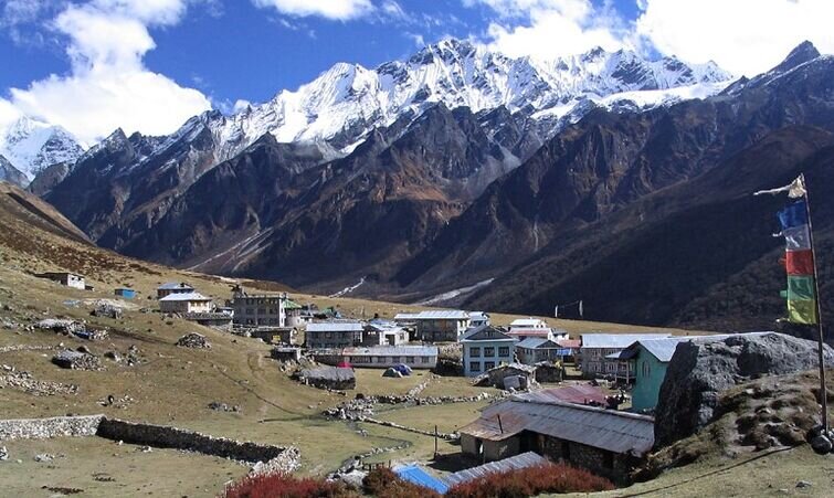
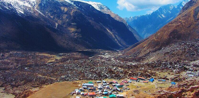
Kyanjin Gompa (3,870m) is the spiritual and cultural high point of the valley. Clustered around a centuries-old monastery, a working yak cheese factory that has been producing exceptional cheese since the 1950s, and a handful of permanent residents who live here through all four seasons, it is one of those rare mountain settlements that feels completely of its place. Visit the monastery, taste the cheese, and rest well tomorrow you climb. Walking time: 3–4 hours.
Your critical acclimatization day and one of the most intimate mountain viewpoint experiences in the entire Langtang region. The hike to Kyanjin Ri (4,773m) begins with a steep, unrelenting climb directly above the village that tests your lungs immediately. Allow 2 to 2.5 hours to reach the top the gradient stays steep from the first step to the last.
At the summit, the view is extraordinary in a specific and personal way that distinguishes Kyanjin Ri from almost every other viewpoint on this circuit. You stand at 4,773m and look directly into the face of Langtang Lirung (7,227m) a wall of ice and rock so close and so immense that it fills your entire field of vision to the north. The Kyanjin Glacier pours from the mountain directly below you. To the south, the entire Langtang Valley stretches westward. To the east, the Tibet border peaks rise in a continuous ridge of ice. It is one of the most powerful mountain views in Nepal not because of the number of peaks but because of the sheer, overwhelming presence of the one mountain directly in front of you.
Descend to Kyanjin Gompa for a late morning snack, then spend the afternoon exploring the monastery interior, walking along the glacier moraine, and resting fully. Your body is doing important altitude-adaptation work even when you sit still give it the time it needs before the sustained demands of the Gosainkunda section ahead. Hike time: 4–5 hours return.
The pivot day the hinge between the Langtang Valley and the Gosainkunda sections. The trail retraces the route westward from Kyanjin Gompa through the mani walls and upper meadows, past the rebuilt Langtang Village, through the memorial zone above Ghoda Tabela, and back down through the thinning forest to Lama Hotel.
At approximately 21 kilometers and nearly 1,500m of altitude loss, this is the longest walking day of the entire circuit. An early start is essential. The descent through the rhododendron and bamboo forest in the afternoon is beautiful the increasing density of the forest and the thickening air as you lose altitude are physically noticeable and genuinely welcome after several days above 3,500m. Eat well at Lama Hotel, rest fully, and prepare for the circuit to branch decisively south tomorrow. Walking time: 6–7 hours.
The route turns south today and the Gosainkunda section begins. Instead of descending back to Syabrubesi, the trail branches from the valley floor at Rimche and climbs through dense rhododendron forest up a broad south-facing ridge to Thulo Syabru (2,210m).
The climb gains significant altitude through beautiful mixed forest oak and rhododendron, giving way to taller fir trees as the ridge is approached. The sound of the Langtang River fades below as you gain height and the forest takes on a quieter, more interior character.
Thulo Syabru, the “big Syabru,” is one of the most beautifully situated villages in the Langtang region. Built along the ridge with an expansive south-facing aspect, the village looks out over an enormous panorama: Ganesh Himal (7,429m) and Langtang Lirung (7,227m) rise to the north, while the rolling forested hill ranges of Nuwakot district stretch south toward Kathmandu in long, blue-green waves. The village has preserved its Tamang character entirely traditional stone houses, carved wooden window frames, chortens at every trail junction, a small gompa, and a community of warm, direct, unhurried mountain people. Watch the sun go down behind Ganesh Himal from the village ridge. Walking time: 5–6 hours.
One of the finest forest climbing days of the entire 18-day trek. From Thulo Syabru the trail heads east and climbs steeply through the national park forest passing through Dursagang (2,660m) and then the high ridge at Foprang Danda (3,200m) before leveling as it approaches the upper forest zone. The gradient in the first two hours is demanding a sustained uphill through rhododendron, oak, and then tall fir forest draped in old man’s beard lichen.
The mountain views that open along the ridge as the forest thins are the reward Langtang Lirung filling the northern horizon, Ganesh Himal to the northwest, and the broad sweeping panorama of the hill country to the south stretching all the way toward Kathmandu on a clear day.
Sing Gompa (3,330m) also called Chandanbari is a small, remote, and deeply peaceful settlement built around an active monastery and a working yak cheese factory that produces some of the finest cheese in the entire Langtang region. The surrounding upper-forest meadows give the settlement a quiet, isolated character entirely different from the busy teahouses of the main Langtang trail. The monastery is worth a visit and the cheese is worth buying. Walking time: 5–6 hours.
Above Sing Gompa the forest progressively thins and the alpine world asserts itself. The trail climbs through scattered fir and juniper to Cholangpati (3,584m) a broad, open ridge with excellent teahouses and one of the most panoramic views of the entire Gosainkunda approach. Langtang Lirung, Ganesh Himal, Manaslu, and on exceptionally clear days even the distant profile of the Annapurna range to the southwest are all visible from the Cholangpati ridge.
From Cholangpati the trail climbs more steeply to the high yak pastures of Lauribina Yak (3,920m) a handful of simple teahouses on a wide, windswept ridge used by herding communities who have brought yaks to these high meadows for generations. The name captures the place perfectly this is the world of the high pasture, above the forest, open to the full sky and the mountain wind.
The temperature drops sharply after sunset at nearly 4,000m. Layer up early, eat a full dinner, and rest with the knowledge that the sacred lakes are directly above you just a morning’s climb away. Walking time: 4–5 hours.
The most spiritually anticipated day of the entire circuit. From Lauribina Yak the trail climbs above the tree line completely into the open, rocky, high-altitude landscape of the Gosainkunda basin. There is nothing above here except rock, sky, and the sacred waters ahead.
The trail passes the companion lakes Saraswatikunda and Bhairavkunda, in sequence as you climb. Each one sits in its rocky bowl in perfect stillness, their surfaces reflecting the peaks above and the enormous sky around them. The silence at this altitude has a particular quality not the silence of emptiness but the silence of presence. These lakes are venerated in both Hindu and Buddhist tradition and the sense of approach to something genuinely sacred builds with each one.
Gosainkunda Lake (4,380m) is the holiest high-altitude site in all of Nepal. Hindu mythology holds that it was created by Lord Shiva, who drove his trident into the mountain to release a spring of water to cool the cosmic poison he had swallowed to save the world. Every August on the full moon of Janai Purnima, thousands of pilgrims from across Nepal make this demanding journey to bathe in the sacred water one of the great Himalayan religious gatherings. Outside the festival, the lake belongs to the wind, the peaks, and the occasional trekker who has earned the right to stand at its edge in silence.
The water is an extraordinary deep turquoise-blue. The surrounding peaks are streaked with snow. A small shrine sits at the water’s edge. Spend the afternoon here unhurriedly walking the shoreline, visiting the shrine, watching the light change on the water through the afternoon hours. This is one of the rare places on any Nepal trek where stopping and doing nothing is exactly the right response. Walking time: 3–4 hours.
The most physically demanding day of the entire 18-day circuit and the one that trekkers remember most vividly. Rise early, eat a full breakfast, and begin the climb to Lauribina La Pass (4,610m) in the still, cold air of the early morning when visibility is at its best and the trail surface is most stable.
From the lake the trail climbs steeply along the northern shore and then up across open rock and scree to the pass. The final approach is steep and exposed no shelter from the wind, the gradient demanding a slow and deliberate pace, every breath conscious and complete. At the top, a bank of prayer flags marks the crossing and the panorama opens in every direction simultaneously.
Lauribina La (4,610m) is the highest point of the entire 18-day circuit and one of the finest mountain pass viewpoints in the Langtang region. Langtang Lirung, Ganesh Himal (7,429m), Dorje Lakpa (6,990m), Jugal Himal, Manaslu (8,163m) all visible at once in a single sweeping arc. Behind you, the sacred lake basin. Ahead, the long green ridges of the Helambu country descending south.
The descent from Lauribina La to Ghopte (3,440m) is long and steep loose scree in the upper section, then dense rhododendron and fir forest as the altitude drops. The small hidden lake of Surya Kunda appears briefly beside the trail on the descent, one more sacred water body in a landscape defined by them. Ghopte is a remote, forested settlement with a handful of teahouses that feels genuinely isolated a quiet, earned end to the hardest day on the circuit. Walking time: 6–7 hours.
From Ghopte the trail continues south through upper rhododendron forest and climbs gradually to the famous junction ridge at Tharepati (3,690m) the crossroads of the Langtang region, where the trails from Gosainkunda, the Langtang Valley, and the Helambu circuit all converge.
The views from Tharepati on a clear morning are the finest panoramic ridge views of the entire circuit Langtang, Ganesh, Jugal, Manaslu, Dorje Lakpa, and on the clearest days even Mount Everest visible on the far eastern horizon. Standing here with the full Himalayan range spread across the northern skyline, you can look back mentally across everything the last 12 days have brought you the valley, the glacier, the lake, the pass and feel the completeness of what you are walking.
From Tharepati the trail turns decisively south into the classic Helambu ridge descent. This is one of the great ridgeline walking sequences in Nepal a long, varied, and genuinely beautiful trail through Magne Goth (3,285m) and down through thinning forest to the welcoming village of Kutumsang (2,470m). The lower altitude is immediately and physically felt. Walking time: 6–7 hours.
A long descent day through the southern Helambu hills the landscape progressively softening from alpine ridge to settled farmland as altitude is lost. From Kutumsang the trail heads west and south along the main ridge through the village of Gul Bhanjyang (2,130m) a natural lunch stop with teahouses and good views.
Beyond Gul Bhanjyang the trail descends more steeply through mixed forest and past scattered Tamang homesteads, crossing several small streams and passing through community forests that are alive with birdsong. The carved mani walls and chortens of the Helambu continue to line the path — this is the ancestral territory of both Tamang and Hyolmo communities and their Buddhist cultural presence is woven into every kilometer of the trail.
Pati Bhanjyang (1,770m) is a pleasant small settlement at a trail junction, lower and warmer than any overnight stop in the past several days. The air at under 2,000m feels noticeably thick and rich compared to the thin atmosphere of Gosainkunda and Lauribina La less than a week ago. Walking time: 5–6 hours.
From Pati Bhanjyang the trail climbs steadily back up through the forest to the famous ridge settlement of Chisapani (2,165m) one of the most celebrated easy-access viewpoints in the entire Kathmandu region. The name means “cold water” in Nepali, a reference to the clear streams that flow from the ridge, but Chisapani is known above all for its extraordinary panoramic Himalayan view.
The climb from Pati Bhanjyang through forested ridgelines passes through the small settlements of Chipling and Thodang Betini before reaching the broad ridge at Chisapani. On a clear evening and clear evenings here are reliably spectacular in both spring and autumn the full sweep of the Central Himalayan range unfolds from west to east in a continuous wall of white: Langtang Lirung, Ganesh Himal, Jugal Himal, Manaslu, Himalchuli, and on the finest days the unmistakable distant pyramid of Mount Everest on the far eastern horizon.
Arriving at Chisapani after 14 days of deep mountain immersion and seeing the same peaks from this new, lower, and final angle carries a particular emotional weight the kind of quiet completeness that comes with knowing the journey is almost over. Stay for the sunset. It is worth every minute. Walking time: 4–5 hours.
The final walking day a descent through the forest of Shivapuri Nagarjun National Park to the road at Sundarijal. From Chisapani the trail drops steeply through dense national park forest pine, oak, and rhododendron closing overhead, the birdsong richest and most varied in these lower altitudes passing through the ridge at Burlang Bhanjyang (2,430m) before descending past a stone reservoir and the national park entrance checkpoint to Sundarijal (1,460m).
Shivapuri National Park is home to over 300 bird species and is one of the most biodiverse protected areas in the Kathmandu Valley the morning walk through here is quietly spectacular for anyone who pays attention to the forest around them. Red panda have been recorded in the park’s bamboo forest sections; early morning is the best window for wildlife sightings.
Your trekking vehicle meets you at the Sundarijal road for the short, easy drive back to Kathmandu about one hour through the northern valley suburbs. Transfer to your hotel, take the longest shower of your life, and let the full weight and beauty of the past 14 trekking days settle in over a proper meal. Walking time: 3–4 hours. Drive time: 1 hour.
A practical buffer day built in to absorb any road or weather disruptions that might affect the return from Sundarijal although the Sundarijal road is the most reliable exit on any Langtang circuit, good planning always includes a buffer.
If your return went smoothly, you have a full free day in Kathmandu. Use it well. Pashupatinath Temple on the banks of the Bagmati River is one of the most sacred Hindu sites in Asia a complex of golden-roofed temples, cremation ghats, wandering sadhus, and concentrated spiritual atmosphere that no visitor forgets quickly. Boudhanath Stupa ringed by monasteries and constantly circled by monks, pilgrims, and the rising smoke of butter lamps, is one of the greatest Buddhist monuments in the world.
For a more architectural experience, the medieval town of Bhaktapur east of Kathmandu preserves its Newari heritage with extraordinary integrity the potters’ squares, the 55-window palace, and the pagoda temples of Bhaktapur Durbar Square are among the finest cultural sights in all of South Asia. Or stay in Thamel, eat at a good restaurant, book a massage, and simply rest in the knowledge that you walked something genuinely worth walking. Overnight in Kathmandu.
Your 18-day Langtang Gosainkunda Pass Trek comes to a close. Our team transfers you to Tribhuvan International Airport for your onward journey. You leave Nepal having completed the full Langtang circuit from the river gorge at Syabrubesi, through the upper valley to Kyanjin Gompa, across to the sacred lakes of Gosainkunda, over Lauribina La Pass, and down the classic Helambu ridge to Sundarijal one of the most complete and varied mountain circuits in all of Nepal, accomplished without a single domestic flight.
Trek Difficulty & Physical Demands
The Langtang Gosainkunda Pass Trek is rated moderate to strenuous a serious and committed Himalayan circuit that rewards proper physical preparation but remains accessible to well-trained trekkers without technical climbing experience.
Altitude: The circuit reaches 4,773m at Kyanjin Ri and 4,610m at Lauribina La Pass. The acclimatization day at Kyanjin Gompa (Day 6) is the critical altitude preparation day before the Gosainkunda section. The gradual ascent from Sing Gompa through Lauribina Yak to Gosainkunda gives the body reasonable adaptation time. The Helambu descent section progressively reduces altitude and provides natural recovery.
Kyanjin Ri: At 4,773m, this is the highest point of the entire circuit. The climb is steep from start to finish — a 2 to 2.5-hour sustained ascent above the village. It is non-technical but aerobically demanding and the altitude makes every step feel heavier than at lower elevations.
Lauribina La Pass: The most challenging single section of the circuit at 4,610m. Steep, open, and exposed to wind on the upper section. The descent to Ghopte is long on loose terrain. In good autumn and spring conditions, it is manageable for well-prepared trekkers with trekking poles and proper footwear.
Helambu descent section: Days 13–16 from Ghopte through Kutumsang, Pati Bhanjyang, and Chisapani to Sundarijal are a long, sustained descent covering significant total distance. The cumulative daily walking over this section 5 to 7 hours per day on undulating ridge trails requires endurance as much as the high-altitude sections require fitness.
Physical fitness: 2–3 months of consistent cardiovascular training — hiking, running, cycling, stair work — before departure is the ideal preparation. The entire circuit covers 140–155 km over 14 trekking days. Leg strength for extended descents and cardiovascular capacity for sustained uphill sections are both important. Prior high-altitude experience is a genuine advantage.
Best Time to Trek: Seasonal Comparison
| Season | Months | Weather | Pass Conditions | Views | Recommended |
|---|---|---|---|---|---|
| Spring | Mar–May | Warm & Stable | Clear from April | Excellent | Best |
| Monsoon | Jun–Aug | Wet & Unstable | Slippery / Dangerous | Poor | Avoid |
| Autumn | Sep–Nov | Cool & Clear | Excellent | Excellent | Best |
| Winter | Dec–Feb | Cold & Snowy | Icy / Impassable | Good (lower) | Experienced Only |
Pro tip: For this specific circuit, October and early April are the two optimal windows. Lauribina La is clear, Gosainkunda is open, Kyanjin Ri delivers its finest panorama, and the Helambu ridge descent is at its most beautiful. The Chisapani sunrise view on Day 15 is at its most extraordinary in October, when the entire Himalayan range is perfectly sharp against a deep blue sky.
Booking Your Langtang Gosainkunda Pass Trek – 18 Days
Our team handles all logistics across all three circuit regions so you can focus entirely on preparation and arrival.
Step 1 — Contact us. Reach out via our website, email, or WhatsApp with your preferred dates and group size. We respond within 24 hours with the full day-by-day itinerary and complete cost breakdown.
Step 2 — Confirm your booking. A 20% deposit secures your dates. We immediately process permits for both national parks, arrange transport for Syabrubesi entry and Sundarijal exit, and assign your guide.
Step 3 — Prepare. We send a comprehensive pre-departure guide covering fitness training, gear list, cultural notes on Tamang and Hyolmo communities, altitude awareness specific to the Gosainkunda section, and day-by-day expectations for all 18 days.
Step 4 — Arrive in Kathmandu. We collect you from the airport, brief you thoroughly across all three circuit sections, and help with any last-minute gear needs. The road to Syabrubesi departs the following morning.
Step 5 — Trek. Your licensed guide leads you through every stage from Syabrubesi to Sundarijal, supported by experienced porters and our full logistical backing throughout.
Step 6 — Pay the balance. The remaining 80% is due on arrival in Kathmandu before departing for Syabrubesi.
Cancellation Policy:
- 30+ days before departure: Full deposit refunded minus bank transfer charges
- 15–29 days before: 50% refund of deposit
- Less than 15 days: Deposit forfeited, no refund
Important: Travel insurance with emergency helicopter evacuation coverage above 5,000m is mandatory. The Gosainkunda area and Lauribina La Pass are remote. A helicopter rescue from the upper circuit costs USD 3,000–5,000 or more. Your policy must explicitly cover these altitudes.
Cost Details
Cost Includes
- Airport pick-up and drop-off in Kathmandu
- Kathmandu–Syabrubesi ground transportation (private jeep or tourist bus)
- Sundarijal–Kathmandu return ground transportation (private vehicle)
- 1 night hotel accommodation in Kathmandu on arrival (bed & breakfast, 3-star)
- All teahouse and lodge accommodation during the trek (15 nights)
- All meals during the trek — breakfast, lunch, and dinner every day on trail
- Experienced, English-speaking, government-licensed trekking guide
- One porter for every two trekkers (maximum 15 kg per porter load)
- All required trekking permits:
- Langtang National Park Entry Permit
- Shivapuri Nagarjun National Park Entry Permit
- TIMS Card (Trekkers’ Information Management System)
- Guide and porter wages, meals, accommodation, and full insurance
- All government taxes and local charges
- Sleeping bag and duffel bag rental (if needed)
- First Aid Kit including pulse oximeter carried by guide throughout
- Emergency evacuation arrangement (evacuation cost covered by your travel insurance)
Cost Excludes
- Nepal entry visa fee (approx. USD 50 for 30 days — obtainable on arrival at Kathmandu airport)
- International flights to and from Kathmandu
- Travel insurance with emergency helicopter evacuation coverage (mandatory)
- Meals in Kathmandu beyond breakfast
- Hot showers, Wi-Fi, and device or battery charging along the trek (charged at teahouses)
- Personal snacks, bottled water, energy drinks, and alcoholic beverages
- Tips and gratuity for guide and porter (strongly recommended)
- Personal trekking gear and clothing
- Extra nights in Kathmandu beyond the planned itinerary
- Helicopter rescue costs (must be covered by personal travel insurance)
- Monastery entry donations and personal religious offerings at Gosainkunda and Kyanjin
- Personal expenses — laundry, souvenirs, phone calls, and incidentals
Trip Gallery
Trek Essentials
- Thermal base layer top and bottom — 2 sets
- Mid-layer fleece or softshell jacket
- Warm down jacket or insulated puffy — non-negotiable from Kyanjin Gompa upward and critical at Gosainkunda where overnight temperatures fall well below freezing
- Waterproof, windproof hardshell jacket and trousers — essential for Lauribina La and the exposed upper Gosainkunda section
- Trekking trousers — 2 to 3 pairs
- Warm trekking socks, wool or synthetic — 5 pairs for 18 days on trail
- Thin liner gloves and warm outer gloves or mittens
- Warm beanie or wool hat — worn daily above 3,500m
- Sun hat with brim for lower valley and Helambu ridge sections
- Neck gaiter or buff — critical on Lauribina La in wind
- Waterproof, ankle-support trekking boots — broken in thoroughly before departure. The Lauribina La descent and the long Helambu ridge days both put significant stress on feet and ankles.
- Lightweight camp sandals for teahouse evenings
- Gaiters — recommended for Lauribina La; essential in winter or after snowfall
- Trekking poles — both collapsible; among the most important items on this circuit for the Lauribina La crossing and the multiple long descent days
- Daypack (20–25 liters) for daily essentials on the trail
- Duffel bag (60 liters) for your porter
- Sleeping bag rated to -15°C — Gosainkunda overnight is the coldest point of the circuit
- Headlamp with spare batteries — useful for early starts on Kyanjin Ri and Lauribina La days
- Quality sunglasses with UV400 protection — UV intensity is high at 4,000m+ and reflected from snow and lake surfaces
- Water bottle (1–2 liters) or hydration bladder
- Water purification tablets or personal filter
- Diamox (acetazolamide) — consult your doctor before the trek. Strongly recommended for the Gosainkunda section given the sustained altitude and the jump from Sing Gompa (3,330m) to Gosainkunda (4,380m) over two days.
- Personal pulse oximeter — monitoring blood oxygen saturation above 4,000m provides concrete data alongside subjective assessment
- Personal first aid kit — blister pads, ibuprofen, bandages, antiseptic cream
- Sunscreen SPF 50+ and SPF lip balm — especially important at Gosainkunda and Lauribina La where UV reflects from water and snow
- Hand sanitizer and biodegradable wet wipes
- Insect repellent for lower forest sections — Shivapuri National Park and lower Langtang forest
- Diarrhea medication and oral rehydration salts
- All personal prescription medications for the full 18-day duration
- Valid passport with at least 6 months remaining validity
- Nepal visa (obtainable on arrival at Kathmandu airport)
- Printed travel insurance policy with emergency helicopter evacuation details
- 2 passport-sized photos for permit processing
- Emergency contact card kept on your person throughout
Final Thoughts: Final Thoughts
There is a specific kind of satisfaction that comes from completing a full circuit — walking into the mountains from one road and walking out onto a different road far away, having traced a complete loop through a landscape rather than retreating the same path twice. The Langtang Gosainkunda Pass Trek delivers that satisfaction in full, across 18 days and three genuinely different mountain worlds.
The Langtang Valley gives you the glaciers, the Tamang culture, and the close personal encounter with Langtang Lirung at Kyanjin Ri. The Gosainkunda section gives you the sacred lake, the deep forest of Thulo Syabru and Sing Gompa, and the pass crossing that stands as the physical and emotional high point of the entire journey. And the classic Helambu ridge from Tharepati’s panoramic junction through Kutumsang, Pati Bhanjyang, and Chisapani to Sundarijal’s forest provides a long, beautiful, culturally layered descent that winds the journey down gradually and leaves you with the full Himalayan range as your final view before the road.
No domestic flights. No repeated trail. Three regions, one continuous path, and 18 days that earn every moment they ask from you in return.
Your Adventure to Langtang Gosainkunda Pass Trek – 18 Days Starts Here
Start your journey with trusted local experts and discover the beauty, culture, and adventure waiting in the Himalayas and beyond.
Frequently Asked Questions
Everything you need to know about the AASRA ECO TREK
This version uses Kyanjin Ri (4,773m) as the acclimatization hike at Kyanjin Gompa rather than Tserko Ri and follows the complete classic Helambu ridge descent from Tharepati through Ghopte, Kutumsang, Pati Bhanjyang, and Chisapani to Sundarijal as the exit. This is the traditional and most historically established Langtang circuit route a point-to-point journey from Syabrubesi to Sundarijal that traces the full geographic breadth of the Langtang region from east to west.
Kyanjin Ri (4,773m) is the classic acclimatization hike from Kyanjin Gompa — a steep 2-hour climb that delivers an extraordinarily intimate, face-to-face view of Langtang Lirung’s southern face and the Kyanjin Glacier directly below. Tserko Ri (5,033m) is higher, takes 4–5 hours to climb, and delivers a wider 360-degree panorama of 20+ peaks. Kyanjin Ri is the better acclimatization choice before the Gosainkunda section because the altitude gain is sufficient for adaptation without exhausting the body before the demanding days ahead. Tserko Ri is the better viewpoint for trekkers who want the broader panorama and have the fitness for the longer summit day.
Gosainkunda (4,380m) is one of the holiest pilgrimage sites in all of Nepal. In Hindu mythology, Lord Shiva struck his trident into the mountainside to release a spring of sacred water — the source that cooled the cosmic poison he had swallowed to save the world during the churning of the ocean. Every August on the full moon of Janai Purnima, thousands of Hindu and Buddhist pilgrims make the demanding high-altitude journey to bathe in this water. The lake is also deeply sacred in Buddhist tradition. Outside the festival season it is a place of profound and palpable stillness.
You need the Langtang National Park Entry Permit (approx. USD 34), the Shivapuri Nagarjun National Park Entry Permit (approx. USD 3 for the Sundarijal exit section), and a TIMS Card. All three are included in the package price and arranged on your behalf.
Yes. Travel insurance with emergency helicopter evacuation coverage above 5,000m is mandatory and non-negotiable. The Gosainkunda basin and Lauribina La area are remote — road access for a medical emergency is several hours of walking below. A helicopter rescue from this section costs USD 3,000–5,000 or more. Your policy must explicitly cover altitude activities above 5,000m.
We strongly recommend consulting your doctor about Diamox before this trek. The section from Sing Gompa (3,330m) to Gosainkunda (4,380m) involves a significant altitude jump over approximately two days. The acclimatization day at Kyanjin Gompa provides a solid foundation for the high sections, but anyone with prior altitude sensitivity history should consider Diamox as a precaution from Day 9 onward.
Langtang National Park and Shivapuri Nagarjun National Park together form one of Nepal’s most biodiverse protected corridors. Red panda are possible in the bamboo and rhododendron forest sections between Syabrubesi and Lama Hotel, between Thulo Syabru and Sing Gompa, and in the Shivapuri forest near Sundarijal. Gray langur monkeys are very commonly seen on the Helambu ridge section between Kutumsang and Chisapani. Himalayan black bear, musk deer, Himalayan thar, wild boar, and over 300 bird species are recorded across both parks.
Teahouses throughout the Langtang and Helambu regions serve a reliable range of local and simple international food dal bhat, noodle soups, pasta, porridge, eggs, momo, Tibetan bread, pancakes, and seasonal vegetables. Three meals per day are included in the package. Do not miss the yak cheese at Kyanjin Gompa and Sing Gompa — both settlements have active cheese factories and the freshly pressed yak cheese is one of the genuine food highlights of the entire circuit. The Helambu ridge teahouses are among the most affordably priced on any standard Nepal circuit.
Approximately 1 hour by private vehicle. Sundarijal is just 12 kilometers northeast of central Kathmandu — the closest standard trekking trailhead to the city. The short road transfer at the end of this circuit is one of its practical advantages over circuits finishing at Syabrubesi or Melamchi Pul Bazaar, both of which require significantly longer return drives.
Absolutely. Common customizations include adding an optional Tserko Ri (5,033m) hike alongside or instead of the Kyanjin Ri acclimatization day for trekkers who want the more demanding and panoramic summit. We can also add extra overnight stops in the Helambu section particularly at Kutumsang for a more relaxed descent pace, or modify the exit to finish at Melamchi Pul Bazaar instead of Sundarijal for groups wanting a longer final Helambu valley experience. Contact us and we will build the right version for your schedule and fitness level.

Still have questions?
Can’t find the answer you’re looking for? Please chat to our friendly team.
Get In TouchSimilar Packages
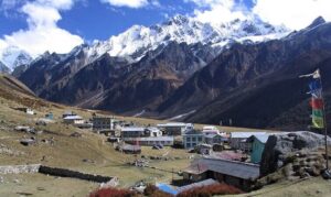
Langtang Ganja La Pass Trek – 15 Days
Approx. 110–125 km
Distance
5,130m
Max. Elevation
15 Days
Duration
2 to 10 people
Group Size
Moderate Level
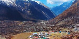
Tamang Heritage Trail Trek – 12 Days
Approx. 95–110 km
Distance
12 Days
Duration
1 to 12 people
Group Size
Moderate Level
Langtang Helambu Trek – 20 Days
5,033m
Max. Elevation
20 Days
Duration
1 to 12 people
Group Size
Hard Level
We are associate with
