
 Plan Your Trip
Lower Dolpo Trek – 18 Days
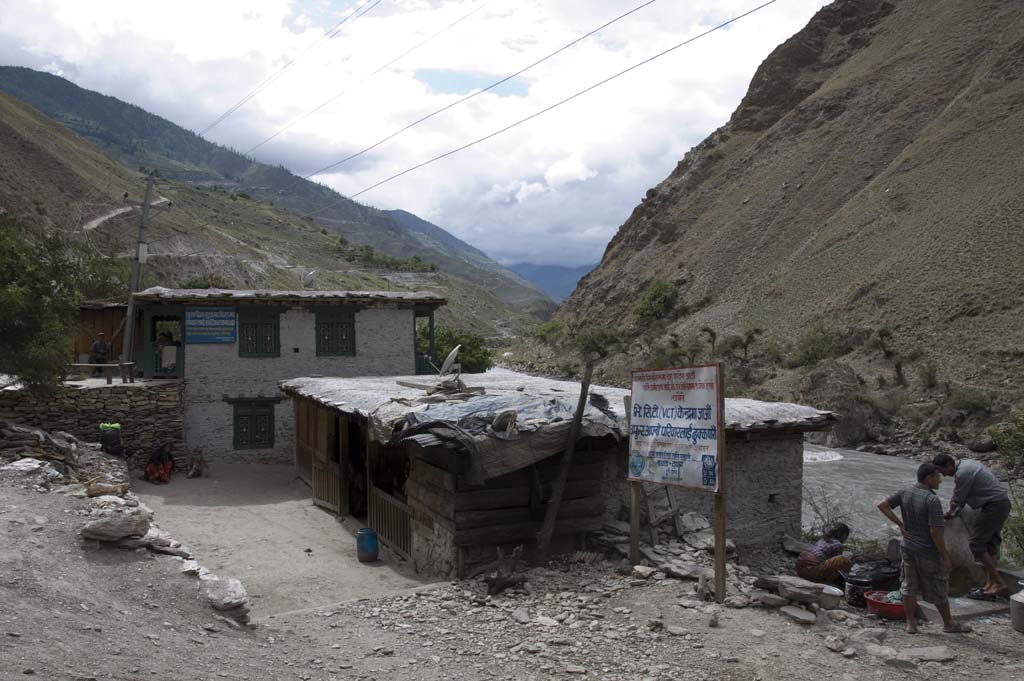
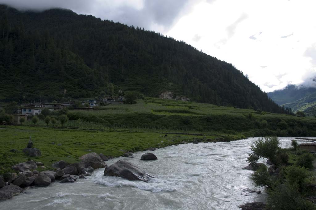
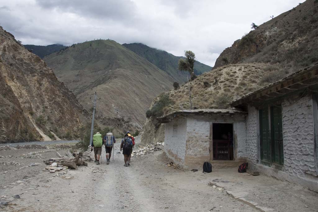

Trip Overview

Trek Region
Dolpo

Difficulty Level
Hard

Transport
Kathmandu–Nepalgunj–Juphal by domestic flight (both ways)

Total Trip Duration
18 Days

Max Elevation
5,309m

Meals
reakfast, Lunch & Dinner included
Trip Highlights
- Fly to Juphal (2,475m) on a spectacular 40-minute mountain flight above the far western Nepal hill ranges — one of the most dramatic domestic flights in Nepal
- Trek the ancient Trans-Himalayan salt trade route — the same paths walked for centuries by Tibetan salt traders, yak caravans, and Bon Po pilgrims between Nepal and Tibet
- Experience the Bon Po religion — the pre-Buddhist animist and shamanistic faith that predates Tibetan Buddhism by centuries and survives in the Dolpo region with greater vitality than almost anywhere else in the world
- Explore Dho Tarap (3,944m) — the most important cultural settlement of Lower Dolpo, a windswept high-altitude village of stone houses, ancient gompas, and a community whose way of life has changed remarkably little in centuries
- Visit the extraordinary Ribo Bhumpa Gompa and Bon Po Gompa (Shipichowk) in the Dho Tarap valley — ancient religious sites representing the two major spiritual traditions of the Dolpo-pa people
- Cross the dramatic Baga La Pass (5,169m) with panoramic views of the Kanjiroba Himal range (6,612m), Dhaulagiri massif, and the arid trans-Himalayan landscape of inner Dolpo
- Stand at the sacred Phoksundo Lake (3,611m) — Nepal’s deepest freshwater lake at 145 meters depth, its color shifting between turquoise, emerald, and deep blue depending on light and season, set in a dramatic bowl of cliffs and forest within Shey Phoksundo National Park
- Visit the ancient Tshowa Gompa (Bon Gompa) perched above Phoksundo Lake — one of the finest Bon monastery sites in Nepal, decorated with pre-Buddhist iconography, sacred texts, and butter lamp altars
- Meet the Dolpo-pa people — a Tibetan-influenced community who wear traditional homespun clothing dyed in maroon, practice Bon and Nyingma Buddhism, and sustain an ancient relationship with yak herding, barley farming, and the salt trade
- Cross the Numa La Pass (5,309m) — the highest point of the entire trek — with extraordinary views of the Dhaulagiri range, Kanjiroba Himal, Churen Himal, and the vast arid plateau landscape of the inner Himalayan rain shadow
- Trek through Shey Phoksundo National Park — Nepal’s largest national park at 3,555 sq km, home to approximately 90 snow leopards, Himalayan blue sheep, musk deer, red panda, Himalayan black bear, and over 200 bird species
- Walk in the rain shadow of the Dhaulagiri and Kanjiroba ranges — an arid, high-altitude landscape that receives almost no monsoon rainfall and resembles the Tibetan plateau in its stark, wind-carved, mineral-colored geology
- Trek through the Tarap Khola gorge — a dramatic narrow canyon of sculpted rock and rushing river that is one of the finest gorge walking sections in western Nepal
- Complete a circuit through one of the most genuinely remote trekking regions in Nepal — where trails see perhaps 200–300 foreign trekkers per year and the villages you walk through are entirely, authentically themselves
Trip Summary
Far western Nepal holds a landscape unlike anywhere else in the Himalayan world. Beyond the reach of the famous trekking highways of the Khumbu and Annapurna, sheltered from the monsoon rains by the massive wall of the Dhaulagiri and Kanjiroba ranges, lies the Dolpo region a high, arid, wind-swept world of Tibetan Buddhist and ancient Bon Po culture that sits geographically and spiritually closer to the Tibetan plateau than to the lowland plains of Nepal.
The Lower Dolpo Trek is the accessible entry point into this extraordinary world a route that requires two domestic flights, proper permits, and a willingness to walk in genuine wilderness, but that rewards those preparations with an experience of cultural and natural depth that very few Nepal trekkers ever encounter. The region inspired the celebrated French director Eric Valli’s 1999 film Himalaya shot entirely in the Dolpo villages and the Oscar-nominated film Shambhala (2024), Nepal’s entry for the Academy Awards, was filmed in similar conditions nearby. The landscape itself is its own extraordinary statement.
This 18-day itinerary begins with a scenic flight from Kathmandu to Nepalgunj — the gateway city of far western Nepal and a second spectacular mountain flight to Juphal (2,475m) above the Bheri River valley in the Dolpa district. The trek follows the ancient salt trade route northward along the Bheri River and through the dramatic Tarap Khola valley, ascending through subtropical forest and terraced farmland to the arid, high-altitude trans-Himalayan landscape of the inner Dolpo. It visits Dho Tarap (3,944m) the most significant cultural settlement of Lower Dolpo crosses the demanding Baga La Pass (5,169m), descends to the sacred and breathtaking Phoksundo Lake (3,611m) Nepal’s deepest freshwater lake, and then crosses the Numa La Pass (5,309m) before the long descent back to Juphal for the flights home to Kathmandu.
Two high passes above 5,100m. Nepal’s deepest lake. Ancient Bon monasteries. A living culture preserved by the barriers of altitude, distance, and the sacred character of the landscape itself. The Lower Dolpo Trek is one of the most genuinely extraordinary walking experiences available in Nepal — and one of the least known.
When To Visit
The Lower Dolpo Trek’s seasonal window is defined by two factors: the condition of the two high passes (Baga La 5,169m and Numa La 5,309m) and the accessibility of the Juphal domestic flight route. The Dolpo’s rain shadow location gives it a wider viable seasonal window than most Nepal routes at similar altitude, but the high passes impose their own timing requirements.
Spring (late April to early June) is one of the two best seasons. By late April the winter snowpack on both passes is consolidating and the crossing becomes feasible. May is the prime spring month — the high passes are clear, the valley vegetation is at its most lush and colorful, the wildflowers of the Tarap valley are in bloom, and the weather is stable. Early June is possible but the pre-monsoon can bring afternoon cloud buildup and occasional snow at altitude.
Autumn (mid-September to mid-November) is the finest season overall and the most recommended window. After the monsoon, the air clears completely and the views from both passes — of Dhaulagiri, Kanjiroba Himal, and the surrounding peaks — are at their absolute sharpest. October is the gold-standard month — stable weather, consolidated snow on the passes, excellent trail conditions, and the cultural calendar of the Dolpo communities in its most active festival period. The Tiji festival (celebrated in Dolpo’s Lo Manthang in spring) and various Bon Po ceremonies observed in autumn add a rich cultural layer to autumn timing.
Monsoon (July to August) is possible in the inner Dolpo valley — the rain shadow means the upper valley near Dho Tarap and the Phoksundo basin receive significantly less rainfall than the rest of Nepal. The lower approach trails from Juphal to Dunai and Tarakot can be muddy and leech-affected. Juphal flights are frequently delayed in heavy monsoon weather. Not recommended for first-time Dolpo visitors but possible for experienced trekkers who want complete solitude.
Winter (December to March) is not recommended. Both passes accumulate heavy snowpack through December and become impassable or extremely dangerous by January. The villages above 3,500m become very cold and some are seasonally abandoned. Juphal flights may be difficult in winter storms. Only for genuine cold-weather expedition trekkers with full mountaineering preparation.
Itinerary
Welcome to Nepal. Our team meets you at Tribhuvan International Airport and transfers you to your hotel in Kathmandu. In the evening, your trekking guide joins you for a comprehensive pre-trek briefing covering the full 18-day circuit, the unique character of the Dolpo region and its Bon Po cultural traditions, the permit system for both the Restricted Area and Shey Phoksundo National Park, the logistics of the two domestic flight legs, altitude awareness for the two high passes at Baga La and Numa La, gear checks, and the camping sections where teahouse accommodation is unavailable.
The Dolpo briefing has a particular cultural dimension worth extra attention. Your guide explains the Bon Po religion the pre-Buddhist faith of the Dolpo-pa people its distinct iconography, its relationship with Tibetan Buddhism, and the respectful protocol for visiting Bon monasteries and shrines. Understanding the difference between a Bon gompa and a Buddhist gompa, and knowing how to engage with a community whose spiritual framework is genuinely ancient and largely unfamiliar to Western visitors, makes the entire cultural experience richer and more meaningful.
If time allows, a visit to Boudhanath Stupa in the evening provides a beautiful first encounter with the Tibetan Buddhist tradition that Bon Po predates and coexists with throughout the Dolpo region. Overnight in Kathmandu.
The journey to the Dolpo begins with two spectacular domestic flights that take you from the capital across the width of Nepal’s hill country to one of its most remote mountain airstrips.
The first flight 50 minutes from Kathmandu to Nepalgunj (150m) descends into the broad Terai lowlands of far western Nepal. Nepalgunj is a lively border city with a distinctly different cultural character from Kathmandu warmer, more commercial, with the flavors and sounds of the India-Nepal border region. Depending on flight timing, there may be time to explore the city briefly before the second flight.
The second flight 40 minutes from Nepalgunj to Juphal Airport (2,475m), is one of the most dramatic short flights in Nepal. The small aircraft climbs steeply from the Terai lowlands, crosses the dramatic southern face of the Dhaulagiri range, and descends into the narrow river valley of the Bheri River on a short mountain airstrip carved into the hillside above the river. The views during this flight of the Dhaulagiri massif, Churen Himal, and the arid, folded hill country of the Dolpa district announce immediately and unmistakably that you have arrived somewhere genuinely different.
At Juphal, meet your porter and camping crew, complete final permit checks, and begin the first short afternoon walk into the Dolpo world. Overnight in Juphal or begin the descent to Dunai depending on afternoon flight timing.
The first full walking day a relatively gentle introduction to the Dolpo landscape. From Juphal the trail descends to the Bheri River valley and follows the river westward and northward toward Dunai (2,145m) the district headquarters of Dolpa district and the administrative center of the Lower Dolpo region.
The Bheri River valley in this section is wide and agricultural by Dolpo standards terraced fields of millet, barley, and potato on the valley walls, small settlements of mixed Hindu and Buddhist population, and the warm, subtropical character of the lower valley that feels at odds with the high-altitude arid plateau you are heading toward. The contrast between the lower Bheri valley and the upper Tarap valley which you will reach in several days is one of the most dramatic ecological transitions of any Nepal trek.
Dunai (2,145m) is a proper town by Dolpa standards a loose collection of government offices, small shops, teahouses, and the checkpoint where Shey Phoksundo National Park permits and Restricted Area Permits are checked and stamped. Your guide manages all documentation. Spend the evening exploring the town, which carries the particular frontier character of a remote administrative outpost at the edge of the accessible world. Walking time: 4–5 hours.
From Dunai the trail heads northward up the Thuli Bheri River the main river draining the inner Dolpo highlands. The character of the landscape begins to change as the valley narrows and the agricultural terracing of the lower valley gives way to more rugged, rocky terrain. The trail crosses the Thuli Bheri on suspension bridges, passes through small settlements of the lower Dolpa district, and climbs gradually to Tarakot (2,540m).
Tarakot is an ancient settlement with a significant history it was once an important regional center and trading hub on the trans-Himalayan salt trade route, and the ruins of old fortifications on the hilltop above the village attest to its historical strategic importance. The ancient fort Tarakot Fort, sits dramatically above the village and is worth a short exploratory hike in the afternoon. The views of the surrounding valley from the fort walls are excellent and the remnant architecture gives a tangible sense of the long history of this remote region.
The cultural character of Tarakot already hints at the Tibetan Buddhist world ahead mani walls begin appearing on the trail approaches, prayer flags flutter from the rooftops, and the distant sound of monastery chanting drifts across the valley in the evening. Walking time: 5–6 hours.
The trail above Tarakot enters the Tarap Khola valley the primary drainage of the inner Lower Dolpo highlands and the most dramatic gorge section of the entire trek. From Tarakot the trail branches from the main Thuli Bheri and follows the Tarap Khola northward through a progressively narrowing canyon whose walls rise steeply on both sides.
The Tarap Khola gorge is one of the geological and scenic highlights of the entire Lower Dolpo circuit. Sculpted by millennia of water action through the arid trans-Himalayan rock, the canyon walls in the most dramatic sections rise nearly vertically above the river in colors of red, ochre, grey, and white a palette of mineral geology entirely unlike the green forested ridgelines of the more humid Nepal trekking regions. The trail crosses the river multiple times on wooden bridges and follows narrow cliff ledge paths above the water in sections that require confident, sure footing.
The vegetation changes significantly as the canyon narrows the subtropical vegetation of the lower valley giving way to pine, birch, and oak forest, and then the first juniper scrub of the higher altitude zones. Ancient mani walls, small chortens, and prayer flag clusters mark the trail with increasing frequency.
Chhyugar / Toltol (3,050m) is a winter settlement for some of the Upper Dolpo communities inhabited seasonally when the high valleys above are inaccessible. Simple teahouse accommodation may be available; camping is prepared as the primary option. Walking time: 6–7 hours.
The gorge deepens and the altitude increases steadily. From Chhyugar the trail continues northward through the increasingly dramatic Tarap Khola canyon passing through boulder-strewn riverbed sections, narrow canyon trails where the walls close to almost nothing above the river, and the first open yak pasture areas that signal the approach to the inner valley.
The vegetation shifts again in this section the pine and birch forest of the mid-gorge giving way to juniper scrub and the first dry, rocky, open hillside that characterizes the rain-shadow landscape of inner Dolpo. The colors of the canyon walls become more vivid and varied at this altitude layers of red, purple, ochre, and grey sedimentary rock telling the geological story of a landscape lifted from an ancient sea floor by the Himalayan uplift.
The trail passes through the small settlement of Nawarpani a cluster of simple buildings at a river confluence where a makeshift lodge or tent site serves as the overnight stop. The altitude at 3,523m is felt noticeably and the views of the surrounding peaks the first glimpses of the high snow peaks of the inner Dolpo, appear above the canyon walls on clear afternoons. Walking time: 6–7 hours.
The day the inner Dolpo world opens fully. From Nawarpani the trail leaves the narrow gorge, crosses the forest section full of pine, oak, wild rose, and juniper bushes, and then enters the broad, open valley of Dho Tarap (3,944m) the cultural and geographical heart of Lower Dolpo.
The approach to Dho Tarap from the south is one of the great trail arrivals in western Nepal. After days in the narrow gorge, the valley suddenly widens into a broad, high-altitude basin surrounded by dramatic peaks red shrines and ancient chortens visible from distance, prayer flags catching wind on the ridges above, the whitewashed walls of the village’s mani walls stretching along the valley floor. The scale and the openness and the silence of Dho Tarap at nearly 4,000m arrives with a particular impact.
Dho Tarap is a village of extraordinary cultural significance home to the Dolpo-pa people, a Tibetan-influenced community who wear homespun clothing dyed in natural colors, favor traditional Tibetan-style boots with upturned toes (somba), practice a blend of Bon Po and Nyingma Buddhism, and sustain an ancient relationship with yak herding, high-altitude barley farming, and the seasonal salt trade with Tibet that has defined life in this valley for centuries.
The Ribo Bhumpa Gompa sits within the village a Buddhist monastery whose prayer hall is decorated with ancient thangka paintings, butter lamp altars, and the smell of centuries of incense practice. The Bon Po Gompa at Shipichowk a 30-minute walk above the village — represents the other spiritual pole of the Dolpo-pa world, its pre-Buddhist Bon iconography and ritual objects making it one of the most fascinating and least-visited religious sites in western Nepal. Walking time: 6–7 hours.
A full rest and exploration day in Dho Tarap both a necessary acclimatization stage before the high passes ahead and one of the most culturally rewarding days of the entire 18-day circuit.
The Ribo Bhumpa Gompa visit this morning is more thorough than the brief evening visit of Day 7 sit in the prayer hall, observe the morning butter lamp lighting ceremony, watch the monks chant, and ask your guide to explain the stories depicted in the ancient thangka paintings on the walls. The artistic style here is distinctly different from the Tibetan Buddhist gompas of the Manaslu or Langtang regions older, rougher, more immediate in its imagery.
The hike to the Bon Po Gompa at Shipichowk above the valley is one of the most rewarding short walks on the entire Dolpo circuit. The 30-minute climb takes you to a monastery whose entire iconographic program is pre-Buddhist the deities, the ritual objects, the structure of the prayer hall itself all reflecting a spiritual tradition that is genuinely ancient in the way that very few remaining religious sites in the Himalayan world are. Sitting in this gompa above the Dho Tarap valley, understanding that this tradition was old when Tibetan Buddhism was young, is a profoundly moving cultural experience.
For those with energy and good altitude fitness, a hike to the Drakmar Dewa Gompa a monastery set dramatically into the red cliff face above the valley provides excellent acclimatization altitude gain and one of the finest views of the Dho Tarap basin from above.
The afternoon is spent in the village — talking to residents through your guide’s translation, watching the daily rhythms of yak herding and barley processing, visiting the traditional craft production that continues here largely as it has for generations. Exploration time: Half day structured + free afternoon.
From Dho Tarap the trail heads northward through the broad Tarap valley a completely different landscape from the narrow canyon of the approach. The upper Tarap valley is wide, open, and arid patches of lush green grass along the river contrasting with the dry, rocky hillsides above, yak herds grazing in the upper pastures, and the increasingly high snow peaks of the Kanjiroba Himal visible at the head of the valley.
The trail follows the Tarap Chu River northward a gentle, gradual ascent through one of the most atmospherically beautiful high-altitude valleys in western Nepal. The silence here is enormous. The scale is enormous. The sky is enormous. The rain-shadow character of inner Dolpo — almost no vegetation above the valley floor, the hillsides bare and mineral-colored, the light intense and clean gives the landscape a quality entirely its own.
Tokyu Gaon (4,250m) also written as Tokyu, is a small, traditional settlement with a graceful kani (gateway chorten) at the village entrance — a carved and painted gateway through which all entering visitors pass under the protection of the Buddhist deities painted within. The village has a beautiful old Bon monastery and a community of pastoral farmers and yak herders who live at over 4,000m year-round with the particular self-sufficiency of people for whom the outside world is genuinely distant. Overnight in the village teahouse or camp. Walking time: 5–6 hours.
The approach to the first high pass of the circuit. From Tokyu the trail continues northward and then turns west, ascending through the upper valley toward the Baga La Pass (5,169m) that divides the Tarap drainage from the Phoksundo basin.
The trail gains significant altitude through a progressively more arid and more dramatic landscape — the last vegetation giving way to pure rock and scree as the high camp zone approaches. Blue sheep (bharal) are commonly spotted on the open hillsides at this altitude the distinctive curled horns and blue-grey coats of these extraordinary high-altitude animals visible against the pale rock faces above the trail. This is also prime snow leopard territory the combination of blue sheep presence and the dramatic cliff terrain above the trail makes this section of the circuit one of the most productive wildlife observation areas of the entire trek.
Baga La High Camp (4,700m) is a camping area on the approach moraine no teahouses, no other facilities, just your tent, the wind, the stars, and the pass above. This is genuine mountain camping at nearly 5,000m and the experience of an evening here the clarity of the air, the scale of the peaks around you, the utter absence of light pollution, is one of those moments that remind you why you came to the Dolpo. Walking time: 4–5 hours.
One of the two great crossing days of the circuit. The alarm sounds early 4:00 to 5:00 AM breakfast is eaten in the pre-dawn camp, and the climb to the Baga La begins in the early morning light when the snow on the upper approach is most consolidated.
The ascent from high camp to the Baga La Pass (5,169m) gains nearly 470m on steep, rocky, and sometimes snow-covered terrain. The gradient is demanding and the altitude makes every step deliberate. Go slowly. Breathe with intention. The approach to any 5,000m+ pass in the Dolpo requires the same fundamental mountain patience that the landscape has been teaching since Juphal.
At the Baga La Pass (5,169m), prayer flags and stone cairns mark the highest point. The panorama from the pass is extraordinary — Kanjiroba Himal (6,612m) rising directly to the north, the arid plateau landscape of inner Dolpo spreading behind you to the east, and to the west and southwest the dramatic valleys and ridgelines leading toward the Phoksundo basin. On clear days, the distant white profiles of Dhaulagiri (8,167m) and Churen Himal are visible on the southern horizon.
The descent from Baga La to Phoksundo Lake is long and continuous, dropping nearly 1,560m from the pass to the lake shore. The terrain changes dramatically as altitude is lost — from bare rock and scree to first juniper scrub, then birch forest, then the denser pine and fir of the Phoksundo gorge, and finally the dramatic cliffs and waterfalls of the approach to the lake.
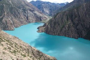
Phoksundo Lake (3,611m) Nepal’s deepest freshwater lake at 145 meters — appears without warning at the end of the gorge descent, its surface an extraordinary, almost impossibly vivid color turquoise, emerald, or deep blue depending on the light, the season, and the position of the sun. The lake sits in a dramatic natural bowl enclosed by towering limestone cliffs, pine and birch forest, and the ancient walls of Ringmo village on the southern shore. It is one of the most beautiful natural sites in Nepal remote enough that seeing it for the first time retains a quality of genuine discovery that the more accessible lakes of the Annapurna and Langtang regions cannot replicate. Walking time: 7–8 hours.
A full rest and exploration day at one of Nepal’s most beautiful and most sacred natural sites. Phoksundo Lake is not simply a natural feature it is a sacred body of water revered by the local communities of Ringmo, Shey Gompa, and Dho Tarap as a deity in its own right. The Tibetan name for the lake Tso Phoksundo, is a name of reverence, and the stories the Dolpo-pa tell about the lake’s origin and its spiritual protection are among the most interesting folk narratives of the entire Dolpo region.
The walk around the lakeshore a full circumambulation takes several hours reveals the extraordinary variety of color in the water from different angles and in different light conditions. Morning light turns the surface a deep, rich turquoise. Midday light reveals a more greenish cast where the water is shallower near the shore. Afternoon shadow deepens the color toward a dark, almost ink-blue in the deepest sections.
Tshowa Gompa also called the Bon Gompa sits on a dramatic rock shelf directly above the northern shore of Phoksundo Lake, its whitewashed walls and prayer flags visible from the opposite shore across the water. The trail to the gompa climbs steeply from Ringmo village and takes approximately 30–45 minutes. The monastery is one of the finest Bon religious sites in Nepal its prayer hall decorated with pre-Buddhist iconography, ancient painted murals, and the distinctive Bon ritual objects that distinguish this tradition from the Tibetan Buddhism practiced in the more accessible parts of Nepal. The view of Phoksundo Lake from the gompa compound — the water directly below, the limestone cliffs on the far shore, and the peaks of the Kanjiroba Himal above is the finest single viewpoint of the lake and one of the great scenic moments of the entire Lower Dolpo circuit.
Spend the afternoon on the lakeshore or in the village of Ringmo a small, traditional settlement of Tibetan-influenced Bon Po community whose residents have been the guardians of this sacred lake for generations. Exploration time: Full day.
Leaving Phoksundo Lake behind and it is genuinely difficult to leave the trail heads north and west from Ringmo through the dense pine and birch forest above the lake’s northern shore. The route climbs steadily through the forest, crossing the gorge of the Phoksundo Khola (the lake’s outflow river) on a dramatic bridge above a narrow canyon, and then ascending through increasingly open terrain toward the high camp zone below the Numa La.
The landscape above the Phoksundo forest changes character completely the forest gives way to open high-altitude meadow, then to juniper scrub, then to the bare rock and alpine grass of the Numa La approach. Blue sheep are commonly seen in this section family groups and bachelor herds grazing on the steep hillsides above the trail.
The high camp zone at approximately 4,100m sometimes called Numa La Base Camp or simply a flat meadow area on the Phoksundo Khola serves as the overnight camping site before the pass crossing. No teahouses exist in this section; this is full wilderness camping. The evening at 4,100m in the Phoksundo basin with the high peaks surrounding the camp and the sounds of the river below has the particular quality of silence and scale that the Dolpo wilderness specializes in providing. Walking time: 6–7 hours.
The highest point of the entire 18-day circuit — and one of the most demanding and most rewarding single days of any western Nepal trekking circuit. The alarm sounds at 4:00 AM. In the pre-dawn darkness, breakfast is eaten at camp, all layers are donned, crampons may be required depending on conditions, trekking poles are in hand, and the climb to the Numa La Pass (5,309m) begins.
The approach from the base camp gains nearly 1,200m in altitude over several hours — a sustained, high-altitude climb through progressively more exposed and more dramatic terrain. The gradient is steep in the final section and the altitude makes the air noticeably thin. The pace is slow and deliberate throughout the Dolpo’s arid atmosphere and the altitude combine to make the Numa La crossing one of the most demanding efforts of the circuit.
At the Numa La Pass (5,309m) the highest accessible point of the entire Lower Dolpo circuit prayer flags and cairns mark the col. The panorama from the pass is one of the finest in western Nepal. Dhaulagiri (8,167m) rises to the southeast enormous, white, and impossibly high from this vantage point. Kanjiroba Himal (6,612m), Kagmara Himal, and dozens of other western Nepal peaks fill the northern and western horizons. Below to the south, the trail descends into the valleys of the lower Dolpa district a completely different landscape from the inner Dolpo plateau above.
The descent from the Numa La is long and steep, dropping over 2,200m from the pass to the overnight camp area near Palam (3,050m) through dramatically varied terrain. Crampons and careful footwork are important on the upper descent. The trail eventually enters pine and birch forest and the gradient eases as the village zone approaches. Walking time: 8–9 hours.
The long descent toward the lower trail system continues. From Palam the trail heads southward through the increasingly lush and forested lower valley the rain-shadow landscape of the inner Dolpo giving way progressively to the moister, greener character of the outer valleys as the Dhaulagiri barrier no longer provides the same shelter from moisture.
The trail passes through several small settlements tiny villages of stone houses and terrace gardens that have the character of communities at the extreme edges of the viable agricultural zone — and through sections of the Shey Phoksundo National Park where the birch and pine forest is particularly rich and alive with birdsong. This section offers some of the best birdwatching opportunities of the entire circuit the altitude and forest type here supports a diversity of high-altitude forest species rarely seen on the more popular Nepal trekking routes.
Suligad (2,400m) is a settlement on the Suli Gad River a tributary of the Bheri, where a handful of simple teahouses or camp sites serve as the overnight stop. The warmth of the lower altitude, the thicker air, and the returning lushness of the vegetation are all physically and psychologically welcome after the high camps and passes of the past several days. Walking time: 5–6 hours.
The final trekking day — a return along the lower valley trail system back to the Juphal airstrip. From Suligad the trail follows the Suli Gad River downstream before joining the main Bheri River valley and heading back along familiar terrain to the area above Juphal.
The return to Juphal carries the particular bittersweet quality of all final trekking days the mountains still close, the landscape still extraordinary, but the road and the airport and the return to normal life visibly ahead. The airstrip at Juphal, seen from the trail below, is both a welcome and a farewell.
Arrive at Juphal, check into the simple accommodation near the airstrip, and spend the evening with your guide and porter team over a final Dolpo meal. The mountains you have walked through for two weeks are still visible above the valley walls. The passes you crossed are up there somewhere in the high distance. The lake is behind those ridges. Dho Tarap is further still. Walking time: 4–5 hours.
The two-flight return journey from the Dolpo to Kathmandu — retracing in 90 minutes of total flying time the distance that took two weeks to walk. The morning flight from Juphal to Nepalgunj provides a final spectacular view of the Dhaulagiri range and the far western Nepal hill country from the air a bird’s-eye perspective on the landscape you have been walking through for the past two weeks that brings the scale and the geography into sharp, satisfying focus.
Mountain flights at Juphal and Nepalgunj are subject to weather conditions and patience and flexibility around departure times is always required particularly at Juphal where the narrow valley and morning cloud can delay departures. This is why buffer days and travel insurance are non-optional components of any Dolpo circuit.
Back in Kathmandu, transfer to your hotel, enjoy the extraordinary pleasure of a hot shower, a proper restaurant meal, and the city’s warmth after two weeks in the high, cold Dolpo wilderness. Flight times: 40 min + 50 min.
A practical buffer day built into the itinerary for the very common occurrence of Juphal or Nepalgunj flight delays due to weather mountain and Terai weather in the far western Nepal region can ground flights for a day or more, particularly during transitional weather periods in spring and autumn. This buffer day is not optional padding it is a critical logistical component of any responsible Dolpo itinerary.
If flights returned on schedule, you have a free day in Kathmandu. Use it for cultural sightseeing Pashupatinath Temple, Boudhanath Stupa, Patan Durbar Square or for rest, shopping, and the gentle decompression from a genuinely demanding Himalayan journey.
Our team transfers you to Tribhuvan International Airport whenever your departure schedule requires.
Trek Difficulty & Physical Demands
The Lower Dolpo Trek is rated strenuous to challenging one of the most demanding standard teahouse-and-camping circuits in Nepal, primarily due to the combination of high-altitude passes, extended camping in remote terrain, and the logistical demands of a genuinely remote western Nepal wilderness area.
- Altitude: The circuit reaches 5,309m at Numa La Pass 240m higher than the Larkya La on the Manaslu Circuit and comparable to the highest passes of the Everest Three Passes Trek. The acclimatization day at Dho Tarap (3,944m) is the critical physiological preparation day before the Baga La and Numa La crossings. Following the itinerary’s pacing without shortcuts is essential.
- High pass crossings: Both Baga La (5,169m) and Numa La (5,309m) are demanding, non-technical crossings that may require crampons in snow conditions. The Numa La is the more demanding of the two, gaining more altitude on the approach and requiring a longer descent. Combined, the two passes account for two of the most physically demanding individual days of the circuit.
- Camping: Multiple nights of wilderness camping in terrain with no facilities — the Baga La High Camp at 4,700m and the Numa La Base Camp at 4,100m are both full camping nights in exposed, high-altitude terrain. Cold temperatures, wind, and the physical demands of managing high-altitude camping add to the circuit’s overall difficulty.
- Remoteness: The Lower Dolpo is genuinely remote. The trail sees very few other trekkers. The nearest road access at many points is days away. Emergency evacuation requires helicopter coordination through your guide’s satellite communication. This remoteness is part of what makes the Dolpo extraordinary — but it demands respect and realistic assessment of your physical capability and medical preparedness.
- Physical fitness: 4–6 months of consistent training before departure hiking with a loaded pack on steep terrain, cardiovascular training, and leg-strengthening work is the appropriate preparation. Prior high-altitude trekking experience above 4,500m is a genuine and meaningful advantage.
Best Time to Trek: Seasonal Comparison
| Season | Months | Pass Conditions | Rain Shadow Effect | Views | Recommended |
| Spring | Apr–Jun | Good from late April | Full protection | Excellent | Best |
| Monsoon | Jul–Aug | Possible (upper valley) | Partial protection | Partial | Experienced only |
| Autumn | Sep–Nov | Excellent | Full protection | Outstanding | Best |
| Winter | Dec–Mar | Impassable | Full protection (but cold) | Good (lower) | Avoid |
Pro tip: For the complete Lower Dolpo experience—with both high passes in optimal condition, Phoksundo Lake glowing in its finest autumn light, Dho Tarap’s cultural calendar in full swing, and blue sheep and other wildlife at their most visible—aim for October. The first three weeks of October offer the best overall conditions across every section of the circuit.
Booking Your Lower Dolpo Trek – 18 Days
The Lower Dolpo Trek requires more advance planning than most Nepal circuits — domestic flight seats to Juphal are limited and book up quickly, particularly in October. We recommend booking 3–4 months in advance for peak autumn departures.
Step 1 — Contact us. Reach out via our website, email, or WhatsApp with your preferred travel dates and group size. We respond within 24 hours with the complete 18-day itinerary, permit details, and full cost breakdown.
Step 2 — Experience assessment. We conduct a brief review of your prior trekking and high-altitude experience to ensure the team composition and pacing plan is appropriate for the group’s background. The Lower Dolpo circuit’s combination of high passes and wilderness camping makes prior high-altitude experience a meaningful safety consideration.
Step 3 — Confirm booking. A 25% deposit secures your dates. We immediately book domestic flights (which fill quickly), process both permits, arrange the camping equipment logistics, and assign your guide.
Step 4 — Prepare. We send a comprehensive pre-departure guide — fitness training program, complete gear list, cultural notes on the Bon Po and Dolpo-pa communities, altitude awareness specific to the Baga La and Numa La crossings, camping section logistics, and day-by-day expectations for all 18 days.
Step 5 — Arrive in Kathmandu. We collect you from the airport, conduct a full briefing covering the circuit’s unique logistics, assist with crampon rental and fitting if needed, and confirm all documentation. The domestic flights to Nepalgunj and Juphal depart early the following morning.
Step 6 — Trek. Your licensed guide and camping team lead the full 18-day circuit from Juphal to Juphal.
Step 7 — Pay the balance. The remaining 75% is due on arrival in Kathmandu before departure for the flights.
Cancellation Policy:
- 45+ days before departure: Full deposit refunded minus bank charges and non-refundable flight bookings
- 30–44 days before: 40% refund minus flight costs
- 15–29 days before: 20% refund minus flight costs
- Less than 15 days: Deposit forfeited, no refund
- Domestic flight tickets are non-refundable once issued regardless of cancellation date
Travel Insurance — Mandatory and Non-Negotiable: Your policy must explicitly cover helicopter evacuation above 5,500m and high-altitude trekking activities. The Dolpo circuit is genuinely remote a helicopter rescue from the Numa La or Phoksundo basin area costs USD 5,000–10,000 depending on conditions and distance. Show confirmed insurance documentation to your guide before departure from Kathmandu.
Cost Details
Cost Includes
- Airport pick-up and drop-off in Kathmandu
- All domestic flights: Kathmandu–Nepalgunj–Juphal (round trip) — both legs both ways
- 1 night hotel accommodation in Kathmandu on arrival (bed & breakfast, 3-star)
- 1 night hotel accommodation in Nepalgunj (if overnight required due to flight scheduling)
- All teahouse and local lodge accommodation during the trek where available
- Full wilderness camping equipment and support for sections without teahouse accommodation:
- High-altitude dome sleeping tents
- Mess / dining tent with basic furnishings
- Kitchen tent and cook equipment
- Toilet tent
- All meals during the trek — breakfast, lunch, and dinner every day including camping days
- Experienced, English-speaking, government-licensed trekking guide with Dolpo regional expertise
- One porter for every two trekkers (maximum 15 kg per porter load)
- Additional cook and kitchen staff for camping sections
- All required permits:
- Shey Phoksundo National Park Entry Permit (included)
- Lower Dolpo Restricted Area Permit (included)
- TIMS Card (if currently required)
- Guide, porter, and cook wages, meals, accommodation, and full insurance
- All government taxes and local charges
- Sleeping bag rated to -20°C rental (if needed — strongly recommended to bring or rent)
- Duffel bag for porter
- First Aid Kit including pulse oximeter, emergency oxygen, and altitude medications carried by guide
- Emergency evacuation coordination (cost covered by your travel insurance)
Cost Excludes
- Nepal entry visa fee (approx. USD 50 for 30 days — obtainable on arrival)
- International flights to and from Kathmandu
- Travel insurance with emergency helicopter evacuation coverage explicitly above 5,500m (mandatory — verified before departure)
- Meals in Kathmandu and Nepalgunj beyond included breakfasts
- Personal snacks, bottled water, energy drinks, and alcoholic beverages
- Hot showers and device charging where available (charged locally)
- Tips and gratuity for guide, porter, and cook (strongly recommended)
- Personal trekking and camping gear
- Extra nights in Kathmandu or Nepalgunj due to flight delays beyond buffer day
- Helicopter rescue costs (covered by personal travel insurance)
- Gompa and shrine entry donations at Dho Tarap and Ringmo
- Personal expenses — souvenirs, phone calls, incidentals
- Crampons (recommended for both passes — rentable in Kathmandu approx. USD 20–35)
Trip Gallery
Trek Essentials
- Expedition-weight thermal base layer (top and bottom) — 2–3 sets; merino wool preferred for the camping nights above 4,500m where moisture management is critical
- Heavyweight fleece or Polartec mid-layer
- Heavy down jacket or insulated puffy rated to -20°C or warmer — the camping nights at Baga La High Camp (4,700m) and Numa La Base Camp (4,100m) with wind chill demand serious insulation
- Waterproof, windproof hardshell jacket and trousers — essential for both pass crossings and exposed ridge sections
- Softshell trousers for active walking at altitude
- Waterproof over-trousers for snow sections
- Warm trekking socks, wool — 5–6 pairs
- Heavyweight mountaineering outer gloves or mittens + thin liner gloves — both needed on the passes
- Balaclava — worn on both pass crossing mornings
- Warm beanie
- Neck gaiter or buff
- Sun hat with brim for the lower valley and open Tarap valley sections
- Stiff, waterproof trekking boots with crampon compatibility (C1 compatible minimum) — the snow sections on both passes require solid crampon attachment. Well broken-in before departure.
- Lightweight camp sandals for teahouse evenings
- Gaiters — mandatory for both pass crossings
- Crampons — strongly recommended for both Baga La and Numa La; can be rented in Kathmandu (approx. USD 20–35)
- Trekking poles — both collapsible; essential for both long descent days (Baga La and Numa La)
- Expedition rucksack (30–35 liters) with hip belt
- Duffel bag (70 liters) for porter
- Sleeping bag rated to -20°C to -25°C — the Baga La High Camp is the coldest night of the circuit; do not underestimate the temperatures at 4,700m with wind
- Sleeping bag liner for additional warmth buffer
- Headlamp with 2 spare battery sets — pre-dawn starts on both pass days require 3+ hours of reliable lighting
- Glacier-grade sunglasses with UV400 protection and side shields — snow reflection at 5,000m+ is intense
- Goggles — recommended for both pass crossings in wind or blowing snow conditions
- Water bottles (2 liters) in insulated sleeves — water freezes in standard bottles at camp above 4,500m
- Water purification tablets or filter — essential throughout the remote sections
- Power bank (20,000 mAh) — very limited charging opportunities throughout the circuit
- Personal camera in insulated pouch — cold kills batteries fast at altitude
- Diamox (acetazolamide) — strongly recommended; consult your doctor. The sustained altitude from Dho Tarap upward (multiple days above 4,000m followed by two passes above 5,100m) makes Diamox a valuable precaution.
- Personal pulse oximeter — monitoring blood oxygen saturation twice daily above 4,000m is important; share readings with your guide
- Personal first aid kit — blister pads, ibuprofen, bandages, antiseptic, wound closures, compression bandage
- Sunscreen SPF 60+ and SPF lip balm — UV at 5,000m+ in the arid Dolpo atmosphere is exceptionally intense; snow reflection compounds this significantly
- Hand warmers (multiple packs) — for both pass crossing mornings
- Diarrhea medication and oral rehydration salts
- All personal prescription medications for the full 18-day duration
- Valid passport with at least 6 months remaining validity
- Nepal visa
- Printed travel insurance policy — guide must have a copy; you keep the original
- Insurance emergency contact numbers in waterproof pouch, accessible at all times
- 2 passport-sized photos for permit processing
- Emergency contact card on your person throughout
Final Thoughts:
The Lower Dolpo Trek occupies a specific and very particular place in the landscape of Nepal trekking experiences. It is not the most famous trek in Nepal. It is not the most technically demanding. It does not have the altitude of the Makalu traverse or the cultural density of the Tsum Valley. What it has instead is something rarer and harder to name a specific quality of place that the combination of remoteness, altitude, aridity, ancient culture, and protected wilderness produces in the Dolpo region more than almost anywhere else.
Walking into Dho Tarap after three days through the Tarap Khola gorge, seeing the red shrines and the mani walls and the stone houses against the dry mountain backdrop, meeting people whose daily lives have looked essentially like this for centuries this is not a manufactured experience. Walking the shore of Phoksundo Lake in the early morning when the cliffs are reflected perfectly in the turquoise water and there is no one else visible in any direction this is not a compromised experience. Crossing the Numa La at 5,309m in the first light of a clear October morning, with Dhaulagiri on the horizon and the Kanjiroba Himal directly ahead this is not an ordinary experience.
The Bon Po religion that survives in the Dolpo with greater vitality than anywhere else in Nepal carries within it a relationship with the natural world the mountains, the rivers, the high pastures, the wildlife that is genuinely ancient in its origins and genuinely intact in its practice. Walking through a landscape where that relationship is still alive and still primary is a privilege that fewer and fewer places in the world can offer.
Come properly prepared. Come with the right guide. Come in October. And come with the understanding that the Lower Dolpo will show you a version of the Himalayan world that the famous routes cannot reach.
Your Adventure to Lower Dolpo Trek – 18 Days Starts Here
Start your journey with trusted local experts and discover the beauty, culture, and adventure waiting in the Himalayas and beyond.
Frequently Asked Questions
Everything you need to know about the AASRA ECO TREK
Dolpo is a large district in far western Nepal divided administratively and geographically into Lower Dolpo and Upper Dolpo. Lower Dolpo the region covered by this trek, is the southern, more accessible portion, encompassing the Tarap valley, the Phoksundo Lake basin, and the approaches from Juphal. Despite the name, Lower Dolpo reaches altitudes of over 5,300m at its highest passes. Upper Dolpo is the northern, more restricted, and more expensive portion centered on Shey Gompa and the high plateau around Shey-Phoksundo National Park’s northern section. Upper Dolpo requires a separate and significantly more expensive Restricted Area Permit (USD 500 per week per person) and is considered one of the most exclusive trekking destinations in Nepal. This trek covers Lower Dolpo only, which has its own extraordinary character and is more accessible in terms of permits and logistics.
Bon Po (or Bön) is the pre-Buddhist animist and shamanistic religion of Tibet that predates the arrival of Buddhist teachings in the region by centuries. In the Dolpo region particularly in the Dho Tarap valley and around Phoksundo Lake the Bon tradition has survived with extraordinary vitality alongside Tibetan Buddhism, creating a dual spiritual culture that is genuinely unique in Nepal. The Bon Po gompas you visit at Dho Tarap and Ringmo have an entirely different iconographic program from Buddhist monasteries different deities, different ritual objects, different artistic traditions. Understanding what Bon Po is before you visit transforms these encounters from curiosity to genuine comprehension.
Two permits are required: the Shey Phoksundo National Park Entry Permit (NPR 3,000 / approx. USD 22–25 per person) and the Lower Dolpo Restricted Area Permit (USD 10 per person per week for the first 10 days, USD 30 per person per day thereafter). Both are included in the package price and arranged on your behalf. The Lower Dolpo RAP is significantly more affordable than the Upper Dolpo permit (which costs USD 500 per week per person) and does not require the same level of advance authorization.
Yes, absolutely mandatory and verified before departure. Your policy must cover helicopter evacuation above 5,500m and high-altitude trekking activities. The Dolpo circuit is remote from road-based emergency access throughout a helicopter rescue from the Phoksundo basin or the Numa La approach area costs USD 5,000–10,000. Your guide requires a copy of your insurance policy before the flights to Juphal.
Yes we strongly recommend carrying crampons for the Baga La and Numa La crossings. The need for crampons depends on recent snowfall and temperature conditions, which vary by year and by timing within the season. In a heavy snow year or early in the autumn season, both passes may have significant ice on the approach and descent that makes crampons genuinely necessary rather than just precautionary. Lightweight microspikes or standard 10-point crampons are appropriate. These can be rented in Kathmandu for approximately USD 20–35 for the trek duration.
Phoksundo Lake (3,611m) is Nepal’s deepest freshwater lake at 145 meters depth and one of its most beautiful natural sites. It sits within Shey Phoksundo National Park at the base of dramatic limestone cliffs, its water color shifting between turquoise, emerald, and deep blue depending on light and season. The lake is sacred to the Tibetan Buddhist and Bon Po communities of the Dolpo region particularly the villages of Ringmo, Shey, and Dho Tarap, who consider it a deity in its own right. The Tshowa (Bon) Gompa above the northern shore is one of the finest Bon religious sites in Nepal. The lake was the primary filming location for Eric Valli’s 1999 film Himalaya (Caravane), which brought international attention to the Dolpo region.
Shey Phoksundo National Park is one of the finest wildlife habitats in Nepal. The park hosts approximately 90 snow leopards one of the highest snow leopard densities of any protected area in Nepal, and the high terrain between the passes and the Phoksundo basin is prime snow leopard territory. While sightings are rare and never guaranteed, this circuit passes through more concentrated snow leopard habitat than any other standard Nepal trekking route. Himalayan blue sheep (bharal) are very commonly seen throughout the upper sections, particularly in the Baga La approach and Numa La areas. Himalayan tahr, musk deer, red panda (in the lower forest sections), and Himalayan black bear are all recorded in the park. Over 200 bird species have been documented including the lammergeier, golden eagle, Himalayan griffon, and multiple high-altitude songbird species.
The Juphal domestic route is served by Twin Otter and similar small aircraft and is subject to mountain weather conditions at Juphal and valley conditions at Nepalgunj. Flight delays of one to two days are common, particularly in the transitional weather periods of spring and autumn. This is precisely why the 18-day itinerary includes a buffer day and why travel insurance that covers additional accommodation costs due to flight delays is strongly recommended. Your trekking company monitors flight conditions and communicates with the airline on your behalf. Patience and flexibility are essential components of any Dolpo circuit.
The Lower Dolpo food experience is genuinely different from the Khumbu or Annapurna teahouse menus. The lower valley teahouses serve standard Nepali dal bhat, noodle soups, and eggs. In the Tarap valley above Chhyugar, the menus narrow considerably — basic dal bhat, tsampa (roasted barley porridge), potato-based dishes, and whatever dried and preserved foods the teahouse has available. In the camping sections, your cook team prepares full hot meals from the supplies carried from the trailhead. At Phoksundo / Ringmo, the menu expands again including locally produced ingredients from the Ringmo community’s small-scale agriculture. The food throughout is honest, filling, and at its best when the cook team demonstrates the ingenuity of preparing a good meal from limited supplies at 4,000m.
Yes for trekkers with the additional budget (the Upper Dolpo RAP costs USD 500 per week per person), the time (adds 7–10 days), and the appropriate level of experience, the Lower Dolpo circuit can be extended northward from the Phoksundo Lake area to include Shey Gompa, the Crystal Mountain pilgrimage site, and the high plateau world of Upper Dolpo. The combined Lower and Upper Dolpo circuit is one of the most extraordinary extended trekking experiences available in Nepal genuinely comparable in scope and remoteness to major Himalayan traverse routes. Contact us for the combined Lower and Upper Dolpo itinerary and pricing.

Still have questions?
Can’t find the answer you’re looking for? Please chat to our friendly team.
Get In TouchSimilar Packages
Dolpo to Jomsom Trek – 28 Days
Approx. 280-310 km
Distance
5,550m
Max. Elevation
28 Days
Duration
2 to 10 people (minimum 2 required by government regulation)
Group Size
Hard Level
Upper Dolpo Trek – 24 Days
Approx. 220–240 km
Distance
5,360m
Max. Elevation
24 Days
Duration
2 to 10 people (minimum 2 required)
Group Size
Hard Level
We are associate with
