
 Plan Your Trip
Dolpo to Jomsom Trek – 28 Days
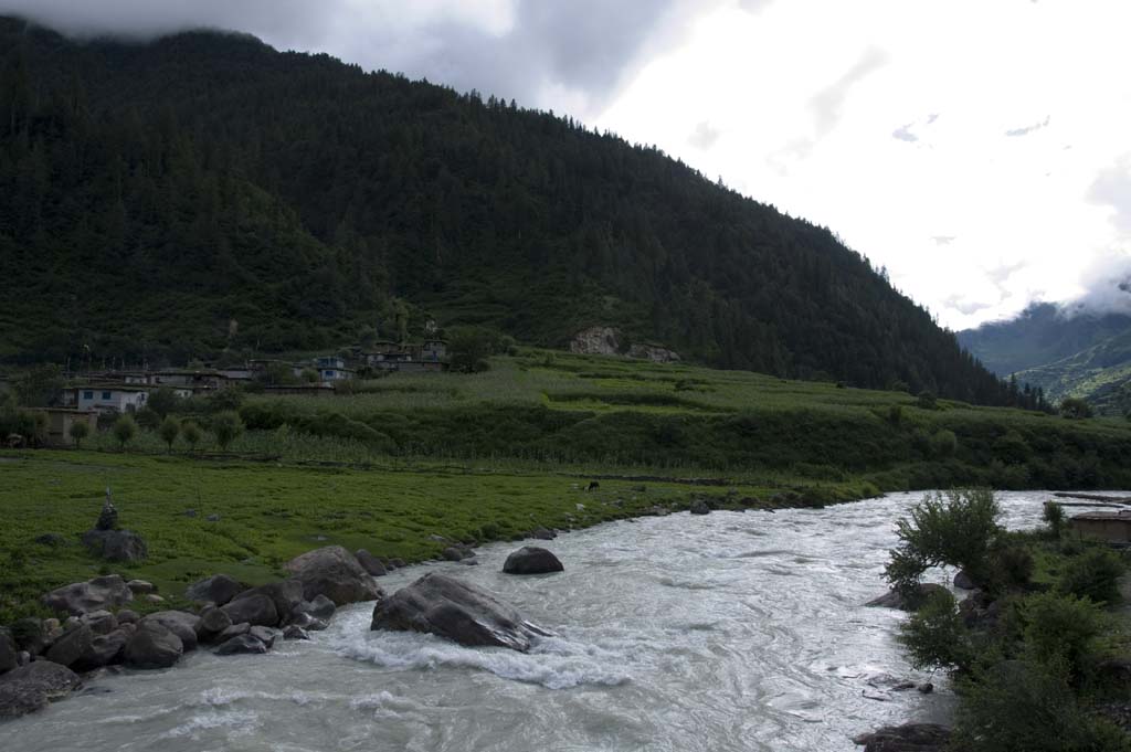
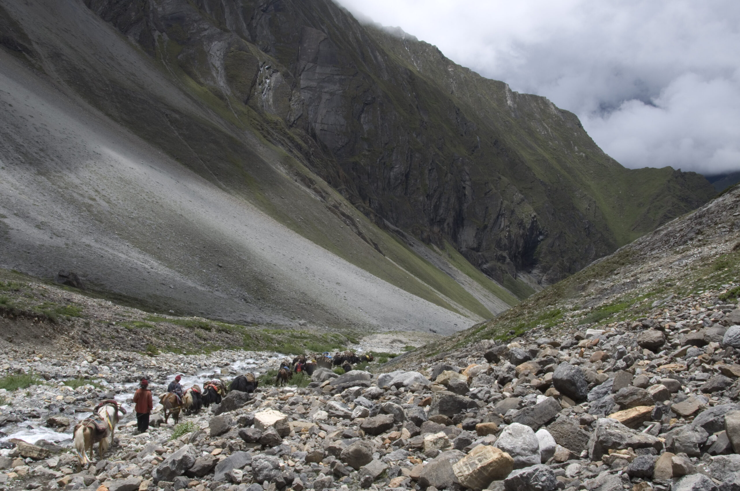
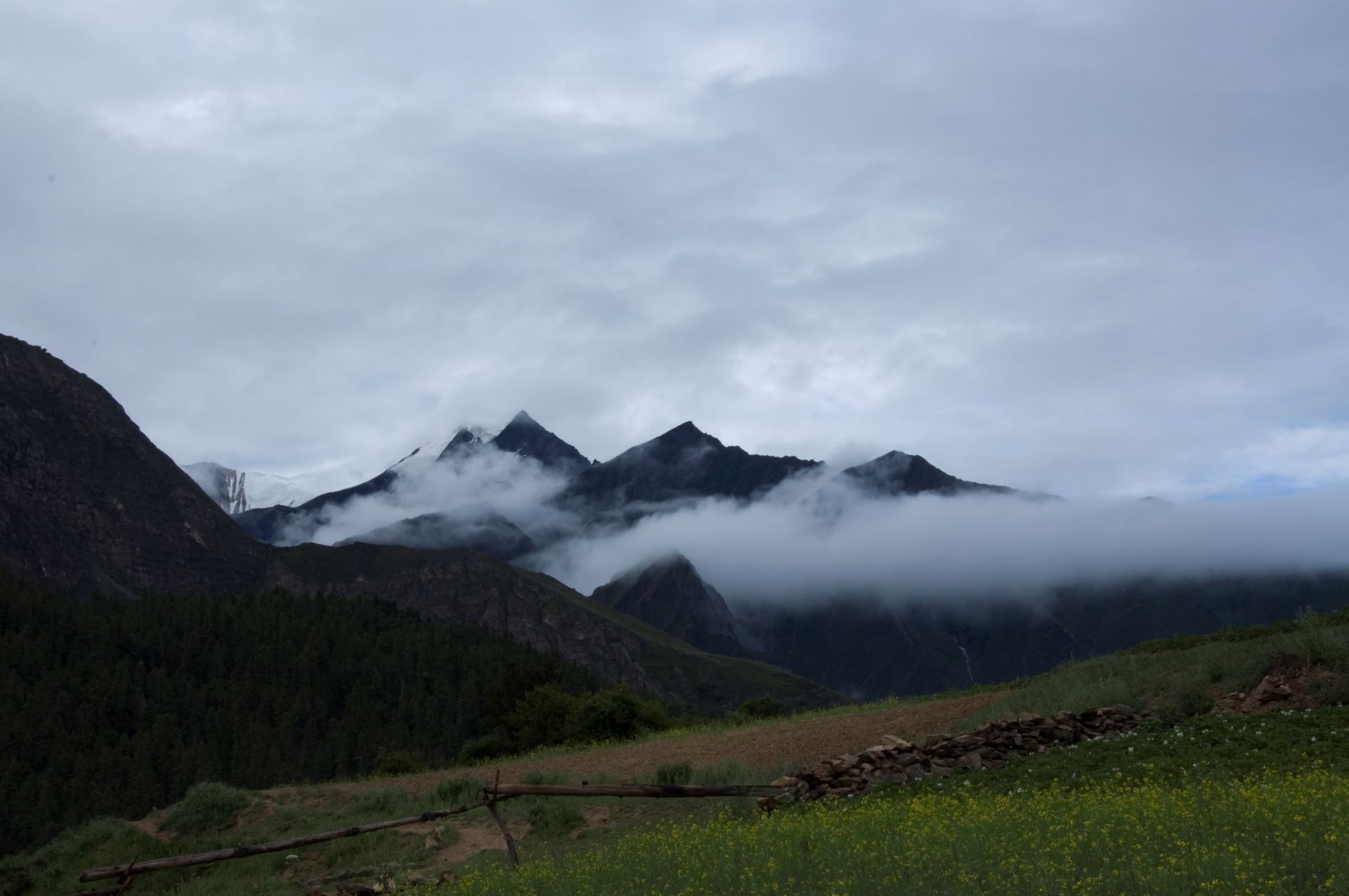

Trip Overview

Trek Region
Dolpo

Difficulty Level
Hard

Transport
Kathmandu-Nepalgunj-Juphal by domestic flight; Jomsom-Pokhara-Kathmandu by domestic flight

Total Trip Duration
28 Days

Max Elevation
5,550m

Meals
All meals included throughout
Trip Highlights
- Complete the greatest trans-Himalayan traverse available to non-climbing trekkers in Nepal – a continuous journey from the arid Bon Po sacred valley of the inner Upper Dolpo to the windswept Kali Gandaki valley of Mustang, crossing four passes above 4,900m in a single point-to-point traverse
- Stand at the sacred Phoksundo Lake (3,611m) – Nepal’s deepest freshwater lake – and explore the ancient Tshowa Bon Gompa above its northern shore
- Cross the Kang La Pass (5,360m) – the formidable high pass that guards the entrance to the inner Upper Dolpo world – with panoramic views of Kanjiroba Himal (6,612m) and the Tibetan plateau
- Visit Shey Gompa (4,350m) – the sacred 11th-century monastery at the base of the Crystal Mountain that Peter Matthiessen described in The Snow Leopard – and walk the ancient circumambulation kora of the quartz-encrusted sacred peak
- Explore Saldang – the largest village of the inner Dolpo world, a cluster of five settlements on a high plateau, ancient trading hub on the Tibet route, and home to some of the finest Tibetan Buddhist mural paintings in Nepal
- Visit the magnificent Yangze Gompa (4,960m) – the thousand-year-old Bon Po cliff monastery above the Nam Khong valley – one of the most remotely situated religious sites in all of Nepal
- Cross the Sela La Pass (5,095m) with views of Kanjiroba Himal and the vast northern Tibetan plateau
- Walk through the genuinely remote corridor of Shimen (4,010m) and Tinje (4,150m) – traditional Tibetan-influenced villages on the ancient salt trade route that have seen almost no outside influence for centuries
- Cross the Chharka La (4,920m) into the high, wide, nomadic world of Chharka Bhot (4,200m) – one of the highest permanently inhabited settlements in Nepal, where the Dolpo-pa nomadic herding tradition continues in its most uncompromised form
- Cross the Jungben La Pass (5,550m) – the highest point of the entire traverse – with the most complete and panoramic view of the entire journey, encompassing the Dhaulagiri range (8,167m), the Annapurna massif, Nilgiri, Tukuche Peak, and on clear days even the distant profiles of Manaslu and the Kanjiroba range
- Descend through the extraordinary southern Mustang landscape – the deep gorges and red rock formations of the Ghustung Khola and Sangda valley – into the Kali Gandaki River corridor that carried Buddhist scholars, salt traders, and pilgrims between Tibet and the Indian subcontinent for two millennia
- Walk the Great Himalayan Trail – the traverse forms a major section of one of the world’s great long-distance hiking routes, and the sense of walking an ancient and continuous path across the roof of the world is present in every stage
- Arrive at Jomsom (2,740m) – the windy, busy, thoroughly Mustang-flavored market town on the Kali Gandaki – after more than three weeks in complete Himalayan wilderness, and take the morning flight back to Kathmandu over the full Annapurna and Dhaulagiri panorama
Trip Summary
Nepal contains some of the finest long-distance trekking routes in the world. Most of them are well documented, well serviced, and walked by thousands of people every year. The Dolpo to Jomsom Trek is not one of those routes. It is instead the kind of journey that experienced Himalayan trekkers refer to quietly among themselves – a traverse that connects two of Nepal’s most prestigious restricted trekking regions across a wilderness corridor that sees perhaps fifty to one hundred groups in a good year, where the trails are sometimes unmarked and the valleys between passes hold settlements that have had almost no contact with the outside world for centuries.
The 28-day traverse begins with the scenic flights to Nepalgunj and Juphal in the far western Nepal, follows the approach gorge of the Phoksundo River to the sacred and extraordinary Phoksundo Lake (3,611m), crosses the formidable Kang La Pass (5,360m) into the inner Upper Dolpo plateau, reaches Shey Gompa (4,350m) at the base of the legendary Crystal Mountain, continues through the largest villages of the inner Dolpo world at Saldang and the Bon Po monastery at Yangze Gompa, pushes north and west through the genuinely remote corridor of Shimen, Tinje, and the high nomadic pastures of Chharka Bhot (4,200m), crosses the highest pass of the entire traverse at Jungben La (5,550m), and descends through the southern Mustang landscape past the ancient Mustang village of Sangda to the windy Kali Gandaki valley at Jomsom (2,740m), where a domestic flight completes the trans-Himalayan crossing.
This is the complete, unhurried version of the traverse. It includes proper acclimatization days, full exploration time at the circuit’s most significant cultural and natural sites, the maximum number of high passes that a well-paced standard itinerary can safely include, and two buffer days in Kathmandu. No significant shortcuts. No stages compressed beyond reason. Every section given the time and the space it genuinely deserves.
When To Visit
The Dolpo to Jomsom traverse’s seasonal timing is determined by two separate pass constraints that must be satisfied simultaneously – the Kang La (5,360m) on the Dolpo entry and the Jungben La (5,550m) on the Mustang exit. Both must be in passable condition, which narrows the viable seasonal window more severely than single-route treks.
Spring (mid-May to early June) is viable with specific timing requirements. By mid-May the Kang La is typically passable in most years and the Jungben La is clearing from its winter accumulation. May is the preferred spring month – the lower approach valleys are lush and the high passes are in reasonable condition. The Jungben La may require more technical care in May than in the autumn due to less consolidated snow. Late April Kang La crossings are possible in low-snow years but are not recommended without specific current-season condition information from guides who have recently crossed.
Autumn (mid-September to mid-October) is the finest and most strongly recommended season for the complete traverse. Post-monsoon atmospheric clarity produces the finest views from every pass and viewpoint. The Kang La and Jungben La are in their most reliable and most consolidated snow conditions. The inner Dolpo plateau is in its finest autumn light. The Mustang descent country has the extraordinary orange and red rock formations at their most vivid in the clear autumn air. The September Shey Gompa festival can be timed as part of the traverse for groups with sufficient flexibility in their departure scheduling.
Monsoon (July to August) is not recommended. The lower approach sections are affected by monsoon conditions and both Juphal and Jomsom flights are severely disrupted. The passes carry unstable summer snowpack. Not viable for standard traverse groups.
Winter (November to April) is not viable. Both the Kang La and the Jungben La are impassable or extremely dangerous under winter snowpack. The inner Dolpo plateau at winter temperatures is outside the operational range of standard camping expeditions.
Itinerary
Welcome to Nepal. Our team meets you at Tribhuvan International Airport and transfers you to your hotel in Kathmandu. The evening briefing for the Dolpo to Jomsom traverse is the most extensive of any trekking itinerary we operate – covering the complete 28-day traverse from Juphal to Jomsom section by section, the altitude profile across four major passes above 4,900m, the full camping logistics for the entire traverse where no teahouses exist in the inner sections, the dual restricted area permit system covering both Upper Dolpo and Annapurna Conservation Area, emergency protocols for a route where the nearest road access is measured in days of walking, and the logistics of the two domestic flight connections at both ends.
The briefing covers the traverse’s unique structure – how the Upper Dolpo section from Phoksundo Lake through Shey Gompa and Saldang forms the first and most culturally dense part of the journey, how the connector section through Shimen and Tinje represents the most remote and least-visited corridor of the entire traverse, how Chharka Bhot is the pivotal pivot point between the Dolpo world and the Mustang world, and how the Jungben La crossing and descent to Jomsom represents the physical and geographical climax of one of the finest trans-Himalayan journeys available to non-climbing trekkers anywhere in the world.
Reading Peter Matthiessen’s The Snow Leopard before this trek is not a recommendation. It is a requirement. The traverse passes through the landscape of that book directly and the depth of encounter that reading brings to the Shey Gompa section in particular cannot be replicated by any pre-departure briefing. Overnight in Kathmandu.
The traverse begins with two domestic flights. The first – fifty minutes from Kathmandu to Nepalgunj (150m) in the Terai lowlands of far western Nepal – descends into warm, flat, subtropical country at the Nepal-India border. The second – forty minutes from Nepalgunj to Juphal Airport (2,475m) – is one of the most spectacular short flights in Nepal. The small aircraft climbs from the plains, crosses the dramatic southern escarpment of the Dhaulagiri massif, and descends through mountain valley walls onto the short sloping airstrip above the Bheri River. The views of Dhaulagiri, Churen Himal, and the arid hill country of the Dolpa district during the approach announce immediately and unmistakably that you have arrived somewhere entirely different from the standard Nepal trekking world.
From Juphal, the trail descends through terraced fields and the first mixed Hindu and Buddhist settlements of the lower Bheri valley to Dunai (2,145m) – the district headquarters of Dolpa, where permit checking begins and the logistics of the inner Dolpo approach are finalized. Your guide processes all documentation at the Dunai checkpoint. Flight times: 50 and 40 minutes. Walking time: 3-4 hours.
From Dunai the trail heads northward along the Thuli Bheri River – the main drainage of the lower Dolpo highlands. The character of the lower valley is subtropical and agricultural – terraced farmland on the valley walls, pine and juniper forest on the upper slopes, small settlements of mixed Hindu and Buddhist community. Mani walls begin appearing along the trail as the Buddhist cultural zone strengthens.
The route enters the Phoksundo River gorge above the confluence with the Thuli Bheri – a progressively narrowing canyon of red and grey sculpted rock where the river rushes through a corridor of increasing drama. The first of the gorge’s suspension bridges swings over the white water below. The forest closes overhead in the narrow sections and the sound of the river fills the gorge wall to wall.
Chhepka / Renje (2,838m) sits on the river bank in the lower gorge – a small settlement with simple lodge accommodation or camping. The surrounding forest at this altitude is excellent bird habitat – dawn and early morning walking through the bamboo and rhododendron sections of the lower approach is particularly productive for bird sightings. Red panda territory begins here. Walking time: 5-6 hours.
The gorge deepens and narrows. From Chhepka the trail follows the Phoksundo River northward through an increasingly dramatic canyon – the walls rising steeply on both sides, the river crossing from bank to bank on suspension bridges, waterfalls cascading directly from the cliff faces above the trail in several sections.
The trail passes through Ryajik village – a traditional settlement where the mani walls and chortens of the Buddhist world thicken – and continues through a dramatic waterfall gorge section that is one of the finest geological spectacles of the entire approach. The canyon walls here are layered in colors of red, ochre, grey, and cream – the sedimentary geology of this ancient seabed landscape displayed at its most vivid.
Jharana / Chunuwar (3,130m) sits near the head of the gorge where the terrain begins to open toward the Phoksundo Lake basin. Lodge accommodation or camping serves the overnight. Walking time: 6-7 hours.
The day the traverse reveals its first and most celebrated natural feature. From Jharana the trail makes the final gorge approach through Palam village, where the canyon opens and the sacred waterfall of the Phoksundo Lake outflow becomes audible and then visible – a long white cascade tumbling from the cliff face above into the gorge below with particular spiritual significance in the Bon Po tradition of the Ringmo community.
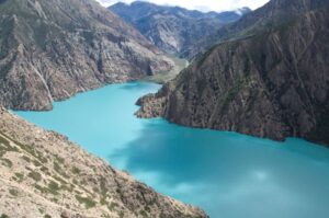
Phoksundo Lake (3,611m) arrives without warning at the top of the gorge – the trail rounds a corner and the water is simply there, an extraordinary turquoise that shifts through emerald to deep blue across the length of the lake, surrounded by limestone cliffs, birch and pine forest, and the ancient flat-roofed stone houses of Ringmo village on the southern shore.
Nepal’s deepest freshwater lake at 145 meters depth. Contained in a natural bowl at the base of vertical cliffs. The Bon Po sacred tradition holds this lake as a deity in its own right. The Shey Phoksundo National Park, Nepal’s largest, encompasses it. Eric Valli filmed the opening sequences of Himalaya here. And the sheer visual power of the turquoise water against the grey limestone cliff faces and the deep green of the forest is simply one of the most beautiful natural compositions in the entire Himalayan world. Walking time: 4-5 hours.
A full acclimatization and exploration day – essential physiologically before the high days ahead and essential experientially as an opportunity to understand the sacred world that Phoksundo represents.
The Tshowa Gompa – the ancient Bon Po monastery on a rock shelf directly above the northern shore of the lake – is reached by a 30-45 minute steep climb from Ringmo village. The gompa provides the finest single viewpoint of the lake – the entire turquoise expanse below, the limestone cliffs of the far shore reflected on the surface, and Kanjiroba Himal rising above the northern valley wall. Pre-Buddhist Bon iconography covers the prayer hall walls. Ancient murals. Ritual objects of the Bon tradition entirely distinct from anything in a Buddhist monastery. A small, continuously maintained monk community in extraordinary isolation.
The full lakeshore circumambulation takes several hours and reveals the extraordinary variety of color in the water from different angles and different qualities of light. Morning light, midday light, and late afternoon shadow each produce completely different readings of the same turquoise surface.
Ringmo village itself – the small traditional Bon Po and Tibetan Buddhist community that has served as the guardian settlement of this sacred lake for generations – rewards unhurried exploration. The flat-roofed stone houses, the carved wooden architectural details, the community water mill, and the easy warmth of a village that still lives primarily within its own ancient frameworks are all worth more than the few hours most trekking groups spend here. Exploration time: Full day.
Leaving Phoksundo Lake is genuinely difficult. But the inner Upper Dolpo world – the extraordinary arid plateau country where the Kang La, Shey Gompa, Crystal Mountain, and the great villages of the inner valley wait – begins today and its pull is very strong.
From Ringmo the trail follows the dramatic cliff-face path along the eastern shore of the lake – climbing high above the water on a narrow ledge trail with extraordinary views back across the turquoise surface to the cliffs and forest of the western shore. Above the lake, the trail descends through birch and pine forest to the meadow area of Ruktang (3,594m) – a camping area on the Phoksundo Khola where the transition between the lush lake basin world and the more arid inner Dolpo terrain begins.
This is your last night in old-growth forest for many days. The inner Upper Dolpo world above is arid, open, cold, and extraordinary. The forest around Ruktang has a particular beauty in the late afternoon light – the old birch trees, the river sound, the first clear sky of the high country above the gorge canopy. Walking time: 5-6 hours.
The approach to the first and highest pass of the traverse. From Ruktang the trail follows the Phoksundo Khola northward through progressively more open and more arid terrain – the forest giving way to juniper scrub, the juniper to open alpine meadow, and the meadow to the bare rock and moraine of the high approach zone.
The trail gains altitude continuously throughout the day – crossing the river at intervals, passing through a dramatic rocky canyon section where the Phoksundo Khola cuts through ancient sedimentary layers, and climbing toward the high camp zone below the Kang La.
Blue sheep are frequently seen on the surrounding slopes from this section onward. The combination of blue sheep presence and the dramatic cliff terrain above the trail makes this one of the most productive sections of the traverse for wildlife observation. Snow leopard tracks have been reported in the moraine sections of the upper approach – the animals are present here in the core of their habitat even if direct sightings remain rare.
Kang La Base Camp (4,677m) sits on a broad moraine shelf below the final approach to the pass. No structures. No facilities. Just your tent, the wind, the cold stars of the inner Dolpo night sky, and the pass visible above in the darkness. Your first genuine wilderness camping night at nearly 4,700m. Eat well, drink water, and sleep early. The pass begins before dawn. Walking time: 5-6 hours.
The alarm sounds at 4:00 AM. Breakfast in the pre-dawn darkness at the high camp. Every insulation layer donned. Crampons fitted. Ice axes distributed. Headlamps on. The climb to the Kang La Pass (5,360m) begins in cold, still darkness on the approach glacier.
The ascent gains nearly 700 meters from the base camp on steep, often snow-covered terrain – crossing the Kang Gompa junction, passing a series of glacial lakes and moraine ridges, and then steepening significantly for the final push to the col. Fixed ropes cover the most exposed sections. The pace at this altitude is deliberately slow – one breath per step, steady and controlled, nothing wasted. Altitude sickness risk is high above 5,000 meters and the crossing demands every trekker’s most careful self-assessment throughout.
At the Kang La Pass (5,360m), prayer flags mark the col and the panorama opens completely. Kanjiroba Himal (6,612m) rises immediately to the west in full massif scale. The Tibetan plateau shimmers beyond the border ridge to the north. The arid inner Upper Dolpo plateau spreads ahead – a landscape of bare rock, ancient valleys, and the sacred peak that has drawn pilgrims for a thousand years.
The descent from the north side of the pass to Shey Gompa (4,350m) drops through rocky scree and open alpine terrain, passing high-altitude lakes and meadow zones before the cluster of ancient whitewashed structures at Shey appears in the valley below. Your first view of the monastery – small, ancient, sitting directly opposite the quartz-crusted cliff face of Crystal Mountain – is one of the finest moments of arrival in any Nepal trekking landscape. Walking time: 7-8 hours.
The day for which the entire first section of the traverse exists.
Shey Gompa was established in the 11th century as a Kagyu school monastery. It is the sacred center of the inner Dolpo world – the monastery that Peter Matthiessen walked to in 1973 and described with extraordinary precision and reverence in The Snow Leopard. The copper statue of Shakyamuni Buddha plated in gold in the main prayer hall. The Tibetan Buddhist texts. The thangka paintings. The small monk community maintaining continuous practice in conditions of profound isolation at 4,350m. Sitting in the monastery courtyard with Crystal Mountain directly above and the valley below is one of those experiences that resists all cliché and simply asks to be witnessed.
Crystal Mountain (Shelri, approx. 6,139m) – directly opposite Shey Gompa – has cliff faces encrusted with quartz crystals and embedded with ancient marine fossils lifted from an ocean floor that once sat where these peaks now stand. Buddhist pilgrims circumambulate clockwise. Bon Po pilgrims circumambulate counter-clockwise. Both directions take several hours on a rocky trail around the sacred peak. Both deliver extraordinary views of the surrounding inner Dolpo plateau. Walking the kora in either direction, with the crystals catching the light on the cliff face above and the monastery visible in the valley below, is the central spiritual act of the entire traverse.
Shey village – the small community that maintains the monastery – still has residents who practice the ancient Tibetan pastoral and religious way of life of the inner Dolpo in particularly pure form. Exploration time: Full day.
The second major pass of the traverse. From Shey Gompa the trail heads east and then climbs through the rocky high-desert terrain toward the Sela La Pass (5,095m) – a demanding high-altitude crossing in the classic trans-Himalayan landscape.
The approach to Sela La follows open, arid terrain – no vegetation above the valley floor, the hillsides composed of loose rock and mineral-colored sediment in shades of red, grey, and ochre. Blue sheep are regularly seen in family groups on the slopes throughout this section. The pass itself provides an extraordinary view of the Tibetan plateau to the north – flat, enormous, and impossibly high from a vantage point already at 5,095 meters.
The descent leads northward to Namduna Gaun (4,430m) – also called Namgung – a settlement famous for the extraordinary cliffside Luri Gompa built into the north wall of a cliff above the village. The ancient murals within the cave monastery date back over a thousand years and represent some of the earliest surviving Buddhist painting in the Nepal Himalaya. The monastery is one of the most visually dramatic and culturally significant religious sites of the entire traverse and rewards every hour spent at it. Walking time: 6-7 hours.
From Namduna Gaun the trail traverses the high landscape toward the largest settlement of the inner Upper Dolpo. The approach to Saldang (3,770m) involves a climb to a high plateau and then a steep descent to the village cluster below – a sequence that reveals the settlement’s dramatic position above the Nam Khong Nala in progressive stages, each one more complete than the last.
Saldang is a cluster of five distinct sub-settlements spread across two kilometers of a broad plateau – each with its own gompa, its own community, and its own distinct position in the complex social world of the inner Dolpo. The Chaiba Monastery and its interior mural paintings of Tibetan Buddhist deities and narratives. The ancient terraced barley fields descending the hillside below the plateau. The traditionally dressed Dolpo-pa community going about their daily lives in a settlement that functions as the commercial and cultural center of the inner Dolpo world.
Saldang sits on the ancient trade route between Nepal and Tibet and its prosperity – visible in the quality of its architecture and the extent of its cultivation – reflects centuries of that strategic position. Walking time: 4-5 hours.
A rest and exploration day in Saldang that serves both acclimatization purposes and the cultural immersion that this most significant inner Dolpo settlement genuinely rewards.
The gompas of Saldang’s five sub-settlements include some of the finest examples of Tibetan Buddhist mural painting accessible on the traverse. The Chaiba Monastery is the most significant – its prayer hall walls covered with paintings of Buddhist deities and narratives in a style that reflects the particular artistic tradition of the inner Dolpo world. Your guide provides the cultural context for each painting and explains the community’s relationship with the monastery and the larger religious calendar it serves.
The terraced barley fields surrounding the settlements are beautiful in the early autumn harvest period – golden against the barren hillside, worked by community members using implements that have not changed in their essential form for many generations. The children of Saldang, whose curiosity about foreign visitors is genuine and entirely unselfconscious, are among the most engaging social encounters of the entire traverse. The warmth of a Dolpo-pa family receiving guests in their home – butter tea, dried cheese, the particular directness of people who live largely without reference to the outside world – is one of the finest human experiences available on any Nepal trek. Exploration time: Full day.
One of the most culturally rewarding walking days of the entire traverse. From Saldang the trail heads north along the Panzang River – crossing the river, passing through the smaller settlements of Marang and Ki – before turning east through pastoral terrain to reach the extraordinary Yangze Gompa (4,960m).
The Yangze Gompa – also called Namdo Gompa – is a thousand-year-old Bon Po monastery built dramatically on a cliff face above the Nam Khong valley at nearly 5,000 meters altitude. One of the most remotely situated and least-visited religious sites in all of Nepal. A small community of monks maintains continuous Bon Po practice in conditions of extraordinary isolation. The murals within the cliff monastery reflect the pre-Buddhist Tibetan tradition in their iconographic program – deities, narrative sequences, and cosmological diagrams painted with a sophistication that reflects the high culture from which this monastery emerged.
The setting alone – the cliff face, the ancient buildings integrated into the rock, the prayer flags, the panoramic view of the Nam Khong valley below and the high peaks surrounding – makes Yangze Gompa the single most atmospheric cultural site of the entire traverse. Arrive before late afternoon to have adequate light for the monastery visit and the exploration of the compound. Walking time: 4-5 hours.
The day the traverse enters its most genuinely remote corridor. From Yangze Gompa the trail descends southward through the valley – passing back through the pastoral Nam Khong landscape, through chortens, mani walls, and scattered herding settlements – before the route turns southwestward toward Shimen (4,010m) through terrain that sees almost no regular trekker traffic.
The approach to Shimen crosses the Nam Khong Khola and enters a valley system that carries no road and supports only the small traditional settlements of communities who have lived in the internal rhythms of the inner Dolpo for centuries. The trail passes through sections of open high-altitude meadow, across minor ridges with good views of the surrounding peaks, and through the beginning of the corridor that will carry the traverse westward toward Tinje and the Chharka approach.
Shimen (4,010m) is a small traditional settlement of flat-roofed stone houses, prayer flags, and the particular unhurried character of a community living entirely within the logic of the high Himalayan pastoral world. A campsite near the village or in the surrounding meadow serves as the overnight. Walking time: 6-7 hours.
Through the heart of the remote corridor. From Shimen the trail continues westward through a landscape of open high-altitude valley country – crossing the ridges and river drainages of the inner Dolpo plateau on a trail that is not always clearly marked and that relies on your guide’s specific knowledge of this section.
The terrain here is genuinely different from the valleys around Shey Gompa and Saldang – wider, more open, carrying a different quality of light and a different character of silence. Small herding communities appear at intervals – seasonal settlements whose residents are focused on yak herding and the slow rhythms of pastoral life at 4,000 meters. The conversations your guide facilitates with these communities are among the most direct cultural encounters of the entire traverse.
Tinje (4,150m) is a beautiful village with its own ancient Tinje Gompa and a long history as a staging point on the ancient trade route that carried salt north from the lower valleys and grain south from the Tibetan plateau. The village is large by inner Dolpo standards and carries the character of a community that has sustained itself through centuries of trade and pilgrimage traffic even as that traffic has largely ceased. An excellent camping area near the village serves as the overnight. Walking time: 5-6 hours.
The gradual ascent toward the Chharka La crossing. From Tinje the trail begins the long westward approach toward Chharka Bhot – heading through a sequence of increasingly high and increasingly open valley systems that gain altitude steadily through pastoral terrain.
Rakpa Kharka (4,530m) is a nomadic herding area – a broad high-altitude pasture where Dolpo-pa herding families bring their yaks and goats to graze in the summer and autumn months. The word kharka means high grazing ground in Nepali, and the character of Rakpa is exactly that – open, grassy, windswept, and inhabited by the seasonal rhythms of the pastoral communities who use it rather than the year-round permanence of a village.
The views from the Rakpa area are extensive and beautiful – the surrounding ridgelines of the inner Dolpo plateau forming a complete and commanding skyline in every direction, and the quiet evening sounds of the kharka – bells of distant animals, the wind, the occasional call of a high-altitude bird – creating the particular atmosphere of a place that has been used by pastoral communities for as long as the mountains have allowed. Walking time: 6-7 hours.
The pass that divides the Dolpo world from the approach to the Mustang world. From Rakpa Kharka the trail climbs steadily and then more steeply toward the Chharka La Pass (4,920m) – a high, open crossing with wide views in both directions.
The ascent to Chharka La is demanding but non-technical – steep rocky trail on solid footing with no glaciated sections. At the top, the panorama includes the inner Dolpo landscape to the east and the beginning of the broader, more open terrain of the Chharka approach to the west. The light quality here is different from the arid inner plateau – slightly more humid, slightly more variable, reflecting the traverse’s movement westward toward the wetter valley systems of the Mustang approach.
The descent from Chharka La leads steadily downward to the wide, open valley of Chharka Bhot (4,200m) – one of the highest permanently inhabited settlements in Nepal and one of the most extraordinary Dolpo-pa communities of the entire traverse. The village sits on a broad, flat valley floor at 4,200 meters – surrounded by high ridgelines, yak herds grazing on the surrounding slopes, and the flat-roofed stone architecture of a community that has lived at this extreme altitude with complete self-sufficiency for generations.
The people of Chharka Bhot are among the most genuinely nomadic of the entire Dolpo-pa world – their annual migration cycles between the high summer pastures and the lower winter grazing areas representing one of the last intact examples of traditional Himalayan pastoral nomadism. A campsite in or near the village serves as the overnight. Walking time: 6-7 hours.
A rest and exploration day at the pivot point of the entire traverse – the settlement that sits most precisely between the Dolpo world you have walked through for the past two weeks and the Mustang approach that begins tomorrow.
Chharka Bhot carries a dual character that reflects its position. The community’s cultural roots are in the same Tibetan Buddhist and pastoral nomadic tradition as the inner Dolpo villages to the east. But the geographical orientation of the valley – opening southwestward toward the Kali Gandaki drainage and the Mustang world – means that the community has historical connections with both the Dolpo salt trade and the Mustang grain trade that make it a genuine crossroads settlement.
The village’s old Chharka Gompa is worth a proper visit – a functioning monastery whose community of monks maintains the Tibetan Buddhist practice of this extreme-altitude settlement. The surrounding high pastures – where yak herds graze on the broad valley floor and the herding families work through their daily patterns of animal management – provide an excellent opportunity for wildlife observation. Blue sheep populations are high in the Chharka area. Himalayan wolves – rarely seen elsewhere on the traverse – have been reported near the upper pastures. And the evening sky above 4,200m at Chharka, with the ridgelines silhouetted against a deep blue that only high altitude provides, is one of the finest natural spectacles of the entire journey. Exploration time: Half day structured, free afternoon.
The approach to the highest and most physically demanding section of the entire traverse. From Chharka Bhot the trail heads northward and then westward – beginning the sustained ascent toward the Jungben La base camp zone through open alpine terrain that gains altitude steadily throughout the day.
The trail passes through seasonal herding areas and crosses several tributary streams of the upper Chharka drainage before entering the high plateau zone above 4,500 meters. The landscape here takes on the extreme high-altitude character of the innermost Himalayan world – bare rock, remnant glacier moraine, the particular quality of light at altitude that makes distant peaks appear simultaneously close and impossibly large.
Norbulung Kharka (4,750m) is a broad high-altitude meadow used as a seasonal herding area – no permanent structures, just the open plateau and the enormous silence of nearly 5,000 meters altitude. This is the highest overnight camp of the traverse before the Jungben La crossing itself. The evening here requires full thermal protection – temperatures at Norbulung drop significantly after sunset – and the stars above this camp are among the finest available anywhere on the entire 28-day traverse. Walking time: 5-6 hours.
A critical acclimatization day before the highest point of the entire traverse. The standard acclimatization hike from Norbulung climbs toward the Jungben La approach – gaining altitude to approximately 5,100-5,200 meters on the lower approach terrain before returning to camp. This altitude work is the essential physiological preparation for crossing a 5,550-meter pass the following day.
Your guide uses this hike to assess current conditions on the Jungben La approach – snow coverage, ice formation on the upper section, the condition of the trail through the final glaciated zone before the col. This assessment directly informs the pace planning and equipment decisions for the crossing day.
The afternoon is spent resting, eating as much as the altitude allows, drinking water constantly, organizing all gear for the crossing, and going to bed early. Crampons are checked and fitted. Ice axes are distributed. Every insulation layer is confirmed. The alarm tomorrow will sound before dawn. Hike time: 3-4 hours.
The final approach stage before the highest crossing of the traverse. From Norbulung the trail enters the upper approach zone of the Jungben La (5,550m) – heading into the glaciated high-country that guards the pass on the Dolpo side.
The terrain becomes increasingly demanding as altitude increases – crossing glacial moraine fields, ascending through rocky sections with significant altitude gain per hour of walking, and eventually reaching the high camp area at approximately 5,100 meters where the final approach to the col begins. Crampons may be required for the upper section of today’s approach depending on current snow conditions.
Jungben La High Camp (5,100m) is pure wilderness at one of the most extreme overnight altitudes of any standard Nepal trekking itinerary. No structures. No facilities. The tent is the only shelter available. The temperature at 5,100 meters after sunset drops well below -15 degrees Celsius with wind chill. The sleeping bag must be rated to at least -25 degrees. The insulation layer must be the warmest available.
Organize everything for tomorrow’s pre-dawn start tonight. Lay out clothing in the order it will be put on in the darkness. Fill water bottles. Eat everything available. Set the alarm for 3:30 AM. The highest point of the entire traverse is eight to nine hours of sustained effort away. Walking time: 4-5 hours.
The defining day of the entire traverse. Everything – the flights to Juphal, the gorge walking, the lake, the Kang La, Shey Gompa, Saldang, the remote corridor through Shimen and Tinje, Chharka Bhot, the acclimatization days – has been preparation for this crossing.
The alarm sounds at 3:30 AM. In the complete darkness of a Himalayan night at 5,100 meters, the team rises, eats hot food by headlamp in the cook tent, dresses in every available layer, fits crampons, takes ice axes, and begins the final approach to the Jungben La Pass (5,550m) before the first hint of dawn.
The climb from high camp to the col gains 450 meters on terrain that is glaciated and steep in the upper section. Fixed ropes cover the most exposed sections. The pace is the slowest of any day on the traverse – every step deliberate, every breath counted. At altitude above 5,300 meters the oxygen content of the air is approximately 53% of sea level and the physical sensation of sustained effort at this altitude – the specific combination of cold, thin air, physical fatigue, and altitude-related heaviness in every movement – is unlike any other climbing experience available outside of technical mountaineering.
The col arrives – at 5,550 meters – as the first light of dawn breaks across the eastern horizon. Standing at the highest point of the entire 28-day traverse, the panorama is the most complete and most overwhelming of any viewpoint on any standard Nepal trekking circuit. Dhaulagiri (8,167m) rises to the south in full massif scale – so close at this latitude that it fills the entire southern horizon from this elevation. Annapurna I (8,091m) and the entire Annapurna massif stretch to the southeast. Nilgiri (7,061m) and Tukuche Peak (6,920m) are immediately visible. The Kanjiroba Himal range stretches to the northeast. The inner Dolpo plateau – everything you have walked through for the past two weeks – spreads behind you to the east in a panoramic retrospective that encompasses the full breadth of the traverse.
The descent from Jungben La on the Mustang side is steep and long – the landscape changes dramatically as the Dolpo side’s characteristic arid geology gives way to the red sandstone formations and deep canyon country characteristic of the Mustang geological province. The descent requires sustained concentration throughout – loose rock, steep gradient, and the physical fatigue of a day that began before 4:00 AM and ends well into the afternoon. Sangda Phedi (4,700m) serves as the overnight camp on the high shelf above the Sangda valley. Walking time: 8-9 hours.
A descent day of extraordinary visual reward – the first full day on the Mustang side of the traverse, where the landscape of red and orange sandstone formations, deeply carved canyon gorges, and the distinctive flat-roofed fortress-architecture of traditional Mustang villages makes every kilometer feel like a transition into a completely different world.
From Sangda Phedi the trail descends steadily through the upper Sangda valley – the red sandstone gorge formations closing in on both sides as altitude drops, the trail crossing the valley floor and climbing small ridges in the characteristic Mustang pattern of descent. The vegetation returns gradually – first sparse high-altitude scrub, then patches of juniper and wild rose, and eventually the cultivated fields and apple orchards that signal the approach to permanent settlement.
Sangda village (3,700m) is a traditional Mustang settlement – flat-roofed stone houses in the characteristic Mustang architectural style, ancient chortens and mani walls at the village perimeter, prayer flags catching the valley wind that distinguishes the Kali Gandaki watershed from the comparative stillness of the inner Dolpo plateau. The people here are Mustang-pa – culturally distinct from the Dolpo-pa of the inner plateau and carrying the particular character of a community shaped by the famous winds and the ancient salt trade of the Kali Gandaki. Walking time: 4-5 hours.
A long descent through the spectacular red canyon country of the southern Mustang approach – the Ghustung Khola and Panda Khola gorge systems dropping through some of the most dramatic geological formations accessible on any Nepal trekking route. The sandstone here is carved by wind and water into extraordinary shapes – eroded pillars, arched canyon walls, layered color sequences in red, orange, cream, and grey that look more like the American Southwest desert than the standard Himalayan landscape.
The trail passes through several small Mustang-influenced settlements – each one with its own gompa, its own chortens, and the particular Tibetan cultural character of the Mustang region that carries continuity with the Dolpo world to the north while being distinctly its own expression of that shared cultural heritage. The descent to Dhagarjung (2,900m) drops over 800 meters from Sangda through this extraordinary canyon landscape. Walking time: 5-6 hours.
The final walking day of the entire traverse. From Dhagarjung the trail continues its descent through the Mustang hill country toward the Kali Gandaki River – the famous valley that carried Buddhist scholars, Tibetan traders, Mustang salt caravans, and Himalayan pilgrims between the Tibetan plateau and the Indian subcontinent for two thousand years.
The trail joins the broad, graveled valley floor of the Kali Gandaki – the deepest gorge in the world by some measurements, cut between the massifs of Dhaulagiri and Annapurna – and follows the river southward through the distinctive strong afternoon winds that have made this valley famous among trekkers and geologists alike. The combination of the wide river bed, the desert-like valley floor, the immense canyon walls on both sides, and the howling wind creates a landscape unlike anything else on the standard Nepal trekking circuits.
Jomsom (2,740m) – the district headquarters of Mustang, a busy small town spread across both banks of the Kali Gandaki – arrives with the particular impact that any significant human settlement has after 23 days of wilderness camping in one of Nepal’s most remote traverses. Hot food. Stone buildings. A runway. Phone signal. Other trekkers on the Annapurna Circuit looking at you with curiosity about what direction you arrived from.
Celebrate the traverse with your guide and camping team over the finest meal available in Jomsom. You have walked from the Dolpo sacred valley world to the windy Mustang trading town on an ancient trans-Himalayan route. That is worth marking properly. Walking time: 4-5 hours.
The final flights. A short 25-minute morning flight from Jomsom to Pokhara crosses the southern wall of the Annapurna massif – a mountain flight of extraordinary visual power, with the entire Annapurna range visible at close range from the aircraft window. Then a 30-minute flight from Pokhara to Kathmandu completes the aerial component of the traverse.
Jomsom domestic flights are subject to the strong valley winds that characterize the Kali Gandaki – flights typically depart early morning before the winds strengthen and patience with timing is always required. Travel insurance that covers additional accommodation expenses due to flight delays is an important component of any Dolpo traverse planning.
Back in Kathmandu, transfer to your hotel and experience the extraordinary pleasure of a hot shower, a proper bed, a restaurant meal, and the warmth of the city after 24 nights of wilderness camping across the roof of the western Himalayan world. Flight times: 25 and 30 minutes.
A mandatory buffer day built into the itinerary primarily for Jomsom flight delay risk – the Kali Gandaki valley winds are one of the most reliably disruptive weather factors on any Nepal domestic flight route and delays of one to two days are entirely normal. This buffer day is not optional padding. It is a critical logistical component of any responsible traverse itinerary that ends at Jomsom.
If flights returned on schedule, the buffer day is a free day in Kathmandu – use it for cultural sightseeing, rest, shopping, or the kind of extended celebration with your guide that a 26-day trans-Himalayan traverse genuinely deserves. Our team transfers you to Tribhuvan International Airport whenever your departure schedule requires.
Trek Difficulty & Physical Demands
The Dolpo to Jomsom traverse is rated extreme – the most demanding point-to-point trans-Himalayan traverse available to non-climbing trekkers in Nepal and in a genuinely different physical and logistical category from every other standard Nepal trekking route.
Four passes above 4,900m in a single traverse. The Kang La (5,360m), Sela La (5,095m), Chharka La (4,920m), and Jungben La (5,550m) collectively represent the highest-pass-density point-to-point traverse of any standard Nepal trekking route. Each pass is a serious physical challenge in its own right. Four consecutive passes over 26 days of sustained wilderness camping demands the highest level of cardiovascular fitness, altitude adaptation, and mental resilience available in standard trekking.
24 nights of wilderness camping above 3,600m. No teahouses exist in the inner Upper Dolpo and Chharka corridor. The entire traverse from Ringmo to Jomsom is fully self-supported camping. Cold temperatures, wind exposure, and the physical and psychological demands of managing expedition-style living for 24 consecutive nights require genuine wilderness camping experience and the kind of mental resilience that only prior extended wilderness experience can provide.
The Jungben La (5,550m). This is the highest point of the entire traverse and the most technically demanding crossing. The approach requires crampons and ice axes on the glaciated upper section. Fixed ropes cover the most exposed sections. The crossing day is 8-9 hours of sustained effort beginning before dawn at an overnight altitude of 5,100 meters. It is in a different category of difficulty from the Kang La and represents the physical climax of the entire 28-day journey.
Remoteness and emergency response. The corridor between Saldang and Jomsom – the Shimen, Tinje, and Chharka section – has almost no infrastructure and no realistic ground-based emergency access. Helicopter evacuation via satellite phone coordination is the only emergency option for the inner sections. Emergency response times of 4-8 hours in good weather are the realistic minimum. This reality demands the most serious standards of fitness, health preparation, and altitude sickness management of any Nepal trek.
Physical fitness baseline. Six months of sustained, progressive expedition training before departure. Specific focus on cardiovascular capacity under load, leg strength for sustained steep climbing and descending, cold-weather camping experience, and prior high-altitude exposure above 5,000m. Completion of a prior demanding high-altitude circuit – the Everest Three Passes, the Manaslu Circuit, or equivalent – within two years before this traverse is a meaningful and recommended prerequisite.
Best Time to Trek: Seasonal Comparison
| Season | Months | Kang La | Jungben La | Inner Dolpo | Views | Recommended |
| Spring | May–Jun | Good from mid-May | Passable with care | Beautiful | Excellent | Good |
| Monsoon | Jul–Aug | Unstable | Dangerous | Partially dry | Limited | Avoid |
| Autumn | Sep–Oct | Excellent | Excellent | Outstanding | Outstanding | Best |
| Winter | Nov–Apr | Impassable | Impassable | Extreme cold | — | Never |
Pro tip: For the finest experience of the complete traverse, plan your departure from Juphal between September 20 and October 5. This period offers crystal-clear post-monsoon skies, the most stable snow conditions on both Kang La and Jungben La, the chance to experience the Shey Gompa Annual Festival, the Inner Dolpo plateau in its spectacular autumn colours, and the striking red-orange sandstone landscapes of the Mustang descent under clear October skies. Reserve your trek at least six months in advance, as the Upper Dolpo Restricted Area Permit (RAP) is non-refundable and experienced guides are in high demand during the October peak season.
Booking Your Dolpo to Jomsom Trek – 28 Days
The Dolpo to Jomsom traverse requires the most careful advance planning of any trek we operate. Book 6-8 months in advance. The Upper Dolpo RAP permit processing takes time. Senior guides with Kang La and Jungben La experience are in very limited supply. October departure windows fill many months ahead.
Step 1 – Contact us. Reach out via our website, email, or WhatsApp with your target dates, group size, and complete prior trekking and mountaineering experience profile. We respond within 24 hours with the complete 28-day itinerary and full cost breakdown.
Step 2 – Experience assessment. We conduct a detailed video call with your senior guide to review your prior altitude experience and technical background. The Dolpo to Jomsom traverse requires prior completion of a serious high-altitude circuit (Everest Three Passes, Manaslu Circuit, or equivalent) and prior crampon and ice axe experience.
Step 3 – Confirm booking. A 30% deposit is required to begin Upper Dolpo RAP processing, which requires passport details and photographs for all trekkers. Permit processing may take 2-4 weeks.
Step 4 – Pre-departure preparation. We send the most detailed pre-departure document in our portfolio – 6-month training program, complete expedition gear list, Bon Po and Tibetan Buddhist cultural context document, altitude management protocols specific to four passes above 4,900m, day-by-day detailed expectations for all 28 days, and emergency procedure documentation.
Step 5 – Arrive in Kathmandu. Two full days of expedition briefing and preparation – guide team introduction, crampon fitting, satellite phone testing, permit document review, and full gear inspection. Nothing is left to chance before the flights to Nepalgunj.
Step 6 – Traverse. Your senior guide and expedition team lead the complete 28-day traverse from Juphal to Jomsom.
Step 7 – Balance payment. The remaining 70% is due on arrival in Kathmandu before departure for Nepalgunj.
Cancellation Policy:
- 60 or more days before departure: Full deposit refunded minus bank charges, non-refundable flight bookings, and non-refundable Upper Dolpo RAP permit fees
- 45-59 days before: 30% refund minus permit and flight costs
- 30-44 days before: 15% refund minus permit and flight costs
- Less than 30 days: Deposit forfeited
- Upper Dolpo RAP permits are completely non-refundable once issued regardless of cancellation timing
Travel Insurance – Mandatory and Non-Negotiable. Your policy must explicitly confirm: emergency helicopter evacuation above 6,500m; medical treatment and hospitalization in Nepal; high-altitude trekking and glacier activities; trek curtailment due to medical emergency; and repatriation costs. A helicopter rescue from the Chharka or Jungben La section costs USD 8,000-15,000. Show original insurance documentation to our Kathmandu office before the flights to Juphal.
Cost Details
Cost Includes
- Airport pick-up and drop-off in Kathmandu
- All domestic flights: Kathmandu to Nepalgunj to Juphal (round trip for entry); Jomsom to Pokhara to Kathmandu (exit flights)
- 1 night hotel in Kathmandu on arrival (bed and breakfast, 3-star)
- 1 night hotel in Nepalgunj if overnight connection required due to flight scheduling
- Complete expedition-standard wilderness camping equipment for the entire traverse (24 nights):
- High-altitude expedition dome sleeping tents (2-person per tent)
- Dining and mess tent with tables, chairs, and full furnishings
- Kitchen tent with full cook equipment and fuel supply
- Toilet tent with portable facilities
- High-density foam and inflatable sleeping mats
- All meals throughout the entire 28-day traverse – breakfast, lunch, and dinner every day including all camping days
- Experienced, English-speaking, senior government-licensed trekking guide with Upper Dolpo and Chharka corridor specialist experience (multiple prior Kang La and Jungben La crossings required)
- Minimum 2 assistant guides and high-altitude Sherpa staff for technical pass sections
- Experienced cook and full kitchen crew throughout
- One porter per two trekkers plus additional porters for expedition camping equipment
- Technical equipment for Kang La and Jungben La crossings: fixed ropes, group crampons, ice axes, harnesses, and ice screws
- All required permits:
- Upper Dolpo Restricted Area Permit (RAP) – USD 500/week – fully included
- Lower Dolpo Restricted Area Permit – fully included
- Shey Phoksundo National Park Entry Permit – fully included
- Annapurna Conservation Area Permit (ACAP) – for the Jomsom exit section – fully included
- Guide, Sherpa, porter, and cook wages, meals, accommodation, and full insurance
- All government taxes and local charges
- Expedition sleeping bag rated to -25 degrees Celsius rental (if needed)
- Duffel bag for porter
- Comprehensive First Aid Kit including pulse oximeter, emergency oxygen, altitude medications (Dexamethasone and Nifedipine), and full emergency equipment
- Satellite phone for emergency communication throughout the traverse
- Emergency evacuation coordination (evacuation cost covered by your mandatory travel insurance)
- Daily weather assessment and route condition briefing throughout technical sections
Cost Excludes
- Nepal entry visa fee (approx. USD 50 for 30 days)
- International flights to and from Kathmandu
- Travel insurance with emergency helicopter evacuation coverage explicitly above 6,500m (mandatory – verified before departure)
- Personal mountaineering or B2/B3-compatible crampon-compatible boots
- Personal crampons and ice axe (rental available in Kathmandu – approx. USD 20-35 each)
- Personal down suit for above 5,000m camping and pass sections
- Personal glacier goggles and mountaineering helmet
- Meals in Kathmandu and Nepalgunj beyond included breakfasts
- Personal snacks, energy supplements, and personal nutrition items for 24 trekking days
- Hot showers and device charging where sporadically available in lower lodge settlements
- Tips and gratuity for the entire expedition team – guide, Sherpa staff, porters, and cook (strongly recommended; standard for this caliber and duration of traverse is 15% of trek cost distributed among the team)
- Helicopter rescue and medical evacuation costs (covered by mandatory travel insurance)
- Gompa and monastery donations at Tshowa Gompa, Shey Gompa, Luri Gompa, Yangze Gompa, Tinje Gompa, and Chharka Gompa
- Personal expenses and souvenirs
Trip Gallery
Trek Essentials
- Expedition-weight merino or synthetic thermal base layers (top and bottom) – 3 sets minimum for 28 days
- Heavyweight Polartec or fleece mid-layer jacket
- Down suit or heavy down jacket rated to -30 degrees Celsius – mandatory for camping above 4,500m and both technical pass crossings
- Down trousers or insulated lower layers for camp mornings and high-altitude nights
- Waterproof windproof Gore-Tex hardshell jacket and trousers for pass crossings and bad weather
- Softshell trousers for active daytime walking
- Waterproof over-trousers for snow sections
- Heavyweight wool trekking socks – 7 pairs minimum
- Expedition outer gloves or mitts and liner gloves – both layers required simultaneously above 5,000m
- Full balaclava
- Warm beanie
- Neck gaiter and buff
- Sun hat with brim for lower valley and open plateau sections
- Lightweight shirts for the lower approach valley days
- B2 or B3 compatible mountaineering or high-altitude trekking boots – crampon-compatible, waterproof, insulated for camping at altitude. The Kang La and Jungben La crossings require secure crampon attachment. Standard flexible trekking boots are not appropriate.
- Heavyweight wool or neoprene boot liners for camping nights above 4,000m
- 12-point crampons – C2 or C-AT compatible with your boots. Mandatory for Kang La and Jungben La. Must be professionally fitted before departure.
- Gaiters – mandatory for all snow sections
- Lightweight camp sandals for lower lodge evenings
- Multiple pairs of wool hiking socks as base layers within boots on the coldest nights
- Ice axe – standard 60-65cm mountaineering ice axe. Mandatory for Kang La and Jungben La.
- Full seat climbing harness for fixed rope sections on both major passes
- 2 locking HMS carabiners for clipping fixed lines
- Ascender for the steeper fixed-rope sections on Jungben La
- Trekking poles – both collapsible with snow baskets
- Sleeping bag rated to -25 degrees Celsius or warmer. Non-negotiable for Kang La Base Camp (4,677m), Jungben La High Camp (5,100m), and multiple other high camping nights.
- Compression dry bag for sleeping bag
- Sleeping bag liner for additional warmth buffer
- Inflatable sleeping pad in addition to provided foam mat
- Expedition rucksack (35-40 liters) with hip belt
- Duffel bag (80 liters) for porter
- Glacier goggles (Category 4 lens, UV400, side shields) – mandatory for Kang La and Jungben La snow sections
- Mountaineering helmet – mandatory for rocky technical sections on both major passes
- Headlamp with 3 spare battery sets
- Insulated water bottle sleeves – water freezes in standard bottles at camp above 4,500m
- Water bottles (2 liters minimum) plus backup collapsible bottle
- Water purification tablets and personal filter
- Power bank (20,000 mAh minimum) – no charging opportunities for up to 15 consecutive days in inner sections
- Personal satellite GPS device – strongly recommended for the Shimen-Tinje-Chharka corridor where trails are less marked
- Camera in insulated padded pouch
- Personal journal – the Dolpo to Jomsom traverse is worth writing about
- Diamox (acetazolamide) – consult your doctor before departure. Strongly recommended for the sustained altitude of this traverse.
- Personal pulse oximeter – monitor blood oxygen saturation morning and evening above 4,000m and share readings daily with your guide
- Personal Dexamethasone (4mg) and Nifedipine for emergency altitude medication – prescribed by and carried per your doctor’s instructions
- Comprehensive personal first aid kit – wound closure strips, blister treatment, ibuprofen, antiseptic, compression bandage, moleskin, medical tape
- Sunscreen SPF 60 and SPF lip balm – UV at 5,000m plus in the arid Dolpo atmosphere with snow reflection is among the most intense of any Nepal traverse
- Hand warmers (15 packs minimum) – used on both Kang La and Jungben La crossing mornings and multiple cold camp mornings
- Eye drops for dry high-altitude conditions
- Anti-nausea medication
- Insect repellent for the lower approach valley sections below 2,500m
- All personal prescription medications plus 30% buffer quantity for potential flight delay extensions
- Valid passport with at least 6 months remaining validity
- Nepal visa (multiple-entry recommended for longer stays)
- Both Restricted Area Permit originals — your guide carries these and presents them at multiple checkpoints
- Printed travel insurance policy — guide requires a copy
- 2 passport-sized photos (for RAP processing)
- Emergency contact card on your person throughout
Final Thoughts:
The Dolpo to Jomsom traverse is not a route that can be adequately described in an itinerary document. The experience of walking continuously for 26 days from one of Nepal’s most sacred and most remote valleys across a wilderness corridor that almost no one has walked to arrive at the windy Kali Gandaki trading town of Jomsom – the contrast between beginning and end, between the absolute silence of the inner Dolpo plateau and the afternoon wind howling through the Kali Gandaki, between the Bon Po monasteries of Shey and the Tibetan Buddhist teahouses of Jomsom – is one that resists summary and instead insists on being experienced as a complete and continuous arc.
The trans-Himalayan quality of the traverse is real in both the physical and cultural sense. You cross an actual geological divide – the Himalayan range itself – from the watershed of the Karnali River system on the Dolpo side to the watershed of the Kali Gandaki on the Mustang side. And you cross a cultural divide as well – from the inner world of the Dolpo-pa, whose Bon Po and Tibetan Buddhist practice has been maintained in near-perfect isolation for centuries, through the transitional pastoral world of Chharka Bhot, and into the more open, more varied, and slightly more connected world of the southern Mustang communities.
The four passes above 4,900m are demanding. The 24 nights of wilderness camping are demanding. The 5,550-meter Jungben La crossing before dawn in the pre-dawn cold is demanding. All of it is demanding. And all of it is worth it in a way that no photograph, no film, and no written account – not even Matthiessen’s, which comes closest – can fully communicate.
This is the traverse that people who have done it talk about for the rest of their lives. Not the mountains they saw, though the mountains are extraordinary. Not the monasteries they visited, though Shey Gompa and Yangze Gompa and the Tshowa above Phoksundo Lake are genuinely among the finest things accessible to a non-climbing visitor in Nepal. They talk about the specific and unrepeatable quality of spending 26 days walking continuously through a world that is still, in the most fundamental sense, itself.
That quality is what you are paying for. And it is worth every rupee.
Your Adventure to Dolpo to Jomsom Trek – 28 Days Starts Here
Start your journey with trusted local experts and discover the beauty, culture, and adventure waiting in the Himalayas and beyond.
Frequently Asked Questions
Everything you need to know about the AASRA ECO TREK
The standard Upper Dolpo circuit (detailed in our Upper Dolpo Trek 24-day itinerary) returns to Juphal from Dho Tarap via the Tarap valley – a circular route that ends where it began. The Dolpo to Jomsom traverse is a complete trans-Himalayan point-to-point journey that continues westward from Saldang through Shimen, Tinje, and Chharka Bhot, crosses the Jungben La at 5,550m, and descends through the southern Mustang canyon country to Jomsom in the Kali Gandaki valley. The traverse adds approximately 8 more trekking days to the standard Upper Dolpo circuit, crosses a second major 5,000m-plus pass complex, passes through the most remote corridor of any standard Nepal trekking route between Shimen and Chharka, and delivers the experience of completing a genuine trans-Himalayan crossing from one major river drainage to another.
Prior Dolpo experience is not strictly necessary but prior experience on a comparably demanding circuit – the Everest Three Passes, the Manaslu Circuit, or the Makalu Base Camp approach – is strongly recommended. The combination of sustained altitude (above 4,000m for 15 or more consecutive days), two major technical pass crossings above 5,300m, 24 nights of wilderness camping, and the remoteness of the Shimen-Tinje-Chharka corridor demands the most serious standard of physical preparation and altitude management experience available in standard trekking.
Both passes require crampons and ice axes. The Kang La (5,360m) has a longer glaciated approach from the Phoksundo side and steeper terrain on the upper section. The Jungben La (5,550m) is 190m higher and the approach from Norbulung involves a more sustained glaciated section at greater altitude. Most guides who have crossed both consider the Jungben La the more technically demanding crossing of the two, primarily because the altitude effect on physical performance at 5,550m is significantly greater than at 5,360m and the descent into the canyon country of the Mustang side is steep and loose underfoot.
Our guide carries a satellite phone and maintains daily communication with our Kathmandu operations base throughout the traverse. If weather or snow conditions make the Jungben La crossing unsafe or impassable, the contingency options depend on the specific circumstances. The most common contingency is holding at Norbulung for one or two days until conditions improve. If conditions remain impassable beyond that window, the route can be modified to exit via the Chharka La back toward Dho Tarap and the standard Tarap valley descent to Juphal. This contingency is built into the travel insurance requirement – additional accommodation and flight costs incurred by route modification are covered by your mandatory travel insurance.
Four permits are required. The Upper Dolpo Restricted Area Permit costs USD 500 per person for the first 7 days and USD 50 per person per additional day in the restricted zone – approximately USD 900 per person for the Upper Dolpo sections of the traverse. The Lower Dolpo approach permit costs approximately USD 80 per person. The Shey Phoksundo National Park permit costs approximately USD 25 per person. The Annapurna Conservation Area Permit for the Jomsom exit section costs approximately USD 30 per person. Total permit package approximately USD 1,035 per person – all included in the package price and processed by our team.
The section from Saldang through Shimen, Tinje, Chharka Bhot, and the Jungben La crossing to Jomsom is entirely self-supported camping with no teahouse or shop access. Your cook team prepares all meals from supplies carried from Saldang. Hot food three times daily – porridge, eggs, and chapati for breakfast; soup and noodles or rice for lunch; dal bhat or pasta-based dishes for dinner. Calorie density is a specific briefing point for the cook team given the sustained physical demands of the traverse. Personal high-energy snacks – energy bars, nuts, dried fruit, chocolate – carried from Kathmandu are strongly recommended for the pass crossing days when the cook team’s preparations are necessarily limited by the pre-dawn start.
The Shey Phoksundo National Park section of the traverse – from the Phoksundo approach through the inner Dolpo plateau to Saldang – passes through the core habitat of approximately 90 snow leopards and one of the highest concentrations of Himalayan blue sheep in Nepal. Blue sheep are extremely commonly seen throughout the inner plateau sections. Snow leopard sightings, while never guaranteed, are more likely on this traverse than on any other standard Nepal trekking route. Himalayan wolf has been reported in the Chharka area. Tibetan fox, Himalayan marmot, and pika are all seen regularly in the high plateau and kharka sections. Lammergeier and golden eagle are regular aerial presences above the high passes.
Yes, the reverse direction is technically feasible and some operators offer it. The Jomsom to Dolpo direction means flying in to Jomsom and out from Juphal. The primary practical difference is that the Jungben La is crossed on the second or third day of the traverse in the reverse direction before full acclimatization is established – a meaningful safety consideration that makes the Dolpo to Jomsom direction (crossing Jungben La on Day 23 after 21 days of gradual acclimatization) significantly safer and more physiologically appropriate. We operate only in the Dolpo to Jomsom direction for this reason.
The Dolpo to Jomsom traverse sees approximately 50-100 complete traverse groups annually – in a good October season you may encounter 2-3 other groups at the major sites like Phoksundo Lake and Shey Gompa. In the Shimen-Tinje-Chharka corridor, other groups are encountered very rarely – perhaps once or twice across three to four days of walking. The Jungben La crossing sees perhaps 15-20 groups per year crossing in the same direction. This is genuine wilderness trekking in the fullest sense – the trail system exists, but the human presence on it is close to zero compared to any Khumbu or Annapurna route.
Yes – after arriving at Jomsom, the Upper Mustang trek extends northward to Lo Manthang (3,840m), the ancient walled capital of the former Kingdom of Lo. The Upper Mustang extension adds 10-12 days, requires a separate Upper Mustang Restricted Area Permit (USD 500 per person per 10 days), and creates one of the most comprehensive restricted-area trans-Himalayan journeys available in Nepal – connecting the Upper Dolpo sacred valley world with the ancient Mustang kingdom in a single continuous journey of approximately 38-40 days. Contact us for the combined Dolpo to Jomsom to Lo Manthang extended traverse itinerary and full logistics planning.

Still have questions?
Can’t find the answer you’re looking for? Please chat to our friendly team.
Get In TouchSimilar Packages
Upper Dolpo Trek – 24 Days
Approx. 220–240 km
Distance
5,360m
Max. Elevation
24 Days
Duration
2 to 10 people (minimum 2 required)
Group Size
Hard Level
Lower Dolpo Trek – 18 Days
Approx. 130–145 km
Distance
5,309m
Max. Elevation
18 Days
Duration
2 to 12 people (minimum 2 required)
Group Size
Hard Level
We are associate with
