
 Plan Your Trip
Singalila Trek – 13 Days

Trip Overview

Trek Region
India

Difficulty Level
Easy

Transport
Private Vehicle + On-Foot Trekking

Total Trip Duration
13 Days

Max Elevation
3,636m

Meals
B – City / BLD – Trek
Trip Highlights
- Stand on Sandakphu at 3,636m, the highest point in West Bengal, and watch sunrise reveal four of the world’s five highest peaks in a single unbroken sweep: Everest, Kanchenjunga, Lhotse, and Makalu.
- Witness the famous “Sleeping Buddha”, the silhouette formed by the Kanchenjunga massif against the sky, an optical alignment visible from almost nowhere else on earth.
- Walk for days along the Singalila Ridge with India on one side of the trail and Nepal on the other, a border walk found on very few treks anywhere in the Himalaya.
- Pass through Singalila National Park, prime red panda habitat and one of the richest birding corridors in the Eastern Himalaya, alive with over 30 species of rhododendron and magnolia in bloom.
- Reach Phalut at 3,600m, the quieter, wilder counterpart to Sandakphu, where the ridge splits toward India, Nepal, and Sikkim and the Kanchenjunga views feel even closer.
- Descend through the untouched forest villages of Gorkhey, Rammam, and Srikhola, communities of Nepali, Lepcha, and Sherpa heritage rarely seen by trekkers who only do the shorter, Sandakphu-only route.
- Experience Darjeeling itself at both ends of the journey, with a Tiger Hill sunrise, the Himalayan Mountaineering Institute, and the tea gardens that made this hill station famous.
- Trek through genuine tea-house and homestay culture rather than tented camping, with warm lodges, wood stoves, and home-cooked meals as the daily rhythm of the trail.
Trip Summary
Of all the classic viewpoints in the Eastern Himalaya, none offer quite what Sandakphu does. This is the one place on the entire Himalayan range where four 8,000-metre giants, Everest, Lhotse, Makalu, and Kanchenjunga, appear together on a single horizon, without a single peak hidden behind another. The Singalila Ridge Trek is built around that view, but it is far more than a single sunrise. Over 13 days, this itinerary carries you the full length of the ridge from Manebhanjan to Phalut and back down through some of the least-visited forest villages in the Darjeeling hills.
What makes this trek genuinely distinctive is the ridge itself. For long stretches, the trail runs directly along the international border between India and Nepal, meaning you can look left into one country and right into another, often within the same footstep. Few treks anywhere let you experience two nations on a single stride, and the Singalila Ridge does exactly this, day after day.
This is also a trek of villages and forests rather than isolated high camps. Tumling, Kalipokhri, Sandakphu, and Phalut each have their own small lodges and trekkers’ huts, meaning nights are spent indoors around wood stoves rather than in a tent, and the descent through Gorkhey, Rammam, and Srikhola brings you through communities with a genuinely different character from the busier trekking routes further north in Sikkim and Nepal. Bookended by proper time in Darjeeling, this itinerary gives the full Singalila experience the pace it deserves.
What Makes This Itinerary Special:
- Covers the full Sandakphu-to-Phalut ridge walk, not just the shorter Sandakphu-only route
- One of very few treks where the trail itself runs along an international border for multiple days
- View of four of the world’s five highest peaks – Everest, Kanchenjunga, Lhotse, and Makalu – from a single point
- Lodge and homestay-based trekking rather than full camping, with home-cooked meals along the route
- Descends through the quieter forest villages of Gorkhey, Rammam, and Srikhola on the return leg
- Includes a full Darjeeling sightseeing day with Tiger Hill sunrise, monasteries, and tea estate visits
- Singalila National Park entry permits and local guide fully arranged
- Moderate grading suitable for reasonably fit first-time Himalayan trekkers, not only seasoned mountaineers
When To Visit
Best Time to visit: Late March–May, Late September–early December
Good times to visit: Early March, Mid-December
Average Time to visit: Late June (early pre-monsoon)
Not Recommended: July–September (Monsoon), Late December–February (Deep Winter)
Spring, from late March through May, brings the Singalila rhododendron and magnolia forests into a full riot of colour, and Kanchenjunga views tend to be clear through the mornings before afternoon cloud typically builds. Autumn, from late September through November, is the most reliable window of the year for the Sandakphu sunrise, with the monsoon haze gone and Everest and Kanchenjunga both visible in sharp detail on most clear mornings. Winter treks are possible with the right gear but bring serious cold and a real chance of snow above Kalipokhri.
Itinerary
Your journey begins at Bagdogra Airport or New Jalpaiguri (NJP) Railway Station. Your guide and private vehicle take you on the scenic 3- to 4-hour drive up through tea gardens and forest to Darjeeling, at 2,050 m. Ghoom, the highest railway station in India, marks the final stretch of the climb. Settle into your hotel and rest ahead of the days to come.
Elevation: 2,050m | Drive: 3–4 hrs | Accommodation: Hotel | Meals: Dinner
An early start, usually around 4am, for the drive to Tiger Hill to watch sunrise over Kanchenjunga, with Everest visible in the distance on the clearest mornings. On the way back, stop at Ghoom Monastery and the Batasia Loop. The rest of the day covers the Himalayan Mountaineering Institute, the Padmaja Naidu Himalayan Zoological Park, and a visit to a working Darjeeling tea estate for a tasting, along with time to explore the Mall Road and local markets.
Elevation: 2,050m | Walking: Light | Accommodation: Hotel | Meals: BLD
The short drive to Manebhanjan, the gateway to Singalila National Park, takes around 1.5 hours. Your guide finalises the national park permits and local registration here. Manebhanjan itself sits at 2,150m and has a genuine frontier-town feel, the last proper settlement before the trail climbs into the park. Spend the afternoon on kit checks and a full trek briefing.
Elevation: 2,150m | Drive: 1.5 hrs | Accommodation: Lodge | Meals: BLD
The trek begins with what many consider the toughest single climb of the trip: a steep, sustained ascent straight out of Manebhanjan. The trail passes Chitrey and Tonglu before reaching Meghma, home to a small but atmospheric monastery, and finally Tumling. At 2,960m, Tumling offers one of the finest sunset views on the entire route, with the Kanchenjunga range catching the day’s last light across the valley.
Elevation: 2,960m | Distance: 11 km | Walking Time: 6–7 hrs | Accommodation: Lodge | Meals: BLD
Leaving Tumling, the trail crosses briefly into Nepali territory at the small settlement of Jaubari before descending to Gairibas through dense, mossy forest. A steady climb through rhododendron woodland follows, via Kaiyakata, to reach Kalipokhri at 3,186m. The settlement takes its name from a small, sacred black pond ringed with prayer flags, considered holy by the local community and worth a quiet visit before dinner.
Elevation: 3,186m | Distance: 12 km | Walking Time: 6–7 hrs | Accommodation: Lodge | Meals: BLD
A shorter day, but a steep one, with the final stretch from Bhikeybhanjan to Sandakphu among the most demanding climbs of the trek. Arriving by early afternoon leaves time to walk out along the Phalut road for a first look at the Kanchenjunga massif forming its famous “Sleeping Buddha” silhouette. At 3,636m, Sandakphu is the highest point in West Bengal, and on a genuinely clear evening the sheer scale of the surrounding peaks becomes apparent even before sunrise.
Elevation: 3,636m | Distance: 6 km | Walking Time: 3–4 hrs | Accommodation: Lodge | Meals: BLD
Rise before dawn for the single most celebrated sunrise on the ridge. On a clear morning, Everest, Lhotse, Makalu, and Kanchenjunga all appear together across a 300-kilometre horizon, a combination found nowhere else on the Himalayan range. After breakfast, the long ridge walk to Phalut begins: roughly 21 kilometres of largely gradual terrain, tracing the India-Nepal border through open meadow and forest for most of the day. Phalut, at 3,600m, is quieter and less developed than Sandakphu, marking the point where the ridge trail splits toward India, Nepal, and Sikkim.
Elevation: 3,600m | Distance: 21 km | Walking Time: 8–9 hrs | Accommodation: Trekkers’ Hut | Meals: BLD
A short pre-dawn walk to Phalut Top rewards early risers with an even closer, wider view of the Kanchenjunga range than Sandakphu offers, with the ridge itself falling away on both sides toward Nepal and Sikkim. After breakfast, the trail begins its long descent through virgin forests of chestnut, hemlock, and silver fir into Gorkhey, a small forest village on the banks of the Gorkhey Khola river, a good spot to rest tired legs in the cool water before the evening.
Elevation: 2,940m | Distance: 15 km | Walking Time: 5–6 hrs | Accommodation: Homestay | Meals: BLD
A gentler day following the river valley through dense, quiet forest via the small settlement of Samandin. Rammam, a trekkers’ hut village at 2,560m, is one of the least-visited stops on the whole route, with a genuinely local character and excellent birdwatching in the surrounding forest.
Elevation: 2,560m | Distance: 10 km | Walking Time: 4–5 hrs | Accommodation: Trekkers’ Hut | Meals: BLD
The final trekking day is a gradual, largely downhill walk to Srikhola, followed by a short onwards walk or drive to Rimbik, where the Singalila trek officially ends. From Rimbik, a private vehicle takes you on the 4-hour drive back to Darjeeling, closing the trekking portion of the journey.
Elevation: 2,050m (Darjeeling) | Distance: 9 km trek + drive | Walking Time: 4 hrs | Accommodation: Hotel | Meals: BLD
A well-earned rest day back in Darjeeling. Use the day for a hot shower, a proper laundry turnaround, and an easy walk around Mall Road and Chowrasta. Many travellers use this day to revisit Darjeeling’s tea shops with a clearer head than on Day 2, or simply sit on a café terrace and let the trek sink in.
Elevation: 2,050m | Walking: Light | Accommodation: Hotel | Meals: BLD
Built in as a flexible day, this can be used as a genuine buffer for any delays earlier in the itinerary or as an optional day trip to Kalimpong, an hour or so from Darjeeling, known for its monasteries, nurseries, and views across the Teesta Valley toward Sikkim.
Elevation: 2,050m | Accommodation: Hotel | Meals: BLD
After breakfast, the 3 to 4 hour drive brings you down through the tea estates to Bagdogra Airport or NJP Railway Station for your onwards journey, closing a trip that carried you the length of one of the Himalayas’ great ridge walks.
Elevation: 2,050m to plains | Drive: 3–4 hrs | Accommodation: Departure | Meals: Breakfast
Trek Difficulty & Physical Demands
The Singalila Ridge Trek is classified as moderate. The terrain itself is not technical, but the trek involves several long, sustained walking days, including one demanding 21-kilometre stage from Sandakphu to Phalut. Reasonable fitness and several weeks of preparation are recommended, though this trek is genuinely achievable for motivated first-time Himalayan trekkers, not only experienced mountaineers.
Elevation Profile
- Manebhanjan: 2,150m
- Tumbling: 2,960m
- Kalipokhri: 3,186m
- Sandakphu: 3,636m (highest point)
- Phalut: 3,600m
- Gorkhey: 2,940m
- Rammam: 2,560m
- Srikhola / Rimbik: ~2,050m
Altitude Considerations
- Altitude gain is gradual across the first three trekking days, allowing natural acclimatization before Sandakphu
- The Sandakphu-to-Phalut stage (Day 7) is the longest day of the trek at 21 km and should not be rushed
- Nights can fall below freezing at Sandakphu and Phalut even outside winter
- Your guide carries a basic high-altitude first-aid kit throughout the trek
Who This Trek Suits:
- First-time Himalayan trekkers looking for a genuinely achievable high-altitude introduction
- Photographers chasing the four-peak sunrise panorama from Sandakphu
- Birdwatchers and nature enthusiasts drawn to Singalila National Park’s forest diversity
- Trekkers who prefer lodge and homestay comfort over tented camping
- Travellers wanting to combine a serious ridge trek with proper time in Darjeeling itself
Best Time to Trek: Seasonal Comparison
Spring (Late March to May)
Rating: Excellent. Rhododendron and magnolia forests along the ridge are at their most spectacular, and pre-monsoon mornings tend to be clear.
Advantages: Forest in full bloom · Clear morning mountain views most days · Comfortable daytime trekking temperatures
Disadvantages: Afternoon cloud buildup common from late April · Lodges book up quickly in peak weeks
Monsoon (June to September)
Rating: Not Recommended Heavy rain makes the trail slippery and leech-prone, and mountain views are almost entirely obscured by cloud for the entire season.
Autumn (Late September to Early December)
Rating: Excellent. The clearest window of the year. Kanchenjunga and Everest both appear sharp-edged from Sandakphu on most clear mornings, and the trail is generally dry.
Advantages: Best visibility of the entire year · Stable, dry weather · Comfortable trekking temperatures · Excellent for photography
Disadvantages: Cold nights at Sandakphu and Phalut, especially by late November · Popular season, book lodges ahead
Winter (Mid-December to February)
Rating: Not Recommended. Snow above Kalipokhri can make the trail difficult or impassable, and temperatures at Sandakphu and Phalut regularly fall well below freezing at night.
Recommendation: Late March to May for the rhododendron bloom, or late September to November for the clearest and most reliable mountain views on the entire trek.
Booking Your Singalila Trek – 13 Days
Step 1: Check Your Permit Requirements
The trek runs through Singalila National Park, requiring a park entry permit arranged by your operator and checked at the entry gate near Tumling. Foreign nationals require passport copies and photographs processed in advance.
Step 2: Arrange Your Indian Visa (If Required)
Most foreign nationals require an Indian tourist visa or e-visa, processed online in 3 to 5 business days. Apply at least 2–3 weeks before departure.
Step 3: Book Your Arrival Flight or Train
Bagdogra Airport (IXB) and New Jalpaiguri (NJP) Railway stations are the standard gateways for Darjeeling. Flights from Delhi, Kolkata, and Mumbai run daily to Bagdogra.
Step 4: Get Travel Insurance
Insurance should cover trekking up to 4,000m and general medical evacuation. Standard travel policies vary in their altitude thresholds, so check the fine print before purchasing.
Step 5: Confirm and Deposit
A 30 to 50 per cent deposit confirms your booking, with the balance due 3 to 4 weeks before departure. Confirm the cancellation policy in writing, especially for peak spring and autumn dates.
Helpful Tips Before You Go:
- Break in your trekking boots fully before arrival; the descent sections are steep and sustained
- Lodges along the route are basic, with limited or solar-only electricity carry a headlamp and spare batteries
- Carry cash from Darjeeling; there are no ATMs anywhere on the trekking route itself
- Mobile network is patchy to non-existent beyond Manebhanjan plan accordingly
Cost Details
Cost Includes
- All accommodation across 13 days (hotel in Darjeeling, lodges/trekkers’ huts/homestays on trek)
- All meals on trekking days (BLD) and breakfast on arrival/departure days
- Private vehicle and driver for all road transfers, including Rimbik to Darjeeling
- Experienced local trekking guide for the full route
- Singalila National Park entry permit fees
- All monastery, museum, and tea estate entry fees in Darjeeling
- Airport or railway station pickup and drop-off
Cost Excludes
- Flights or trains to Bagdogra / NJP from your home city
- Travel insurance (should cover trekking up to 4,000m)
- Indian tourist visa (if applicable to your nationality)
- Porter service for personal luggage (available locally, arranged on request)
- Tips for guide and porters
- Personal expenses, alcoholic beverages, and optional activities
- Meals outside the included package in Darjeeling
Trip Gallery
Trek Essentials
- Moisture-wicking base layers (avoid cotton)
- Fleece mid-layer
- Down jacket for cold nights at Sandakphu and Phalut
- Waterproof shell jacket and trousers
- Sturdy, well-broken-in trekking boots with good ankle support
- Warm hat, gloves, and neck gaiter
- 4–5 pairs of warm wool socks
- Passport with a valid Indian visa, if required
- Permit confirmation documents
- Travel insurance policy
- Emergency cash in Indian rupees
- Sleeping bag liner or lightweight sleeping bag for colder lodges
- Trekking poles, recommended for steep descents
- Headlamp with spare batteries
- Daypack (25–30 litres)
- Duffel bag if using porter services
- Power bank
- Lodges offer basic, mostly vegetarian meals, including rice, dal, noodles, and occasional eggs. Carry personal snacks if you have specific dietary preferences
- Electricity is limited to a few hours each evening at most lodges
- Remove shoes before entering monasteries
- Pack out all non-biodegradable waste from the national park
Final Thoughts:
The Singalila Ridge is not the highest trek in the Himalayas nor the longest, but it offers something genuinely singular: a single sunrise view containing four of the five highest mountains on earth and days spent walking a trail that quite literally straddles two countries. Thirteen days is enough to do this properly enough to acclimatise gradually along the ridge, enough to walk the full stretch to Phalut rather than turning back at Sandakphu, and enough to properly experience Darjeeling itself at both ends of the journey rather than treating it as a mere transit point.
By the end, you will have watched Everest, Lhotse, Makalu, and Kanchenjunga catch the first light of day from the highest point in West Bengal, walked for hours with India on one side of the trail and Nepal on the other, and spent quiet evenings in forest villages that most trekkers passing straight through to Sandakphu never see. The descent through Gorkhey, Rammam, and Srikhola brings a different Singalila altogether: slower, greener, and rarely crowded.
This is a trek built for patience and for early mornings. Come ready for both, and the Sleeping Buddha will show itself to you exactly as it has to travellers for generations.
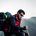
Your Adventure to Singalila Trek – 13 Days Starts Here
Start your journey with trusted local experts and discover the beauty, culture, and adventure waiting in the Himalayas and beyond.
Frequently Asked Questions
Everything you need to know about the AASRA ECO TREK
No. This trek is graded moderate and is genuinely achievable for fit, motivated first-time Himalayan trekkers, provided a few weeks of prior fitness preparation, including regular walking or stair-climbing, are undertaken beforehand.
Unlike higher Sikkim and Nepal treks that require full camping, this route uses lodges, trekkers’ huts, and homestays throughout. Rooms are basic, often shared, with limited electricity, but offer a warm bed, wood-stove heating, and home-cooked meals each evening.
No mountain view can ever be guaranteed, as visibility depends entirely on weather at the time. Autumn (late September to November) and spring mornings offer the best statistical chances of a fully clear panorama.
The 21-kilometre stage to Phalut is optional in shorter itineraries, but it is the section that gives this trek its name as the “Singalila Ridge Trek” rather than simply the Sandakphu Trek. It also offers quieter, arguably even more spectacular Kanchenjunga views than Sandakphu itself.
Singalila National Park is home to red pandas, Himalayan black bears, various pheasant species, and rich forest birdlife. Sightings are possible but not guaranteed, most likely around Gairibas and on the descent toward Gurdum and Rammam.
Nighttime temperatures at these elevations regularly fall below freezing, even in spring and autumn, and can drop to -4°C to -8°C in winter months. A proper down jacket and warm sleeping layers are essential year-round.
Coverage is unreliable beyond Manebhanjan and largely absent at Tumling, Kalipokhri, Sandakphu, and Phalut. Download offline maps and inform family of limited contact before setting out.
Yes, a shorter 8 to 9-day version covering only Manebhanjan to Sandakphu and back is possible, but it omits the Phalut ridge walk and the quieter descent villages that give this 13-day itinerary its distinct character.

Still have questions?
Can’t find the answer you’re looking for? Please chat to our friendly team.
Get In TouchSimilar Packages
Journey Through Indian Wilderness – 13 Days
13 Days
Duration
Easy Level
Romantic Rajasthan – 13 Days
13 Days
Duration
Easy Level
Markha Valley Trek & Golden Triangle – 23 Days
5,260m
Max. Elevation
23 days
Duration
Moderate Level
We are associate with
