
 Plan Your Trip
Kanchenjunga Trek – 28 Days
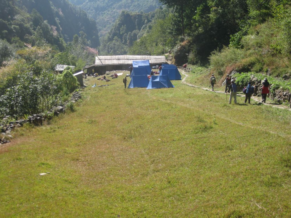
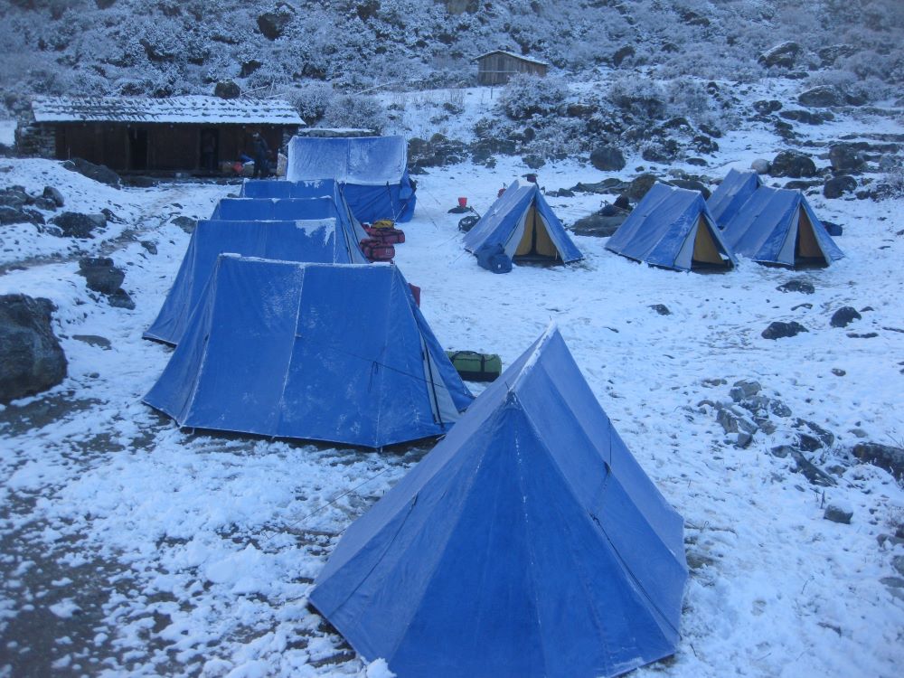
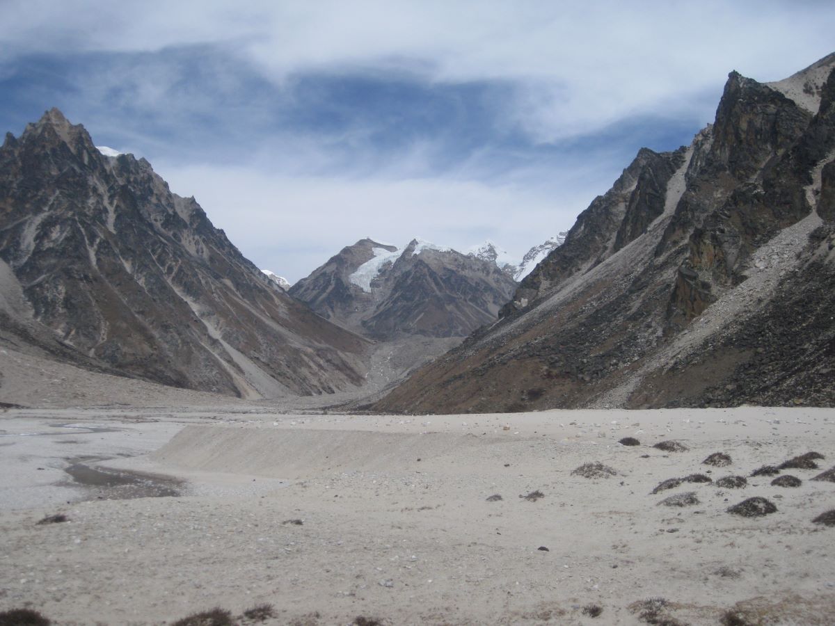
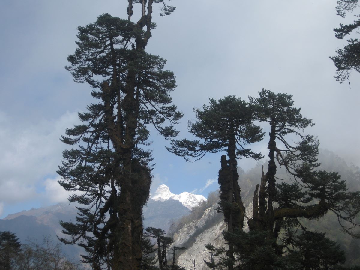

Trip Overview

Trek Region
Kanchenjunga

Difficulty Level
Hard

Transport
Kathmandu - Bhadrapur - Suketar by flight; Suketar - Kathmandu by flight

Total Trip Duration
28 Days

Max Elevation
5,143m

Meals
Breakfast, Lunch and Dinner included
Trip Highlights
- Stand at Pangpema (5,143m) – the North Base Camp of Kanchenjunga – with the most overwhelming close-up panorama of the world’s third-highest mountain available from any standard trekking route, including Kanchenjunga’s north face, Jannu / Kumbhakarna Himal (7,710m), Nepal Peak, Tent Peak, Kirat Chuli, and the entire northern massif
- Reach Ramche (4,610m) – the South Base Camp – and hike to Oktang for the finest viewpoint of Kanchenjunga’s spectacular southwest face and the vast Yalung Glacier – the original route of the 1955 British expedition that made the first ascent
- Complete a genuine circuit of the world’s third-highest mountain – visiting both the north and south base camps in a single continuous traverse that crosses the high passes connecting the two sides
- Cross the Sele La Pass (4,960m) – the dramatic high ridge connecting the north and south circuit – with panoramic views of Kanchenjunga, Jannu, Makalu, Everest, and Lhotse on a clear day
- Trek through the Kanchenjunga Conservation Area – one of Nepal’s most biodiverse protected areas, home to snow leopard, red panda, Himalayan black bear, musk deer, clouded leopard, and over 250 bird species including the endangered Himalayan monal pheasant
- Explore Ghunsa (3,410m) – the finest and most culturally complete Tibetan Buddhist Sherpa village in the Kanchenjunga region, with ancient gompas, mani walls, prayer wheel corridors, and a warmth of community that reminds experienced Nepal trekkers of the Khumbu’s finest villages before mass tourism
- Walk the Tamor River valley – the ancient trade route connecting eastern Nepal with Sikkim and Tibet – through a landscape of extraordinary subtropical to alpine biodiversity, Limbu and Rai villages with living indigenous cultural traditions, and the finest rhododendron forests of any Nepal trekking route
- Witness the Jannu massif (7,710m) from the high upper valley near Khambachen and Lhonak – one of the most technically dramatic mountain faces in the entire Himalayan range, rising directly from the valley floor in a near-vertical sweep of ice and rock
- Trek through Lhonak (4,790m) – the high, windswept sandy plain at the base of the Kanchenjunga Glacier approach – with the full Kanchenjunga massif filling the sky ahead and the desolate, beautiful character of the extreme high-altitude trans-Himalayan landscape
- Explore Yamphudin (2,080m) – the gateway village of the south Kanchenjunga approach – and the beautifully varied cultural and natural landscape of the lower Tamor valley Limbu communities
- Visit the ancient Ghunsa Gompa and the remarkable Tibetan Buddhist architecture of the upper valley settlements, where the cultural heritage of the Sherpa and Tibetan communities of far eastern Nepal remains intact and actively practiced
- Trek in a Restricted Area with controlled visitor numbers – the Kanchenjunga region sees a fraction of the trekker traffic of the Everest or Annapurna regions, and the genuine solitude, genuine wildlife, and genuine cultural encounters that result are among the most authentic experiences available in Nepal trekking today
- Experience the extraordinary ecological transition from subtropical Sal forest and bamboo in the lower Tamor valley, through temperate mixed forest, through the most spectacular rhododendron and magnolia forests in eastern Nepal, to the alpine meadows and glacial moraine of the high base camp areas
Trip Summary
Nepal has three great trekking mountains. Most of the world knows two of them – Everest in the northeast and Annapurna in the central north. The third – Kanchenjunga (8,586m) – stands in the far eastern corner of the country on the border with Sikkim, India, and it belongs to a different world entirely. Remote, rarely visited, ecologically extraordinary, and culturally rich in ways that the more famous trekking regions have largely lost to commercialization, the Kanchenjunga region remains one of the last genuinely wild and genuinely authentic trekking landscapes in the Nepal Himalaya.
Kanchenjunga means Five Treasures of Snow in the Tibetan language – a reference to its five summits, each holding one of five sacred treasures: salt, gold, turquoise, grain, and holy scriptures. The mountain is sacred to the Limbu, Rai, and Sherpa communities of eastern Nepal, and the Kanchenjunga Conservation Area that surrounds it – managed by local communities in partnership with the WWF – is one of the most biodiverse protected areas in the entire Himalayan range.
This 28-day circuit – the most complete version of the Kanchenjunga trekking experience – visits both base camps in the most logical and rewarding sequence. Starting from the small airstrip at Suketar near Taplejung in the Taplejung district, the route follows the Tamor River northward through Limbu and Rai villages of the lower valleys, climbs through extraordinary rhododendron forests, reaches the Tibetan Buddhist Sherpa village of Ghunsa (3,410m) – the last permanent settlement on the north side – and pushes on to Pangpema (5,143m), the North Base Camp, with its overwhelming close-up panorama of Kanchenjunga’s north face, Jannu (Kumbhakarna Himal), Nepal Peak, Tent Peak, and the entire northern massif.
From Ghunsa, the route crosses the challenging high passes of Mirgin La (4,480m) and Sele La (4,960m) to the south side of the mountain, reaching the Yalung Glacier and the Ramche (4,610m) base camp area on the south side, with the optional summit viewpoint hike to Oktang for the finest panoramic view of Kanchenjunga’s southwest face. The circuit finishes through Yamphudin and the lower Tamor valley back to Suketar for the flight home.
Two base camps. One complete circuit around the world’s third-highest mountain. The finest eastern Nepal trekking experience available.
When To Visit
The Kanchenjunga circuit’s seasonal window is shaped by two factors: the condition of the Sele La Pass (4,960m) connecting the north and south sides, and the accessibility of the lower approach trails through the Tamor and Yalung valleys.
Spring (late March to late May) is one of the two finest seasons for the complete circuit. The rhododendron forests of the approach sections – from Gyabla through the upper Ghunsa Khola and the south side Yalung valley – are at their most spectacular from late March through April, producing one of the finest floral displays of any Nepal trekking route. The lower valley forests are in bloom simultaneously with magnolia, orchid, and wild strawberry. The Sele La is generally passable from mid-April onward. Mountain views from the base camps and the passes are excellent in spring.
Autumn (mid-September to mid-November) is the peak season and the finest overall window for mountain visibility and trail conditions. The post-monsoon atmosphere is crystalline and the views from Pangpema, Oktang, and the Sele La are at their sharpest and most panoramic. October is the gold-standard month – stable weather throughout, the Sele La in excellent condition, full teahouse availability along the circuit, and the cultural landscape of the Limbu and Sherpa villages at its most active with the autumn harvest calendar.
Monsoon (June to August) is generally not recommended for the full circuit. The lower Tamor valley becomes leech-heavy and slippery, the Sele La approach can have unstable conditions, and flight connections to Suketar are frequently disrupted. The upper Kanchenjunga valley does receive some monsoon protection but the lower approach sections are genuinely difficult.
Winter (December to February) is challenging for the full circuit. The Sele La accumulates significant snowpack and can become dangerous. The upper valley sections above Ghunsa are extremely cold. The lower valley teahouses remain accessible and the winter character of the Kanchenjunga Conservation Area is beautiful in its own right, but the complete circuit including both base camps and the pass connection is not recommended in winter for standard trekking groups.
Itinerary
Welcome to Nepal. Our team meets you at Tribhuvan International Airport and transfers you to your hotel in Kathmandu. In the evening your trekking guide joins you for a thorough pre-trek briefing – covering the complete 28-day circuit section by section, the altitude profile across the two base camps and the connecting passes, the permit system for the Kanchenjunga Conservation Area and the Restricted Area Permit, cultural background on the Limbu, Rai, and Sherpa communities of the Tamor valley, gear checks and camping requirements for the upper sections, and the logistics of the domestic flights to Bhadrapur and the drive to Suketar.
The briefing covers the circuit’s distinctive structure – approaching the North Base Camp first for physiological and logistical reasons, then crossing to the South side via the Mirgin La and Sele La passes, visiting Ramche and the Oktang viewpoint, and descending through the south side villages to Yamphudin and back to Suketar. Understanding this structure before departure makes each day’s walking more purposeful and more rewarding.
The Kanchenjunga region is the most ecologically diverse of any Nepal trekking destination – the altitude range from 1,200m at Mitlung to 5,143m at Pangpema encompasses an extraordinary range of ecosystems, and your guide’s knowledge of the wildlife, flora, and cultural communities along the route adds significant depth to the experience. Overnight in Kathmandu.
The journey to the Kanchenjunga region begins with a 45-minute domestic flight from Kathmandu to Bhadrapur Airport in the eastern Terai lowlands of Nepal – a flight that on clear days provides extraordinary views of the entire eastern Himalayan chain from Kanchenjunga to Makalu as the aircraft crosses the middle hills.
Bhadrapur is a lowland Terai town in the Jhapa district – warm, flat, and agricultural, with the characteristic character of the Nepal-India border region. From Bhadrapur, a private jeep drive of 5-6 hours takes you northward through the progressively more hilly terrain of the Ilam and Taplejung districts to the Suketar airstrip area near Taplejung (1,820m) – the district headquarters and the gateway to the Kanchenjunga Conservation Area.
The road to Taplejung is one of the more dramatic hill country drives in eastern Nepal – climbing from the Terai plains through tea gardens, terraced hillsides, and forested ridgelines with views of the Kanchenjunga range beginning to appear on the northern horizon in the final section. Overnight in Taplejung or Suketar. Flight time: 45 minutes. Drive time: 5-6 hours.
The first walking day begins from the Suketar airstrip area and descends through the upper Tamor valley toward the river corridor that will carry the circuit northward toward Kanchenjunga. The trail passes through the terraced hillsides and farming communities above the Tamor gorge, descending steadily through the rich ecological diversity of the upper Taplejung district.
The lower Tamor valley is inhabited primarily by the Limbu people – one of the most culturally distinct and historically significant indigenous communities of eastern Nepal, with a language, spiritual tradition, and architectural style entirely their own. The Limbu practice Yumaism – an ancient animist and shamanistic religion that predates both Hinduism and Buddhism in these hills – alongside various degrees of Buddhist and Hindu practice. Their traditional carved wooden houses, their distinctive dress and jewelry, and the warm directness of their community character are immediately apparent from the first villages of the approach.
The trail descends through stands of bamboo, oak, and the first of the magnificent rhododendron trees that will accompany the circuit to extraordinary heights at upper elevations. Mitlung / Phawa Khola (1,200m) serves as the overnight stop – teahouse accommodation at the lower valley floor. Walking time: 5-6 hours.
following the riverbank through alternating sections of forest and farmland, and passing through a series of Rai and Limbu villages whose character shifts gradually as the valley culture transitions from the warmer, more agricultural lower valley world to the cooler, more mixed community of the middle Tamor.
The Rai people of these middle valley settlements – like the Limbu – are indigenous to eastern Nepal with their own distinct language, their own ancient animist spiritual traditions, and a cultural presence in this valley that predates the arrival of Hinduism and Buddhism by many centuries. The Rai and Limbu together form what anthropologists call the Kiranti peoples – the original inhabitants of the eastern Nepal hills – and walking through their villages with a guide who knows their cultural context transforms the experience from simple transit to genuine cultural encounter.
The trail passes through the significant market town of Tapethok and continues to Chirwa (1,270m) – a lively Limbu village with good teahouse options and the warm character of a community accustomed to hosting trekkers passing through on their way to the high mountains. Walking time: 5-6 hours.
The valley narrows and the character of the walk intensifies. From Chirwa the trail continues northward along the Tamor River, crossing to both banks on suspension bridges and climbing steadily through increasingly lush forest as altitude increases. The subtropical vegetation of the lower valley – banana trees, wild ginger, and the broad-leafed forest of the warm lower slopes – begins giving way to more temperate species as the trail gains elevation.
The route passes through the settlement of Sinwa and continues through mixed forest and small farming communities to Sekathum (1,660m) – a significant village at the confluence of the Tamor and the Ghunsa Khola, the tributary stream that drains the upper valley leading toward Kanchenjunga North Base Camp. Sekathum marks the practical junction where the trail committed to the North Kanchenjunga approach branches from the main Tamor valley.
Teahouse accommodation in Sekathum is well-established and the village carries the friendly, welcoming energy of a community that has served as the gateway settlement for the upper Kanchenjunga route for many generations. The permit checkpoint here is the first of several along the circuit where your Conservation Area and Restricted Area permits will be checked. Walking time: 5-6 hours.
The trail leaves the warm, agricultural Tamor valley and enters the upper Ghunsa Khola gorge – a dramatic narrowing of the landscape into a canyon of extraordinary character. The trail follows the river northward through a sequence of crossings, narrow ledge paths, and forested gorge sections where the walls close steeply above the rushing water.
The vegetation in the Ghunsa Khola gorge is particularly rich – the combination of altitude, moisture, and the protected gorge microclimate supports stands of old-growth forest including magnificent specimens of magnolia, oak, and alder. In spring, the magnolia trees in this section flower in white and pink displays of extraordinary beauty. The forest floor is thick with ferns, mosses, and the orchids for which the Kanchenjunga Conservation Area is celebrated among botanists.
The trail climbs steadily through this beautiful gorge landscape to Amjilossa (2,490m) – a small settlement in the mid-gorge where basic teahouse accommodation serves trekkers heading to and from the upper valley. The name means “good view” in the local dialect and the ridge above the village offers views of the first high snow peaks of the Kanchenjunga massif on clear afternoons. Walking time: 6-7 hours.
From Amjilossa the trail continues the steady climb through the upper Ghunsa Khola gorge – the forest now dominated by rhododendron, with the first spectacular blooming displays appearing on the south-facing slopes even at this altitude in the spring season. The gorge is deeply forested and deeply quiet – a landscape of waterfalls, mossy cliff faces, and the constant background sound of the river below.
The route passes through a dramatic gorge section where the trail is cut into the cliff face above the river and then climbs through oak and rhododendron forest to the small settlement of Gyabla (2,730m) – a cluster of traditional stone and timber houses in a forest clearing with a beautiful old Sherpa gompa sitting at the upper edge of the village.
Gyabla marks the transition into the Sherpa cultural zone of the upper Kanchenjunga approach. The flat-roofed architecture, the mani walls, the prayer wheels, and the welcome smell of butter tea in the teahouses announce the shift from the Limbu and Rai world of the lower valley to the Tibetan Buddhist Sherpa community of the upper valley. Small but genuinely beautiful, Gyabla is one of the trail’s pleasantest overnight stops. Walking time: 5-6 hours.
The trail from Gyabla climbs through the finest forest section of the entire approach – a spectacular corridor of old-growth rhododendron, birch, and conifer that in spring is alive with color and in autumn carries the deep, resinous smell of old forest at altitude. The trail crosses several streams on wooden bridges and passes through a beautiful meadow section before the final descent to the valley floor at Kyapra and the approach to Ghunsa.
Ghunsa (3,410m) is the cultural heart of the upper Kanchenjunga north side – a beautifully preserved Tibetan Buddhist Sherpa village that is the finest settlement on the entire circuit. The village sits in a broad valley bowl surrounded by towering peaks – Kanchenjunga (8,586m), Jannu / Kumbhakarna Himal (7,710m), and the jagged ridgelines of the upper massif all visible above the treeline. A line of prayer wheels stretches through the lower village, spinning in the breeze from the river. Two ancient gompas – one at each end of the village – frame the settlement in the traditional Tibetan Buddhist spatial arrangement.
The teahouses of Ghunsa are well-established by the standards of the upper valley – warm, friendly, and serving good food by the standards of this remote region. The community character of Ghunsa – welcoming, unhurried, proud of their valley and their traditions – is immediately and completely apparent. Spend the evening exploring the village and visiting the gompas as the afternoon light falls on the peaks above. Walking time: 5-6 hours.
A full rest and acclimatization day at Ghunsa – essential physiologically before the sustained high-altitude days ahead and deeply rewarding culturally as an opportunity to genuinely understand the village and its setting.
The standard acclimatization hike climbs the ridge above Phole village – a smaller Sherpa settlement a short walk east of Ghunsa – to approximately 3,800-4,000m, gaining altitude and returning. The views from the Phole ridge are extraordinary – Kanchenjunga’s north face appears for the first time in close-up profile, framed by the valley walls, and the Jannu massif (7,710m) – the extraordinary technical mountain known as Kumbhakarna to local communities – fills the northeastern horizon in a sweep of ice and rock that stops every trekker in silence.
The afternoon is spent exploring Ghunsa thoroughly. The two ancient gompas deserve unhurried visits – the older one above the village has thangka paintings of considerable antiquity and a prayer hall decorated with the carved and painted wooden columns of classical Tibetan Buddhist architecture. The village water mill, the chortens at the village entrance and exit, and the families who run the teahouses are all worth patient, respectful engagement through your guide’s translation.
Ghunsa is also famous for its hot springs – a natural geothermal source below the village where a simple stone bath structure has been built for community and visitor use. After the walking of the past several days, the hot spring water is profoundly welcome. Hike time: 3-4 hours.
Above Ghunsa the character of the landscape changes completely and decisively. The trail leaves the forest, crosses open yak pasture, and enters the high-alpine moraine landscape of the upper Kanchenjunga valley – a world of glacial debris, alpine grass, and towering peaks that feels entirely and completely wild.
The trail climbs northward through the valley above Ghunsa, crossing moraine ridges and following the river through boulder fields and open alpine terrain. Jannu / Kumbhakarna Himal (7,710m) grows progressively more dominant and more overwhelming as the approach brings you closer to its base – the mountain rising directly from the valley floor in a sweep of technical ice and rock that experienced mountaineers consider one of the finest mountain faces in the Himalayan world.
Khambachen (4,050m) – also written as Kambachen – is a seasonal settlement at the base of the upper approach, used primarily by yak herders in the warmer months and by expedition teams as a staging camp. The teahouses here are basic by any standard but functional, and the views of Jannu and the surrounding peaks from the settlement platform are extraordinary. Sleep early. The altitude has increased significantly today. Walking time: 5-6 hours.
One of the finest high-altitude walking days of the entire 28-day circuit. From Khambachen the trail continues northward through the narrowing upper valley – the terrain becoming increasingly dramatic as the walls close in and the peaks above grow more immediate and more imposing.
The trail passes the seasonal settlement of Ramtang – where the ancient Ramtang Monastery sits on a moraine ridge above the valley floor, a remote and genuinely atmospheric religious site – and continues along the glacier moraine trail toward the Kanchenjunga Glacier approach. The mountain scenery from this section is extraordinary – Kirat Chuli (7,365m), Nepal Peak (7,168m), the twin towers of Tent Peak (7,365m), and the massive bulk of Kanchenjunga itself all filling the northern horizon in a continuous wall of ice and rock.
Lhonak (4,790m) is a high, flat, sandy plain at the base of the Kanchenjunga Glacier approach – a surreal, wind-swept landscape of moraine debris and angular glacier ice that looks more like a Tibetan plateau landscape than anything in the Nepal middle hills. Blue sheep herds graze on the surrounding slopes in the evening. The silence here – at nearly 4,800m in complete wilderness – has the quality of absolute solitude that the Kanchenjunga region specializes in delivering. Walking time: 5-6 hours.
The most anticipated day of the north side approach. From Lhonak the trail continues northward along the glacier moraine – crossing boulder fields and rocky terrain with the Kanchenjunga massif growing ever closer and ever more overwhelming as the base camp approaches.
The route climbs steadily on the moraine beside the Kanchenjunga Glacier – the ice visible directly to the east as the trail threads between the glacier and the valley wall. The scale of the surroundings at this altitude – the peaks above, the glacier below, the silence of the high wilderness – is genuinely unlike anything in the more frequented Nepal trekking circuits.
Pangpema (5,143m) – the North Base Camp of Kanchenjunga – arrives with an impact that no description adequately prepares you for. The camp area sits on a moraine platform at the base of the glacier with the full north face of Kanchenjunga (8,586m) filling the entire southern sky. To the east, Jannu / Kumbhakarna Himal (7,710m) rises in profile. Nepal Peak (7,168m), Tent Peak (7,365m), Kirat Chuli, Givegela Chuli – the full northern massif is arrayed in a panorama of such scale and such immediacy that most trekkers simply stand in silence for a long time after arriving.
This is the highest point of the entire 28-day circuit. You are standing at over 5,100m at the base of the world’s third-highest mountain, in a landscape that very few people on Earth will ever see directly. Take time here. Walk the moraine. Let the scale of what surrounds you land properly. Walking time: 4-5 hours.
A morning of exploration at and around Pangpema before beginning the return descent to Lhonak. The early morning light on Kanchenjunga’s north face – as the first sun reaches the upper ice fields and the summit begins to glow above the shadow of the lower ridges – is one of the finest sunrise mountain spectacles accessible from any standard Nepal trekking route. Wake early. Be at the moraine viewpoint before dawn.
The area around Pangpema rewards careful exploration – walking the moraine ridge above the base camp provides progressively higher and more complete panoramas of the massif, and on the clearest mornings the distant profiles of Makalu (8,481m) and even Everest (8,848m) are visible to the west. The scale of what can be seen from this location – encompassing three of the five highest mountains on Earth simultaneously – is extraordinary.
After morning exploration, the trail descends the same approach route back to Lhonak (4,790m) for the overnight. The descent provides the opportunity to see the landscape from a different direction and in a different quality of light. Walking time: 5-6 hours.
A straightforward but beautiful descent day – returning through the upper valley from Lhonak past Ramtang and the Ramtang Monastery to Khambachen. The descent is entirely downhill and the views of Jannu and the surrounding massif from the high section of the trail are consistently extraordinary.
The descent through the moraine terrain provides an excellent opportunity for wildlife observation – the blue sheep populations of the upper valley are significant and the animals are commonly seen in family groups grazing on the slopes above the trail in the afternoon hours. Red panda sightings have been reported in the lower sections of the descent toward the Ramtang area. And the lammergeier – the bearded vulture whose enormous wingspan makes it one of the most visually impressive high-altitude raptors – is a regular aerial presence above the upper valley. Walking time: 4-5 hours.
The final descent back to Ghunsa before the circuit pivots from the north side to the south side via the high passes. From Khambachen the trail retraces through the upper valley – past the junction with the moraine trail, through the alpine meadow sections, and back into the forest zone above Ghunsa.
Arriving back at Ghunsa after the high base camp experience is a genuinely satisfying transition – the warmth of the air at 3,410m compared to Pangpema and Lhonak, the return of forest and birdlife, the butter tea and the warm teahouse kitchen, and the familiar landscape of the village after the exposed wilderness of the upper valley all combine to create a feeling of return that is both physical and psychological. Rest well at Ghunsa. Eat generously. Tomorrow the south side section of the circuit begins. Walking time: 5-6 hours.
The circuit pivots. Instead of continuing down the Ghunsa Khola valley southward, the trail branches west from Ghunsa and climbs toward the high camp zone below the Mirgin La and Sele La passes that connect the north and south sides of the Kanchenjunga massif.
The trail climbs steeply from Ghunsa through a magnificent corridor of rhododendron, juniper, birch, and pine forest – one of the finest forest sections on the entire circuit. The views back across the Ghunsa valley and upward toward the Kanchenjunga massif open and close as the trail winds through the forest, providing a series of framed mountain views that are among the finest mid-altitude panoramas of the entire trek.
Above the forest, the trail enters open alpine meadow and continues to the High Camp area (approximately 4,200m) – a flat area on the approach ridge used as the staging camp before the double pass crossing to the south side. Basic teahouses may be available here; camping is the primary accommodation option at this altitude. The mountain views from the high camp area on a clear evening – of Kanchenjunga, Jannu, the Ghunsa valley below, and the high ridgeline of the connecting passes above – are deeply satisfying. Walking time: 5-6 hours.
The most physically demanding and most scenically spectacular day of the circuit. From the high camp, the trail crosses two significant passes in a single sustained effort – the Mirgin La (4,480m) and the Sele La (4,960m) – crossing the high ridge that divides the north and south sides of the Kanchenjunga massif.
The ascent to the Mirgin La is steep and demanding – climbing through open alpine terrain above the forest with progressively wider views of the massif behind and the south side valleys ahead. At the Mirgin La (4,480m) the first views of the south side open – the completely different landscape of the Yalung valley system, the south face of the massif, and the distant lowland valleys of the south side.
From Mirgin La the trail continues the high traverse to the Sele La (4,960m) – the higher and more demanding of the two passes – a magnificent high ridge from which on clear days the panorama encompasses Kanchenjunga’s full massif, Jannu, Makalu, Baruntse, and on the finest days the distant profiles of Everest and Lhotse to the northwest. Standing at Sele La at nearly 5,000m with the full eastern Himalayan panorama arrayed in every direction is one of the genuine highlight moments of the entire 28-day circuit.
The descent from Sele La to Tseram (3,870m) drops steeply through rocky terrain and then through forest to the basic teahouse settlement in the upper Yalung valley. It is a long day with significant altitude gain and loss – plan for an early start from high camp. Walking time: 7-8 hours.
From Tseram the trail heads northward into the upper Yalung valley – a completely different landscape from the Ghunsa Khola world of the north side. The Yalung valley is wider, more open, and carries a different quality of alpine character – the Yalung Glacier visible above the valley floor, the south and southwest faces of the Kanchenjunga massif rising directly ahead in a configuration of peaks entirely different from the north face panorama.
The trail passes through the small settlements of Lapsang and the open meadow terrain of the glacier approach before reaching Ramche (4,610m) – the South Base Camp area and the last teahouse on the south approach. The location is extraordinary – the broad flat of the Yalung Glacier moraine, the southwest face of Kanchenjunga directly above, and the distinctive profile of Kokthang Peak (6,147m), Rathong (6,678m), and Kabru (7,338m) completing the mountain panorama.
This is the site of the 1955 British expedition’s base camp – the expedition led by Charles Evans that made the first ascent of Kanchenjunga on 25 May 1955, with George Band and Joe Brown reaching the summit and stopping just short of the very top out of respect for the Sikkimese belief that the summit itself is sacred. Knowing that history, standing at the same base camp from which those climbers launched their successful ascent, gives the location an additional layer of meaning. Walking time: 5-6 hours.
A full exploration day at the south base camp – equally important for acclimatization after the demanding double pass crossing of Day 17 and for the extraordinary optional hike to the finest viewpoint on the south side of the circuit.
The hike to Oktang – also called Okhardhunga – is the highlight of the south side exploration. From Ramche the trail climbs northward above the Yalung Glacier moraine for approximately 2-3 hours to the Oktang viewpoint at approximately 4,900m. From Oktang, the southwest face of Kanchenjunga (8,586m) is visible in its full and overwhelming extent – the most complete and most panoramic view of the mountain’s south aspect available from any trekking route. Yalung Kang (8,505m) – Kanchenjunga’s western summit – and the full southwest ridge of the massif are visible from this viewpoint in a panorama that many experienced Himalayan trekkers consider even more dramatic than the north face view from Pangpema.
The afternoon at Ramche is spent exploring the glacier moraine, watching the mountains change color in the afternoon light, and absorbing the particular quality of the south base camp setting – wider and more open than the enclosed north base camp approach, with a different and equally extraordinary quality of mountain presence. Hike time: 4-5 hours.
Beginning the long south-side descent back toward Suketar and the circuit’s conclusion. From Ramche the trail retraces southward through the Yalung valley past Lapsang and back through the meadow and forest sections to Tseram (3,870m).
The descent from the base camp area to Tseram passes through some of the finest alpine and sub-alpine scenery of the south side – the Yalung Glacier visible above the valley, the surrounding peaks of the south massif creating a constantly changing panorama as the trail winds through the valley, and the forest sections below the glacier zone carrying the rich, mature character of the Kanchenjunga Conservation Area’s best-protected forest ecosystems.
Wildlife sightings are common in this section on the descent – red panda have been seen in the rhododendron forest below the alpine zone, Himalayan black bear tracks are regularly found on muddy sections of the trail, and the bird diversity in the for
A long descent through the mid-altitude forest zone of the south Kanchenjunga approach – the landscape returning progressively to the warm, forested, and culturally inhabited world of the lower Yalung valley.
The trail from Tseram descends steeply through dense rhododendron and magnolia forest – in spring, the magnolia trees in this section are among the finest in eastern Nepal, their white and pink flowers filling the forest canopy for weeks in late March and April. In autumn, the forest takes on a beautiful quality of russet and gold as the deciduous species change color before the winter.
The trail passes through a section that requires some care – landslide-prone slopes above the valley floor where careful footing is important, particularly after wet weather. Your guide knows the current trail condition and will brief the group on any sections requiring extra attention. Tortong (2,995m) is a small settlement in the lower Yalung valley where basic teahouse accommodation serves the overnight. Walking time: 5-6 hours.
The trail continues its descent through the forest and open hillside country of the lower south approach, dropping from the cool temperate forest zone back into the warmer, more lush, more culturally inhabited landscape of the Yalung Khola valley.
Yamphudin (2,080m) is the most significant village of the south Kanchenjunga approach – a large, prosperous settlement of mixed Limbu, Sherpa, and Tamang community with well-established teahouses, a thriving local market, and the warm character of a community that has served as the gateway to the south Kanchenjunga valley for generations. The transition from the high wilderness of the base camp area back to a proper inhabited village – with children playing in the lanes, women weaving on wooden looms outside their houses, and the smell of cooking from the teahouse kitchens – is one of those deeply pleasant arrivals that long wilderness treks consistently produce.
Spend the evening in Yamphudin. The warmth and the food and the company of people going about their ordinary lives is genuinely and completely welcome after the demanding high days of the past week. Walking time: 5-6 hours.
From Yamphudin the trail heads southward through the lower Tamor valley system – the route connecting the south Kanchenjunga approach back to the main valley trail and the road access at Taplejung. The trail passes through a beautifully varied landscape of terraced farmland, mixed forest, small settlements, and the rich birdlife of the subtropical to temperate transition zone.
Khebang (2,100m) is a significant Limbu village in the lower section of the return route – a settlement with the characteristic Limbu architecture, prayer structures, and community character of the eastern Nepal hill country. The surrounding farmland of millet, buckwheat, and maize growing on carefully terraced hillsides carries the productive, settled character of a community that has been farming this landscape for many generations. Walking time: 5-6 hours.
The final trekking day of the entire 28-day circuit. From Khebang the trail makes the final descent and traverse through the lower Tamor valley system back to the Suketar airstrip area near Taplejung – the same point from which the trek began 22 walking days ago.
The trail passes through a final sequence of Limbu and Rai villages whose character carries the full richness of the lower Tamor valley cultural landscape – carved wooden facades on traditional houses, the distinctive dress and silver jewelry of Limbu women, the sounds of the village water mills on the small streams, and the warm greetings of communities who see trekkers returning from the high Kanchenjunga circuit with a particular quality of recognition.
Arriving at Suketar completes a genuine circuit – you departed from this airstrip 22 trekking days ago and you have walked a complete loop around the base of the world’s third-highest mountain, visiting both its north and south base camps, crossing the high passes that connect the two sides, and walking through the extraordinary ecological and cultural diversity of the Kanchenjunga Conservation Area from the subtropical river valley to the glacial high alpine. That is an achievement worth a proper acknowledgment over dinner in Taplejung tonight. Walking time: 5-6 hours
The return flights from Kanchenjunga country to Kathmandu. The morning flight from Suketar (also called Taplejung Airport) to Bhadrapur takes approximately 30 minutes and provides a final aerial view of the Kanchenjunga massif – the full sweep of the five summits visible above the eastern Nepal hill country at close range from the aircraft. The connection flight from Bhadrapur to Kathmandu takes 45 minutes.
Both flights are subject to mountain weather conditions and the weather patterns of the Taplejung area can delay departures, particularly in the early morning when valley fog sometimes grounds aircraft until late morning. Patience and flexibility are the standard requirements at any eastern Nepal mountain airstrip. Your guide monitors flight conditions and communicates with the airline on your behalf.
Back in Kathmandu, transfer to your hotel and enjoy the fully earned luxury of a hot shower, a proper bed, and a city meal after 22 days on the trail. Flight times: 30 and 45 minutes.
A well-earned day of rest and cultural exploration in Kathmandu. After 22 days of walking in one of Nepal’s most remote and ecologically extraordinary trekking regions, the city offers a profoundly different but complementary quality of cultural experience.
The great religious sites of the Kathmandu Valley – Pashupatinath Temple on the Bagmati River, Boudhanath Stupa and its circumambulation community of Tibetan Buddhist monks and pilgrims, the medieval Newari architecture of Patan Durbar Square – all provide the urban and religious context for the Limbu, Rai, and Sherpa cultures you have been walking among for the past three weeks. The day trip to Bhaktapur – the finest preserved medieval city in the Nepal Valley – is an excellent way to understand the broader context of Nepal’s extraordinary cultural heritage.
Or simply rest. Eat at the restaurants you have been looking forward to for three weeks. Shop in Thamel for the souvenirs you have been planning since Pangpema. Book a proper massage. And begin letting the experience of the circuit settle into the kind of memory that the finest journeys always eventually become.
A critical buffer day for the very common occurrence of Suketar or Bhadrapur flight delays. The Taplejung flight connection is one of the most weather-affected domestic routes in Nepal – morning fog in the Tamor valley regularly delays or cancels the Suketar departure, and this buffer day is a non-optional logistical component of any responsible Kanchenjunga circuit itinerary.
If flights returned on schedule, the buffer day is a free second day in Kathmandu – use it for any unfinished cultural sightseeing, additional rest, extended shopping, or the kind of relaxed final day that a three-week Himalayan circuit genuinely deserves.
Your 28-day Kanchenjunga circuit comes to a close. Our team transfers you to Tribhuvan International Airport for your onward journey. You leave Nepal having completed the most complete circuit of the world’s third-highest mountain available to non-climbing trekkers – two base camps, two high passes, the finest wild mountain landscape in eastern Nepal, and the extraordinary cultural and ecological richness of the Kanchenjunga Conservation Area from its subtropical river valleys to its glacial high alpine
Trek Difficulty & Physical Demands
The Kanchenjunga Trek is rated strenuous to challenging – one of the most demanding standard teahouse circuits in Nepal and significantly more demanding than the Annapurna Base Camp or Langtang routes, comparable in overall difficulty to the Everest Three Passes Trek but with a longer approach and greater remoteness.
Duration and daily demand: 22 full trekking days covering 210-230 km is a serious physical commitment. The consistent daily walking of 5-8 hours across a full range of terrain – from subtropical river valley to glacial high alpine – requires endurance as much as cardiovascular fitness.
Altitude: The circuit reaches 5,143m at Pangpema and 4,960m at the Sele La – both significant altitudes requiring proper acclimatization. The single acclimatization day at Ghunsa (Day 9) is the critical physiological preparation before the sustained high-altitude days above. Following the itinerary’s pacing rather than rushing toward the base camps is essential.
Sele La crossing: The connection between the north and south sides via the Mirgin La (4,480m) and Sele La (4,960m) is the most demanding single day of the circuit – a sustained 7-8 hour effort crossing two consecutive high passes with significant altitude gain and loss. Snow conditions on the upper Sele La section may require crampons or gaiters in some seasons.
Remoteness: The Kanchenjunga circuit is significantly more remote than the Everest or Annapurna regions. Medical facilities are non-existent above Taplejung. Emergency evacuation requires helicopter coordination. Trail infrastructure is basic throughout and the circuit demands genuine self-sufficiency.
Physical fitness: 3-4 months of consistent cardiovascular training before departure – hiking with a loaded pack on steep terrain, running, cycling, and stair work – is the appropriate preparation. Prior high-altitude trekking experience above 4,000m is a genuine and meaningful advantage.
Best Time to Trek: Seasonal Comparison
| Season | Months | Sele La Conditions | Forest and Scenery | Views | Recommended |
| Spring | Mar–May | Good from mid-April | Spectacular bloom | Excellent | Best |
| Monsoon | Jun–Aug | Difficult | Lush green | Limited | Avoid |
| Autumn | Sep–Nov | Excellent | Beautiful | Outstanding | Best |
| Winter | Dec–Feb | Snow covered | Bare | Good (lower) | Avoid |
Pro tip: For the best combination of vibrant rhododendron forests and favorable Sele La conditions, plan your trek between late April and early May. If your priority is crystal-clear mountain views from Pangpema, Oktang, and the Sele La Pass, choose October. Both seasons provide exceptional trekking experiences—the ideal choice depends on whether you prefer colorful spring blooms or the unmatched mountain visibility of autumn.
Booking Your Kanchenjunga Trek – 28 Days
Step 1 – Contact us. Reach out via our website, email, or WhatsApp with your preferred travel dates and group size. We respond within 24 hours with the complete 28-day itinerary and full cost breakdown.
Step 2 – Confirm your booking. A 20% deposit secures your dates. We immediately book domestic flights (which fill quickly in peak season), process Conservation Area and Restricted Area permits, arrange ground transport from Bhadrapur to Taplejung, and assign your guide.
Step 3 – Prepare. We send a comprehensive pre-departure guide covering fitness training recommendations, complete gear list, cultural background on the Limbu, Rai, and Sherpa communities of the Kanchenjunga region, altitude awareness for the Pangpema approach and the Sele La crossing, and day-by-day expectations for all 28 days.
Step 4 – Arrive in Kathmandu. We collect you from the airport, conduct a full pre-trek briefing covering the circuit structure and the permit checkpoint system, assist with any gear needs, and confirm all documentation. The flights to Bhadrapur depart early the following morning.
Step 5 – Trek. Your licensed guide leads the full 28-day circuit from Suketar to Suketar, managing all permit checkpoints throughout.
Step 6 – Pay the balance. The remaining 80% is due on arrival in Kathmandu before departure for Bhadrapur.
Cancellation Policy:
- 30 or more days before departure: Full deposit refunded minus bank transfer charges and non-refundable flight bookings
- 15-29 days before: 50% refund minus domestic flight costs
- Less than 15 days: Deposit forfeited, no refund
- Domestic flight tickets are non-refundable once issued regardless of cancellation date
Travel Insurance – Mandatory: Travel insurance with emergency helicopter evacuation coverage is mandatory. The Kanchenjunga circuit is remote throughout – road-based emergency access is unavailable above Taplejung. A helicopter rescue from the upper circuit area costs USD 4,000-8,000. Your policy must explicitly cover trekking activities at altitudes above 5,500m. Your guide requires a copy of your insurance documentation before departure from Kathmandu.
Cost Details
Cost Includes
- Airport pick-up and drop-off in Kathmandu
- Kathmandu to Bhadrapur domestic flight (one way)
- Bhadrapur to Suketar (Taplejung) domestic flight or private jeep (one way)
- Suketar to Bhadrapur domestic flight (return)
- Bhadrapur to Kathmandu domestic flight (return)
- Bhadrapur to Taplejung and Taplejung to Bhadrapur ground transportation
- 1 night hotel accommodation in Kathmandu on arrival (bed and breakfast, 3-star)
- All teahouse and basic lodge accommodation during the trek (22 nights)
- Camping equipment for sections where teahouses are unavailable or insufficient
- All meals during the trek – breakfast, lunch, and dinner every day on trail
- Experienced, English-speaking, government-licensed trekking guide with Kanchenjunga specialist expertise
- One porter for every two trekkers (maximum 15 kg per porter load)
- All required permits:
- Kanchenjunga Conservation Area Permit (KCA)
- Kanchenjunga Restricted Area Permit
- TIMS Card (if currently required)
- Guide and porter wages, meals, accommodation, and full insurance
- All government taxes and local charges
- Sleeping bag rated to -15 degrees Celsius rental (if needed)
- Duffel bag for porter
- First Aid Kit including pulse oximeter and emergency medications carried by guide
- Emergency evacuation coordination (evacuation cost covered by your travel insurance)
Cost Excludes
- Nepal entry visa fee (approx. USD 50 for 30 days)
- International flights to and from Kathmandu
- Travel insurance with emergency helicopter evacuation coverage (mandatory)
- Meals in Kathmandu and Bhadrapur beyond breakfast
- Hot showers, Wi-Fi, and device charging along the trek (charged at teahouses)
- Personal snacks, bottled water, energy drinks, and alcoholic beverages
- Tips and gratuity for guide and porter (strongly recommended)
- Personal trekking gear and clothing
- Extra nights in Kathmandu beyond the planned itinerary
- Helicopter rescue costs (covered by personal travel insurance)
- Gompa entry donations at Ghunsa and other gompas along the circuit
- Personal expenses – laundry, souvenirs, phone calls, incidentals
Trip Gallery
Trek Essentials
- Thermal base layer top and bottom – 2 sets
- Mid-layer fleece or softshell jacket
- Warm down jacket or insulated puffy – essential from Khambachen upward at the north base camp approach and for the high camp and Sele La crossing
- Waterproof windproof hardshell jacket and trousers – important for the Sele La crossing day and for the lower valley sections during rain
- Lightweight shirts for the warm subtropical lower Tamor valley sections
- Trekking trousers – 2 to 3 pairs
- Warm trekking socks wool or synthetic – 5 to 6 pairs for 22 trekking days
- Warm gloves and thin liner gloves
- Warm beanie or wool hat
- Sun hat with brim for open valley and high base camp sections
- Neck gaiter or buff
- Waterproof ankle-support trekking boots – broken in thoroughly before departure. The Sele La section may require crampon compatibility in snow conditions; check with your guide about current seasonal requirements.
- Lightweight sandals for warm lower valley teahouse evenings
- Gaiters – recommended for the Sele La crossing in snow conditions
- Trekking poles – both collapsible; strongly recommended for the long descent days and the Sele La crossing
- Daypack 20-25 liters for daily trail essentials
- Duffel bag 60 liters for your porter
- Sleeping bag rated to -15 degrees Celsius – the upper valley above Ghunsa and the high camp nights require serious insulation
- Headlamp with spare batteries
- Quality sunglasses with UV400 protection – essential at base camp altitudes
- Water bottle 2 liters or hydration bladder
- Water purification tablets or personal filter – critical in the lower valley where water source quality is variable
- Insect repellent – the lower subtropical valley sections below Sekathum genuinely require it
- Diamox (acetazolamide) – consult your doctor before the trek; recommended for the upper valley sections above 4,000m
- Personal pulse oximeter – monitoring blood oxygen saturation above 4,000m is important
- Personal first aid kit – blister pads, ibuprofen, bandages, antiseptic cream
- Sunscreen SPF 50 and SPF lip balm – important at base camp altitudes
- Hand sanitizer and wet wipes
- Diarrhea medication and oral rehydration salts
- All personal prescription medications for the full 28-day duration
- Valid passport with at least 6 months remaining validity
- Nepal visa (obtainable on arrival at Kathmandu airport)
- Printed travel insurance policy with emergency evacuation coverage details
- 2 passport-sized photos for permit processing
- Emergency contact card on your person throughout
Final Thoughts:
Kanchenjunga occupies a specific and very particular place in the geography of Nepal trekking. It is not the highest mountain in Nepal. It is not the most famous. It does not have the infrastructure of the Khumbu or the Annapurna Circuit. What it has instead is something that those more developed regions have largely traded away for the comforts and conveniences of mass trekking tourism – the particular quality of genuine wildness, genuine remoteness, and genuine cultural encounter that only comes when a landscape has been protected by the combination of restricted access, the Kanchenjunga Conservation Area’s community management, and the sheer distance from the road system that has transformed every other major trekking region in Nepal.
The Limbu and Rai villages of the lower Tamor valley have a vitality and an authenticity that is becoming increasingly rare in Nepal’s trekking corridors. Ghunsa is one of the finest Tibetan Buddhist Sherpa villages in the country – not despite its remoteness but because of it. Pangpema at 5,143m with the north face of Kanchenjunga filling the sky is a view of such scale and such immediacy that it generates genuine awe in people who thought they had been adequately briefed about what to expect. And the Sele La – crossed in a sustained 7-8 hour effort above 4,500m with the full eastern Himalayan chain visible in clear weather – is one of those high passes that trekkers who have crossed it remember as a defining physical and panoramic experience.
The circuit is long. It is demanding. It is remote. It requires proper preparation and proper respect for what it asks of you. And it gives back – in wildlife, in cultural depth, in ecological richness, in mountain scale, and in the specific and irreplaceable quality of solitude in a genuinely wild Himalayan landscape – more than almost any other standard trekking circuit available in Nepal.
Kanchenjunga’s five treasures of snow are waiting. The circuit is one of Nepal’s finest journeys. Come properly prepared. Walk it fully. And you will carry it with you for the rest of your life.
Your Adventure to Kanchenjunga Trek – 28 Days Starts Here
Start your journey with trusted local experts and discover the beauty, culture, and adventure waiting in the Himalayas and beyond.
Frequently Asked Questions
Everything you need to know about the AASRA ECO TREK
The Kanchenjunga region was designated a restricted trekking area by the Nepal government to limit visitor numbers, protect the ecological integrity of the Kanchenjunga Conservation Area, and preserve the cultural authenticity of the communities along the circuit. The Restricted Area Permit requires all trekkers to be accompanied by a licensed guide and to be in a minimum group of two. In practice, it means the circuit sees a small fraction of the trekker traffic of the Everest or Annapurna regions – perhaps 2,000-3,000 foreign visitors annually compared to 50,000 or more on the Everest Base Camp route. The result is genuine trail solitude, genuine cultural encounters with communities not yet shaped by mass tourism, and the finest conservation-status wildlife habitat of any standard Nepal trekking route.
The two circuits are broadly comparable in overall difficulty with significant differences in character. The Everest Three Passes Trek has three passes above 5,300m and reaches 5,545m at Kala Patthar – higher passes and a higher maximum altitude than the Kanchenjunga circuit’s Sele La at 4,960m and Pangpema at 5,143m. However, the Kanchenjunga circuit is significantly longer (22 trekking days versus the Three Passes’ 14-16 days), operates in greater remoteness with more basic teahouse infrastructure, and requires a substantially higher baseline of physical endurance due to the cumulative demand of the longer duration. For trekkers who have done the Three Passes and want a new challenge, the Kanchenjunga circuit is the natural next step.
Late March through late April is the optimal rhododendron window for the Kanchenjunga circuit. The lower approach forests between Gyabla and Ghunsa and the south side forests of the Yalung valley are among the finest rhododendron display corridors in eastern Nepal. Nepal has 32 species of rhododendron and the Kanchenjunga Conservation Area supports the majority of them in an extraordinary altitudinal gradient from red and pink species at the lowest forest levels through the progressively more alpine white-flowering species of the higher zones. The magnolia trees of the lower approach are simultaneously spectacular – Nepal has some of the finest wild magnolia populations in Asia and the south side approach sections in particular are justly celebrated for their spring floral display.
Red panda sightings are possible throughout the mixed rhododendron and bamboo forest sections of the lower approach, particularly between Amjilossa and Ghunsa on the north side and in the Yalung valley forest on the south side. Morning walking is the most productive time. Himalayan black bear are present throughout the conservation area’s mid-altitude forests – sightings are possible but rare. Musk deer are commonly seen in the forest edge and alpine meadow sections of the upper valley. Blue sheep are very commonly seen in the upper valley from Khambachen upward, particularly around Lhonak and in the high terrain between Sele La and Ramche. Snow leopard tracks have been reported in the upper valley areas above Lhonak and in the high terrain near the Sele La – sightings are extremely rare but the circuit passes through core snow leopard habitat.
Crampons are not always required but are strongly recommended for the Sele La crossing and the upper approach to Pangpema in certain conditions. In October the high terrain above 4,500m is typically dry enough for trekking boots and gaiters alone. In spring (April-May), residual winter snowpack on the Sele La approach may require crampons for safe footing. In late autumn (November), early snowfall on the passes can make crampons valuable. We advise on specific seasonal requirements at the time of booking and based on current guide reports from the circuit. Lightweight microspikes or 6-point crampons are generally sufficient for this circuit compared to the heavier technical crampons required for the Upper Dolpo or Makalu traverses.
Two permits are required: the Kanchenjunga Conservation Area Permit (KCA) at approximately USD 22 per person and the Kanchenjunga Restricted Area Permit at approximately USD 20 per person per week. For a 28-day circuit where approximately 20 days are spent within the restricted area, the total Restricted Area Permit cost is approximately USD 57 per person. Total permit package approximately USD 80 per person – all included in our package price and arranged by our team.
Yes, travel insurance with emergency helicopter evacuation coverage is mandatory and non-negotiable. The circuit is remote throughout – the nearest road access from Pangpema or the Sele La area is at least 3-4 days of walking below. A helicopter rescue from the upper circuit costs USD 4,000-8,000. Ensure your policy explicitly covers helicopter evacuation at altitudes above 5,500m and trekking activities in remote areas.
The teahouses of Ghunsa offer the best food quality of the north side circuit – a good range of Nepali dal bhat, noodle soups, pasta, eggs, and Tibetan dishes including thukpa and tsampa. Above Ghunsa at Khambachen and Lhonak, the teahouse options are basic and the menus narrow – primarily dal bhat, noodle soups, eggs, and porridge. At Pangpema itself, very basic accommodation and food preparation may be available in season or camping may be the primary option. The south side from Tseram to Ramche follows a similar pattern – better food at the lower settlements, progressively simpler as altitude increases. Three meals per day are included throughout the trek.
The south-first direction starts at Yamphudin (via a different road approach from Taplejung) and visits the South Base Camp before crossing to the north side. This direction is technically feasible but is generally not recommended for physiological reasons – the south side ascent to Ramche at 4,610m is more gradual and provides less altitude adaptation than the north side approach to Pangpema at 5,143m. Visiting the higher north base camp before the south is therefore the safer acclimatization sequence. The north-first direction described in this itinerary is the standard and most recommended circuit direction for this reason.
Yes – the Kanchenjunga circuit connects naturally with the Arun Valley Trek, which also starts from the eastern Nepal flight hub at Tumlingtar or Bhadrapur. A combined itinerary starting at Bhadrapur, trekking the Arun Valley approach route to the Kanchenjunga circuit entry, and completing the circuit before returning from Suketar creates one of the finest extended eastern Nepal trekking experiences available – covering the extraordinary Arun River gorge, the lower Tamor valley, and the full Kanchenjunga circuit in a single continuous journey of approximately 35-40 days. Contact us for the combined eastern Nepal circuit itinerary and logistics planning.

Still have questions?
Can’t find the answer you’re looking for? Please chat to our friendly team.
Get In TouchSimilar Packages
Kanchenjunga South Base Camp Trek – 14 Days
Approx. 110-125 km
Distance
4,730m
Max. Elevation
14 Days
Duration
2 to 12 people (minimum 2 required by government regulation)
Group Size
Moderate Level
Kanchenjunga North Base Camp Trek – 20 Days
Approx. 160-175 km
Distance
5,143m
Max. Elevation
20 Days
Duration
2 to 12 people (minimum 2 required)
Group Size
Easy Level
We are associate with
