
 Plan Your Trip
Rolwaling and Tashi Laptsa Pass Trek – 25 Days

Trip Overview

Trek Region
Gaurishankar

Difficulty Level
Hard

Transport
Kathmandu to Singati/Jagat by private jeep; Lukla to Kathmandu by domestic flight

Total Trip Duration
25 Days

Max Elevation
5,755m

Meals
All meals included throughout
Trip Highlights
- Traverse the Tashi Laptsa Pass (5,755m) – one of the highest and most technically demanding non-climbing passes in all of Nepal, crossing the glaciated divide between the Rolwaling Himal and the Khumbu Everest region on crampons and fixed ropes in the pre-dawn darkness of a Himalayan morning
- Walk the complete length of the Rolwaling Valley – one of Nepal’s most remote and most restricted trekking corridors, inhabited by fewer than a hundred permanent residents in two tiny Sherpa villages, surrounded on all sides by unclimbed or rarely-climbed peaks above 6,000m
- Stand at Tsho Rolpa Lake (4,580m) – the largest glacial lake in Nepal, a vast, hauntingly beautiful body of glacial meltwater enclosed by the walls of the Rolwaling Himal massif, sitting at the base of the Trakarding Glacier approach
- Walk the Trakarding Glacier and the extraordinary Drolambau Glacier – two of the most dramatically crevassed and visually spectacular glacial environments accessible on any standard Nepal trekking route, with the peaks of Tengi Ragi Tau (6,943m), Bigphero Go Shar (6,729m), Dragkar Go (6,793m), and Pachermo (6,273m) rising from the ice on every side
- Explore Beding Village (3,694m) – the lower of the two permanent Rolwaling Sherpa settlements – and its ancient monastery, one of the finest small valley monasteries in northeastern Nepal, where the tantric Buddhist tradition of the Rolwaling community maintains a distinctive intensity not found in the more touristed Sherpa villages of the Khumbu
- Trek to Na Village (4,183m) – the upper and most remote permanent settlement of the Rolwaling Valley – where fewer than thirty families maintain a yak herding and potato farming life at over 4,000m surrounded by glaciers and unclimbed peaks, and where the quality of Himalayan wilderness directly above the houses is unlike anything found in any other inhabited valley of Nepal at this altitude
- Walk beneath the extraordinary southwest wall of Gaurishankar (7,134m) – the beautiful twin-peaked sacred mountain considered the embodiment of Shiva and Parvati, visible in dominating close-range profile throughout the lower and middle approach to the Rolwaling
- Observe the Ramdung Glacier and the approach to Ramdung Peak (5,925m) – the classic trekking peak of the Rolwaling region – from the upper valley above Na Village
- Descend from the Tashi Laptsa Pass into the Thame Valley – the quietest and most pristine side valley of the Khumbu Everest region, inhabited by a traditional Sherpa community whose famous monastery sits on a dramatic rock terrace above the village and whose position on the ancient Nangpa La (5,716m) trade route to Tibet gives it a specific historical and cultural character entirely different from the busier villages of the main Khumbu trail
- Walk through Namche Bazaar (3,440m) – the vibrant Sherpa capital of the Khumbu – arriving from the west via Thame rather than from the south via Phakding, on a less-traveled approach that delivers the Namche experience with the freshness of a genuinely unusual arrival direction
- Stand on the Tashi Laptsa Pass with a simultaneous panorama of peaks from two completely different mountain ranges – the Langtang range, Gaurishankar, and the Rolwaling Himal behind you to the west, and the Everest region’s full lineup of Everest (8,848m), Lhotse (8,516m), Makalu (8,485m), Ama Dablam (6,812m), Nuptse (7,861m), and dozens of other Khumbu peaks ahead to the east – the only standard trekking pass in Nepal that delivers this specific dual-range panorama
- Follow in the footsteps of Eric Shipton (1951) and the lineage of Himalayan explorers who pioneered this extraordinary connection between Nepal’s most secret valley and its most famous one
Trip Summary
- Traverse the Tashi Laptsa Pass (5,755m) – one of the highest and most technically demanding non-climbing passes in all of Nepal, crossing the glaciated divide between the Rolwaling Himal and the Khumbu Everest region on crampons and fixed ropes in the pre-dawn darkness of a Himalayan morning
- Walk the complete length of the Rolwaling Valley – one of Nepal’s most remote and most restricted trekking corridors, inhabited by fewer than a hundred permanent residents in two tiny Sherpa villages, surrounded on all sides by unclimbed or rarely-climbed peaks above 6,000m
- Stand at Tsho Rolpa Lake (4,580m) – the largest glacial lake in Nepal, a vast, hauntingly beautiful body of glacial meltwater enclosed by the walls of the Rolwaling Himal massif, sitting at the base of the Trakarding Glacier approach
- Walk the Trakarding Glacier and the extraordinary Drolambau Glacier – two of the most dramatically crevassed and visually spectacular glacial environments accessible on any standard Nepal trekking route, with the peaks of Tengi Ragi Tau (6,943m), Bigphero Go Shar (6,729m), Dragkar Go (6,793m), and Pachermo (6,273m) rising from the ice on every side
- Explore Beding Village (3,694m) – the lower of the two permanent Rolwaling Sherpa settlements – and its ancient monastery, one of the finest small valley monasteries in northeastern Nepal, where the tantric Buddhist tradition of the Rolwaling community maintains a distinctive intensity not found in the more touristed Sherpa villages of the Khumbu
- Trek to Na Village (4,183m) – the upper and most remote permanent settlement of the Rolwaling Valley – where fewer than thirty families maintain a yak herding and potato farming life at over 4,000m surrounded by glaciers and unclimbed peaks, and where the quality of Himalayan wilderness directly above the houses is unlike anything found in any other inhabited valley of Nepal at this altitude
- Walk beneath the extraordinary southwest wall of Gaurishankar (7,134m) – the beautiful twin-peaked sacred mountain considered the embodiment of Shiva and Parvati, visible in dominating close-range profile throughout the lower and middle approach to the Rolwaling
- Observe the Ramdung Glacier and the approach to Ramdung Peak (5,925m) – the classic trekking peak of the Rolwaling region – from the upper valley above Na Village
- Descend from the Tashi Laptsa Pass into the Thame Valley – the quietest and most pristine side valley of the Khumbu Everest region, inhabited by a traditional Sherpa community whose famous monastery sits on a dramatic rock terrace above the village and whose position on the ancient Nangpa La (5,716m) trade route to Tibet gives it a specific historical and cultural character entirely different from the busier villages of the main Khumbu trail
- Walk through Namche Bazaar (3,440m) – the vibrant Sherpa capital of the Khumbu – arriving from the west via Thame rather than from the south via Phakding, on a less-traveled approach that delivers the Namche experience with the freshness of a genuinely unusual arrival direction
- Stand on the Tashi Laptsa Pass with a simultaneous panorama of peaks from two completely different mountain ranges – the Langtang range, Gaurishankar, and the Rolwaling Himal behind you to the west, and the Everest region’s full lineup of Everest (8,848m), Lhotse (8,516m), Makalu (8,485m), Ama Dablam (6,812m), Nuptse (7,861m), and dozens of other Khumbu peaks ahead to the east – the only standard trekking pass in Nepal that delivers this specific dual-range panorama
- Follow in the footsteps of Eric Shipton (1951) and the lineage of Himalayan explorers who pioneered this extraordinary connection between Nepal’s most secret valley and its most famous one
When To Visit
The Rolwaling and Tashi Laptsa Pass Trek has a more restricted seasonal window than most Nepal circuits – the Tashi Laptsa at 5,755m is a glaciated pass and its condition changes significantly by season, determining both feasibility and safety.
Spring (late April to early June) is one of the two viable seasons. By late April the winter snowpack on the pass has begun consolidating and the crossing becomes feasible for well-equipped teams. May is the finest spring month – the lower approach rhododendron forests are spectacular in bloom, the Rolwaling Valley is emerging from winter, and the pass conditions are generally reliable. The approach through the Gaurishankar Conservation Area forest section is at its most beautiful. Late May is warm and slightly hazier but entirely viable for the crossing.
Autumn (late September to early November) is the finest and most strongly recommended season. The post-monsoon atmosphere delivers the sharpest visibility of the year from the Tashi Laptsa Pass panorama – both the Rolwaling-Langtang view behind and the full Khumbu-Everest view ahead are at their most crystalline. October is the gold-standard month – stable weather, consolidated snow on the pass, the full Khumbu teahouse infrastructure active and well-stocked, and the dual-range panorama from the pass at its most extraordinary. The descent through the Khumbu in October is in the peak season at its finest.
Monsoon (June to August) is not recommended. The Trakarding and Drolambau Glaciers carry unstable summer snowpack, the lower approach trails are affected by monsoon conditions, and the pass crossing becomes genuinely dangerous in wet summer conditions.
Winter (November to April) is not viable for the pass crossing. The Tashi Laptsa accumulates dangerous winter snowpack from November and is impassable or extremely dangerous from December through March. The lower Rolwaling Valley sections remain accessible and are beautiful in winter but the full traverse requires the pass to be crossable.
Itinerary
Welcome to Nepal. Our team meets you at Tribhuvan International Airport and transfers you to your hotel in Kathmandu. The evening briefing for the Rolwaling and Tashi Laptsa Pass Trek is among the most detailed of any circuit we operate. Your guide covers the complete 25-day traverse day by day – the approach through the Tama Koshi valley, the Rolwaling Valley’s unique character as one of Nepal’s most restricted and least visited trekking corridors, the camping requirements from Tsho Rolpa through the pass section, the technical demands of the Trakarding and Drolambau Glacier crossings and the Tashi Laptsa Pass itself, the altitude profile and acclimatization strategy, the permit system for the multiple protected areas the traverse crosses, and the logistics of the jeep journey to Singati and the Lukla domestic flight at the end.
Your guide also covers the specific cultural character of the Rolwaling Sherpa community – a group distinct from the Khumbu Sherpas in their maintenance of a more intense and less commercialized form of Tibetan Buddhist practice, including tantric ritual traditions that have largely disappeared from the busier monastery communities of the Khumbu. Understanding this cultural specificity before arriving in Beding and Na makes the village encounters significantly richer. Overnight in Kathmandu.
A full guided day exploring the finest cultural and religious monuments of the Kathmandu Valley before the traverse begins. This day serves both as a genuine cultural experience and as a final rest day before the long jeep journey and sustained wilderness trekking begin.
Boudhanath Stupa is the spiritual heart of Kathmandu’s Tibetan Buddhist community and the finest preparation for the deeply Buddhist cultural world of the Rolwaling Sherpa villages ahead. The morning kora around the great white dome – walking clockwise among monks, nuns, pilgrims, and local practitioners in the same Kagyu tradition practiced by the Rolwaling community – connects the city and the mountain in a way that makes the subsequent cultural encounters on the trail more immediately meaningful.
Pashupatinath Temple on the Bagmati River, Swayambhunath on its forested hilltop, and Patan Durbar Square with its extraordinary Newari architectural heritage complete the day’s cultural program. Return to your hotel for a final gear check and early sleep before the departure for Singati tomorrow morning. Overnight in Kathmandu.
An early morning departure from Kathmandu for the long but genuinely beautiful road journey northeast through the Dolakha district to the Rolwaling trailhead. The road follows the Tama Koshi River valley northward – passing through the ancient trading town of Dolakha (one of the finest preserved medieval hill towns in Nepal), continuing through the market centers of the upper Dolakha district, and eventually reaching Singati Bazaar (950m) or the lodge settlement at Jagat (1,440m) depending on road conditions.
The drive through the Tama Koshi valley is one of Nepal’s finest road journeys in the northeast – the river cutting through a progressively narrowing gorge of spectacular geological character, terraced farmland on the valley walls, and the first distant profiles of the high peaks of the Rolwaling Himal and the Gaurishankar massif appearing above the valley as the road gains elevation. On a clear afternoon the twin peaks of Gaurishankar (7,134m) are visible above the northern ridgeline from the upper sections of the road – a first and immediate announcement of the mountain world ahead.
The local settlement at Jagat serves as the overnight – basic lodge accommodation in a community whose position on the Tama Koshi valley road gives it a particular frontier character. Organize any last-minute trail supplies. The trekking begins in earnest tomorrow. Drive time: 7-8 hours.
The first walking day enters the Rolwaling approach immediately through terrain of extraordinary variety and beauty. From Jagat the trail crosses the Tama Koshi River on a suspension bridge and begins climbing the western valley wall through terraced fields and mixed subtropical forest toward the village of Simigaon.
The approach to Simigaon passes through a sequence of cultural landscapes – Tamang, Chhetri, and Brahmin communities in the lower sections giving way to the Sherpa-influenced upper village as the trail gains altitude. The route crosses ridges and valleys through forest that is visually extraordinary in every season – rich in bird life, wild orchids in spring, and the particular light-filtered quality of subtropical forest at mid-altitude.
Simigaon (1,996m) is a large, prosperous Sherpa and Tamang village perched on a broad terrace above the Tama Koshi with excellent views of the surrounding hills and the first hints of the high peaks to the north. The village has a functioning monastery, beautifully terraced fields of millet and corn, and the warm community character of a settlement that has been the gateway to the upper Rolwaling for generations of local traders and herders. The teahouses here are basic but welcoming. Walking time: 5-6 hours.
The most varied and most physically testing day of the lower approach. From Simigaon the trail begins a sustained, challenging climb to the Daldung La Pass (3,976m) – a high ridge crossing that gains nearly 2,000m of altitude from the village and delivers the traverse’s first truly extraordinary mountain panorama before descending to the overnight stop.
The climb from Simigaon to the Daldung La passes through a complete sequence of forest types – subtropical mixed forest in the lower section, dense rhododendron and oak in the mid-altitude zone, and then open sub-alpine scrubland as the pass approaches. The gradient is demanding and sustained throughout the morning. By the time the pass is reached, the effort is entirely repaid.
At the Daldung La (3,976m), the full southwest wall of Gaurishankar (7,134m) appears for the first time in close-up, dominating the northern horizon with extraordinary scale and beauty. The twin peaks of the mountain – sacred to both Hindu and Buddhist traditions as the embodiment of Shiva and Parvati – are visible in their most complete and most dramatic profile from this angle.
The descent from the pass drops into the Rolwaling Valley proper – entering the world that Eric Shipton discovered in 1951 and that has remained largely unchanged since. Dongang (2,850m) or the kharka area nearby serves as the overnight. Walking time: 7-8 hours.
Fully into the Rolwaling Valley now. From Dongang the trail follows the Rolwaling Khola river westward and northward through the valley – a walking day of sustained beauty through the finest forest section of the entire lower approach. The Rolwaling Valley forest in this section is among the finest old-growth forest in the Gaurishankar Conservation Area – ancient rhododendron, birch, and oak trees of enormous scale draped in silver-green lichen, the forest floor thick with ferns and mosses, and the river audible below through the dense growth.
The trail crosses several tributaries on wooden bridges, passes through the ruins of lower valley settlements that were abandoned when their communities moved higher into the valley system, and eventually arrives at the first and lower of the two permanent Rolwaling Sherpa villages.
Beding (3,694m) is the gateway community of the inner Rolwaling and one of the finest small Sherpa villages in northeastern Nepal. The community maintains the most complete example of the traditional Rolwaling Sherpa way of life – yak herding, high-altitude barley and potato farming, a tantric Buddhist practice tradition of particular intensity, and a community architecture of carved stone and timber that fits its setting in the glaciated valley with total naturalness.
The Beding Monastery above the village is the cultural centerpiece of the entire Rolwaling community. Founded centuries ago and still actively maintained by the village’s monk community, the monastery’s prayer hall carries the distinctively intense visual program of the tantric Nyingma tradition – fierce protective deities alongside peaceful Buddhas and bodhisattvas, ancient thangka paintings in the low lamplight, and the smell of butter lamps and juniper incense that no description adequately conveys. Walking time: 5-6 hours.
A full rest and acclimatization day at Beding – essential before the significant altitude gains above and genuinely rewarding as an opportunity to understand the Rolwaling community and its extraordinary setting.
The morning begins with a proper, unhurried visit to the Beding Monastery. Your guide provides the cultural context for the monastery’s iconographic program – explaining the fierce deity paintings that cover the walls of the tantric prayer hall, the identity of the lineage masters depicted in the thangka paintings, the role of the monk community in maintaining the ritual calendar of the valley, and the specific Nyingma tantric tradition practiced here in its most undiluted form. The afternoon puja ceremony at the monastery – with the drums and chanting of the resident monks – is one of the most genuinely powerful small-monastery religious experiences in Nepal.
The acclimatization hike follows the trail above Beding toward the upper valley – climbing to approximately 4,000-4,100m and returning. The views from the high point above the village are the first proper panoramas of the Rolwaling Himal peaks that flank the upper valley – Chugimago (6,259m), Ramdung (5,925m), Pharchamo (6,273m), and the distant glaciated ridgelines of the Tashi Laptsa approach all visible above the valley walls.
The hot springs above Beding – a natural geothermal source used by the community – are the perfect afternoon destination after the acclimatization hike. Simple stone-wall facilities make the spring accessible and the warm water after the altitude and the morning’s walking is a genuinely pleasurable experience. Acclimatization hike time: 3-4 hours.
From Beding the trail continues deeper into the Rolwaling Valley on a route that follows the Rolwaling Khola river through open yak pasture and alpine meadow. The forest is largely behind you now – above Beding the valley opens into the high-alpine world of the upper Rolwaling where the glaciers are close, the peaks above are massive, and the handful of human beings who maintain permanent residence here do so in conditions of genuine Himalayan remoteness.
The walk to Na is a continuous reveal of the upper Rolwaling world – each bend in the valley opening a new angle on the surrounding massif. Gaurishankar is visible behind and to the west. The peaks at the head of the valley – the glaciated ridgelines that carry the Tashi Laptsa and the high Rolwaling summits – build ahead in the northern skyline.
Na Village (4,183m) is one of the most extraordinary permanently inhabited settlements in Nepal. Fewer than thirty families maintain year-round residence here at over 4,000m – yak herders and potato farmers whose daily life is organized entirely around the animals, the fields, the monastery, and the glacial world directly above their homes. The traditional stone and timber houses of Na sit directly at the base of the Ramdung Glacier – the glacier’s moraine visible from the village lanes. The surrounding peaks are closer and more imposing than from any other permanently inhabited valley in this part of Nepal.
The small Na Monastery serves the upper valley community with the same intense tantric practice tradition as the Beding Monastery below. In the evening, the sound of the monks’ chanting drifts across the village – one of the finest single sounds of the entire 25-day traverse. Walking time: 4-5 hours.
The second critical acclimatization day – at 4,183m before the sustained high-altitude section above. The standard hike climbs toward the Ramdung Glacier base area – ascending to approximately 4,600-4,800m on the lower glacier moraine before returning to the village.
The Ramdung Glacier approach from Na Village is one of the finest high-altitude excursions of the entire Rolwaling approach – the glacier tongue visible from the village grows larger and more dramatic as the moraine climb progresses, and the peaks above the glacier – Ramdung Peak (5,925m), Pharchamo (6,273m), and the unnamed summits of the Rolwaling Himal ridgeline – become more specific and more imposing with every meter gained.
From the upper moraine above 4,600m, the first views of the Trakarding Glacier approach – the route to Tsho Rolpa Lake and the Tashi Laptsa – are visible in the northward direction. The altitude gain of today’s acclimatization hike is the physiological preparation that makes the subsequent high-altitude days above Tsho Rolpa safe and achievable.
The afternoon is entirely free – rest, explore the village, sit with the Na community through your guide’s translation, watch the yak herds come in from the upper pastures in the evening light, and absorb the extraordinary quality of inhabiting a place where the glacier is within walking distance of the houses and the nearest road is four days away. Acclimatization hike time: 4-5 hours.
The approach to the most celebrated natural feature of the Rolwaling Valley. From Na Village the trail continues northward through the upper valley – crossing the Trakarding Glacier moraine and following the glacier’s lateral moraine trail toward the lake.
The approach to Tsho Rolpa crosses terrain of increasing wildness and increasing glacial character – the valley floor composed of moraine debris, the ice of the Trakarding Glacier visible directly above and to the east, and the peaks of the upper Rolwaling Himal rising on every side. The trail requires careful navigation through the moraine boulder fields and is one of the sections where your guide’s specific knowledge of the route is most important.
Tsho Rolpa Lake (4,580m) is the largest glacial lake in Nepal – a vast, hauntingly still body of glacier meltwater that has grown dramatically over the past several decades as the Rolwaling and Trakarding Glaciers have retreated under the effects of climate warming. The lake has become significantly larger since Shipton’s 1951 visit and the government has installed monitoring equipment and a drainage tunnel to reduce the risk of a glacial lake outburst flood (GLOF) that could devastate the lower Tama Koshi valley communities.
The lake itself – its color a peculiar pale grey-white rather than the turquoise of many glacial lakes, reflecting the specific mineral content of the Rolwaling glacial meltwater – is enclosed by the walls of the upper Rolwaling massif on three sides and the outlet gorge on the fourth. The peaks visible above the lake include Chugimago (6,259m) and the high ridgelines of the Rolwaling Himal, and the scale and the remoteness of the setting make Tsho Rolpa one of the most impressive natural features accessible on any standard Nepal trekking route. Camp is set up near the lake shore. Walking time: 5-6 hours.
A full rest and exploration day at Tsho Rolpa – both a physiologically necessary rest before the technical glacier sections above and an opportunity to explore the extraordinary glacial landscape of the upper Rolwaling in detail.
The morning exploration follows the lake shoreline – a complete circuit of the accessible parts of the lake’s perimeter, observing the extraordinary scale of the water body and the dramatic mountain walls surrounding it. The GLOF drainage tunnel installed by the government to reduce the risk of catastrophic outburst flooding is visible at the lower end of the lake – a practical reminder of the genuinely dynamic and potentially dangerous nature of large glacial lake systems in a warming climate.
The afternoon is spent at rest in the camp – preparing gear for the glacier sections ahead, drinking water aggressively, eating well, and letting the body do the altitude adaptation work that this day is physiologically organized to provide.
Your guide briefs the entire team on the glacier travel protocol for the following days – crampon technique review, ice axe usage, the fixed rope system for the Tashi Laptsa approach, the crossing sequence on the Trakarding and Drolambau Glaciers, and the specific safety procedures for the pass crossing day. This briefing is not optional. The glacier sections above Tsho Rolpa demand technical confidence and clear understanding of the procedure before they are encountered in the darkness of the pre-dawn start. Exploration time: 3-4 hours
The glacier world begins in earnest. From Tsho Rolpa the trail heads toward the upper end of the lake and then onto the Trakarding Glacier itself – the primary glacial flow system of the upper Rolwaling. Crampons go on. Ice axes are in hand. The rules of glacier travel – staying roped in crevassed sections, following your guide’s lead without deviation, moving deliberately and slowly – apply from this point forward.
The Trakarding Glacier crossing is technically demanding but manageable for well-prepared trekkers with prior crampon experience. The glacier surface above the lake is heavily crevassed in sections and your guide navigates through the safest route between the cracks. The character of the glacier terrain – the blue-green ice, the crevasse walls, the moraine ridges, the distant peaks above – is one of the most visually extraordinary environments encountered on any standard Nepal trekking route.
As altitude increases above the glacier, the surrounding peaks grow more imposing and more specific – Tengi Ragi Tau (6,943m) to the west, Bigphero Go Shar (6,729m) to the north, and the great ridgeline of the upper Rolwaling Himal forming a continuous white wall above the glacier on both sides.
Trakarding Glacier Camp (approximately 5,000m) is a high camp on the glacier’s upper moraine – a flat area between the ice and the valley wall where your camping team sets up the tents in the landscape of pure glacial wilderness. The evening at 5,000m in the upper Rolwaling – with the peaks catching the last alpenglow above the glacier and the temperature dropping rapidly after sunset – is one of the finest single camping experiences of the entire 25-day traverse. Walking time: 5-6 hours.
The traverse continues deeper into the glacial world. From the Trakarding Glacier camp, the route crosses onto the Drolambau Glacier – the upper extension of the Rolwaling glacial system and the approach corridor to the Tashi Laptsa Pass. The Drolambau is a larger, more dramatic, and more heavily crevassed glacier than the Trakarding and the crossing requires sustained attention and rope management throughout the day.
The trail through the Drolambau Glacier system passes through some of the most wild and most visually extraordinary terrain of the entire traverse. Ice towers (seracs) rise from the glacier surface. Crevasse bridges require careful testing and confident crossing. The glacier surface alternates between solid blue ice, snow-covered sections, and the loose moraine debris of the medial moraines where two glacial flows have merged.
The peaks above the Drolambau are extraordinary at close range – Dragkar Go (6,793m) rising directly above the glacier to the north, and the whole of the inner Rolwaling Himal ridge system visible in a complete panoramic sweep from the glacier surface. On clear days in autumn and spring, the distant profile of Gaurishankar is visible behind and to the south.
Drolambau Glacier Camp (approximately 5,100m) is the most exposed overnight position of the traverse – a camp in the middle of a living glacial system at over 5,000m, with the wind coming across the ice and the temperature falling rapidly to genuinely cold levels after dark. Every sleeping system must be fully deployed. Every insulation layer is needed. The stars above a glacier camp at 5,100m in the Rolwaling wilderness are among the finest available on any Nepal trekking route. Walking time: 5-6 hours.
The final approach to the Tashi Laptsa Pass. From the Drolambau Glacier camp the trail climbs the upper glacier toward the base of the pass approach – gaining altitude steadily through increasingly dramatic terrain as the pass draws closer and the character of the surrounding mountains becomes more overwhelming.
The route above the Drolambau camp involves some of the most technical glacier navigation of the entire traverse – the upper glacier is heavily crevassed and the approach to the col is steep in the final section. Your guide’s rope team fixes lines and manages the most exposed sections with practiced precision.
Pachermo Peak (6,273m) – the classic Rolwaling trekking peak – is visible directly above the pass approach from this section. The lower flanks of Pachermo form the eastern wall of the Tashi Laptsa col and the mountain’s extraordinary profile accompanies the entire approach from the Drolambau.
Tashi Laptsa Phedi High Camp (5,400m) is the final camp before the pass – positioned on the last flat area of the upper glacier approach at approximately 5,400m. This is the coldest and most exposed camp of the entire traverse. Temperatures drop well below -15 degrees Celsius after sunset. Every piece of insulation available is in use tonight.
Your guide briefs the team on tomorrow’s crossing – the exact sequence of the pre-dawn approach, the specific sections where ropes will be fixed, the timing requirements to ensure the team is over the pass and descending before afternoon weather builds, and the emergency protocols if any team member cannot complete the crossing. Organize your pack, keep your warmest layers accessible, set the alarm early, and sleep as well as the altitude allows. Walking time: 4-5 hours.
The defining day of the entire 25-day traverse and one of the finest single days available to any trekker in Nepal. Everything – the drive to Jagat, the Simigaon approach, the Daldung La, Beding, Na, Tsho Rolpa, the glaciers, the high camps – has been leading to this crossing.
The alarm sounds at 2:00 AM or earlier. In the complete darkness of the high glacier camp at 5,400m, the team rises, eats what the altitude and the cold allow, layers up completely, fits crampons, takes ice axes, straps on headlamps, and begins the pre-dawn approach to the Tashi Laptsa Pass (5,755m).
The ascent from the high camp to the pass gains approximately 350m in altitude on steep glaciated terrain. The final approach to the col is the most technical section of the entire traverse – a sustained climb on ice and snow where your guide’s rope management and the fixed lines make the difference between a safe crossing and a genuinely dangerous situation. At altitude above 5,500m the physical demands are extreme – every step is conscious, every breath is counted, and the discipline of maintaining a slow, steady, controlled pace is the fundamental requirement of the entire ascent.
At the Tashi Laptsa Pass (5,755m) – the highest point of the entire 25-day traverse – the panorama opens in one of the most complete and most extraordinary simultaneous views available from any standard Nepal trekking pass. Looking west and south: Gaurishankar (7,134m), Melungtse (7,181m), the entire Rolwaling Himal ridge, and the Langtang peaks on the horizon. Looking east and north: Everest (8,848m), Lhotse (8,516m), Makalu (8,485m), Nuptse (7,861m), Ama Dablam (6,812m), Kwangde Ri (6,187m), Pachermo (6,273m), and the entire Khumbu Himalayan panorama spreading across the eastern horizon. This is the only standard trekking pass in Nepal that delivers a simultaneous view of both the Langtang-Rolwaling range and the full Khumbu-Everest range in a single panorama. Standing on the Tashi Laptsa in clear conditions is one of the transcendent Himalayan experiences available to a non-climbing trekker anywhere in Nepal.
The descent from the north side of the pass drops steeply on ice and rock – a sustained technical descent requiring crampons, ice axe use, and careful rope management for the first 200-300m. Below the technical section the terrain opens into the upper Khumbu approach – a completely different landscape from the Rolwaling side, the geological character of the rock changing, the quality of the light changing, and the character of the wilderness changing from the enclosed Rolwaling world to the broader, more open Khumbu landscape.
Ngole Camp (approximately 5,000m) – near the glacial pond of Parchemuchetsho – serves as the overnight on the Khumbu side of the pass. The camp is positioned in wild, open terrain with the first views of the familiar Khumbu peaks from an unfamiliar direction – Kwangde Ri particularly prominent above the camp to the east. Walking time: 8-10 hours.
The descent to the Khumbu world. From Ngole Camp the trail descends steadily and continuously through the upper Khumbu terrain – dropping from the raw, wild, high-altitude landscape of the pass approach into the more settled and more vegetated lower Khumbu country.
The route from the camp to Thame passes through the Tengpo area and then follows the trail down the Bhote Koshi River valley toward the Thame settlement. As altitude drops, the vegetation returns – alpine scrub, juniper, and eventually the first proper trees of the lower Khumbu appear after the complete absence of forest on the Rolwaling glacier section.
Thame (3,820m) is one of the finest and least-crowded villages in the entire Khumbu Everest region – a traditional Sherpa settlement on the quieter western arm of the Khumbu valley system. Thame’s famous position on the ancient Nangpa La trade route to Tibet gives it a historical and cultural character entirely different from the more touristed villages of the main Everest trail. The village monastery – perched dramatically on a rock terrace above the settlement – is one of the most beautifully positioned religious buildings in the Khumbu.
Arriving at Thame with its functioning teahouses after the camping section of the traverse carries an intensity of pleasure that the standard Khumbu trekker never quite experiences. The warmth of a teahouse kitchen, a bowl of dal bhat, and a proper bed after the Tashi Laptsa crossing and the glacier camps are among the most genuinely appreciated comforts of the entire 25 days. Walking time: 6-7 hours.
A full rest and cultural exploration day at Thame – well earned after the technical demands of the Tashi Laptsa crossing and the high glacier camps, and deeply rewarding as an opportunity to understand one of the finest and most authentic Sherpa communities of the entire Khumbu region.
Thame Monastery (Thubtencholing Gompa) is the cultural centerpiece of the village and one of the most atmospherically powerful monastery experiences in the entire Khumbu. Unlike the larger and more famous Tengboche Monastery on the main Everest trail, Thame’s monastery sees very few visitors and maintains a quality of undisturbed monastic routine that makes encounters within its compound genuinely moving. The prayer hall is decorated with traditional Kagyu thangka paintings and the morning puja – if you time your visit correctly – delivers the complete sensory experience of active Tibetan Buddhist monastic practice in a setting of extraordinary architectural and natural beauty.
Thame village itself is famous throughout Nepal for its role as the birthplace of many of the finest mountaineers the Sherpa community has produced – including the legendary Appa Sherpa who held the world record for most Everest summits. Walking through the village with this knowledge in mind gives a specific and satisfying additional dimension to what is already a deeply beautiful and deeply authentic Sherpa settlement.
The Nangpa La – the 5,716m pass to Tibet used for centuries as a trading and pilgrimage route – is visible above the valley to the north from various points around the village. The yak caravans that once used this route are largely a memory, but the historical significance of Thame’s position on this ancient trans-Himalayan corridor is a central part of what makes the village so culturally rich. Exploration time: Full day.
From Thame the trail descends and traverses eastward through the Khumbu valley system toward Namche Bazaar – following the Bhote Koshi River downstream and then climbing through the village of Khumjung on the approach to Namche from the western side.
The route through Khumjung (3,790m) is particularly rewarding – one of the finest traditional Sherpa villages in the Khumbu, positioned on a high plateau above Namche with extraordinary views of Everest, Lhotse, and Ama Dablam above the valley walls, and home to the famous Khumjung School built by Sir Edmund Hillary in 1961 and the Khumjung Monastery which displays what is claimed to be a Yeti scalp – a genuinely extraordinary cultural artifact whatever its actual origin.
Arriving at Namche Bazaar (3,440m) from the west via Thame and Khumjung is a completely different experience from the standard approach from the south via Phakding and the Hillary Suspension Bridge. The village appears from above rather than from below, the shops and cafes and teahouses of the Khumbu’s most famous trading town visible all at once in the natural bowl of the mountainside. Walking time: 5-6 hours.
A full day in Namche Bazaar – the vibrant, lively, commercially energetic Sherpa capital of the Khumbu and the finest single day of transition between the remote wilderness of the Rolwaling and the more comfortable, more serviced world of the Everest trekking corridor.
For trekkers who have just crossed the Tashi Laptsa Pass and spent multiple nights camping above 5,000m, Namche’s bakeries, coffee shops, restaurants, gear shops, and the extraordinary views from its terraces of Everest, Lhotse, Nuptse, Thamserku, and Ama Dablam constitute one of the most complete and most pleasurable arrivals of the entire 25-day traverse.
The optional hike to the Everest View Hotel (3,880m) above Namche delivers the finest accessible panorama of the Everest massif from any location on the main Khumbu valley trail. The Sagarmatha National Park Museum within Namche provides excellent context for the natural and cultural history of the Khumbu region. The Saturday market in the valley below Namche – when Tibetan traders and Khumbu villagers gather for weekly commerce – is one of the most colorful cultural events of any Nepal trekking route. And the simple pleasure of a proper espresso, a slice of apple pie, and a long sit in a warm teahouse after the cold and demanding high glacier camps is worth every minute of the rest day. Exploration time: Full day.
The standard descent from Namche along the main Everest Base Camp trail – through the checkpoint at Monjo, past the entrance to Sagarmatha National Park, and along the Dudh Koshi River valley to Phakding (2,610m).
The trail from Namche to Phakding is familiar to hundreds of thousands of Khumbu trekkers and carries the specific quality of a well-established, well-serviced mountain trail – excellent teahouses, clear trail marking, prayer flags and chortens at every junction, and the prayer wheel corridors that characterize the Sherpa villages of the lower Khumbu. After the unmarked glacier terrain of the Rolwaling, the established trail infrastructure of the Khumbu section is appreciated with a specific and genuine gratitude.
The descent through the rhododendron and pine forest sections between Namche and Monjo is particularly beautiful in spring when the flowering trees line the trail in red and pink, and the Dudh Koshi River gorge below Phakding carries the same dramatic character of rushing water and steep valley walls that defines the finest river valley walking in the Khumbu region. Walking time: 5-6 hours.
The final trekking day – a climb from Phakding back up to the famous Tenzing-Hillary Airport at Lukla (2,840m). The trail reverses the standard first-day approach direction – climbing from the river valley through the village of Cheplung and up the forested hillside to the Lukla settlement above.
Arriving at Lukla from the Khumbu side after 20 days of walking through the Rolwaling and Khumbu regions – having crossed the Tashi Laptsa Pass and navigated the Trakarding and Drolambau Glaciers and camped on the ice at 5,400m – carries the particular satisfaction of a journey genuinely and fully earned. The famous airport, the teahouses, the gear shops, the other trekkers in various states of arrival and departure – all of it feels genuinely welcoming after three weeks in the wilderness.
Share a final dinner with your guide and porter team in Lukla. The morning flight to Kathmandu will close the traverse. Walking time: 3-4 hours.
The 35-minute domestic flight from Tenzing-Hillary Airport in Lukla to Kathmandu completes the traverse – the aircraft descending from the mountain world in minutes to the city that you left 20 days ago on a jeep heading northeast toward the Tama Koshi.
Mountain flights at Lukla are subject to weather conditions – morning fog or afternoon cloud can delay departures significantly and this is one of Nepal’s most weather-affected domestic flight routes. Two buffer days at the end of the itinerary are specifically designed to absorb these delays. Patience at Lukla is the final requirement of the traverse.
Back in Kathmandu, transfer to your hotel. Hot shower. Proper bed. Restaurant meal. The complete and fully earned luxury of the city after 20 days of the most extraordinary trekking Nepal offers. Flight time: 35 minutes.
A full free day in Kathmandu after the traverse. Use it for any cultural exploration not covered on Day 2, for extended rest, for shopping in Thamel for souvenirs and last-minute items, or for the extended celebration with your guide that a 20-day traverse through the Rolwaling and over the Tashi Laptsa genuinely deserves. Overnight in Kathmandu.
The second buffer day – specifically for Lukla flight delay insurance. If the flight returned on schedule, this is a second free day in Kathmandu. The Bhaktapur day trip, the Nagarkot sunrise, or simply two days of comfortable city rest after the demands of the traverse are all excellent uses of this time. Overnight in Kathmandu.
Your 25-day Rolwaling and Tashi Laptsa Pass Trek comes to a close. Our team transfers you to Tribhuvan International Airport for your onward journey. You leave Nepal having completed one of the finest and most demanding trans-Himalayan traverses accessible to a non-climbing trekker – from Nepal’s most secret valley to its most famous one through a glaciated pass that Eric Shipton found in 1951 and that the mountains have not made any easier since.
Trek Difficulty & Physical Demands
The Rolwaling and Tashi Laptsa Pass Trek is rated Extreme / Highly Challenging – one of the two or three most demanding standard trekking traverses in Nepal and in a genuinely different category from even the most strenuous teahouse circuits.
Technical glacier travel. The sections from Tsho Rolpa Lake to the Tashi Laptsa Pass involve sustained travel on the Trakarding and Drolambau Glaciers – crevassed, changing, and technically demanding terrain requiring crampons, ice axes, and experience navigating glaciated surfaces. Prior crampon experience is mandatory. Prior glacier travel experience is strongly recommended.
The Tashi Laptsa Pass (5,755m). The highest point of the traverse and the most technically demanding single crossing. The approach from the south (Rolwaling) side requires crampons, ice axes, and fixed rope sections in the final 300-400m below the col. The descent on the north (Khumbu) side is steep and requires controlled crampon technique for the first section. A pre-dawn start is essential. This crossing demands everything from every member of the team simultaneously.
Ten camping nights above 4,000m. The upper Rolwaling camping section from Tsho Rolpa to Ngole Camp spans approximately 10 nights of wilderness camping at between 4,580m and 5,400m. Cold temperatures, wind exposure, altitude-related sleep disruption, and the logistical demands of sustained expedition-style camping in genuinely remote terrain require physical and mental resilience of a specific and serious kind.
Total traverse length and duration. Twenty walking days across approximately 185-200km requires genuine endurance as much as cardiovascular fitness. The cumulative demand of sustained daily walking at progressively higher altitudes through increasingly technical terrain distinguishes this traverse from shorter, lower, or less technical routes.
Prior experience mandatory. Completion of at least one prior serious high-altitude circuit – Everest Three Passes, Manaslu Circuit, or equivalent – is the minimum recommended background. Prior crampon and ice axe experience is non-negotiable. Prior glacier travel experience in a guided context is strongly recommended.
Best Time to Trek: Seasonal Comparison
| Season | Months | Tashi Laptsa Pass | Glacier Conditions | Views | Recommended |
| Spring | Apr–Jun | Good from late April | Good | Excellent | Good |
| Monsoon | Jun–Aug | Dangerous | Unstable | Poor | Never |
| Autumn | Sep–Nov | Excellent | Excellent | Outstanding | Best |
| Winter | Nov–Apr | Impassable | Dangerous | — | Never |
Pro tip: For the finest experience of the complete traverse—including the most reliable conditions on Tashi Laptsa Pass, crystal-clear dual Himalayan panoramas from the summit, vibrant autumn forests on the lower approach, and the best teahouse atmosphere in the Khumbu—plan your departure from Kathmandu between October 1 and October 12. This short post-monsoon window offers the year’s most stable conditions on both sides of the pass while the Khumbu trekking infrastructure is operating at full capacity.
Booking Your Rolwaling and Tashi Laptsa Pass Trek – 25 Days
Step 1 – Contact us. Reach out via our website, email, or WhatsApp with your target dates, group size, and complete prior trekking and technical experience. We respond within 24 hours.
Step 2 – Experience assessment. We conduct a detailed review of your prior altitude experience and crampon/glacier experience. Prior completion of a serious high-altitude circuit and prior crampon experience are mandatory prerequisites.
Step 3 – Confirm booking. A 25% deposit secures your dates. We process all four permit systems, arrange the senior guide and assistant Sherpa team, organize camping equipment preparation, and coordinate technical rope hardware.
Step 4 – Pre-departure preparation. We send a comprehensive pre-departure guide – 5-month training program, complete gear list, glacier travel briefing notes, Rolwaling cultural background, altitude management protocols for sustained days above 5,000m, and day-by-day expectations.
Step 5 – Arrive in Kathmandu. Two days of full expedition preparation – guide team introduction, crampon fitting, technical briefing, permit documentation review, and complete gear inspection.
Step 6 – Traverse. Your senior guide and full expedition team lead the complete 20-day traverse from Jagat to Lukla.
Step 7 – Balance payment. Remaining 75% due on arrival before departure for Singati.
Cancellation Policy:
- 60 or more days before: Full deposit refunded minus bank charges and non-refundable bookings
- 45-59 days before: 40% refund minus permit and flight costs
- 30-44 days before: 20% refund
- Less than 30 days: Deposit forfeited
Travel Insurance – Mandatory. Your policy must explicitly confirm helicopter evacuation above 6,000m. A rescue from the Trakarding Glacier or Tashi Laptsa area costs USD 6,000-12,000. Show original documentation to our team before departure.
Cost Details
Cost Includes
- Airport pick-up and drop-off in Kathmandu
- Full-day guided Kathmandu heritage sightseeing on Day 2 with private vehicle
- Kathmandu to Singati / Jagat private jeep ground transportation
- Lukla to Kathmandu domestic flight (including Lukla airport taxes)
- 3 nights hotel accommodation in Kathmandu (arrival, post-trek, and buffer nights, bed and breakfast, 3-star)
- Teahouse accommodation in the lower Rolwaling and Khumbu sections
- Full expedition camping equipment and support for the upper Rolwaling and pass sections (approximately 10 camping nights):
- High-altitude expedition dome sleeping tents
- Dining and mess tent with tables, chairs, and furnishings
- Kitchen tent with full cook equipment and fuel
- Toilet tent with portable facilities
- Foam and inflatable sleeping mats
- All meals throughout the entire 25-day traverse
- Experienced, English-speaking, government-licensed trekking guide with Rolwaling Valley and Tashi Laptsa Pass specialist experience including multiple prior pass crossings
- Minimum 2 high-altitude Sherpa / assistant guides for the glacier and pass sections
- Experienced cook and kitchen crew for the camping section
- One porter per two trekkers plus additional porters for camping equipment
- Technical equipment for glacier and pass sections:
- Fixed ropes for Tashi Laptsa approach and technical sections
- Group crampons (if not bringing personal)
- Group ice axes (if not bringing personal)
- Group climbing harnesses and locking carabiners for fixed rope sections
- All required permits:
- Gaurishankar Conservation Area Permit (GCA)
- Rolwaling Restricted Area Special Permit
- Sagarmatha (Everest) National Park Entry Permit
- Pasang Lhamu Rural Municipality Fee (Khumbu entry)
- TIMS Card
- Guide, Sherpa, porter, and cook wages, meals, accommodation, and full insurance
- All government taxes and local charges
- Sleeping bag rated to -25 degrees Celsius rental (if needed – strongly recommended)
- Comprehensive First Aid Kit including pulse oximeter, emergency oxygen, and altitude medications
- Satellite phone for emergency communication throughout the traverse
- Emergency evacuation coordination (cost covered by your mandatory travel insurance)
Cost Excludes
- Nepal entry visa fee (approx. USD 50 for 30 days)
- International flights to and from Kathmandu
- Travel insurance with emergency helicopter evacuation coverage above 6,000m (mandatory)
- Personal crampons and ice axe (rentable in Kathmandu – approx. USD 20-35 each)
- Personal down suit for above 5,000m camping sections (strongly recommended)
- Personal glacier goggles and mountaineering helmet
- Kathmandu heritage site entry fees on Day 2
- Hot showers, Wi-Fi, and device charging at teahouses
- Personal snacks, energy supplements, and personal nutrition items
- Tips and gratuity for the entire team (strongly recommended)
- Helicopter rescue costs (covered by mandatory travel insurance)
- Personal expenses and souvenirs
- Optional Pachermo Peak climbing permit (if wishing to attempt the peak from the Tashi Laptsa base camp area)
Trip Gallery
Trek Essentials
- Expedition-weight thermal base layers (top and bottom) – 3 sets for 25 days
- Heavyweight Polartec or fleece mid-layer jacket
- Expedition-weight down suit or heavy down jacket rated to -30 degrees Celsius – mandatory for the high glacier camps at 5,000-5,400m where overnight temperatures with wind chill drop well below -20 degrees
- Down trousers for cold camp mornings above 5,000m
- Waterproof windproof Gore-Tex hardshell jacket and trousers for glacier sections and Tashi Laptsa crossing
- Softshell trousers for active daytime walking
- Waterproof over-trousers for snow sections
- Heavyweight wool trekking socks – 7 pairs minimum
- Expedition outer gloves or mitts and liner gloves – both layers used simultaneously on the pass crossing
- Full balaclava
- Warm beanie
- Neck gaiter and buff
- Lightweight shirts for the warm lower sections around Jagat and Simigaon
- B2 or B3 compatible mountaineering or high-altitude trekking boots – crampon-compatible and insulated. Standard trekking boots cannot be used on the Trakarding and Drolambau Glaciers or the Tashi Laptsa approach.
- Heavyweight boot liners for camping nights above 5,000m
- 12-point crampons compatible with your boots – mandatory for glacier sections and pass crossing
- Gaiters – mandatory throughout the glacier section
- Camp sandals for Khumbu teahouse evenings
- Ice axe – standard 60-65cm mountaineering ice axe
- Full seat climbing harness for fixed rope sections
- 2 locking HMS carabiners
- Ascender for steeper fixed rope sections on Tashi Laptsa approach
- Trekking poles – both collapsible with snow baskets
- Sleeping bag rated to -25 degrees Celsius or warmer – the Tashi Laptsa Phedi high camp at 5,400m is the coldest overnight of the traverse and the nights on the Trakarding and Drolambau are not far behind
- Sleeping bag compression dry bag
- Sleeping bag liner
- Expedition rucksack (35-40 liters) with hip belt
- Duffel bag (80 liters) for porter
- Glacier goggles (Category 4 lens, UV400, side shields) – mandatory for glacier sections
- Mountaineering helmet – mandatory for rocky sections on both sides of the Tashi Laptsa
- Headlamp with 3 spare battery sets – the pre-dawn Tashi Laptsa start requires 4+ hours of reliable lighting
- 2L insulated water bottle plus backup collapsible bottle – water freezes in standard bottles above 5,000m overnight
- Water purification tablets and personal filter
- Power bank (20,000 mAh) – very limited charging for 10 consecutive camping days
- Personal GPS device recommended for the glacier sections
- Diamox (acetazolamide) – mandatory doctor consultation; strongly recommended for the sustained altitude section from Tsho Rolpa through the pass crossing
- Personal pulse oximeter – share readings with your guide morning and evening above 4,000m
- Personal Dexamethasone for emergency altitude treatment – per doctor’s prescription
- Comprehensive personal first aid kit
- Sunscreen SPF 60 and SPF lip balm – glacier reflection at 5,000m plus is intense
- Hand warmers – minimum 15 packs for camping mornings and the pass crossing day
- Eye drops for dry high-altitude conditions
- All personal prescription medications plus 30% buffer
- Valid passport with at least 6 months remaining validity
- Nepal visa (obtainable on arrival at Kathmandu airport)
- Printed travel insurance policy with emergency evacuation coverage – your guide requires a copy before departure from Yamphudin
- 2 passport-sized photos for permit processing at the checkpoints
- Emergency contact card on your person throughout
Final Thoughts:
The Rolwaling Valley has an old name in the local Sherpa language that translates loosely as “the groove” or “the furrow” – referring to the deep glacial valley carved by the Rolwaling Khola through the massif. But the community also uses the word in a slightly different sense – as a name that implies something set apart, something sealed, something that the mountains have kept for themselves.
Walking into the Rolwaling for the first time, through the approach forest from Simigaon, over the Daldung La and down into the valley below – the sense of entering somewhere that has been deliberately kept set apart from the ordinary world is immediate and strong. Beding and Na are not villages that have been transformed by mass trekking tourism. They are villages that have continued being exactly what they were before trekkers arrived – Sherpa communities organized around yak herding, high-altitude farming, tantric Buddhist practice, and the specific relationship with an extraordinary glacial landscape that their position in the valley creates.
The Tashi Laptsa Pass is the seal that has kept the Rolwaling world apart. Crossed in the pre-dawn darkness on crampons and fixed ropes, with the full panorama of two separate Himalayan ranges visible simultaneously from the col at 5,755m, it is one of the most dramatic and most genuinely demanding single crossings available to a non-climbing trekker anywhere in Nepal. On one side: the secret valley, the glaciers, the tantric monasteries, the thirty-family community of Na. On the other: the famous Khumbu, Thame, Namche, the Everest region teahouses.
The traverse from one world to the other – through the glacier camps, over the pass, down into Thame and on to Lukla – is one of the finest 20-day journeys Nepal contains. Eric Shipton found it in 1951 looking for a Yeti and found something better instead. The mountains are still there. The pass is still the same pass. The valley is still the valley.
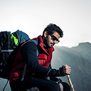
Your Adventure to Rolwaling and Tashi Laptsa Pass Trek – 25 Days Starts Here
Start your journey with trusted local experts and discover the beauty, culture, and adventure waiting in the Himalayas and beyond.
Frequently Asked Questions
Everything you need to know about the AASRA ECO TREK
You must have prior experience using crampons on actual ice or hard snow – not just familiarity with the theory. You must be comfortable using an ice axe for balance and self-arrest position. You must be able to move confidently on fixed ropes in exposed mountain terrain. The Tashi Laptsa approach from the Rolwaling side involves sustained glacier travel on crevassed ice, a steep final approach to the col with fixed ropes covering the most exposed sections, and a technical descent on the Khumbu side requiring controlled crampon technique throughout. Your guide manages the most demanding sections with fixed lines, but each trekker must be capable of moving safely and confidently on the rope.
Multiple factors combine to keep the Rolwaling Valley genuinely remote and genuinely undervisited. The approach requires a long road journey from Kathmandu followed by a sustained trek through terrain with very basic infrastructure. The valley is protected by the Gaurishankar Conservation Area and requires a Restricted Area Special Permit. The Tashi Laptsa Pass at 5,755m is technical enough to be inaccessible to standard teahouse trekkers without prior glacier and crampon experience. There are no domestic flights into or out of the Rolwaling approach – no Lukla equivalent exists on the Rolwaling side. And the combination of all these factors keeps annual visitor numbers very low – perhaps 200-300 trekkers per year complete the full traverse. The result is a valley that carries all of the qualities that the Khumbu and Annapurna had before mass trekking tourism transformed them.
Tsho Rolpa Lake (4,580m) is the largest glacial lake in Nepal – a body of glacial meltwater formed at the terminus of the Trakarding Glacier in the upper Rolwaling Valley. It has grown dramatically since Eric Shipton’s 1951 visit as the Trakarding and Rolwaling Glaciers have retreated under the effects of climate change – the lake volume increasing from a relatively small glacial pond to a large and potentially dangerous glacial lake. The Nepal government, with international assistance, installed a drainage tunnel and monitoring equipment to reduce the risk of a Glacial Lake Outburst Flood (GLOF) that could have catastrophic consequences for the Tama Koshi valley communities downstream. The lake is now one of the most closely monitored glacial systems in Nepal and a powerful visible indicator of glacial retreat in the Himalaya.
Pachermo (6,273m) is a trekking peak adjacent to the Tashi Laptsa Pass whose summit rises above the southeastern wall of the col. It is considered one of the finest and most accessible trekking peaks in the Nepal Himalaya – a non-technical summit for experienced mountaineers that can be attempted from the base camp area near the Tashi Laptsa Phedi high camp. A separate trekking peak climbing permit (approximately USD 300-400) is required. The summit of Pachermo provides the most complete simultaneous panorama of both the Rolwaling and Khumbu ranges available from any point on or near the traverse route. If you have mountaineering experience beyond standard trekking and wish to add a Pachermo summit to the traverse, contact us for the combined traverse and peak climbing itinerary.
Four separate permits are required covering three different protected area systems. The Gaurishankar Conservation Area Permit (GCA) covers the Rolwaling approach from Jagat to the Tashi Laptsa. A Rolwaling Restricted Area Special Permit adds the specific restricted area authorization for the upper Rolwaling above Beding. The Sagarmatha National Park Entry Permit covers the Khumbu section from Thame to Lukla. The Pasang Lhamu Rural Municipality Fee is payable at the Khumbu entry point. All four permits are included in the package price and arranged by our team in Kathmandu before departure.
Yes, absolutely mandatory and non-negotiable. Your policy must explicitly confirm: helicopter evacuation above 6,000m; glacier and technical trekking activities; medical treatment in Nepal; trip curtailment. A helicopter rescue from the Drolambau Glacier or Tashi Laptsa area costs USD 6,000-12,000. Show original insurance documentation to our team before departure from Kathmandu.
Beding and Na have basic teahouse and lodge facilities that are functional and welcoming but far simpler than the Khumbu or Annapurna teahouse infrastructure. Rooms have wooden platforms and basic bedding. Bathrooms are shared and basic. The menus are limited to dal bhat, noodle soups, eggs, and simple potato dishes – the same ingredients available in any remote Himalayan teahouse but with menus that reflect the limited supply chains of a valley accessible only on foot. The food is honest, filling, and prepared with fresh local ingredients. Hot showers are generally unavailable in Beding and Na. Three full meals per day are included throughout the trek.
Thame Monastery (Thubtencholing Gompa) is one of the most historically and culturally significant monasteries in the Khumbu region – a Kagyu school monastery perched dramatically on a rock terrace above the village that has been active for several centuries. Thame is famous as the site of the annual Mani Rimdu festival held in May – one of the finest monastic ritual dance festivals in the Khumbu, drawing monks and pilgrims from across the Everest region. The monastery is also famous for its association with many of the Khumbu’s most celebrated mountaineers – Thame village has produced a disproportionate number of high-altitude climbers including Appa Sherpa, who holds the world record for most Everest summits. Arriving at Thame after the Tashi Laptsa Pass crossing gives the monastery visit a specific and powerful quality – you have just crossed from the Rolwaling world to the Khumbu through terrain that the Thame community has historically known and used, and the arrival at the monastery feels like an arrival at a cultural anchor point after the weeks of wilderness above.
The Khumbu-to-Rolwaling direction is technically feasible but is generally not recommended for several important reasons. The approach to the Tashi Laptsa from the Khumbu (Thame) side is shorter and less gradual than the Rolwaling approach – meaning trekkers attempting the pass from the Khumbu side without the extended acclimatization of the Rolwaling approach are at significantly higher risk of altitude-related problems. The Rolwaling side of the traverse also provides a more logical acclimatization sequence – the gradual altitude gain from Jagat through Simigaon, Beding, Na, and Tsho Rolpa gives the body maximum adaptation time before the 5,755m crossing. Most experienced operator
The Gaurishankar Conservation Area is an important biodiversity corridor in northeastern Nepal. Red panda are present in the bamboo and rhododendron forest sections of the lower approach between Simigaon and Beding. Himalayan black bear sign is found in the mid-altitude forest sections. Musk deer are occasionally seen in the forest and sub-alpine zones. Himalayan tahr and blue sheep are regularly seen above Na Village in the upper valley sections near the Ramdung Glacier approach. Snow leopard territory extends through the upper Rolwaling Valley above Na – tracks have been reported in the high terrain and the combination of blue sheep prey and appropriate rocky cliff habitat makes the upper valley a significant snow leopard area, though sightings are rare.

Still have questions?
Can’t find the answer you’re looking for? Please chat to our friendly team.
Get In TouchSimilar Packages
Lapchi Pilgrimage Trek – 15 Days
Approx. 130-145 km
Distance
4,600m
Max. Elevation
15 Days
Duration
2 to 12 people
Group Size
Moderate Level
We are associate with
