
 Plan Your Trip
Kanchenjunga North Base Camp Trek – 20 Days

Trip Overview

Trek Region
Kanchenjunga

Difficulty Level
Easy

Transport
Kathmandu - Bhadrapur by domestic flight; Bhadrapur - Taplejung by jeep (both ways)

Total Trip Duration
20 Days

Max Elevation
5,143m

Meals
Breakfast, Lunch and Dinner included
Trip Highlights
- Stand at Pangpema (5,143m) – the North Base Camp of Kanchenjunga – with the most overwhelming close-up panorama of the world’s third highest mountain available from any standard trekking route, including the full north face of Kanchenjunga (8,586m), Jannu / Kumbhakarna Himal (7,710m), Nepal Peak, Tent Peak, Kirat Chuli, and the entire northern massif
- Walk the remote Ghunsa Khola valley – one of the finest glacial valley approaches in eastern Nepal, rising from subtropical gorge forest at Sekathum through rhododendron and birch forest corridors to the open alpine terrain of Khambachen and Lhonak
- Explore Ghunsa (3,410m) – the finest Tibetan Buddhist Sherpa village in the entire Kanchenjunga region, with ancient gompas, prayer wheel corridors, mani walls, hot springs, and a warm and genuine community character that experienced Nepal trekkers consistently describe as one of the country’s most authentic mountain village encounters
- Witness the extraordinary near-vertical north face of Jannu / Kumbhakarna Himal (7,710m) rising directly from the valley floor near Khambachen – one of the most technically dramatic mountain faces in the entire Himalayan range and a view that stops every trekker in complete silence
- Optional side trip to Jannu Base Camp (approx. 4,600m) from Khambachen – a rarely visited and extraordinarily atmospheric glacial location at the base of Jannu’s north face
- Trek through Lhonak (4,790m) – the high windswept sandy plain at the base of the Kanchenjunga Glacier approach – with the full Kanchenjunga massif filling the northern sky and the raw, serene quality of extreme high-altitude wilderness surrounding the camp
- Walk the ancient Tamor River trade route – the historical corridor connecting the eastern Nepal hill communities with Sikkim and Tibet – through Limbu and Rai villages whose cultural traditions, indigenous architecture, and animist spiritual practices represent some of the oldest living cultures in the Nepal hills
- Trek through the Kanchenjunga Conservation Area – managed by local communities in partnership with WWF, home to snow leopard, red panda, Himalayan black bear, musk deer, blue sheep, and over 250 bird species including the Himalayan monal pheasant and the magnificent lammergeier
- Visit a dedicated Kathmandu heritage sightseeing day at the start of the trip covering Pashupatinath Temple, Boudhanath Stupa, Swayambhunath, and Patan Durbar Square – a full cultural orientation to Nepal before the trek begins
- Trek in genuine Restricted Area solitude – the Kanchenjunga north base camp trail sees a small fraction of the trekker traffic of the Everest or Annapurna routes, and the wild, unmodified character of the trail, the villages, and the mountain encounters is entirely intact
- Experience the extraordinary ecological transition from warm subtropical Tamor valley forest at 1,200m through the finest rhododendron and magnolia forests of the mid-altitude zones to the raw glacial moraine and alpine wilderness above 4,500m – one of the greatest vertical ecological gradients of any Nepal trekking route
Trip Summary
Nepal’s eastern corner holds a secret that most trekkers never discover. While tens of thousands of visitors each year walk the famous trails of the Khumbu and Annapurna regions, the Kanchenjunga Conservation Area in the far east of the country receives a fraction of that traffic – and rewards those who make the journey with an experience of the Himalayan world that is genuine, raw, solitary, and deeply moving in ways that the crowded, well-serviced trekking highways of the western circuits rarely deliver.
Kanchenjunga (8,586m) is the world’s third highest mountain and one of Nepal’s most sacred peaks. Its name means Five Treasures of Snow in Tibetan – a reference to the five summits that together form the massif, each one traditionally said to hold one of five sacred gifts: salt, gold, turquoise, grain, and holy scriptures. The mountain stands on the border between Nepal and the Indian state of Sikkim, and the communities who live in its shadow – the Limbu, Rai, and Sherpa peoples of the eastern Tamor valley – have maintained a relationship with it as a spiritual presence rather than a geographical feature since long before the first mountaineers arrived.
The Kanchenjunga North Base Camp Trek is the most rewarding single-destination route in the Kanchenjunga region. This 20-day itinerary is the most complete and most generously paced version of the north base camp route – starting with the scenic domestic flights to Bhadrapur and the drive through the eastern Nepal hill country to the trailhead, following the Tamor River and then the Ghunsa Khola northward through a sequence of cultural and ecological landscapes of extraordinary diversity, reaching the beautifully preserved Tibetan Buddhist Sherpa village of Ghunsa (3,410m), climbing through the finest glacial valley in eastern Nepal past the spectacular Jannu / Kumbhakarna Himal (7,710m), and arriving at Pangpema (5,143m) – the North Base Camp – where the full north face of Kanchenjunga fills the sky in one of the most overwhelming mountain encounters available to any non-climbing trekker anywhere in the Himalayan world.
The 20-day version includes a Kathmandu heritage sightseeing day, proper acclimatization days, an optional side trip to the Jannu Base Camp, an optional sunrise hike on the moraine above Pangpema, and a generously paced descent through all the same extraordinary landscape in the opposite direction – a trip structure that gives you the best possible chance to genuinely absorb what you are walking through rather than simply passing through it.
When To Visit
The Kanchenjunga North Base Camp Trek has two well-defined peak seasons determined by the condition of the trail above Ghunsa and the clarity of the mountain views from the base camp.
Spring (late March to late May) is one of the two finest seasons and the most visually spectacular for the forest sections of the approach. The rhododendron forest between Gyabla and Ghunsa and the mid-altitude gorge sections below are in full bloom from late March through April – one of the finest floral displays of any Nepal trekking route. Old-growth rhododendron trees of 15-20 meters, covered in deep red, pink, and white flowers, line the trail for kilometers. The magnolia trees of the lower gorge flower simultaneously. Mountain views from the upper valley and Pangpema are excellent in spring. The upper trail above Ghunsa is generally clear from mid-April onward.
Autumn (mid-September to mid-November) is the peak season overall and the best window for mountain clarity. After the monsoon clears, the post-monsoon atmosphere is crystalline and the views from Khambachen, Lhonak, and Pangpema are at their annual finest – the north face of Kanchenjunga, Jannu, and the surrounding peaks in complete and sharp detail against a deep blue sky. October is the gold-standard month – stable weather, full teahouse availability throughout the route, the upper valley in its finest autumn character, and the mountain views at their most panoramic. The Limbu and Rai villages of the lower approach are at their most active with the autumn harvest calendar.
Monsoon (June to August) is generally not recommended. The lower gorge sections of the Ghunsa Khola become leech-heavy and slippery and the mountain views are frequently obscured. Teahouses above Ghunsa may be minimally staffed. The conservation area does have significant wildlife activity in the monsoon season and the landscape is intensely green and lush – possible for experienced monsoon trekkers who know what to expect, but not the standard recommendation.
Winter (December to February) is challenging for the upper section. The trail above Ghunsa accumulates significant snowpack through December and the temperatures at Lhonak and Pangpema are extreme. The lower approach sections remain accessible and the winter character of the forest and the lower villages is beautiful in its own right, but the full trek to Pangpema and return is not recommended for standard trekking groups in winter.
Itinerary
Welcome to Nepal. Our team meets you at Tribhuvan International Airport and transfers you to your hotel in Kathmandu. The evening briefing for the Kanchenjunga North Base Camp Trek covers the complete 20-day itinerary day by day, the altitude profile from the Tamor valley to Pangpema, the cultural background of the Limbu, Rai, and Sherpa communities of the eastern Nepal hills, the permit system for the Kanchenjunga Conservation Area and the Restricted Area Permit, gear checks, altitude awareness protocols, and the logistics of tomorrow’s guided heritage sightseeing day and the subsequent domestic flight and drive to the trailhead.
Your guide explains what makes this trek different from the more famous routes of the Khumbu and Annapurna. The solitude. The genuinely wild landscape. The cultural communities of the eastern hills whose traditions have not been shaped by decades of mass trekking tourism. The quality of the mountain encounter at Pangpema – the north face of Kanchenjunga at close range, Jannu visible in profile to the east, the silence of the high wilderness all around. Understanding the character of what lies ahead makes every stage of the journey more purposeful and more rewarding. Overnight in Kathmandu.
A full guided day exploring the finest cultural and religious monuments of the Kathmandu Valley before the trek begins. This day serves two purposes – a rich introduction to Nepal’s cultural heritage and a final day of physical rest before the walking begins the following day.
Pashupatinath Temple on the banks of the Bagmati River is the most sacred Hindu site in Nepal – a complex of golden-roofed temples, active cremation ghats, wandering ash-covered sadhus, and a layered devotional atmosphere that no visitor forgets. The cremation ghats carry a philosophical weight that feels particularly appropriate as preparation for a journey into the mountains that the Limbu and Rai communities of the Kanchenjunga approach hold as sacred land.
Boudhanath Stupa – the great white dome that anchors Kathmandu’s Tibetan Buddhist community – is the spiritual center of the same Buddhist tradition practiced by the Sherpa community of Ghunsa. Walking the kora around the stupa among monks, pilgrims, and the constant smoke of butter lamps gives you a living preview of the monastic culture you will encounter at the gompas of the upper valley.
Swayambhunath (Monkey Temple) sits on a forested hilltop above the western valley with panoramic views of Kathmandu and the surrounding hills. The resident monkey population and the ancient stupa complex together make it one of the most visually distinctive religious sites in Nepal. Patan Durbar Square in Lalitpur completes the day with the finest examples of Newari architecture and stone-carved temple art in the entire Kathmandu Valley.
Return to your hotel in the evening, confirm gear is organized for the early morning flight, and sleep well. The mountains begin tomorrow. Overnight in Kathmandu.
The journey to the Kanchenjunga region begins with a 45-minute domestic flight from Kathmandu to Bhadrapur Airport in the eastern Terai lowlands of Jhapa district. On a clear morning the flight provides extraordinary views of the entire eastern Himalayan chain – from Kanchenjunga and Jannu in the far east to Makalu and Everest in the central north – an aerial introduction to the mountain world you are heading toward.
From Bhadrapur, a private jeep drive of 5-6 hours takes you northward through the progressively more dramatic terrain of the Ilam and Taplejung districts. The road climbs from the flat Terai through the tea-garden country of the Ilam hills – the finest tea-growing region in Nepal – through dense forested ridgelines, past cascading waterfalls, and into the deeper hill country of the Taplejung district. The first glimpses of the high snow peaks of the Kanchenjunga range appear above the northern ridgeline in the final section of the drive, building a sense of anticipation that the mountains themselves will satisfy in the coming days.
The drive continues to Sekathum (1,660m) – the standard trekking trailhead on the Ghunsa Khola, the tributary valley that leads toward Kanchenjunga North Base Camp. Sekathum is a pleasant small settlement at the river confluence with good teahouse options and the warm character of an eastern Nepal village. This is the last road access point before the trek begins properly tomorrow. Flight time: 45 minutes. Drive time: 5-6 hours.
The first full walking day of the trek enters the Ghunsa Khola gorge immediately and decisively. From Sekathum the trail crosses the Ghunsa Khola on a suspension bridge and begins its northward journey through a canyon of extraordinary character – narrow, forested, with the river rushing through sculpted rock far below and the trail finding its way alternately along the bank, across bridges, and on narrow ledge paths cut into the cliff face above the water.
The forest of the lower Ghunsa Khola gorge is among the finest in eastern Nepal. Old-growth magnolia trees – Nepal has some of the most spectacular wild magnolia populations in Asia and the Kanchenjunga Conservation Area is celebrated for them among botanists – fill the lower gorge in spring with white and pink flowers of extraordinary size and beauty. The understory is thick with ferns, mosses, orchids, and the wild ginger and cardamom that grow in the shade of the valley floor.
The trail passes through a series of dramatic waterfall sections – one particularly spectacular cascade of approximately 150 meters falls directly from the cliff face above the trail – and through small settlements of the lower gorge communities before climbing to Amjilossa (2,490m). The name translates as “good view” and the ridgeline above the village delivers exactly that on clear afternoons – the first distant white profiles of the Kanchenjunga massif visible above the forest to the north. Walking time: 6-7 hours.
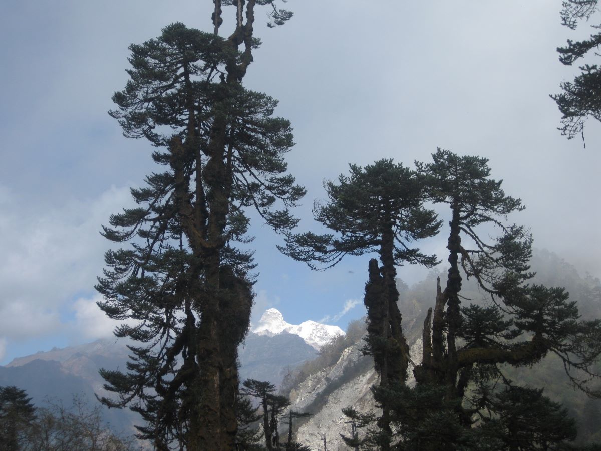
The gorge continues its steady climb northward and the forest transitions progressively from the subtropical lower gorge species into the temperate mixed forest of the mid-altitude zones. Rhododendron becomes the dominant tree species from this section – first as scattered individuals in the mixed forest, then in increasingly dense stands that in the spring blooming season paint the gorge walls in shades of red, crimson, and pink that are among the finest floral displays of any Nepal trekking route.
The trail from Amjilossa passes through forest sections of particular beauty – the old-growth character of the Kanchenjunga Conservation Area’s protected forests visible in the scale and diversity of the trees, the richness of the epiphytic mosses and ferns covering every branch, and the density of bird life audible from the canopy. The Kanchenjunga Conservation Area has recorded over 250 bird species and the mid-altitude forest zones of the Ghunsa approach are among the most productive birdwatching sections.
Gyabla (2,730m) announces the beginning of the Sherpa cultural zone with a beautiful old gompa at the upper edge of the village – a small, ancient, butter lamp-lit monastery whose prayer hall carries the carved and painted wooden columns of classical Tibetan Buddhist architecture. The village is small, clean, and warm in its welcome. The community character here – the flat-roofed stone houses, the prayer flags, the smell of wood smoke and butter tea – is the first full taste of the Sherpa world that will define the upper valley. Walking time: 5-6 hours.
The most culturally and scenically anticipated arrival day of the approach section. From Gyabla the trail climbs through the finest forest corridor of the entire trek – a spectacular stand of old-growth rhododendron, birch, and conifer whose scale and density and the quality of light filtering through the canopy makes this one of the most beautiful sections of trail in eastern Nepal. In spring the rhododendron blooming here is extraordinary – trees that are fifty years old and twenty meters high, covered entirely in deep red flowers, lining both sides of the trail for kilometers.
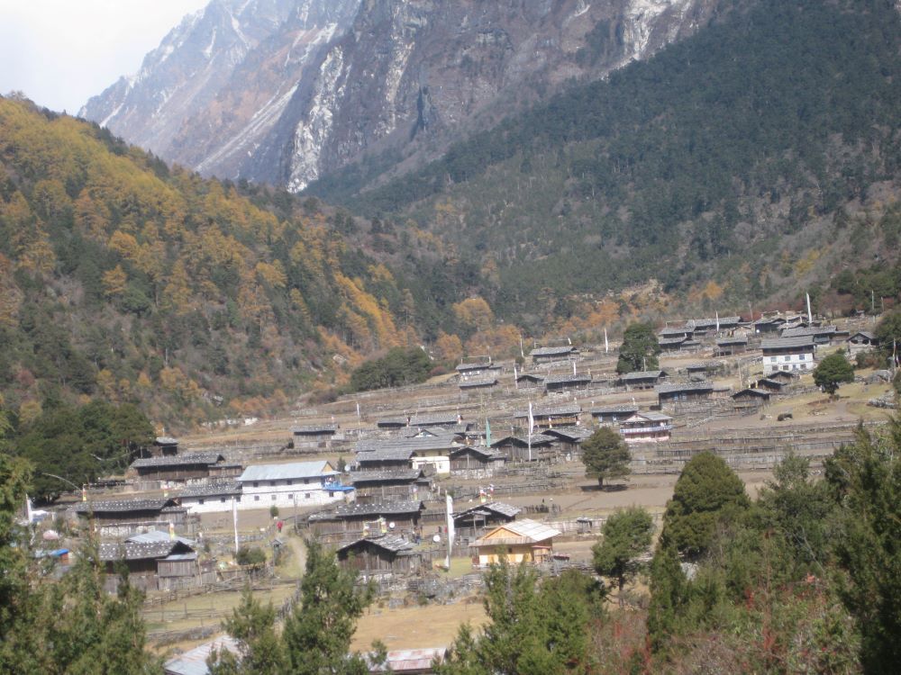
The trail crosses several streams on wooden bridges and passes through the settlement of Kyapra before the descent to the valley floor and the first view of Ghunsa (3,410m) from the ridge above. The village sits in a broad valley bowl enclosed by towering peaks – Kanchenjunga (8,586m) to the north, Jannu / Kumbhakarna Himal (7,710m) to the northeast, and the dramatic ridgelines of the upper massif rising in every direction. Prayer flags catch the valley breeze from every rooftop. A long line of prayer wheels spins continuously at the lower village entrance. Two ancient gompas frame the settlement.
Ghunsa is the cultural heart of the north Kanchenjunga approach and one of the finest Tibetan Buddhist Sherpa villages in Nepal. The community’s warmth, the beauty of its setting, the quality of its religious architecture, and the authenticity of its daily life – unchanged in its essential character by the small number of trekkers who pass through each year – make it a genuinely extraordinary place to arrive. Spend the evening walking through the village, visiting the lower gompa in the last light of the afternoon, and settling into the teahouse with a cup of butter tea. Walking time: 5-6 hours.
A full rest and acclimatization day in Ghunsa – both a necessary physiological stage before the sustained high-altitude days ahead and one of the most rewarding cultural days of the entire trek.
The morning begins with a visit to the upper gompa above Ghunsa village – older and less frequently visited than the lower gompa, with thangka paintings of considerable antiquity decorating the prayer hall and the particular atmosphere of a place of continuous devotional practice maintained over many generations in extraordinary isolation. Your guide provides the cultural and historical context for what you see – the iconographic program of the paintings, the identity of the deities represented, the history of the monastery and its relationship with the wider Sherpa community of the upper valley.
The standard acclimatization hike climbs the ridge above Phole village – a smaller Sherpa settlement a short walk east of Ghunsa – to approximately 3,800-4,000m and back. The views from the Phole ridge are the finest available from any hiking trail in the Ghunsa area – Kanchenjunga’s north face appears in close-up profile for the first time, the scale of the mountain establishing itself completely against the valley backdrop, and Jannu (7,710m) fills the northeastern horizon in a sweep of ice and rock whose technical drama even at this distance is completely apparent.
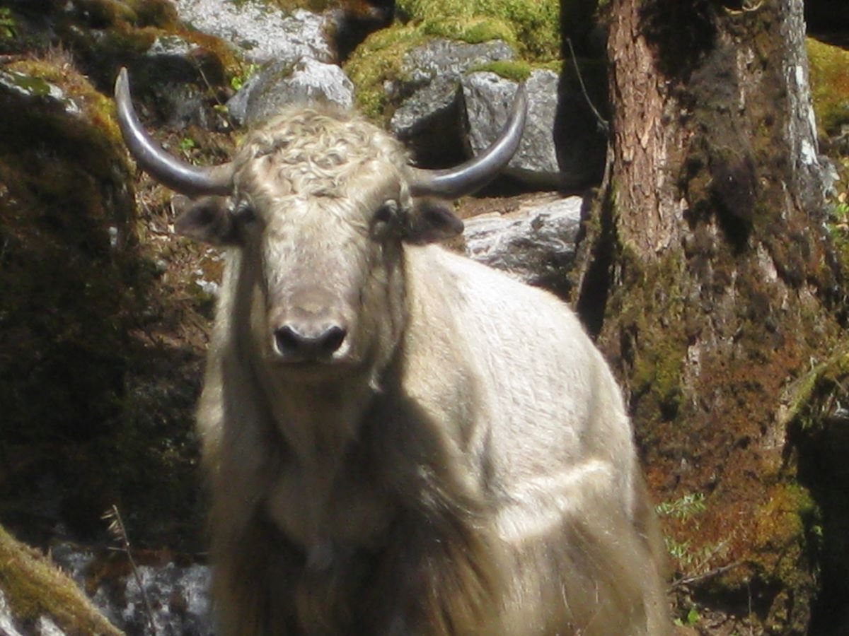
Ghunsa has a natural hot spring below the village – a geothermal source whose warm, mineral-rich water has been used by the community and trekkers for generations. A simple stone bath structure serves as the facility. After several days of walking through the gorge, the hot spring is one of the most genuinely pleasurable experiences the trek offers. The afternoon is entirely free – explore the village at your own pace, sit with local families through your guide’s translation, watch the yak herds come down from the high pastures in the evening light, and rest thoroughly before the high-altitude days that begin tomorrow. Hike time: 3-4 hours return.
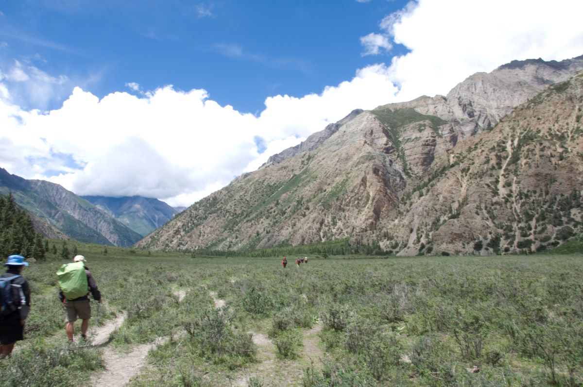
Above Ghunsa the trail leaves the forest entirely and enters the high-alpine moraine landscape of the upper Kanchenjunga valley – one of the most dramatic and most rewarding landscape transitions of the entire trek. The character of the world changes completely within the first hour above the village – the forest gives way to open yak pasture, the valley widens, and the peaks above grow more immediate and more specific.
The trail climbs northward through progressively more open terrain – crossing moraine ridges and boulder fields, passing the seasonal stone shelters of yak herding families, and following the river through sections of loose glacial debris. The scale of the upper valley is enormous and the silence – above the forest, in the open alpine world – has the quality of complete isolation that the Kanchenjunga Conservation Area preserves more successfully than almost any other protected area in Nepal.
Jannu / Kumbhakarna Himal (7,710m) begins its extraordinary appearance from this section of the approach. The mountain is considered by many alpinists to be one of the most technically demanding and most visually dramatic peaks in the entire Himalayan range – its north face a near-vertical sweep of ice couloirs and rock buttresses that rises directly from the valley floor with no gentle foothills or gradual approaches to soften its impact. From the trail between Ghunsa and Khambachen, Jannu reveals itself progressively as the valley turns – first a profile glimpse above the lateral moraine, then a growing revelation, then the full overwhelming presence of a 7,700-meter mountain at very close range.
Khambachen (4,050m) is a seasonal settlement used by yak herders and expedition teams – basic teahouses in a stunning location with close views of Jannu and the surrounding upper valley peaks. The altitude at Khambachen is serious and the teahouse warmth after the exposed high-altitude walking is completely welcome. Walking time: 5-6 hours.
A rest and exploration day at Khambachen with an optional side trip to one of the most atmospheric and least-visited base camp locations in the entire eastern Nepal trekking world.
The hike to Jannu Base Camp (approximately 4,600m) from Khambachen follows the lateral moraine of the Jannu Glacier northeastward for approximately 3-4 hours – a sustained climb through open moraine terrain with the Jannu north face growing progressively more overwhelming as the base camp area approaches. At the base camp itself, you stand at the foot of one of the most technically dramatic mountain faces in the Himalayas – the near-vertical wall of ice and rock that has challenged the finest alpinists in the world since the 1950s rising directly above you in a scale that is genuinely awe-inspiring.
The views from the Jannu Base Camp area include not only Jannu itself but Nepal Peak (7,168m), Tent Peak (7,365m), Kirat Chuli (7,365m), and the upper reaches of the Kanchenjunga massif visible to the northwest. Blue sheep are very commonly seen in family groups on the slopes above the moraine throughout this section – the animals are accustomed to the very small number of trekkers who visit this area and can be observed at quite close range. Snow leopard sign – tracks and kills – has been reported in the upper moraine sections above the base camp area.
Trekkers who prefer a gentler acclimatization day can rest at Khambachen, explore the immediate surroundings on shorter walks, and use the time to drink water, eat well, and prepare for the high-altitude days ahead. The acclimatization value of today is important regardless of which option is chosen – a body properly rested and prepared at 4,050m before climbing to 4,790m at Lhonak and 5,143m at Pangpema is a safer and more capable body. Optional hike time: 4-6 hours return.
One of the finest single walking days of the entire 20-day trek. From Khambachen the trail continues northward through the upper valley – the terrain becoming increasingly dramatic as the landscape narrows toward the base camp zone, the peaks above growing more immediate, and the character of the wilderness more complete and more overwhelming.
The trail passes through the spectacular Kando Waterfall section – a high cascade visible from the trail crossing a rocky face above the river gorge – and continues along the riverbank through boulder fields and sections of glacial moraine. The upper valley here is one of the finest places on the trek for wildlife observation. Blue sheep graze on the slopes above the trail throughout the morning. Lammergeier – the bearded vulture whose enormous wingspan makes it one of the most visually spectacular high-altitude raptors in the Himalayas – soars regularly above the upper valley, riding the thermal columns above the moraine.
The trail passes the ancient Ramtang Monastery on a moraine ridge above the valley floor – a remote and deeply atmospheric religious site accessible by a short detour that rewards the effort with a view of the surrounding peaks and the quality of solitude that only a monastery maintained in complete wilderness can provide.
Lhonak (4,790m) is a high, flat, sandy plain at the base of the Kanchenjunga Glacier approach – a landscape of such extreme and elemental character that it consistently produces a powerful physical and emotional response in trekkers who reach it. The plain is surrounded on three sides by the peaks of the Kanchenjunga massif – the mountain itself directly north, Kanchenjunga West (8,505m) to the northwest, and the jagged ridgelines of the upper massif completing the enclosure. The wind at Lhonak in the afternoon is cold and insistent. The teahouses here are very basic. The silence between wind gusts is complete. This is the final stage before the base camp. Walking time: 5-6 hours.
The day every trekker on this route has been working toward since Kathmandu. From Lhonak the trail follows the moraine of the Kanchenjunga Glacier northward – the ice of the glacier visible directly to the east as the trail threads between the moraine wall and the valley cliff face. The scale of the glacier – hundreds of meters wide, kilometers long, flowing slowly southward from the upper ice fields – is one of those natural features whose true size only becomes apparent at close range.
The trail climbs steadily on the moraine, passing through boulder sections where the footing requires care and concentration. The Kanchenjunga massif fills the northern horizon completely – the summit pyramid rising higher and clearer with every step forward, the surrounding peaks of Tent Peak, Nepal Peak, Kirat Chuli, and the main ridge connecting the five summits of the massif all becoming more specific and more detailed as the approach continues.
Pangpema (5,143m) arrives as both a destination and an experience. The camp area sits on a broad moraine platform with the full north face of Kanchenjunga (8,586m) filling the entire southern sky above the glacier. The mountain at this range and this angle – the summit over 3,400 meters above the camp, the north face a sweep of ice, rock, and seracs of overwhelming scale – produces in almost every trekker a quality of silence and stillness that is different from any other mountain encounter on the Kanchenjunga approach.
To the east, Jannu (7,710m) rises in its distinctive profile. Kirat Chuli (7,365m) and Nepal Peak (7,168m) complete the eastern skyline. On the clearest days, Makalu (8,481m) and even the distant profile of Everest (8,848m) are visible to the west – three of the five highest mountains on Earth visible simultaneously from a single location. That specific and extraordinary fact lands with particular force when you are standing at 5,143m looking at them directly.
Spend as much time at Pangpema as the weather and the light allow. Walk the moraine ridge above the camp for higher and more complete views. Find a boulder to sit on facing the north face and simply look at the mountain for a long time. This is one of the finest places accessible to a non-climbing trekker anywhere in the Himalayan world. Walking time: 4-5 hours.
A full day at the North Base Camp – one of the most rewarding rest days of the entire trek and an opportunity to experience the extraordinary atmosphere of Pangpema across different times of day and different quality of light.
Wake before sunrise and climb the moraine ridge above the camp before first light. The pre-dawn darkness at 5,143m is cold and completely clear, and the first light of day on the summit of Kanchenjunga – the mountain turning from grey to gold to blazing white as the sun reaches the upper ice fields – is one of those sunrise mountain experiences that experienced Himalayan trekkers rank among the finest accessible from any standard trekking route. The quality of the dawn light on Kanchenjunga’s north face at Pangpema is the specific experience that has brought trekkers to this location for decades.
The morning after sunrise is spent exploring the moraine above the camp – the higher you climb on the moraine ridge, the more complete the panorama and the more specific the views of the individual peaks around the massif. Your guide identifies each peak by name, explains the climbing history of the north face routes, and provides the context of what you are looking at – the 1977 Indian expedition that made the first ascent from the north, the technical challenges of the ridgelines above, and the sacred significance of the summit to the Sikkimese communities who have traditionally believed the very top to be the abode of the mountain god.
The afternoon can be spent at rest in the camp – reading, writing, photographing, or simply sitting with the mountain. The light quality changes throughout the afternoon as the sun moves westward and the shadows on the north face reveal different textures and different features of the glaciated terrain above. Evening at Pangpema – with the last alpenglow fading from the summit and the stars of the eastern Nepal sky appearing in complete clarity above 5,000m – is the finest single evening of the entire trek. Optional hike time: 2-3 hours on the moraine ridge.
The descent begins – not with any sense of disappointment but with the particular and fully earned satisfaction of heading away from a place you have reached completely and genuinely. From Pangpema the trail retraces the moraine southward through the upper Lhonak plain, past the glacier edge, and back down through the upper valley to Khambachen.
The descent from Pangpema through Lhonak and to Khambachen is one of the longest single descent days of the trek – covering the altitude from 5,143m to 4,050m in a sustained downhill walk through terrain that you now know forward and backward. The landscape is entirely familiar but entirely different in the downhill direction – the perspectives reversed, the light quality different, and the attention freed from the anticipatory focus of the ascent to simply observe and absorb what surrounds you.
Blue sheep sightings are frequent on the descent through the upper valley – the animals commonly move down to the lower moraine areas in the afternoon hours. The Ramtang Monastery deserves a proper visit on the descent if it was passed quickly on the approach – the afternoon light in the monastery’s direction is better for observation of the paintings and the architectural details. Walking time: 6-7 hours.
The descent through the upper valley returns to Ghunsa – a straightforward, entirely beautiful day of sustained downhill walking through the same landscape that revealed itself in stages on the approach. From Khambachen the trail retraces southward through the high alpine terrain above Ghunsa, crossing the moraine ridges and open meadow sections, and descending through the first returning forest to the warm valley of the Sherpa village.
The return to Ghunsa after the high base camp days has a specific quality of arrival – the warmth of the air at 3,410m compared to Pangpema and Lhonak, the smell of forest and the sound of birdlife returning, the butter tea and the teahouse kitchen. The hot springs below the village are particularly welcome after the cold, dry air of the upper valley. An evening return visit to the gompas of Ghunsa – with the afternoon light falling on the carved and painted wooden facades – closes the upper valley section of the trek with the cultural depth of the community that has been here at the mountain’s foot the entire time. Walking time: 5-6 hours.
The long descent back through the Ghunsa Khola gorge begins. From Ghunsa the trail retraces southward through the rhododendron and birch forest – the forest that was spectacular on the approach now familiar and beloved, the trail flowing easily downhill in the direction of the lower valley.
The descent through the mid-altitude forest zones is one of the finest wildlife observation sections of the entire descent – the altitude range between 2,500m and 3,400m supporting the highest diversity of bird species on the route. The Himalayan monal pheasant – Nepal’s national bird, the male resplendent in iridescent plumage of green, blue, and copper – is regularly seen in the rhododendron forest sections of the upper descent. Red panda territory begins in the rhododendron and bamboo sections between Ghunsa and Gyabla – morning walking gives the best chance of sightings.
The trail passes through Gyabla with its small gompa and continues the descent through the progressively warmer forest to Amjilossa (2,490m). The waterfall sections of the lower gorge – particularly the large cascade that was so dramatic on the approach – are equally extraordinary from the opposite direction. Walking time: 5-6 hours.
The final full trekking day before the road section. From Amjilossa the trail continues its southward descent through the lower Ghunsa Khola gorge – the subtropical forest returning as altitude drops below 2,000m, the temperature warming, the river gaining volume from the tributary streams feeding in from the gorge walls.
The lower gorge sections carry a different quality of attention on the descent from the approach – you walk these sections as someone who has been to Pangpema and returned, and the awareness that the mountain you stood beneath at 5,143m is still there, still directly north above the gorge walls, gives the lower trail a retrospective quality that feels genuinely meaningful.
Sekathum (1,660m) receives you at the river confluence with the warmth and bustle of a proper inhabited village after the complete wilderness of the upper valley. The teahouses, the community gardens, the sound of daily life – all of it is welcome in the particular way that populated places are always welcome after days in the high wilderness. Share a final dinner with your guide and porter team and acknowledge what the trek has been together. Walking time: 5-6 hours.
A morning walk from Sekathum to Taplejung / Suketar connects the trekking trail with the road system – a 2-3 hour walk or jeep connection depending on the current state of the road extension. From Taplejung the private jeep begins the long return drive southward through the Taplejung and Ilam districts back to Bhadrapur in the eastern Terai.
The return drive through the eastern Nepal hill country carries the same beautiful scenery as the inward journey – the tea gardens of Ilam, the forested ridgelines, the cascading waterfalls – but with the additional quality of recognition and the particular pleasure of watching a landscape you have come to know receding behind you. The drive takes 5-6 hours and arrives at Bhadrapur in the evening for the overnight before the morning flight to Kathmandu. Walking time: 2-3 hours. Drive time: 5-6 hours.
The morning flight from Bhadrapur to Kathmandu takes 45 minutes and provides – on a clear morning – a final spectacular aerial view of the entire eastern Himalayan chain as the aircraft crosses the middle hills. Kanchenjunga visible to the north. Makalu to the west. The full sweep of the mountains you have been among for two weeks seen from above in the clean morning air.
Back in Kathmandu, transfer to your hotel. Hot shower. Proper bed. Restaurant meal. The full and completely earned luxury of a city after 14 days on the trail in one of Nepal’s most remote and extraordinary trekking landscapes. Flight time: 45 minutes.
A mandatory buffer day for the very common occurrence of Bhadrapur or the Taplejung jeep connection facing delays due to road conditions, flight weather, or other eastern Nepal logistics events. The Taplejung district road is one of the more variable in Nepal and delays of one day in either direction are entirely normal.
If your return went smoothly, the buffer day is a free day in Kathmandu – use it for any additional cultural sightseeing not covered on Day 2, for rest and recovery, for shopping in Thamel, or for the kind of celebratory dinner with your guide that a 15-day trek through the Kanchenjunga Conservation Area genuinely deserves. Overnight in Kathmandu.
Your 20-day Kanchenjunga North Base Camp Trek comes to a close. Our team transfers you to Tribhuvan International Airport for your onward journey. You leave Nepal having stood at 5,143m at the base of the world’s third highest mountain, having walked through some of the finest rhododendron and glacier valley terrain in eastern Nepal, and having encountered the Limbu, Rai, and Sherpa communities of the Tamor valley in their most genuine and least-commercialized form.
Trek Difficulty & Physical Demands
The Kanchenjunga North Base Camp Trek is rated strenuous – significantly more demanding than the Annapurna Base Camp or standard Langtang routes, broadly comparable to the Everest Base Camp Trek in overall physical demand but with greater remoteness and more basic infrastructure throughout.
- Altitude: The trek reaches 5,143m at Pangpema – comparable to Kala Patthar on the Everest Base Camp route. The acclimatization day at Ghunsa (Day 7) and the rest day at Khambachen (Day 9) are the critical physiological preparation stages before the upper base camp push. Following the itinerary’s pacing is essential.
- Duration and cumulative demand: 15 full trekking days covering 160-175 km demands genuine endurance. The consistent daily walking of 5-7 hours through a range of terrain from subtropical gorge to glacial moraine requires physical stamina that builds over the trek rather than being required from the first day.
- Gorge sections: The lower Ghunsa Khola gorge between Sekathum and Gyabla involves narrow ledge paths and cliff-face trail sections above the river. Not technical but requiring confident footing and comfort with exposure.
- Remoteness: The Kanchenjunga region is significantly more remote than the Khumbu. Medical facilities are unavailable above Taplejung. Emergency evacuation requires helicopter coordination via satellite communication. The basic teahouse infrastructure above Ghunsa demands genuine self-sufficiency.
- Physical preparation: 2-3 months of consistent cardiovascular training before departure – hiking with a loaded pack on steep terrain, running, cycling, and stair work – is ideal preparation. Prior trekking experience above 4,000m is a genuine advantage for the upper valley sections.
Best Time to Trek: Seasonal Comparison
| Season | Months | Upper Trail | Forest and Scenery | Mountain Views | Recommended |
| Spring | Mar–May | Clear from mid-April | Spectacular bloom | Excellent | Best |
| Monsoon | Jun–Aug | Difficult | Lush but leech-heavy | Limited | Not recommended |
| Autumn | Sep–Nov | Excellent | Beautiful color | Outstanding | Best |
| Winter | Dec–Feb | Snow covered | Bare | Good (lower only) | Avoid |
Pro tip: For the ideal combination of vibrant rhododendron forests and clear mountain views, plan your trek during the last week of April to the first week of May. This brief period offers peak spring blooms alongside increasingly stable weather, making it excellent for mountain photography from Pangpema. If your priority is the clearest possible views from Kanchenjunga Base Camp, aim for October 5–20, when post-monsoon skies are at their most reliable and crystal clear.
Booking Your Kanchenjunga North Base Camp Trek – 20 Days
Step 1 – Contact us. Reach out via our website, email, or WhatsApp with your preferred travel dates and group size. We respond within 24 hours with the complete 20-day itinerary and full cost breakdown.
Step 2 – Confirm your booking. A 20% deposit secures your dates. We immediately book domestic flights (October departures fill quickly), process both Conservation Area and Restricted Area permits, arrange private jeep ground transport for both the Bhadrapur to Taplejung and Taplejung to Bhadrapur legs, and assign your guide.
Step 3 – Prepare. We send a comprehensive pre-departure guide covering fitness training recommendations, complete gear list, cultural background on the Limbu, Rai, and Sherpa communities of the Kanchenjunga region, altitude awareness protocols for the Pangpema approach, the optional Jannu Base Camp side trip details, and day-by-day expectations for all 20 days.
Step 4 – Arrive in Kathmandu. We collect you from the airport, conduct a full pre-trek briefing, assist with any gear needs in Thamel, confirm all permit documentation, and prepare you for the guided sightseeing day on Day 2 and the domestic flight the following morning.
Step 5 – Trek. Your licensed guide leads the complete trek from Sekathum to Pangpema and back, managing all permit checkpoints throughout and providing the cultural and ecological expertise that makes this remote trek genuinely rewarding.
Step 6 – Pay the balance. The remaining 80% is due on arrival in Kathmandu before the domestic flight to Bhadrapur.
Cancellation Policy:
- 30 or more days before departure: Full deposit refunded minus bank transfer charges and non-refundable domestic flight bookings
- 15-29 days before: 50% refund minus domestic flight costs
- Less than 15 days: Deposit forfeited, no refund
- Domestic flight tickets are non-refundable once issued regardless of cancellation timing
Travel Insurance – Mandatory: Travel insurance with emergency helicopter evacuation coverage above 5,500m is mandatory. The Kanchenjunga north route is remote throughout and road-based emergency access is unavailable above Taplejung. A helicopter rescue from the upper valley area costs USD 4,000-8,000. Your guide requires a copy of your insurance documentation before departure from Kathmandu.
Cost Details
Cost Includes
- Airport pick-up and drop-off in Kathmandu
- Full-day guided Kathmandu heritage sightseeing tour on Day 2 with private vehicle
- Kathmandu to Bhadrapur domestic flight (one way)
- Bhadrapur to Taplejung ground transportation by private jeep (one way)
- Taplejung to Bhadrapur return ground transportation by private jeep
- Bhadrapur to Kathmandu domestic flight (return)
- 2 nights hotel accommodation in Kathmandu (arrival night and buffer night, bed and breakfast, 3-star)
- All teahouse and basic lodge accommodation during the trek (15 nights)
- All meals during the trek – breakfast, lunch, and dinner every day on trail
- Experienced, English-speaking, government-licensed trekking guide with Kanchenjunga north route specialist expertise
- One porter for every two trekkers (maximum 15 kg per porter load)
- All required permits:
- Kanchenjunga Conservation Area Permit (KCA)
- Kanchenjunga Restricted Area Permit
- TIMS Card (if currently required)
- Guide and porter wages, meals, accommodation, and full insurance
- All government taxes and local charges
- Sleeping bag rated to -15 degrees Celsius rental (if needed)
- Duffel bag for porter
- First Aid Kit including pulse oximeter and emergency altitude medications carried by guide
- Emergency evacuation coordination (evacuation cost covered by your travel insurance)
- Kathmandu sightseeing vehicle and cultural guide fees
Cost Excludes
- Nepal entry visa fee (approx. USD 50 for 30 days – obtainable on arrival at Kathmandu airport)
- International flights to and from Kathmandu
- Travel insurance with emergency helicopter evacuation coverage (mandatory)
- Meals in Kathmandu and Bhadrapur beyond included breakfasts
- Kathmandu heritage site entry fees – Pashupatinath (approx. USD 15 for foreigners), Patan Museum (approx. USD 10)
- Hot showers, Wi-Fi, and device charging along the trek (charged at teahouses)
- Personal snacks, bottled water, energy drinks, and alcoholic beverages
- Tips and gratuity for guide and porter (strongly recommended)
- Personal trekking gear and clothing
- Extra nights in Kathmandu beyond the planned itinerary
- Helicopter rescue costs (covered by personal travel insurance)
- Gompa entry donations at Ghunsa and Ramtang Monastery
- Personal expenses – laundry, souvenirs, phone calls, incidentals
Trip Gallery
Trek Essentials
- Thermal base layer top and bottom – 2 sets
- Mid-layer fleece or softshell jacket
- Warm down jacket or insulated puffy – essential from Khambachen upward and for cold mornings at Lhonak and Pangpema where overnight temperatures drop well below zero
- Waterproof windproof hardshell jacket and trousers – important for the upper valley where afternoon wind and occasional precipitation require full waterproof protection
- Lightweight shirts for the warm subtropical lower gorge sections below 2,000m
- Trekking trousers – 2 to 3 pairs
- Warm trekking socks wool or synthetic – 5 pairs for 15 trekking days
- Warm gloves and thin liner gloves
- Warm beanie or wool hat
- Sun hat with brim for the open upper valley and base camp sections
- Neck gaiter or buff
- Waterproof ankle-support trekking boots – broken in thoroughly before the trek. The gorge sections require good grip on wet rock and the upper moraine sections require stability on loose boulders.
- Lightweight sandals for warm lower valley teahouse evenings
- Gaiters – useful in the upper valley above Lhonak where snow may be present in spring and late autumn
- Trekking poles – both collapsible; strongly recommended for the descent from Pangpema through the moraine terrain and the long gorge descent days
- Daypack 20-25 liters for daily trail essentials
- Duffel bag 60 liters for your porter
- Sleeping bag rated to -15 degrees Celsius – the teahouses at Khambachen and Lhonak are very basic and Pangpema overnight accommodation is cold
- Headlamp with spare batteries – useful for early starts on the Pangpema day and the pre-dawn sunrise moraine hike on Day 12
- Quality sunglasses with UV400 protection – essential at base camp altitude
- Water bottle 2 liters or hydration bladder
- Water purification tablets or personal filter – essential throughout the lower gorge sections where source quality is variable
- Insect repellent – the lower valley below Sekathum genuinely requires it in warmer months
- Diamox (acetazolamide) – consult your doctor; recommended for the upper valley above 4,000m
- Personal pulse oximeter – monitoring blood oxygen saturation above 4,000m is important on a route this remote
- Personal first aid kit – blister pads, ibuprofen, bandages, antiseptic cream
- Sunscreen SPF 50 and SPF lip balm – UV intensity at Pangpema altitude is significant
- Hand sanitizer and wet wipes
- Diarrhea medication and oral rehydration salts
- All personal prescription medications for the full 20-day duration
- Valid passport with at least 6 months remaining validity
- Nepal visa (obtainable on arrival at Kathmandu airport)
- Printed travel insurance policy with emergency evacuation coverage details – your guide requires a copy
- 2 passport-sized photos for permit processing at the checkpoints
- Emergency contact card on your person throughout
Final Thoughts:
The Kanchenjunga North Base Camp Trek belongs to a specific category of Nepal trekking experience – one that is not defined by the famousness of the destination or the comfort of the infrastructure, but by the quality and the authenticity of what the journey actually delivers. Very few trekkers have been to Pangpema. Very few people have stood at the base of Kanchenjunga’s north face and looked up at a mountain that rises 3,400 meters above the camp they slept in the previous night. Very few people have walked the Ghunsa Khola gorge in the spring rhododendron season or watched a blue sheep herd cross the moraine above Lhonak in the evening light or sat in the Ghunsa hot spring in the afternoon with the prayer flags of the Sherpa village visible above the steam.
All of that is available on this trek. And all of it is available without sharing the experience with thousands of other trekkers or staying in teahouses designed for mass tourism or walking on trails that have been paved to accommodate the foot traffic of Nepal’s most popular circuits.
The Kanchenjunga Conservation Area is managed by its communities and by the WWF with a genuine commitment to preserving both the ecological integrity of the area and the cultural authenticity of the communities within it. The Restricted Area Permit system keeps visitor numbers low enough that the mountain environment and the human communities within it retain the character that makes the experience worth seeking out.
Come properly prepared. Walk slowly through the gorge. Stop at the Ghunsa hot springs. Spend a full day at Pangpema and wake up early for the sunrise on the north face. And trust the 20-day itinerary completely – every acclimatization day is there for a reason and every pace decision has been made with both safety and experience quality in mind.
Kanchenjunga means Five Treasures of Snow. Trekkers who make it to Pangpema consistently describe the experience as one of the finest of their lives. The mountain delivers on its name.
Your Adventure to Kanchenjunga North Base Camp Trek – 20 Days Starts Here
Start your journey with trusted local experts and discover the beauty, culture, and adventure waiting in the Himalayas and beyond.
Frequently Asked Questions
Everything you need to know about the AASRA ECO TREK
The relative obscurity of the Kanchenjunga region is primarily a function of logistics and access rather than quality of experience. The combination of multiple domestic flights, a long jeep drive, a Restricted Area Permit that requires a licensed guide, a minimum group size of two, and a trekking duration significantly longer than most Nepal routes has kept annual visitor numbers very low – approximately 1,500-2,000 trekkers per year compared to over 50,000 at Everest Base Camp. The trekking infrastructure, while perfectly functional, is more basic than the well-developed teahouse circuits of the Khumbu and Annapurna. These factors together keep the Kanchenjunga north route firmly in the “genuinely adventurous” category rather than the “accessible to mass tourism” category – which is precisely what makes it so rewarding for trekkers who make the journey.
Both routes reach approximately the same maximum altitude – Pangpema at 5,143m vs. Kala Patthar at 5,545m on the Everest route – and both provide a close-up mountain encounter at the base of one of the world’s highest peaks. The key differences are in the character of the experience rather than the objective facts. The Kanchenjunga route is significantly more remote, significantly less crowded, significantly more varied in its ecological and cultural diversity, and significantly less supported by teahouse infrastructure. The mountain encounter at Pangpema – the north face of Kanchenjunga at extremely close range – is considered by many experienced Himalayan trekkers to be more personally overwhelming than the Everest view from Kala Patthar, precisely because the scale and the proximity of the mountain are combined with genuine wilderness solitude rather than the company of hundreds of other trekkers.
Jannu – known locally as Kumbhakarna Himal after the younger brother of Ravana in Hindu mythology – is a 7,710m peak in the Kanchenjunga massif whose north face is considered one of the most technically dramatic and most visually stunning in the entire Himalayan range. Unlike many high peaks that sit behind foothills and subsidiary ridges that reduce their visual impact, Jannu rises almost directly from the valley floor near Khambachen with essentially no gradual approach to soften the scale of its north face. The mountain is a near-vertical sweep of ice couloirs, rock buttresses, and hanging glaciers from its base to its summit – a technical mountaineer’s objective of legendary difficulty and a visual spectacle that many trekkers describe as even more immediately overwhelming than Kanchenjunga itself. The view of Jannu from the trail between Ghunsa and Khambachen, and particularly from the optional Jannu Base Camp excursion on Day 9, is one of the defining mountain visual experiences of the entire trek.
Two permits are required: the Kanchenjunga Conservation Area Permit (KCA) at approximately USD 22 per person, and the Kanchenjunga Restricted Area Permit. The Restricted Area Permit costs approximately USD 20 per person per week. For the 15-day trekking section of the 20-day itinerary, the total restricted area permit cost is approximately USD 45-60 per person. Combined total permit package approximately USD 65-80 per person – all included in the package price and arranged by our team before departure from Kathmandu.
Yes, travel insurance is mandatory and non-negotiable for this trek. Your policy must explicitly cover: emergency helicopter evacuation above 5,500m; medical treatment and hospitalization in Nepal; high-altitude trekking activities; and trip cancellation due to medical emergency. The Kanchenjunga north route above Ghunsa has no road access and helicopter evacuation is the only emergency option above a certain altitude. A rescue from the Lhonak or Pangpema area costs USD 4,000-8,000 depending on conditions. Your guide requires a copy of your insurance documentation before the trekking begins.
The Limbu and Rai peoples are the indigenous peoples of eastern Nepal – collectively known as the Kiranti – whose presence in these hills predates the arrival of both Hinduism and Buddhism by many centuries. The Limbu practice Yumaism – an ancient animist and nature-based spiritual tradition involving shamanic healers called Phedangma – alongside varying degrees of Buddhist and Hindu practice. Their language is distinct from Nepali, their architecture is recognizable in the carved wooden facades of their traditional houses, and their community character – direct, warm, and deeply self-sufficient – is one of the finest cultural encounters of the lower approach. The Kanchenjunga Conservation Area is managed in part through the traditional resource management systems of these communities, and the ecological health of the lower valley reflects the effectiveness of those traditional management frameworks.
Blue sheep are seen on almost every trek above Khambachen – the populations in the upper valley are significant and the animals are not heavily disturbed by the small number of trekkers who pass through. Red panda sightings are possible in the rhododendron and bamboo forest sections between Ghunsa and Gyabla on both the approach and descent – early morning walking gives the best chance. Himalayan black bear sign – tracks, diggings, and occasionally the animals themselves – is commonly noted in the mid-altitude forest sections. Musk deer are seen occasionally in the forest zones. Snow leopard sightings are rare but not unheard of in the upper valley above Khambachen – their tracks and prey kills are more commonly observed than the animals themselves. The lammergeier is a regular aerial presence above the upper valley and Pangpema area – one of the most visually spectacular raptors in the Himalayas.
Above Ghunsa the teahouse facilities become progressively more basic. At Khambachen, the teahouses offer simple rooms with wooden platform beds, basic blankets, and straightforward Nepali food menus. Hot showers are generally unavailable and charging facilities are limited or absent. At Lhonak, the accommodation is very basic – simple structures in an exposed location where the wind adds to the cold – with minimal food options and no facilities beyond the essential. At Pangpema itself, basic accommodation structures may be available in season but carrying your own sleeping bag rated to -15 degrees Celsius is essential at this altitude. Three meals per day are included throughout and your guide ensures that food availability is confirmed at each stage before departure from the previous stage.
No. Government regulation requires all trekkers in the Kanchenjunga Restricted Area to be accompanied by a licensed guide and to be in a minimum group of two foreign trekkers. Solo trekking in the restricted area is not legally permitted and permits will not be issued for solo travelers. This regulation exists both for safety reasons – the route is remote and the terrain above Ghunsa demands experienced navigation – and for conservation reasons – guided groups are briefed on the environmental and cultural protocols of the conservation area. If you are traveling alone and wish to do this trek, contact us and we will arrange for you to join a small group departure with other trekkers.
Yes – the 20-day North Base Camp trek can be extended to include the South Base Camp by continuing from Ghunsa after the return from Pangpema rather than descending to Sekathum. The extension crosses the Mirgin La (4,480m) and Sele La (4,960m) passes to the south side, visits Ramche (4,610m) and the Oktang viewpoint, and descends through Yamphudin to Suketar – adding approximately 8-10 days to the itinerary and creating the full 28-day Kanchenjunga circuit described in our complete circuit package. This combined experience is the most comprehensive single journey available in the Kanchenjunga region. Contact us for the combined itinerary and pricing.

Still have questions?
Can’t find the answer you’re looking for? Please chat to our friendly team.
Get In TouchSimilar Packages
Kanchenjunga South Base Camp Trek – 14 Days
Approx. 110-125 km
Distance
4,730m
Max. Elevation
14 Days
Duration
2 to 12 people (minimum 2 required by government regulation)
Group Size
Moderate Level
Kanchenjunga Trek – 28 Days
pprox. 210-230 km
Distance
5,143m
Max. Elevation
28 Days
Duration
2 to 12 people (minimum 2 required by government regulation)
Group Size
Hard Level
We are associate with
