
 Plan Your Trip
Langtang Ganja La Pass Trek – 15 Days
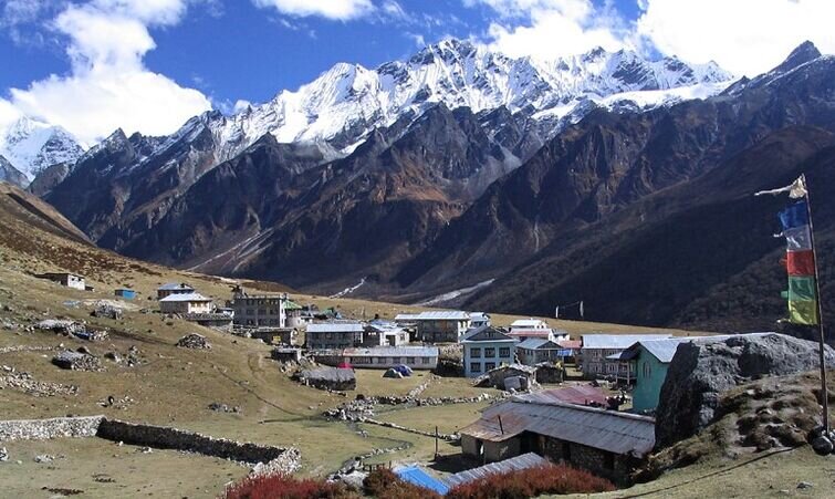
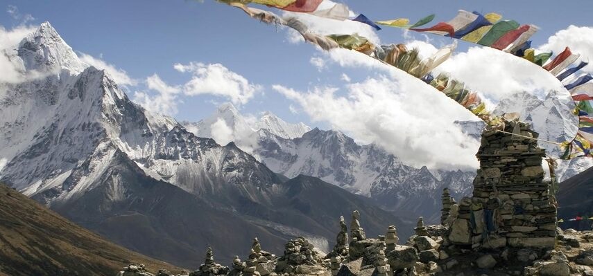
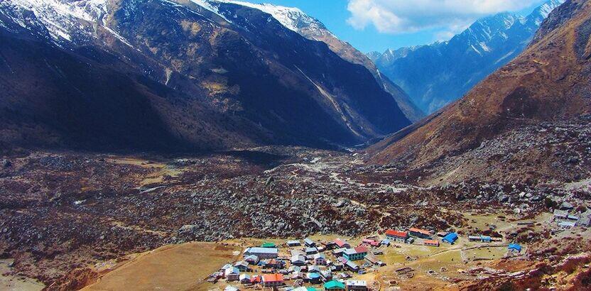

Trip Overview

Trek Region
Langtang

Difficulty Level
Moderate

Transport
Kathmandu–Syabrubesi by road; Melamchi Pul Bazaar–Kathmandu by road

Total Trip Duration
15 Days

Max Elevation
5,130m

Meals
Breakfast, Lunch & Dinner included
Trip Highlights
- Cross the formidable Ganja La Pass (5,130m) — one of the most technically demanding and least-traveled high passes in the Langtang region, covered in snow year-round and requiring ropes, crampons, and ice axes on the approach and descent
- Experience three nights of full wilderness camping above 4,200m in terrain where no teahouses, shops, or other facilities exist — just the mountains, the glacier, the stars, and your team
- Summit Tserko Ri (5,033m) — the finest panoramic viewpoint in the entire Langtang region — with over 20 peaks visible simultaneously including Langtang Lirung, Ganesh Himal, Dorje Lakpa, and Manaslu
- Explore Kyanjin Gompa (3,870m) — an ancient monastery in a dramatic high alpine setting — and taste world-famous yak cheese from the Kyanjin Cheese Factory
- Walk through the entire Langtang Valley from the lush river gorge at Syabrubesi to the high alpine meadows of the upper valley — through Nepal’s first Himalayan national park
- See the emotionally powerful rebuilt Langtang Village and the memorial area honoring the 350 people lost in the 2015 earthquake avalanche
- Stand at the Ganja La Pass summit and look across one of the most spectacular high-altitude panoramas in Nepal — Langtang Lirung, Langtang II, Dorje Lakpa, Yala Peak, Naya Kanga, Manaslu, Ganesh Himal, and the snowfields of the Tibet border range all visible from the pass
- Descend through the utterly remote camping grounds at Keldang (4,270m) and Dukpu (4,040m) — wild, silent, and extraordinarily beautiful high-altitude wilderness
- Visit the hidden gem of Gekye Gompa (Keldang Gompa) — a remote monastery in the upper Helambu wilderness that very few trekkers ever reach
- Immerse in the culture of the Hyolmo Sherpa people in the beautifully preserved village of Tarkeghyang (2,740m) and its legendary monastery founded in 1727
- Walk through the apple orchards and hilltop fields of Sermathang (2,610m) and experience authentic Hyolmo village life on the final Helambu descent
- Complete a genuine point-to-point wilderness traverse — Syabrubesi to Melamchi Pul Bazaar — from the Langtang Valley to the Helambu valley via one of the highest and most remote crossings in the region
Trip Summary
Nepal has dozens of mountain passes. Only a handful of them qualify as genuinely wild, technically demanding, and largely unvisited all at once. Ganja La Pass (5,130m) is one of those handful. Sitting at the head of the Langtang Valley on the divide between the Langtang and Helambu regions, it is the most challenging and most rewarding high pass in the entire Langtang trekking area requiring ropes, crampons, ice axes, and three nights of wilderness camping in terrain where no teahouses exist and no other trekkers are likely to appear.
The Langtang Ganja La Pass Trek combines the classic cultural and mountain experience of the Langtang Valley with the raw, wild, adventure-trekking experience of crossing Ganja La and descending into the remote upper Helambu. In 15 days, the circuit begins with the road drive to Syabrubesi, follows the Langtang Khola River through national park forest to Kyanjin Gompa (3,870m), acclimatizes with a hike to Tserko Ri (5,033m), enters the high wilderness above the valley at Ngengang (4,200m), crosses the technically demanding Ganja La Pass (5,130m) in full mountaineering equipment, descends through Keldang and Dukpu on camping nights in the complete Himalayan wilderness, and finishes through the Hyolmo Sherpa villages of Tarkeghyang and Sermathang to the road at Melamchi Pul Bazaar.
This is not a teahouse circuit. The section from Kyanjin Gompa to Tarkeghyang requires full camping tents, sleeping systems, cook staff, and all food carried by the team. It demands prior high-altitude trekking experience, genuine physical fitness, comfort with technical terrain, and the kind of appetite for remote wilderness that makes three nights under the stars at the edge of a Himalayan glacier feel like a privilege rather than a hardship. For the right trekker, it is exactly that.
When To Visit
Ganja La Pass is covered in snow throughout the year and its condition changes significantly by season more so than any other standard high pass in the Langtang region. The timing of this trek is therefore more critical than for most Nepal circuits.
Spring (March to May) is an excellent season for this trek with important caveats. April and May are the preferred spring months the rhododendron forests of the lower Langtang Valley are spectacular, the weather is stable, and the pass is in good condition. March can have heavy snow on the pass approach and the descent side, making it more demanding. Late May is possible but warming temperatures increase the risk of soft snow and rockfall on the glaciated sections. The best spring window is mid-April to mid-May.
Autumn (September to November) is the finest and most recommended season for the Ganja La crossing. The monsoon clears the air completely and October delivers the sharpest visibility of the year — the views from Tserko Ri, from the pass summit, and from the camping sections are at their most extraordinary. The snow on the pass is at its most consolidated and stable in autumn, the trail is well-defined, and the Helambu descent section is at its most beautiful with clear light and warm colors. October is the gold-standard month for this trek.
Winter (December to February) is not recommended for Ganja La Pass. The pass accumulates deep snow from December onward and the approach and descent sections become genuinely dangerous even with technical equipment. Some years the pass becomes completely impassable. Winter trekking in the Langtang Valley below Kyanjin Gompa is possible and beautiful, but the Ganja La crossing itself should not be attempted in winter without specific mountaineering experience far beyond standard trekking ability.
Monsoon (June to August) is not recommended. Wet, unstable snow on the pass, rockfall risk on the glaciated approach sections, and poor visibility make the crossing unsafe and unrewarding in monsoon conditions.
Itinerary
Welcome to Nepal. Our team meets you at Tribhuvan International Airport and transfers you to your hotel in Kathmandu. In the evening your trekking guide and expedition team leader join you for a comprehensive pre-trek briefing this is not a standard teahouse circuit briefing and it covers more ground than most.
The briefing includes the complete 15-day route day by day, a detailed discussion of the Ganja La Pass section what the terrain looks like, what the technical requirements are, how the rope and crampon sections work, what camping at 4,200m involves in practice, and how the team manages the logistics of carrying everything the group needs for three days of complete wilderness. You also go through altitude awareness protocols specific to a trek that reaches 5,130m, gear checks for both the teahouse section and the camping section, permit logistics, cultural notes on the Tamang and Hyolmo communities, and the road journey details for tomorrow.
The Ganja La Pass Trek is one where the quality and confidence of the pre-departure briefing directly impacts how well-prepared and well-rested you feel heading into the high section. Take notes, ask questions, and sleep well. Overnight in Kathmandu.
An early morning departure northwest from Kathmandu for the long but scenic road journey to the Langtang trailhead. The road climbs out of the Kathmandu Valley through Balaju, rises into the Nuwakot hills through terraced farmland and small roadside temples, then drops into the broad Trishuli River valley and follows it northward through Dhunche before descending steeply into the Bhote Koshi gorge to reach Syabrubesi (1,550m) at the confluence of the Trishuli and Langtang rivers.
Syabrubesi is a lively, well-serviced border-region town that functions as the main gateway to both the Langtang Valley and the Tamang Heritage Trail. Check into your teahouse, eat a proper meal, and rest from the road. The camping gear, food supplies, and technical equipment for the Ganja La section will have been arranged and transported ahead of your arrival by our logistics team. Your guide goes through final equipment checks this evening. The trail begins tomorrow. Drive time: 7–8 hours.
The first walking day and one of the most immersive forest experiences of the entire 15-day circuit. From Syabrubesi, the trail crosses the Bhote Koshi River on a suspension bridge and enters Langtang National Park almost immediately Nepal’s first Himalayan national park, established in 1976 and one of the country’s most biodiverse protected areas.
The forest takes over within minutes of leaving the road. Dense bamboo thickets, oak and rhododendron canopy overhead, the sound of the Langtang Khola River rushing through the gorge far below. The settlements of Bamboo (1,960m) and Rimche (2,400m) are the natural lunch stops small clusters of teahouses where hot noodle soup and sweet tea restore energy for the afternoon climbing.
Yak trains pass with bells ringing. Gray langur monkeys move through the canopy. The bamboo sections between Syabrubesi and Lama Hotel are primary red panda habitat walk slowly in the early morning and look carefully into the understory. Lama Hotel (2,380m) is a well-established cluster of teahouses at the forest edge where the valley begins to widen above and the first high peaks appear above the ridgeline. Walking time: 5–6 hours.
The day the mountains claim the horizon completely. From Lama Hotel the trail climbs continuously through thinning forest rhododendron first, then fir and pine, then open scrubland as the tree line retreats and the Langtang Himalayan range builds above the northern ridge in successive reveals, each more dramatic than the last.
At Ghoda Tabela (3,030m) the wide grassy flat whose name means “horse stable” the national park checkpoint marks the transition into the upper valley. The landscape opens here into the full breadth of the upper Langtang world. Ancient mani walls begin lining both sides of the trail and continue without interruption all the way to Kyanjin. Always pass to the left.
Langtang Village (3,430m) stands today as one of the most moving testimonies to human resilience in Nepal. The April 2015 earthquake triggered a catastrophic avalanche that buried the original village and killed over 350 residents and visitors in a matter of seconds. The community rebuilt every building by hand and by deliberate choice refusing to leave the valley that has been home to their families for generations. Walk into the village slowly and with full awareness of this history. The rebuilt teahouses and the memorial chortens above the village both deserve your attention and your respect. Walking time: 6–7 hours.
A shorter, beautiful walking day through the upper valley that opens broader and more dramatic with every kilometer east. The trail continues through wide open alpine meadows where yak herds graze freely and the northern border ridge of the valley Langtang Lirung (7,227m), Langtang II, Kimshung, Yansa Tsenji rises directly ahead with growing authority and immediacy.
A magnificent water-powered prayer wheel spins ceaselessly beside the trail. Ancient mani walls stretch along both sides of the path. The peaks grow closer and more specific as you walk each one gaining individual identity and scale that the distance of the lower valley had kept abstract.
Kyanjin Gompa (3,870m) is the cultural centerpiece of the upper valley and the last permanently inhabited teahouse settlement you will see for several days after tomorrow’s departure. An ancient monastery decorated with thangka paintings and butter lamp altars, a working yak cheese factory producing exceptional cheese since the 1950s, and a small permanent community living at nearly 4,000m through every season. Visit the monastery this afternoon, buy rounds of yak cheese to carry for the camping section, and prepare your gear for the Tserko Ri hike tomorrow. Rest well and sleep early. Walking time: 3–4 hours.
The most critical day of the entire 15-day circuit and the finest viewpoint of the Langtang region. Tserko Ri (5,033m) is your acclimatization summit before Ganja La Pass reaching and recovering from just over 5,000m today is the altitude preparation that makes the 5,130m pass crossing on Day 9 physiologically achievable and safe.
Wake before sunrise, eat a full breakfast, and start early. The trail climbs steeply from the first step above Kyanjin Gompa through yak pastures, past the glacier moraine, and onto the open rocky ridgeline above. The gradient is sustained and unrelenting for 4 to 5 hours of uphill effort. At altitude, every step above 4,500m requires more attention and more deliberate breathing than it would lower down. Take your time.
At the summit of Tserko Ri, standing at just over 5,000m, over 20 Himalayan peaks are visible simultaneously Langtang Lirung (7,227m), Ganesh Himal (7,429m), Dorje Lakpa (6,990m), Naya Kanga (5,844m), Kimshung, Langshisha Ri, Jugal Himal, Manaslu (8,163m), and on the clearest days even the distant outlines of the Annapurna range and Shishapangma (8,027m) beyond the Tibet border. The entire Langtang Valley stretches below you like a relief model. This is the finest viewpoint accessible on foot in the entire Langtang region and one of the most extraordinary high-altitude panoramas in Nepal.
Descend carefully — the upper section is steep and tired legs need the same attention on the way down. Back at Kyanjin Gompa by late afternoon. Eat generously, hydrate fully, pack your technical gear tonight, and go to bed knowing that tomorrow you enter the wilderness section of the trek that makes this circuit genuinely unique. Hike time: 7–8 hours return.
This is the day the character of the trek changes completely. From Kyanjin Gompa, the trail heads east away from all teahouses, away from all other trekkers, away from any form of infrastructure into the high wilderness above the valley. Beyond the last yak herder huts at the eastern end of the valley, the trail enters terrain that is genuinely remote.
The route climbs steadily through high alpine meadows and glacial moraine above Kyanjin, passing a series of small glacial lakes that sit blue and still in their rocky basins. The Langtang Glacier fills the valley to the northeast and the scale of the surrounding peaks seen now from the inside of the upper valley rather than from the village below becomes staggeringly immediate. Langtang Lirung fills the entire western sky. Yala Peak, Naya Kanga, and the peaks of the Jugal Himal rise to the south and east.
Ngengang (4,200m) is a high alpine pasture used seasonally by yak herders in summer, temporary stone shelters appear here, but in most trekking seasons the site is completely empty. This is where your camping team sets up the first wilderness camp sleeping tents, mess tent, kitchen tent, and the full complement of equipment and food your team has carried up from Kyanjin. Your first night in the high wilderness. The sky at 4,200m with no light pollution is remarkable. Walking time: 5–6 hours
A rest and altitude-adaptation day at the high camp before the technical pass crossing. This day is non-negotiable in the itinerary attempting Ganja La Pass without a proper rest day at Ngengang after the demanding Tserko Ri hike on Day 6 significantly increases both the physical risk and the altitude risk of the crossing.
The morning acclimatization hike climbs above Ngengang on the approach trail toward the pass gaining altitude and coming back down, the classic acclimatization protocol. This gives your body a preview of the terrain above camp and your guide an opportunity to assess trail and snow conditions on the lower approach to the pass, which directly informs the decisions made on Day 9.
The afternoon is spent at camp resting, eating well, hydrating aggressively, and going through final gear checks with your guide. Crampons are fitted and adjusted. The rope system for the technical sections near the pass is reviewed. Ice axes are distributed. Your guide explains exactly what the next day involves which sections require roping up, where the fixed ladder may be in use, what the descent terrain on the far side looks like, and what the emergency protocols are if weather closes in. A warm, early dinner and an early night. The alarm tomorrow will sound before dawn. Short hike time: 2–3 hours.
The defining day of the entire 15-day circuit the hardest, the highest, the most technically demanding, and for most trekkers the single most memorable day they have ever spent in the mountains. The alarm sounds before dawn. You eat in the darkness inside the mess tent, put on every layer, strap on crampons, take your ice axe, and begin climbing toward Ganja La Pass (5,130m) in the pre-dawn cold.
The approach from Ngengang climbs steeply through the upper glacial basin. The trail gains altitude rapidly on rocky moraine and then moves onto snow and ice as the pass draws closer. The final 200–300 meters to the pass are the most technically demanding section of the entire trek steep, glaciated terrain where your guide fixes ropes and the team moves carefully, one section at a time. A fixed aluminum ladder has been installed on one of the steepest rock-and-ice sections in recent years a practical aid that has made the crossing significantly safer for well-equipped trekkers with a competent guide. Ice axes are used for balance and self-arrest position throughout the upper section. The pace is slow, deliberate, and controlled.
At the summit of Ganja La Pass (5,130m), prayer flags whip and snap in the cold mountain wind. The panorama is extraordinary Langtang Lirung (7,227m) towers to the northwest, so close and so massive it barely fits in your field of vision. Naya Kanga (5,844m), Yala Peak (5,500m), Dorje Lakpa (6,990m), Kimshung (6,745m), Langtang II (6,571m) form a jagged, snow-streaked arc around the upper basin. To the south, the ridges of the Helambu country descend in long green waves. The view from Ganja La is arguably the finest and most dramatic mountain panorama accessible on foot anywhere in the Langtang region more raw and more immediate than Tserko Ri precisely because you earned it with technical effort rather than simply a steep walk.
The descent from the south side of the pass is steep and long over a kilometer of careful downward movement on loose scree, rocky terrain, and snow in the upper section. It requires sustained concentration throughout. The route eventually levels and leads through the upper Helambu wilderness to Keldang (4,270m) a remote, high alpine basin where your camping team has established the second wilderness camp. The Keldang Lake sits near the camp, cold and still at high altitude. Tonight the sky overhead belongs entirely to you and the mountains. Walking time: 8–9 hours.
A long and physically demanding but scenically exceptional day through the upper Helambu wilderness. From Keldang the trail heads southwest and begins the long gradual descent through a landscape that most Nepal trekkers have never seen remote, grassy ridgelines dotted with seasonal stone shelters, the distant peaks of the Helambu and Jugal Himal ranges visible to the south, and the utter silence of high-altitude wilderness that has almost no regular foot traffic.
The route passes through open alpine grassland and then enters upper rhododendron forest as altitude is lost, crossing several ridges and descending through increasingly dense vegetation. The Gekye Gompa a remote monastery also known as Keldang Gompa appears in the upper forest, an atmospheric and largely unvisited religious site that feels entirely consistent with the wild remoteness of everything around it. Your guide can explain the history of this gompa and the herding communities that have maintained it for generations.
Dukpu (4,040m) is a summer settlement for Helambu valley herders used seasonally when yaks are driven to the high pastures and completely empty in off-season trekking months. Your camping team sets up the third and final wilderness camp here, inside the forest at the edge of the high pasture. The forest at this altitude has a particular beauty tall rhododendron trees, deep silence broken only by occasional bird calls, the distant sound of a stream. A good dinner, a final night under canvas, and a quiet sense of satisfaction at having crossed the pass and survived the wilderness intact. Walking time: 6–7 hours.
The day the wilderness gives way to the human world again and what a human world it is. From Dukpu the trail descends continuously and steeply through dense rhododendron and pine forest, losing nearly 1,300m of altitude over the course of the walk. The trail passes a 4,100m ridge above Gekye Gompa that provides a spectacular final panoramic view of the Himalayan range the Annapurna range, Everest, Ganesh Himal, and the long ridgeline of the Helambu hills visible simultaneously on a clear morning.
Below the ridge the descent steepens through the forest pine and rhododendron giving way to mixed oak and fir and eventually the stone-paved lanes of the upper Helambu valley appear. The first permanent habitation since Kyanjin Gompa. The first hot meal cooked in a teahouse kitchen. The first proper bed in four nights.
Tarkeghyang (2,740m) is the largest and most historically significant village in the Helambu region a worthy and deeply welcome destination after the wilderness of the preceding days. The village monastery, founded in 1727 and rebuilt in a striking Bhutanese architectural style in 1969, is one of the finest religious buildings in the Helambu region. The Hyolmo Sherpa community here is warm, proud of their village, and genuinely glad to see the occasional trekker who arrives from the Ganja La direction you will have approached from the high wilderness rather than the standard lower trail, and the reaction of the village to your arrival has a particular quality of acknowledgment to it. Walking time: 6–7 hours.
A full rest and exploration day in Tarkeghyang one of the most genuinely rewarding free days of the entire circuit, arriving at exactly the right moment after four demanding high-altitude days.
Begin with the monastery. The Tarkeghyang Monastery (Geljun Khangsar Gompa) rewards a proper, unhurried visit the thangka paintings inside the prayer hall are extraordinary, depicting the deities and Buddhist narratives that have been at the center of Hyolmo spiritual life since the gompa’s founding nearly three centuries ago. Your guide can translate the painted stories and explain the significance of the 1969 Bhutanese-style reconstruction that gave the building its distinctive architecture.
The ridge above the village provides excellent short hiking through apple orchards that Tarkeghyang is famous for throughout the Helambu region in season, the apples hang heavy on the branches, the orchards smell of ripening fruit, and local households press fresh juice and dry slices for the trail. The ridge viewpoint above the orchards looks north toward the Jugal Himal and east toward the distant silhouette of Mount Everest on a clear autumn morning.
Spend the afternoon walking through the village, sitting with the family at your teahouse, tasting the local food, and simply recovering from the physical demands of the past four days. The body benefits from this rest. The spirit benefits from this village. Rest day.
Leaving Tarkeghyang, the trail heads south through a gently rolling landscape of apple orchards, terraced fields, and open forest that is entirely different in character from the remote high wilderness of the pass section. The walking is pleasant and unhurried warm, agricultural, human-scaled, and filled with the sounds of village life drifting across the hillside.
The route passes through the small hamlet of Ghangyul whose residents practice Drukpa Kagyu Buddhism, the national religion of Bhutan, a fascinating cultural detail in this corner of Nepal and through Chumik where a large peace stupa marks the trail junction, before arriving at Sermathang (2,610m).
Sermathang is a quiet, lovely hilltop village with views across the Helambu valley and a small old monastery at the top of the settlement. The pace here is slow and the atmosphere genuinely restful. On clear autumn mornings, Ganesh Himal, Jugal Himal, Langtang Lirung, and the distant profile of Everest are all visible from the village. Gray langur monkeys are commonly seen in the forested sections along the trail between Tarkeghyang and Sermathang family groups moving through the oak trees in the morning hours. Walking time: 4–5 hours.
The final walking day a long descent through the lower Helambu hills to the valley road. From Sermathang the trail drops steadily and continuously southward through a series of small Sherpa settlements and increasingly lush lower-altitude forest, losing nearly 1,750m of altitude over the course of the walk. The birdsong in the lower forest sections is extraordinarily rich this transitional forest zone between the alpine ridge and the Melamchi valley floor supports an exceptional diversity of bird species and the variety of calls in the early morning is remarkable.
The forest gives way to terraced farmland and the sounds of the lower valley as you approach Melamchi Pul Bazaar (870m) a busy market town on the Melamchi River where road access begins. Your trekking vehicle is waiting. The drive back to Kathmandu follows the Melamchi River valley westward and then the main highway approximately 2 hours depending on traffic.
Back in Kathmandu, transfer to your hotel, take the longest shower of your life, and find the finest meal you can. You have walked 110+ kilometers, crossed a 5,130m technical mountain pass with ropes and crampons and ice axes, camped for three nights in the complete Himalayan wilderness, and descended from one of the most remote and rewarding sections of the entire Langtang region into the human world of the Helambu valley. That is an achievement that deserves a proper celebration. Walking time: 3–4 hours. Drive time: 2 hours.
Your 15-day Langtang Ganja La Pass Trek comes to a close. Our team transfers you to Tribhuvan International Airport for your onward journey. You leave Nepal having completed one of the most technically demanding and genuinely adventurous trekking circuits in the entire Langtang region a circuit that very few international trekkers have done and that those who have done it rarely stop talking about.
Trek Difficulty & Physical Demands
The Langtang Ganja La Pass Trek is rated strenuous to technical one of the most demanding standard trekking circuits available in Nepal and in a different category of difficulty from any other Langtang route.
Technical requirements: Ganja La Pass is not a standard walking pass. The upper approach from Ngengang involves glaciated terrain that requires crampons and ice axes. A fixed rope system is used on the steepest sections. A fixed ladder assists on one particularly steep rock-and-ice section. The descent from the south side is steep and long on loose terrain. These requirements are non-negotiable this section cannot be done safely without technical equipment and an experienced guide who has crossed the pass before.
Altitude: The trek reaches 5,033m on Tserko Ri (Day 6) and 5,130m at Ganja La Pass (Day 9) the highest altitude point. The acclimatization structure of the itinerary teahouse nights at Kyanjin Gompa, the Tserko Ri summit day, and a full rest day at Ngengang is specifically designed to prepare the body for the pass crossing. Following this structure strictly is essential.
Camping: Three nights of wilderness camping at 4,200–4,270m in terrain with no shelter, facilities, or infrastructure beyond what your team carries. Cold temperatures, wind exposure, and the absence of any teahouse support require your own high-quality sleeping system, proper layering, and the physical and mental resilience to be comfortable in the wilderness overnight.
Daily walking: The Ganja La crossing day (Day 9) involves 8–9 hours of sustained effort at high altitude on technical terrain the longest and hardest single day of the circuit. Several other days exceed 6–7 hours on demanding mixed terrain.
Prior experience required: This trek requires prior high-altitude trekking experience at a minimum. Completion of a trek reaching 5,000m (Everest Base Camp, Annapurna Base Camp, or similar) before attempting Ganja La is strongly recommended. Prior experience with crampons and ice axes even basic mountaineering courses is a meaningful advantage.
Physical fitness: 4–6 months of consistent training before departure is the appropriate preparation for this circuit hiking with loaded packs on steep terrain, regular cardiovascular training, and strength work for legs and core. Fitness levels appropriate for a standard EBC or three-pass trek are the minimum baseline for Ganja La.
This trek is not suitable for: First-time trekkers, people without prior altitude experience above 4,000m, anyone who has not been comfortable with steep exposed terrain on previous treks, or anyone unwilling to use ropes and technical equipment on a mountain pass.
Best Time to Trek: Seasonal Comparison
| Season | Months | Pass Conditions | Views | Trail Status | Recommended |
| Spring | Mar–May | Good from mid-April | Excellent | Clear from April | Good |
| Monsoon | Jun–Aug | Dangerous / Unstable | Poor | Risky | Avoid |
| Autumn | Sep–Nov | Excellent | Outstanding | Excellent | Best |
| Winter | Dec–Feb | Deep Snow / Impassable | Good (lower) | Dangerous on pass | Avoid |
Pro tip: For the Ganja La Pass specifically, October is the single best month of the year. The snow on the pass is consolidated and stable after the monsoon, the visibility from the pass summit is at its absolute finest, the camping nights are cold but clear and dry, and the entire descent through the Helambu section is at its most beautiful. If you can only do one month, choose October. The second-best option is late April to mid-May for rhododendron blooms in the lower valley combined with stable pass conditions.
Booking Your Langtang Ganja La Pass Trek – 15 Days
This trek requires more advance planning than a standard teahouse circuit — camping equipment logistics, technical team assembly, permit processing, and equipment rental all take time to arrange properly.
Step 1 — Contact us early. We recommend contacting us at least 6–8 weeks before your preferred start date ideally 3 months in advance for peak October season. Reach out via our website, email, or WhatsApp with your travel dates, group size, and prior trekking experience. We respond within 24 hours with a complete itinerary, technical section briefing document, and full cost breakdown.
Step 2 — Experience and fitness assessment. Before confirming your booking, we conduct a brief assessment of your prior trekking and high-altitude experience. This is not a gatekeeping exercise — it is a safety requirement specific to the technical nature of Ganja La Pass. We need to understand your background to plan the right team and pace for your group.
Step 3 — Confirm your booking. A 25% deposit secures your dates. We immediately begin permit processing, arrange the guide and assistant guide team, coordinate camping equipment logistics, and organize technical equipment rental in Kathmandu.
Step 4 — Prepare. We send a comprehensive pre-departure package — detailed fitness training plan for 3–4 months before the trek, complete technical and standard gear list, crampon and ice axe rental guidance for Kathmandu, altitude awareness protocols specific to Ganja La, camping section logistics explained, day-by-day expectations for all 15 days, and cultural notes on the Tamang and Hyolmo communities.
Step 5 — Arrive in Kathmandu. We collect you from the airport, conduct a full technical briefing with your guide team, assist with crampon fitting and ice axe selection if renting in Kathmandu, and go through final gear checks. The camping equipment is packed and confirmed. The road to Syabrubesi departs the next morning.
Step 6 — Trek. Your licensed senior guide, assistant guide, cook, and porter team lead you through every stage of the circuit from Syabrubesi to Melamchi Pul Bazaar — with the full technical team active from Day 7 onward through the pass crossing.
Step 7 — Pay the balance. The remaining 75% is due on arrival in Kathmandu before departing for Syabrubesi.
Cancellation Policy:
- 45+ days before departure: Full deposit refunded minus bank transfer charges
- 30–44 days before: 50% refund of deposit
- Less than 30 days: Deposit forfeited, no refund
Important: Travel insurance with emergency helicopter evacuation coverage explicitly above 5,500m is mandatory and verified before departure. The Ganja La Pass reaches 5,130m and the camping section above 4,200m is completely remote from road access. A helicopter rescue from this area costs USD 4,000–7,000. Do not attempt to join this trek without confirmed and verified evacuation coverage.
Cost Details
Cost Includes
- Airport pick-up and drop-off in Kathmandu
- Kathmandu–Syabrubesi–Kathmandu ground transportation (private jeep)
- Melamchi Pul Bazaar–Kathmandu return ground transportation (private vehicle)
- 1 night hotel accommodation in Kathmandu on arrival (bed & breakfast, 3-star)
- All teahouse accommodation on teahouse nights (Days 2–6, Days 11–14)
- Full wilderness camping equipment and setup for 3 camping nights (Days 7–10):
- Dome sleeping tents (2-person per tent, high-altitude rated)
- Dining / mess tent with tables and chairs
- Kitchen tent with full cook equipment
- Toilet tent with portable facilities
- High-altitude sleeping mats
- All meals during the trek — breakfast, lunch, and dinner every day including camping days
- Experienced, English-speaking, government-licensed trekking guide with high-altitude and technical pass experience
- Assistant guide for the Ganja La Pass technical section (mandatory safety requirement)
- Cook and kitchen staff for camping section
- One porter for every two trekkers (maximum 15 kg per trekker duffel)
- Additional porters for camping equipment and food supplies
- Full technical equipment for Ganja La Pass crossing:
- Fixed ropes for technical sections
- Group crampons (if not bringing personal)
- Ice axes (if not bringing personal)
- All required trekking permits:
- Langtang National Park Entry Permit
- TIMS Card
- Guide, assistant guide, porter, and cook wages, meals, accommodation, and full insurance
- All government taxes and local charges
- Sleeping bag rated to -15°C rental (if needed)
- Duffel bag for porter
- First Aid Kit including pulse oximeter, emergency oxygen, and altitude medication
- Emergency evacuation arrangement (evacuation cost covered by your travel insurance)
Cost Excludes
- Nepal entry visa fee (approx. USD 50 for 30 days — obtainable on arrival)
- International flights to and from Kathmandu
- Travel insurance with emergency helicopter evacuation coverage (mandatory)
- Meals in Kathmandu beyond breakfast
- Personal crampons and ice axe (can be rented in Kathmandu — approx. USD 15–25 each)
- Hot showers, Wi-Fi, and device charging at teahouses
- Personal snacks, bottled water, energy drinks, and alcoholic beverages
- Tips and gratuity for guide, assistant guide, porter, and cook (strongly recommended)
- Personal trekking and mountaineering gear
- Extra nights in Kathmandu
- Helicopter rescue costs (must be covered by personal travel insurance)
- Monastery donations at Kyanjin, Gekye, and Tarkeghyang
- Personal expenses — laundry, souvenirs, phone calls, incidentals
Trip Gallery
Trek Essentials
- Thermal base layer top and bottom — 2 sets, merino wool preferred for camping nights
- Mid-layer fleece or softshell jacket — worn constantly on camping nights
- Expedition-weight or heavy down jacket — non-negotiable for camping at 4,200m; light down is insufficient
- Waterproof, windproof hardshell jacket and trousers — worn for the pass crossing day and in any wind or precipitation
- Trekking trousers — 2 to 3 pairs
- Waterproof over-trousers — critical for the pass crossing
- Warm trekking socks, wool or synthetic — 5 to 6 pairs
- Thin liner gloves and warm mountaineering outer gloves or mittens — both are worn during the pass section
- Warm beanie and balaclava — the pass is cold and windy
- Sun hat or cap for lower valley and Helambu sections
- Neck gaiter or buff — essential on the pass and camping nights
- Stiff, waterproof, crampon-compatible trekking or mountaineering boots — this is the most critical gear decision on this trek. Standard flexible trekking boots are not appropriate for crampons on the Ganja La Pass. Semi-rigid or rigid mountaineering-style boots that accept C1 or C2 crampons are required.
- Camp sandals or lightweight shoes for teahouse evenings
- Neoprene or wool boot liners for camping nights
- Gaiters — mandatory for the pass crossing and camping section
- Crampons — 10-point or 12-point, compatible with your boots. Can be rented in Kathmandu.
- Ice axe — standard 60–70cm mountaineering ice axe. Can be rented in Kathmandu.
- Mountaineering harness — for the rope sections near the pass summit
- Locking carabiner (2) — for clipping to fixed ropes
- Trekking poles — both collapsible; invaluable for the non-technical terrain and for balance when wearing crampons
- High-altitude dome tent
- Sleeping mat (foam and inflatable)
- Dining tent, kitchen tent, toilet tent
- Sleeping bag rated to -20°C or warmer — the camping nights at 4,200m with wind chill can drop well below -15°C. Do not underestimate this.
- Daypack (25–30 liters) with hipbelt — heavier than standard for the technical section
- Duffel bag (60 liters) for porter
- Headlamp with spare batteries and backup — the pre-dawn start on pass day requires reliable lighting for 2+ hours
- High-quality sunglasses with UV400 glacier protection — snow and ice reflection at 5,000m+ is intense
- Goggles — wind and blowing snow on the pass make goggles highly recommended
- Water bottle (2 liters) — water freezes at camp; insulated bottle or bladder essential
- Water purification tablets or filter
- Personal camera or phone in an insulated pocket — batteries drain fast in cold
- Diamox (acetazolamide) — strongly recommended; consult your doctor. The acclimatization structure of this trek is solid but the altitude demands — Tserko Ri at 5,033m followed by Ganja La at 5,130m — make Diamox a meaningful precaution.
- Personal pulse oximeter — monitoring blood oxygen saturation above 4,000m provides concrete data for both you and your guide
- Personal first aid kit — blister pads, ibuprofen, bandages, antiseptic cream, wound closure strips
- Sunscreen SPF 50+ and SPF lip balm — critical at altitude and in snow reflection
- Hand sanitizer and biodegradable wet wipes — particularly important on camping days
- Diarrhea medication and oral rehydration salts
- Hand warmers — useful for camping mornings and the pre-dawn pass start
- All personal prescription medications for the full 15-day duration
- Valid passport with at least 6 months remaining validity
- Nepal visa (obtainable on arrival at Kathmandu airport)
- Printed travel insurance policy with emergency helicopter evacuation above 5,500m explicitly confirmed
- 2 passport-sized photos for permit processing
- Emergency contact card kept on your person throughout
Final Thoughts:
Most Nepal treks offer teahouses, mountain views, cultural villages, and well-marked trails. All of those are genuinely wonderful things. The Langtang Ganja La Pass Trek offers all of those things and then, for three days between Kyanjin Gompa and Tarkeghyang, offers something that the vast majority of Nepal’s trekking circuits do not genuine wilderness. A place where no teahouses exist and no other trekkers appear, where the mountains are close enough to feel like they belong to you and only you, where the night sky at 4,200m is a spectacle that city life has made most of us forget is possible, and where the effort required to cross a 5,130m technical pass rewards you with a panorama and a sense of personal achievement that no amount of altitude ticket-punching on a crowded trail can replicate.
The technical demands of Ganja La are real and should be respected. The altitude is serious. The camping section requires physical and mental resilience. The ice axes and crampons and ropes are not theatrical props they are tools required for a genuine mountain crossing.
But for the trekker who arrives properly prepared fit, experienced, equipped, and guided by a team who has crossed this pass before the Langtang Ganja La Pass Trek delivers something increasingly rare in Nepal’s growing trekking industry: a route that remains genuinely, consequentially wild.
The mountains do not perform for you here. You go to meet them on their own terms. And they are extraordinary.
Your Adventure to Langtang Ganja La Pass Trek – 15 Days Starts Here
Start your journey with trusted local experts and discover the beauty, culture, and adventure waiting in the Himalayas and beyond.
Frequently Asked Questions
Everything you need to know about the AASRA ECO TREK
Ganja La Pass (5,130m) is significantly more technically demanding than the three passes of the Everest Three Passes Trek (Renjo La, Cho La, Kongma La) or the standard Annapurna passes. Unlike those crossings which require good fitness and careful footing on steep terrain Ganja La involves genuine glaciated sections requiring crampons, ice axes, and fixed rope systems. A fixed aluminum ladder assists on one of the steepest rock-and-ice sections. It is comparable in technical difficulty to passes more commonly associated with mountaineering-style trekking than standard teahouse circuits. A competent, experienced guide who has crossed Ganja La multiple times is not optional it is the single most important safety factor on this trek.
You should have completed at least one high-altitude teahouse trek reaching 5,000m or above — the Everest Base Camp Trek, the Annapurna Circuit with Thorong La, or a comparable route. You should be comfortable on steep, exposed terrain and have no significant prior altitude sickness history above 4,500m. Prior experience with crampons and ice axes even a basic mountaineering course or a day of ice training is a meaningful advantage. If you have not used crampons before, we arrange a practice session in Kathmandu before departure.
Yes. Between Kyanjin Gompa (Day 6) and Tarkeghyang (Day 11), there are no teahouses, no shops, no electricity, no Wi-Fi, no charging points, no running water, and no other trekking infrastructure of any kind. Everything your team needs for three days tents, food, cooking equipment, toilet facilities, technical gear is carried by your porter team. The camping is fully self-contained wilderness camping in the truest sense. This is one of the defining characteristics of the Ganja La circuit and the reason it remains far less crowded than every other Langtang route.
Weather and snow conditions on Ganja La can change rapidly and unexpectedly. If your guide assesses conditions as unsafe on the planned crossing day heavy fresh snow, poor visibility, high wind, or icy conditions beyond what the group can safely handle the crossing is postponed. An additional acclimatization day at Ngengang is built into the schedule buffer for exactly this reason. If conditions remain unsafe after the buffer, the group returns to Kyanjin Gompa via the same approach trail a safe, well-defined retreat that avoids the technical section entirely. Your guide makes the final call and their assessment is always followed.
You need the Langtang National Park Entry Permit (approx. USD 34) and a TIMS Card (approx. USD 20). Both are included in the package price and arranged on your behalf in Kathmandu before departure.
Absolutely mandatory and non-negotiable. Your policy must explicitly confirm helicopter evacuation coverage at altitudes above 5,500m. The wilderness camping section between Kyanjin Gompa and Tarkeghyang is the most remote terrain on any standard Nepal trekking circuit road-based emergency access is completely unavailable. A helicopter rescue from the Ganja La area costs USD 4,000–7,000 or more. Show your guide your insurance documents before leaving Kathmandu.
Yes. Thamel has multiple reputable gear shops and rental operators that supply crampons, ice axes, harnesses, carabiners, and other technical mountaineering equipment. We coordinate the rental logistics and crampon fitting session in Kathmandu before departure. Rental costs are approximately USD 15–25 per item and are not included in the package price. If you already own crampons and an ice axe, bring them known gear that fits well is always better than rental equipment.
At Ngengang (4,200m) and Keldang (4,270m), overnight temperatures in October typically drop to -10°C to -15°C inside the tent, with wind chill making effective temperatures lower. In spring, similar or slightly warmer temperatures can be expected. A sleeping bag rated to -20°C or warmer is the absolute minimum requirement for the camping nights — do not attempt to use a summer-rated or three-season sleeping bag. Our high-altitude dome tents provide good wind protection but the temperature inside is always close to outside ambient temperature by midnight.
Our cook team prepares full hot meals at every camp breakfast, lunch, and dinner. Camping meals include porridge, eggs, and chapati for breakfast; soup and noodles for lunch; and warm dal bhat, pasta, or rice-based dishes for dinner. Hot drinks tea, coffee, hot lemon are available throughout the day. Bringing personal high-energy snacks (energy bars, nuts, dried fruit, chocolate) for the pass crossing day specifically is strongly recommended the physical demands of Day 9 benefit from frequent small calorie inputs throughout the 8–9 hour crossing.
Yes. The most common extension is adding the Tamang Heritage Trail circuit (Gatlang, Tatopani, Thuman, Briddim) at the beginning of the trek replacing the direct Syabrubesi-to-Lama Hotel approach with the cultural western circuit that joins the main Langtang trail at Lama Hotel. This adds 3–4 days and provides exceptional cultural depth before the mountain section. The Ganja La circuit can also finish via Melamchi Ghyang and Sermathang for a deeper Helambu cultural experience rather than the direct descent through Tarkeghyang. Contact us and we will design the right extended version for your available time and experience.

Still have questions?
Can’t find the answer you’re looking for? Please chat to our friendly team.
Get In TouchSimilar Packages
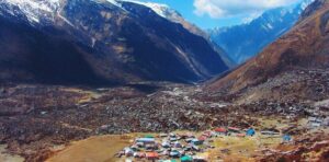
Tamang Heritage Trail Trek – 12 Days
Approx. 95–110 km
Distance
12 Days
Duration
1 to 12 people
Group Size
Moderate Level
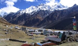
Langtang Helambu Trek – 20 Days
5,033m
Max. Elevation
20 Days
Duration
1 to 12 people
Group Size
Hard Level
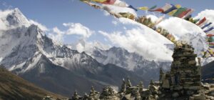
Langtang Gosainkunda Pass Trek – 18 Days
Approx. 140–155 km
Distance
4,773m
Max. Elevation
18 Days
Duration
1 to 12 people
Group Size
Easy Level
We are associate with
