- HOME
- Destination
- Adventure Activities
- About Us
- BLOGS
- CONTACT US

Thousands of tourists visit Nepal from around the world for the sole purpose of trekking or mountaineering. As here lie the most of the tallest mountains in the world including the tallest one, Mount Everest which stands at an elevation of 8,848 meters from sea level. Thus, Nepal is one true destination for the adventure lovers.
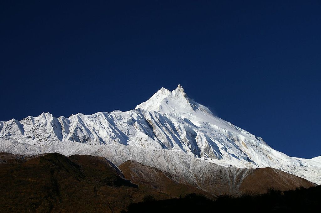
Among many of the trekking routes, Manaslu Circuit is one of the popular ones. This circuit trek will take to Manaslu region, wherein lies the eleventh tallest mountain of the world, Mount Manaslu including others.
Manaslu Circuit trek offers one of the best trekking routes where you will witness the view of many high mountains along the Mount Manaslu which is at an altitude of 8,183 meters. The very word “Manaslu” is derived from Sanskrit, which means “mountain of the spirit.” While, there is the separate name of Manaslu as per the Tibetan language, which is “Kutan I,” “tan” meaning flat place in Tibetan.
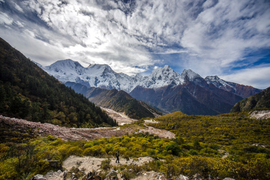
You will see the view of several mountains which exceeds the height of 7,000 meters/23,000 feet. Also, there are ten mountain peaks over the height of 6,500 meters/21,300 feet, which are visible en route of circuit trek.
You will also encounter some of the distinctive villages with rare ethnic groups of Nepal, whose traditional way of life and culture are alive till today. You will also see the villages influenced by the Tibetan culture, and there is a Tibetan refugee camp itself, where you can meet the Tibetans and know all about them.
With one of the most scenic route with the beautiful mountain peaks, distinctive villages with unique culture and tradition, and the amazing trail with suspension bridges over rivers and gorges, amazing waterfalls and streams, delightful forest, monasteries and gompas: all these things make Manaslu Circuit one of the favorites and popular trekking destination of Nepal.
The Manaslu region is mostly inhabited by two ethnic groups; they are Nubri and Tsum. A river locates at Chhikur divides the village of this two ethnic groups. Since Nepal has opened up to the tourism from 1950, Bubri has been visited frequently by tourists while Tusm has still kept their traditional, art and culture.
Apart from those two ethnic groups, Gurung, Bhutais (also spelled as Bhotias) and Sherpas are some other ethnic groups which can be found in this region. The central hills of Manaslu region mostly comprise Gurungs. Manaslu region is mainly characterized by the Buddhists, so you will encounter chortens, mani walls, and monasteries.

In the Manaslu region, there are 19 different types of forest, and the Himalayan blue pine and rhododendron dominate most of them. There are about 1,500-2,000 different species of plant that grows in this region. There is a plant of medicinal uses and aromatic plants too. Also, Manaslu is the home of some of the highly endangered animals including snow leopard and red pandas.
Some of the wildlife that can be found includes grey wolf, Asian black bear, lynx, Himalayan goral, woolly hare, Himalayan mouse hare, and black-lipped pika. There are 33 species of mammals, three species of reptiles. Also, there are 100 species of birds and 11 species of butterflies. As Manaslu is the protected area, hunting is banned.
It was declared as Manaslu conservation Area in December 1998 under the National Parks and Wildlife Conservation Act. The area is managed by National Trust for Nature (NTNC) of Nepal. Manaslu was declared as a protected area to conserve flora and fauna, along with sustainable management of the natural resources and rich cultural heritage.
It also aims to promote ecotourism to improve the livelihood of locals.
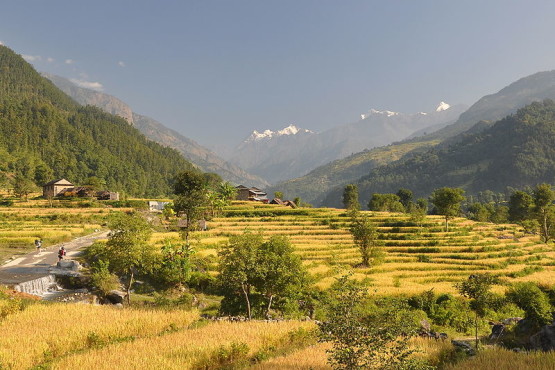
This excellent trek gets started from Arughat (570 meters), where you can arrive by taking a bus from Kathmandu through the Kathmandu-Pokhara Highway. You will see the beautiful mountain views, rivers, and charming small towns while taking a bus. Moving from Arughat, you will pass by the river of Budhi Gandaki and walk by the bridge over it. There will be terraces, waterfall, villages, and scenic hills while moving forwards.
You will also see the beautiful view of Sringeri Himal, which stands at the height of 7,187 meters. Then after passing some villages, you will arrive at Soti Khola (710 meters). Moving on after the night stay, you will walk over the bridge of Budhi Gandaki. You will also climb up onto a ridge above the huge rapids of river water.
Then, walking the trails which are rocky and narrow, you will arrive at Labubesi (880 meters). LabuBesi is a typical Gurung village of Manaslu region.

Continuing from Labu Besi, your trails will take you from ups and down. In this route, you will climb a ridge, passing through villages and enjoy the view of the delightful green hill. You will also come across Tatopani, which means “hot water” in the Nepali language.
Tatopani is a popular place where you can enjoy the natural hot bath. Then, crossing ridges and bridges, you will arrive at Doban (1,000 meters). From Doban comes Jagat (1,410 meters). Jagat is a beautiful flagstone village where you will find camping sites too. Now, you will climb the rocky ridge in a village called Salleri. You can also see the view of Sringeri Himal from the village. Descending from the village, you will walk past stone houses.
Continuing the trail, you will arrive at Ngyak Bensi (2,300 meters). Then, your trail will take you along the beautiful pine trees, delightful forest and villages. Moving on you will come across ups and down. You will also get the view of Manaslu Massif. Moving further, you will arrive at Ghap. Then, you will pass some delightful forest of bamboo and rhododendron, villages and waterfalls. Now, you arrive in a village called Namrung (2,660 meters).
Namrung is a Buddhist village where you will find prayer flags, monasteries, hydroelectricity powerhouse, and a water turbine too. After Namrung is the village called Samagaon (3,530 meters), where the culture and tradition are like that of Tibetans. From Samagoan, you can get the view of Manaslu and Kutang Himal Massif. You will move on to a village named Samdo (3,860 meters), where lies a Tibetan refugee site camp.
Then you will trek to Dharamshala (4,480 meters). Moving forward from Dharamshala, you will pass the highest point of this circuit trek, Larke Pass, which is at an elevation of 5,160 meters. After passing Larke Pass and witnessing the magnificent view of mountains all around, you descend down towards Bimthang (3,720 meters). From Bimthang is Tilije (2,300 meters) and comes to Tal (1,700 meters).
Moving down to Syange (1,080 meters), you can take a bus ride and go to Kathmandu. Well, these are just the outline of Manaslu Circuit trek, there are many other trails you can choose to explore and enjoy in Manaslu region.
Your email address will not be published.Required fields are marked *
You must be logged in to post a comment.
0 Comments on "Manaslu Circuit Trekking – Flora and Fauna, difficulty and Itinerary"